Colour and customise
Highlight individual countries and areas with colours, borders and palettes.


GEOGRAPHIC MAP MAKER / ASIA
Create a custom map of Asia online. Colour countries, highlight regions, import geographic data and export a high-resolution PNG.
Free online editor · No sign-up required
ATLAS / REGIONS OF ASIA
Regions of Asia
50 selectable countries and areas
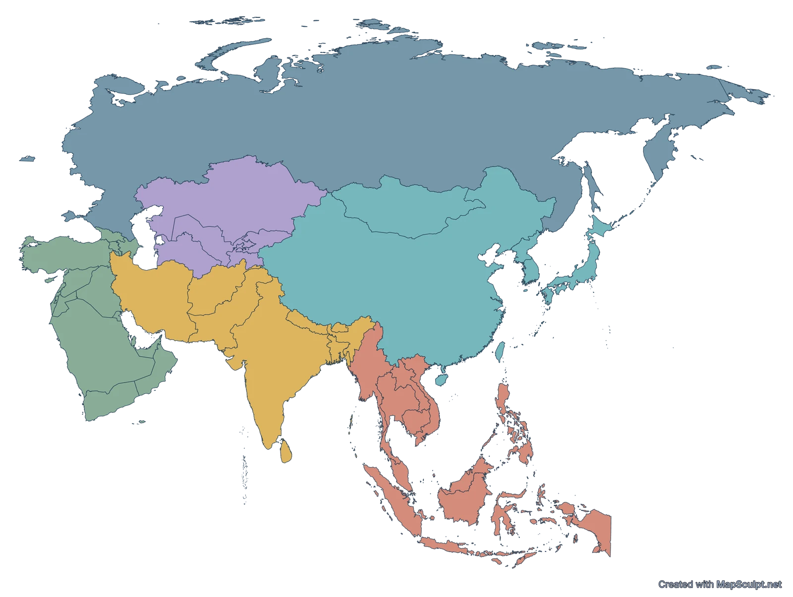
Illustrative · Not UN classification · MapSculpt
01 / MAKE IT YOURS
Highlight individual countries and areas with colours, borders and palettes.
Where CSV import is enabled, match geographic values or categories, then apply them to your map.
Use titles, labels, legends and source information to explain the map.
Download a polished PNG for slides, reports or the classroom.
02 / EXPLORE ASIA
Start with a regional overview, explore official data or tell a personal travel story.
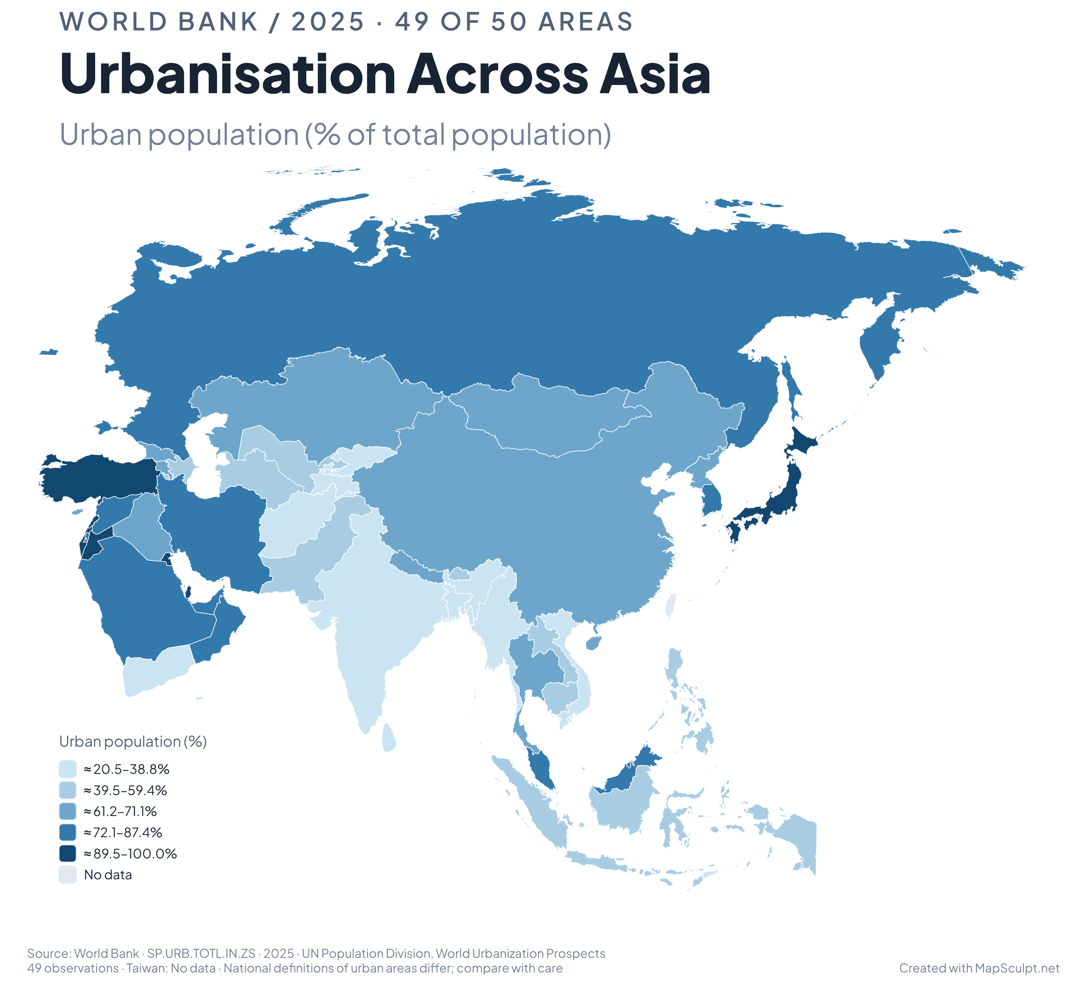
WORLD BANK / URBAN POPULATION
Urbanisation Across Asia
Urban population (%) · World Bank 2025
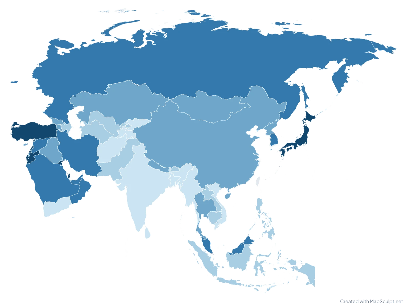
World Bank 2025 · 49 observations · MapSculpt
01 / WORLD BANK · DATA VISUALISATION
Compare urban population as a percentage of total population with World Bank data for 2025.
Five country-count quantiles: 10 / 10 / 10 / 10 / 9 observations. Ranges show approximately rounded observed endpoints. Taiwan: No data.
Source: World Bank World Development Indicators / UN Population Division · SP.URB.TOTL.IN.ZS
National definitions of urban areas differ between countries. Compare the figures with that context in mind.
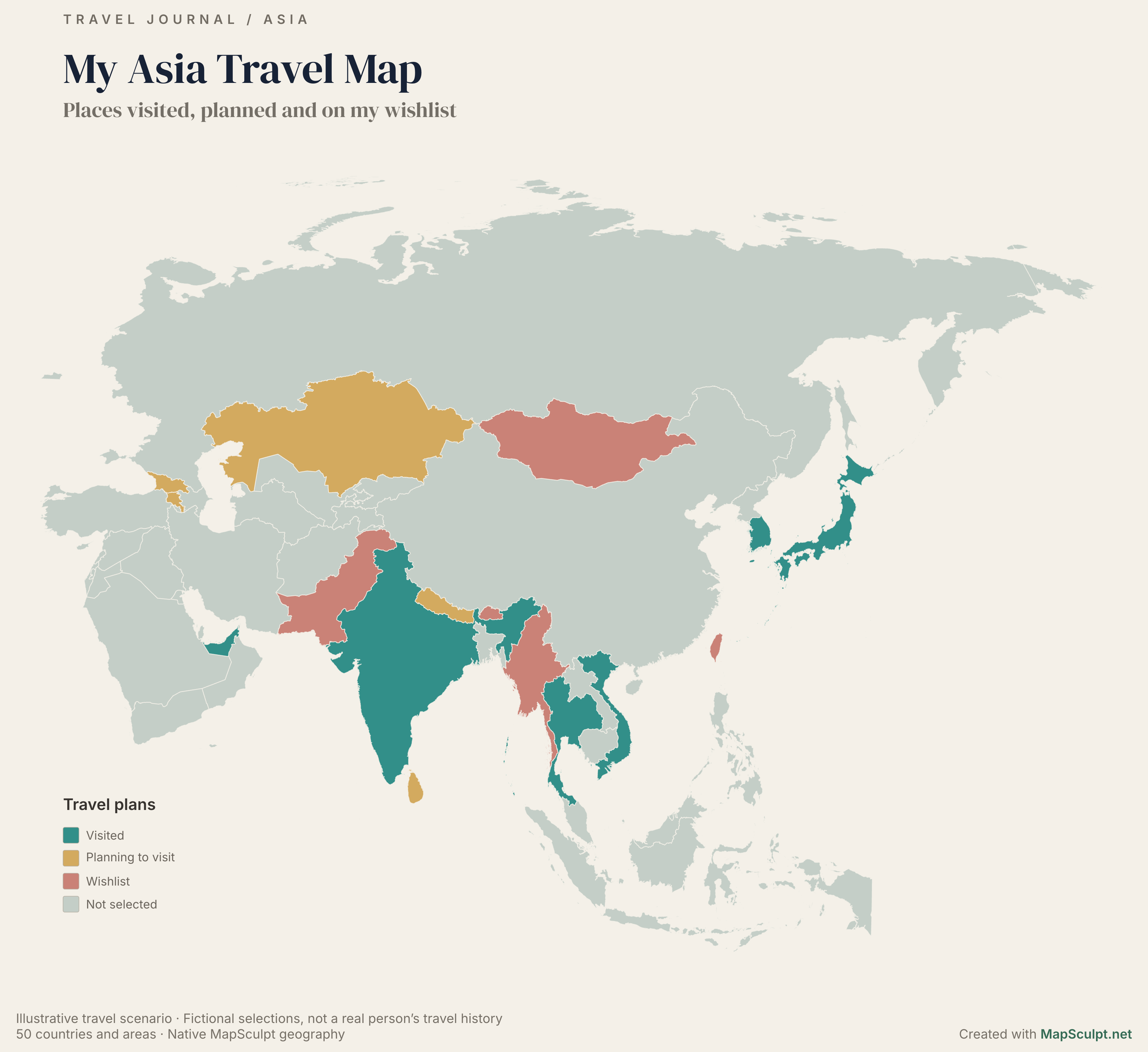
TRAVEL JOURNAL / ASIA
My Asia Travel Map
Visited · Planning · Wishlist
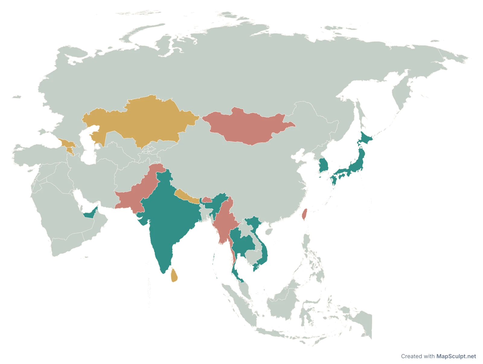
Illustrative selections · Created with MapSculpt
02 / ILLUSTRATIVE TRAVEL STORY
Highlight places visited, trips planned and destinations on a wishlist. All selections are fictional and only demonstrate map styling.
6 visited · 5 planning to visit · 5 wishlist · 34 not selected
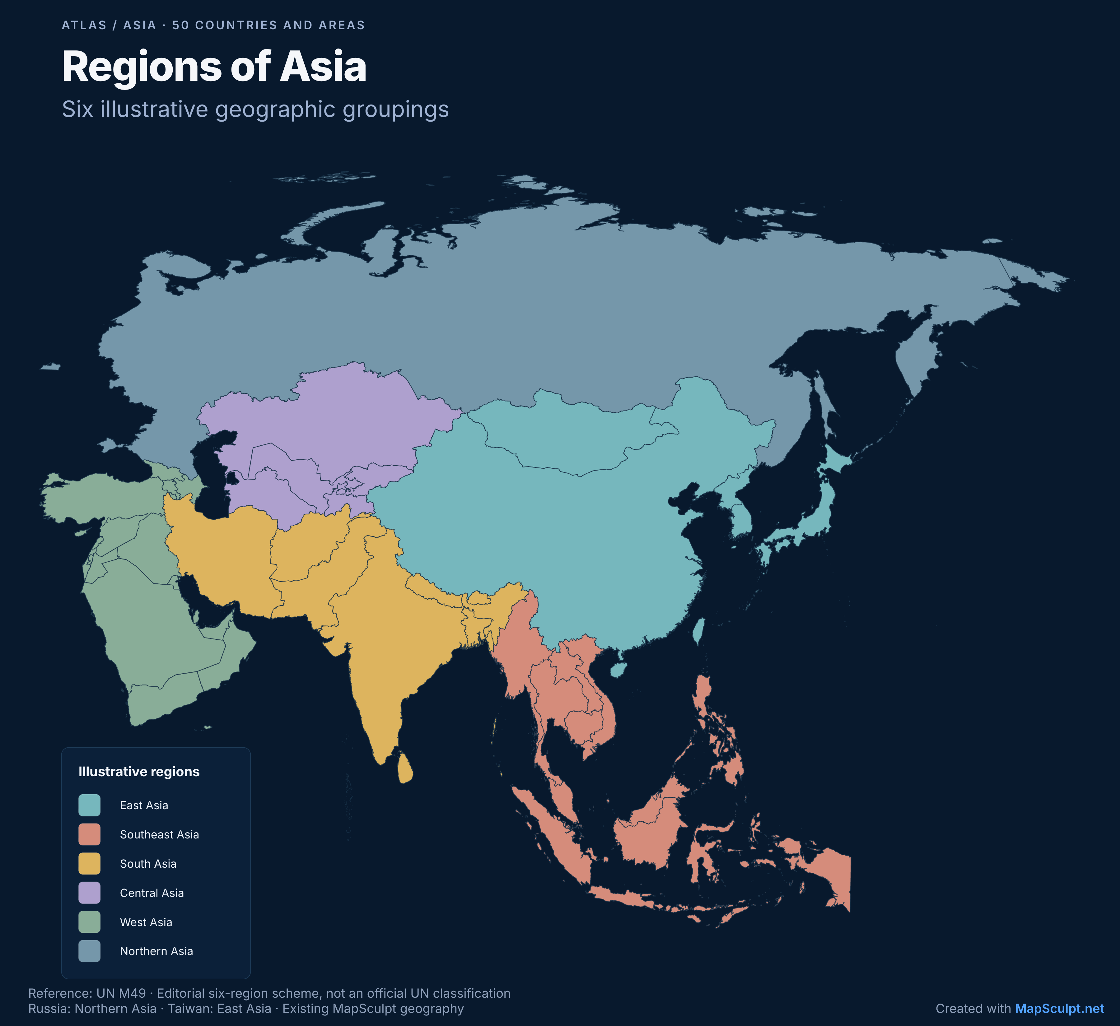
ATLAS / REGIONS OF ASIA
Regions of Asia
50 selectable countries and areas
Illustrative · Not UN classification · MapSculpt
03 / ILLUSTRATIVE REGIONAL GROUPS
Six illustrative geographic groupings based on UN M49 memberships with editorial exceptions. This is not an official UN six-region classification.
Russia: Northern Asia · Iran: South Asia · Taiwan: East Asia
GET STARTED
Start with 50 selectable countries and areas in the Asia editor.
Colour countries manually or, where CSV import is enabled, import values and review geographic matches.
Add labels, a title, readable legend, borders and annotations.
Download a high-resolution PNG for presentations, reports or social media.
ASIA / GEOGRAPHIC COVERAGE
The Asia editor includes 50 selectable countries and areas, including separate Taiwan and Palestine entities. Russia is one indivisible entity. Hong Kong and Macao are not separately selectable. Internal administrative subdivisions are not included; geographic regional definitions differ.
Explore the Asia editorDESIGN WITH CLARITY
Use distinct colours for groups and sequential scales for numerical data.
Consider labels, framing and export resolution for islands and small countries.
Include a title, units, reporting year and source attribution.
KEEP EXPLORING
COMMON QUESTIONS
Open the Asia editor, choose countries and areas, and apply your colours. Add a title, labels and a legend, then export your finished map as a PNG.
Yes. Each of the 50 selectable countries and areas can be coloured individually. Russia is one indivisible entity; Hong Kong and Macao are not separately selectable.
Yes. You can colour and customise an Asia map and export a PNG for free. No sign-up is required.
Start with an uncoloured Asia map in the editor, adjust the borders and background, then export a PNG. There is no separate one-click blank-map download on this page.
Where CSV import is enabled, you can match country identifiers to values or categories, review geographic matches and apply a colour scale. Availability depends on the editor release. The World Bank example shows a verified CSV import and can be opened as a saved map.
The editor contains 50 selectable countries and areas, including separate Taiwan and Palestine map entities. This is a geographic editing scope, not a count of sovereign states. Internal administrative subdivisions are not included, and regional definitions differ.
Yes. Use the editor’s PNG export controls to choose the output size and include the title, legend and background you need for slides, reports or classroom materials.
YOUR NEXT MAP STARTS HERE
Choose a country, highlight a region or visualise data. Create an Asia map that tells your story.