Skip to content
MapSculpt

GEOGRAPHIC MAP MAKER / MISSISSIPPI

Mississippi
Counties Map Maker

Explore how net domestic moves differ between the Delta, the Jackson area and the Gulf Coast. Use the same 82 Census county boundaries to map your own records.

Free online editor · No sign-up required

82counties
individually editable

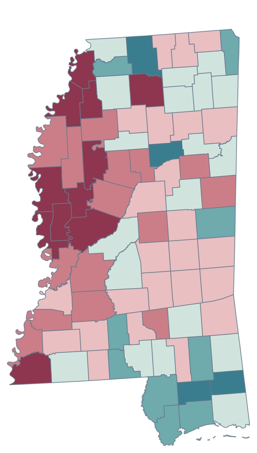
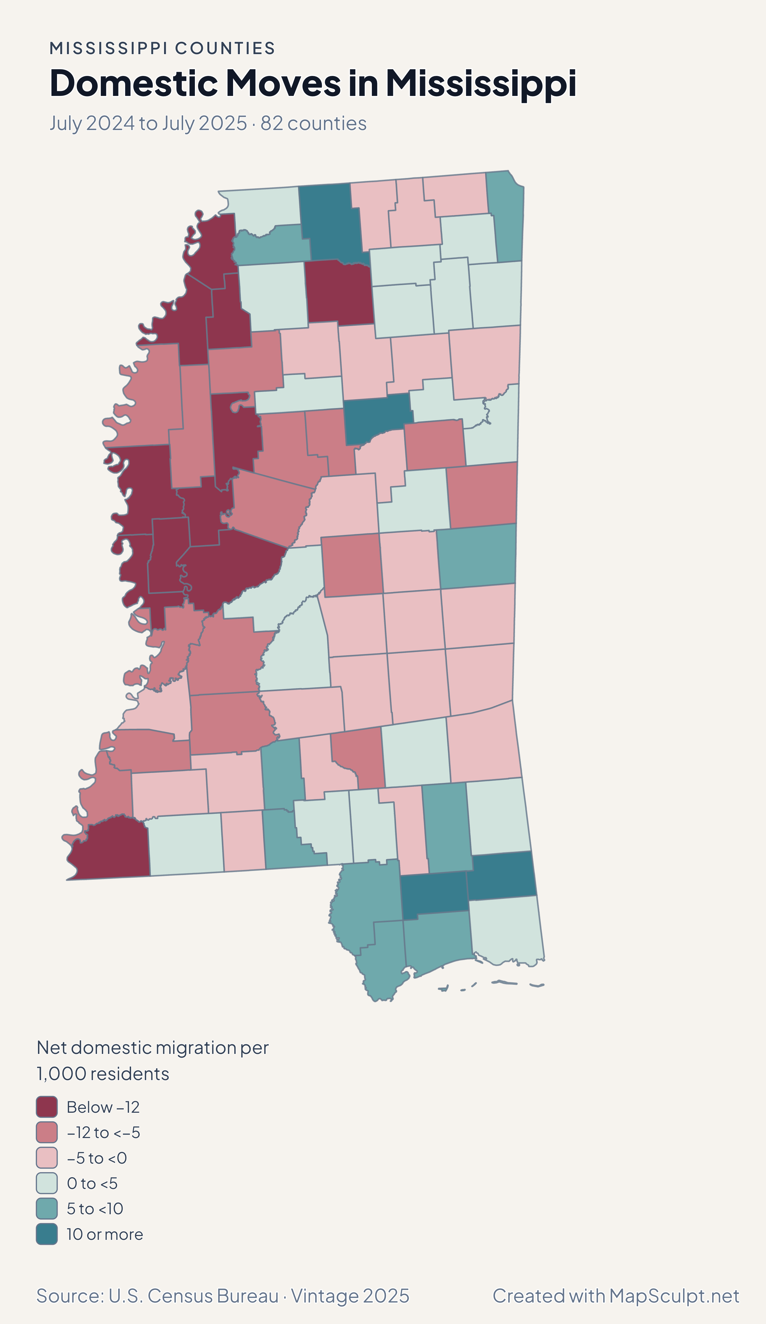
Domestic Moves in Mississippi

July 2024 to July 2025 · 82 counties

Mississippi county choropleth of domestic moves, including Hinds, Hancock, Harrison, Washington.

Net domestic migration per 1,000 residents

  • Below −12
  • −12 to <−5
  • −5 to <0
  • 0 to <5
  • 5 to <10
  • 10 or more
U.S. Census Bureau · Vintage 2025Download complete PNG Net domestic moves within the United States are measured per 1,000 average residents.

KNOW YOUR GEOGRAPHY

From the Mississippi River to the Gulf Coast

The western outline follows generalized Census geography near the Mississippi River. The southern counties include coast and island pieces retained in that source. All pieces of a county share its GEOID.

Jackson city is primarily in Hinds County and extends into Madison and Rankin counties. Jackson County is a separate county on the Gulf Coast. Use county-wide observations for the county map.

Browse all county GEOIDs ↗

2025 Census boundaries

OFFICIAL DATA

The Delta, the Jackson area and the Gulf Coast

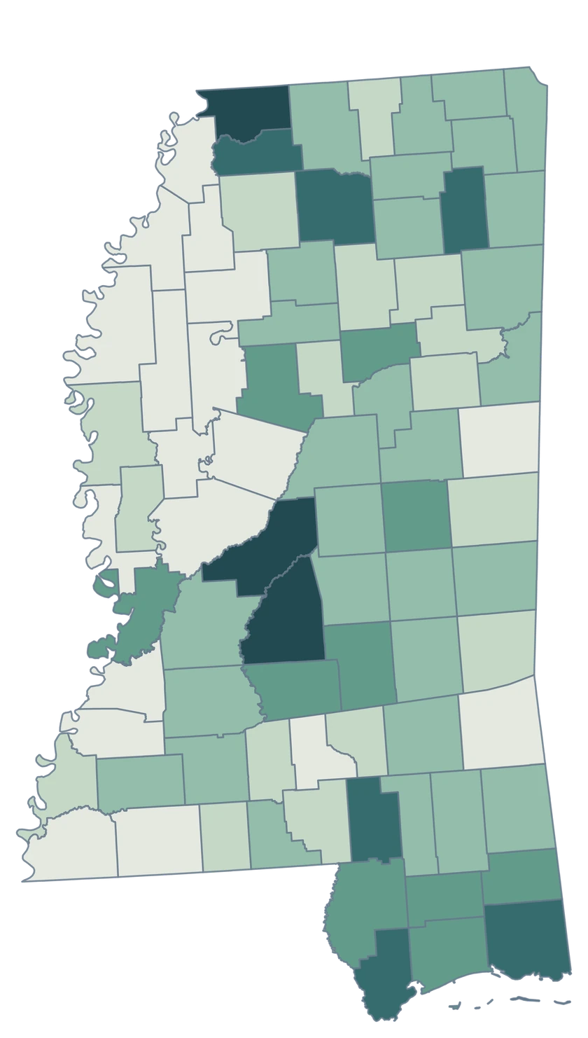
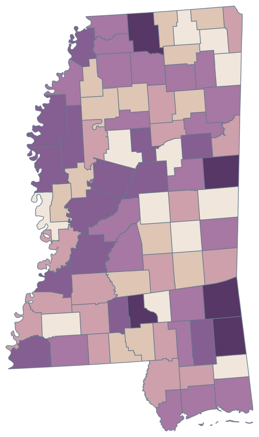
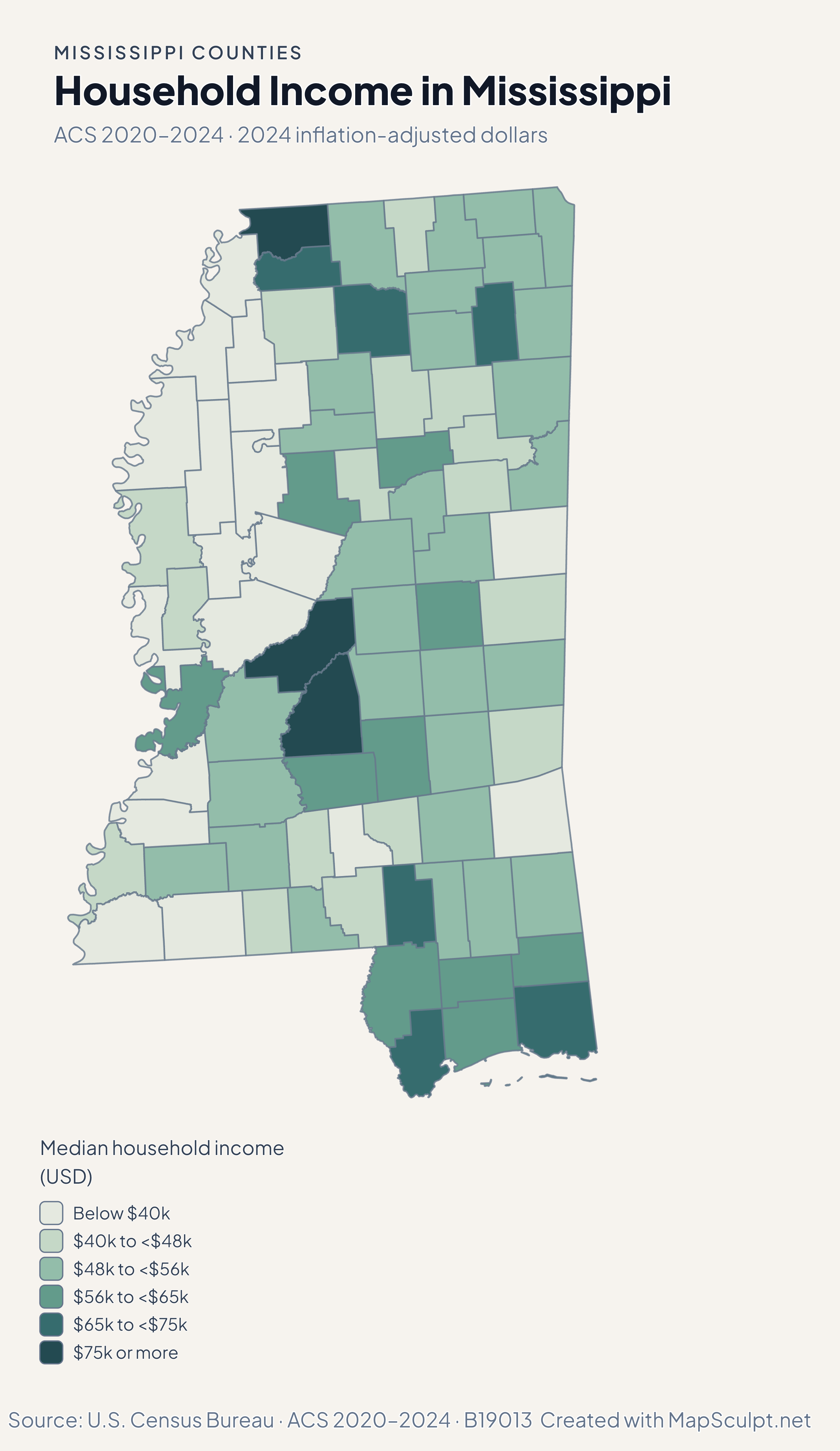
Population and net domestic moves compare July 2024 and July 2025. Household income and renter costs use the 2020–2024 American Community Survey.

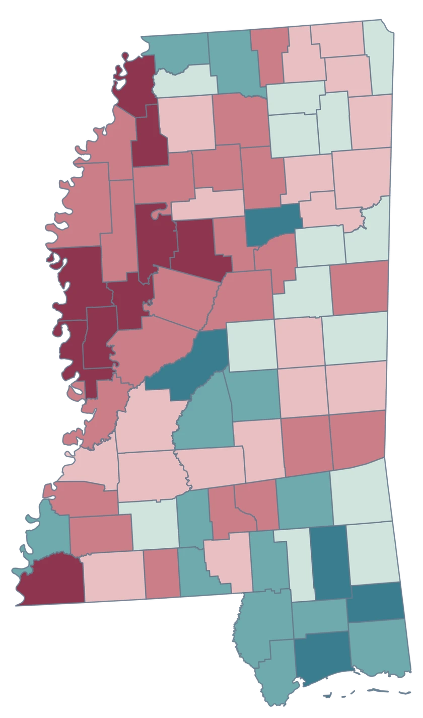
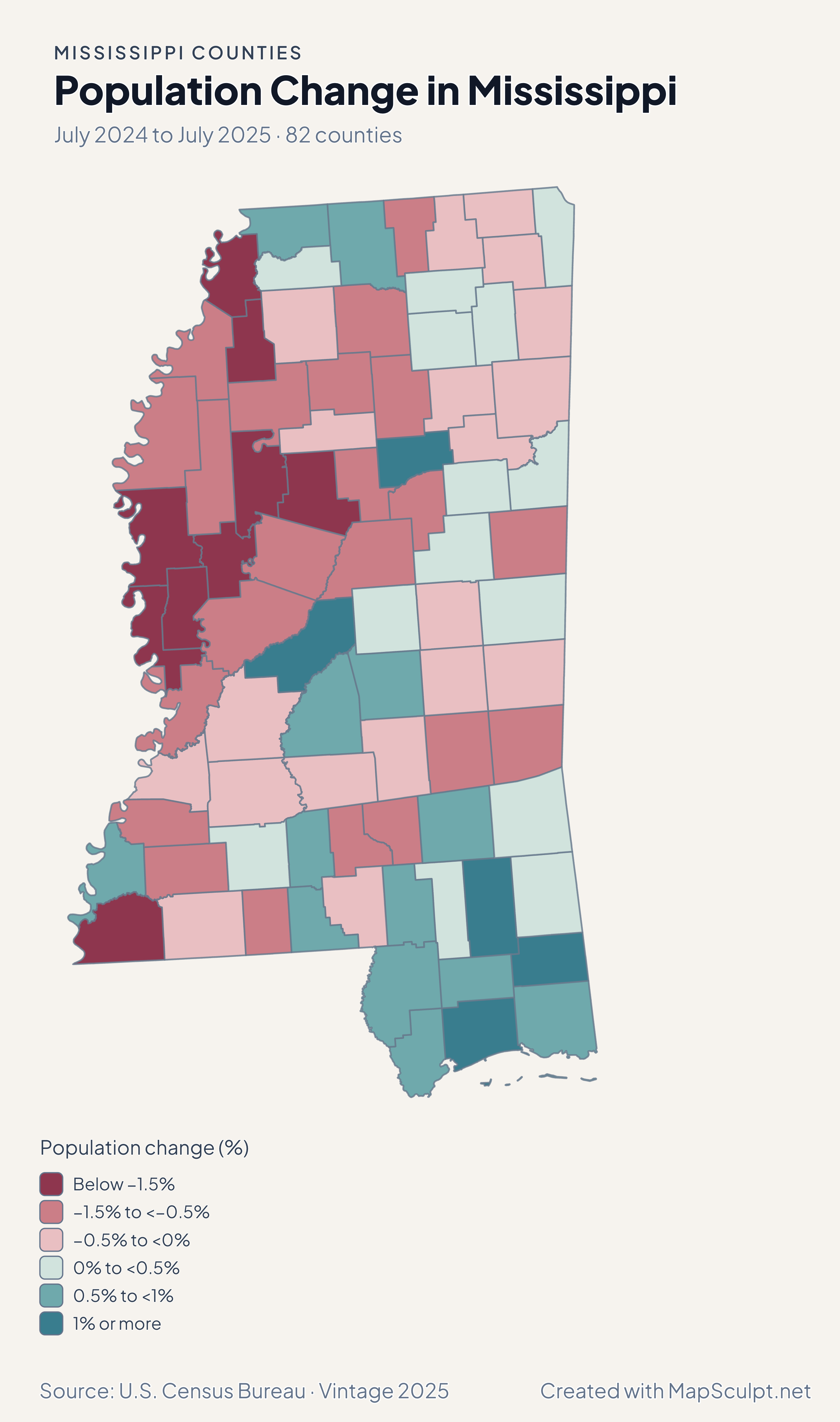
Mississippi county choropleth of population change, including Harrison, Jackson, Hinds, Madison.

July 2024 to July 2025 · 82 counties

Growth on the Gulf Coast contrasted with losses in Hinds.

Harrison grew 1.19% and Jackson County grew 0.52% between July 2024 and July 2025. Hinds declined 0.39%, while neighboring Madison grew 1.20%.

Population change (%)

  • Below −1.5%
  • −1.5% to <−0.5%
  • −0.5% to <0%
  • 0% to <0.5%
  • 0.5% to <1%
  • 1% or more

U.S. Census Bureau · Vintage 2025

Download complete PNG

Hinds recorded −7.82 net domestic movers per 1,000 residents. Hancock recorded +9.94 and Harrison +6.27. In the Delta, Washington County recorded −16.58. See the Census estimates ↗

MAKE IT YOURS

From county data to a finished map.

  1. Open the Mississippi editor

    Start with all 82 county features.

  2. Match county records

    Use the five-digit GEOID, such as 28049. Review matches before applying a color scale.

  3. Classify by measurement

    Choose intervals and colors that make the units and direction of change easy to read.

  4. Export the finished map

    Include the source, period and legend in a downloadable PNG.

TRY CSV IMPORT

Try six Mississippi records.

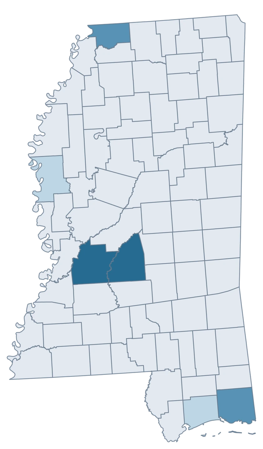
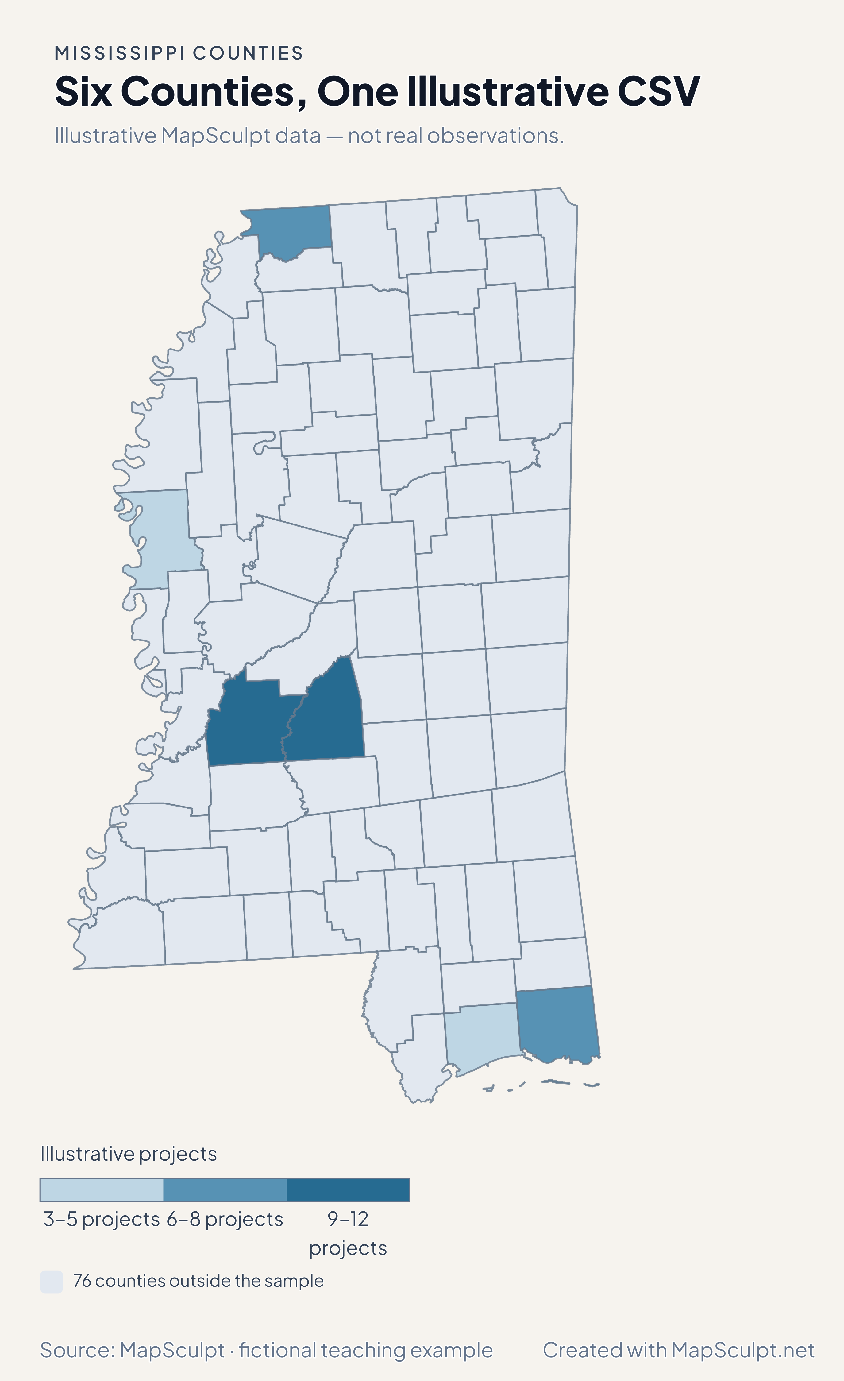
Import the fictional project counts and use breaks of 3, 6, 9 and 12. The remaining 76 counties stay neutral.

Illustrative MapSculpt data — not real observations.
CountyGEOIDProjects
Hinds County2804912
Rankin County281219
DeSoto County280337
Harrison County280473
Jackson County280598
Washington County281515

Keep five-digit GEOIDs as text. The sample uses 28049 for Hinds County.

Download illustrative CSV ↓

Six Counties, One Illustrative CSV

Illustrative MapSculpt data — not real observations.

Mississippi example map with six fictional project counts and 76 neutral counties.

Illustrative projects

  • 3–5 projects
  • 6–8 projects
  • 9–12 projects
  • 76 counties outside the sample
Download complete PNG

CSV → Match 6 counties → Style → Export PNG Create a Mississippi map

COUNTY REFERENCE

All 82 Mississippi counties and GEOIDs.

Official county names and five-digit Census GEOIDs. Search by name or code.

  1. Adams CountyGEOID 28001
  2. Alcorn CountyGEOID 28003
  3. Amite CountyGEOID 28005
  4. Attala CountyGEOID 28007
  5. Benton CountyGEOID 28009
  6. Bolivar CountyGEOID 28011
  7. Calhoun CountyGEOID 28013
  8. Carroll CountyGEOID 28015
  9. Chickasaw CountyGEOID 28017
  10. Choctaw CountyGEOID 28019
  11. Claiborne CountyGEOID 28021
  12. Clarke CountyGEOID 28023
  13. Clay CountyGEOID 28025
  14. Coahoma CountyGEOID 28027
  15. Copiah CountyGEOID 28029
  16. Covington CountyGEOID 28031
  17. DeSoto CountyGEOID 28033
  18. Forrest CountyGEOID 28035
  19. Franklin CountyGEOID 28037
  20. George CountyGEOID 28039
  21. Greene CountyGEOID 28041
  22. Grenada CountyGEOID 28043
  23. Hancock CountyGEOID 28045
  24. Harrison CountyGEOID 28047
  25. Hinds CountyGEOID 28049
  26. Holmes CountyGEOID 28051
  27. Humphreys CountyGEOID 28053
  28. Issaquena CountyGEOID 28055
  29. Itawamba CountyGEOID 28057
  30. Jackson CountyGEOID 28059
  31. Jasper CountyGEOID 28061
  32. Jefferson CountyGEOID 28063
  33. Jefferson Davis CountyGEOID 28065
  34. Jones CountyGEOID 28067
  35. Kemper CountyGEOID 28069
  36. Lafayette CountyGEOID 28071
  37. Lamar CountyGEOID 28073
  38. Lauderdale CountyGEOID 28075
  39. Lawrence CountyGEOID 28077
  40. Leake CountyGEOID 28079
  41. Lee CountyGEOID 28081
  42. Leflore CountyGEOID 28083
  43. Lincoln CountyGEOID 28085
  44. Lowndes CountyGEOID 28087
  45. Madison CountyGEOID 28089
  46. Marion CountyGEOID 28091
  47. Marshall CountyGEOID 28093
  48. Monroe CountyGEOID 28095
  49. Montgomery CountyGEOID 28097
  50. Neshoba CountyGEOID 28099
  51. Newton CountyGEOID 28101
  52. Noxubee CountyGEOID 28103
  53. Oktibbeha CountyGEOID 28105
  54. Panola CountyGEOID 28107
  55. Pearl River CountyGEOID 28109
  56. Perry CountyGEOID 28111
  57. Pike CountyGEOID 28113
  58. Pontotoc CountyGEOID 28115
  59. Prentiss CountyGEOID 28117
  60. Quitman CountyGEOID 28119
  61. Rankin CountyGEOID 28121
  62. Scott CountyGEOID 28123
  63. Sharkey CountyGEOID 28125
  64. Simpson CountyGEOID 28127
  65. Smith CountyGEOID 28129
  66. Stone CountyGEOID 28131
  67. Sunflower CountyGEOID 28133
  68. Tallahatchie CountyGEOID 28135
  69. Tate CountyGEOID 28137
  70. Tippah CountyGEOID 28139
  71. Tishomingo CountyGEOID 28141
  72. Tunica CountyGEOID 28143
  73. Union CountyGEOID 28145
  74. Walthall CountyGEOID 28147
  75. Warren CountyGEOID 28149
  76. Washington CountyGEOID 28151
  77. Wayne CountyGEOID 28153
  78. Webster CountyGEOID 28155
  79. Wilkinson CountyGEOID 28157
  80. Winston CountyGEOID 28159
  81. Yalobusha CountyGEOID 28161
  82. Yazoo CountyGEOID 28163

U.S. Census Bureau · 2025 Cartographic Boundary Files

COMMON QUESTIONS

Mississippi county map questions.

Which county contains Jackson city?

Jackson is primarily in Hinds County, GEOID 28049, and extends into Madison and Rankin. Use the geographic unit named by your source.

Is Jackson County the same place as Jackson?

Jackson County, GEOID 28059, is on the Gulf Coast. It is geographically separate from the state capital.

Can I color all three coastal counties?

Hancock, Harrison and Jackson can be styled separately or colored as a group. The generalized source retains coastal pieces at county scale.

Which counties should I include in a Delta comparison?

Define your study area in the legend or caption. Washington and Bolivar are examples you can compare individually using their GEOIDs.

How do I join a file with Mississippi and Louisiana records?

For a cross-state comparison, use the national county editor and keep the full five-digit GEOIDs so similarly named places stay distinct.

Why does population change differ from domestic migration?

Total change includes births, deaths and international migration. The domestic map isolates net moves within the United States and scales by population.

YOUR NEXT MAP STARTS HERE

Build your Mississippi county map.

Join your own Mississippi county records by GEOID, review the matches and export with an accurate legend.

Create a Mississippi map