Skip to content
MapSculpt

Geographic map maker / Switzerland

Switzerland Cantons Map Maker

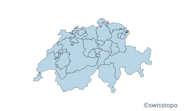
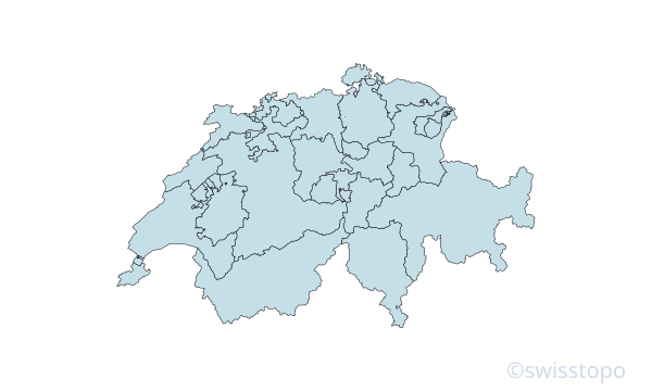
Colour all 26 Swiss cantons using official 2026 boundaries. Import CSV data, customise colours and legends, and export a high-resolution map.

Free online editor · No sign-up required

26cantons individually editable

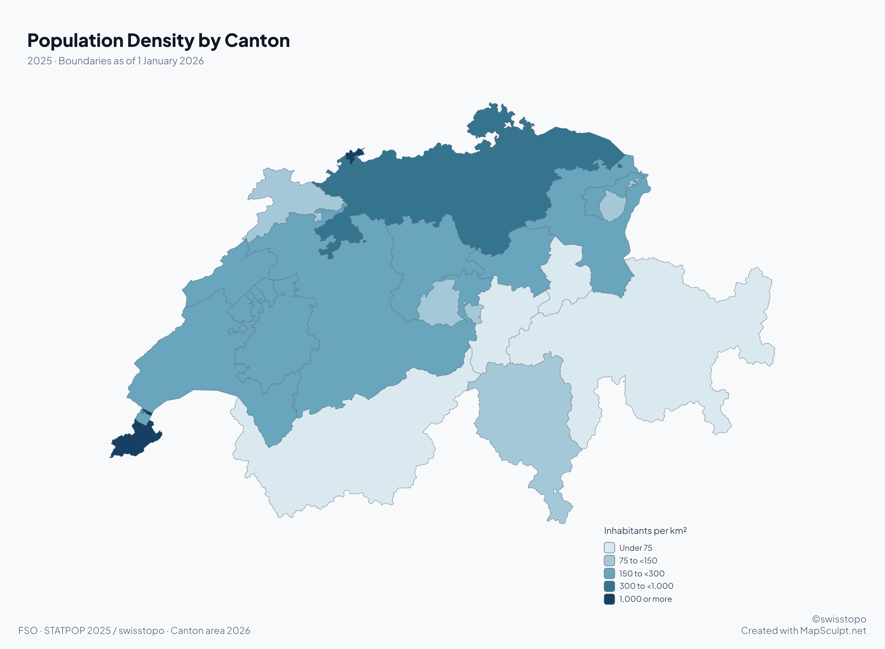
Population Density by Canton

Blue choropleth of population density in all 26 Swiss cantons in 2025.

Inhabitants per km²

  • Under 75
  • 75 to <150
  • 150 to <300
  • 300 to <1,000
  • 1,000 or more

Permanent residents on 31 December 2025 per square kilometre of canton area, including assigned waters. Moutier’s 2025 residents are counted in Jura to match the 2026 map.

Know your geography

26 cantons. One Switzerland.

Cantons are Switzerland’s constituent federal units. You can colour all 26 individually, including the six historically known as half-cantons. Four cantons have more than one official language.

Moutier transferred from Bern to Jura on 1 January 2026. The editor uses the official boundaries from that date. swisstopo · swissBOUNDARIES3D 2026

Find a canton in the directory

Map examples

Switzerland through three different maps

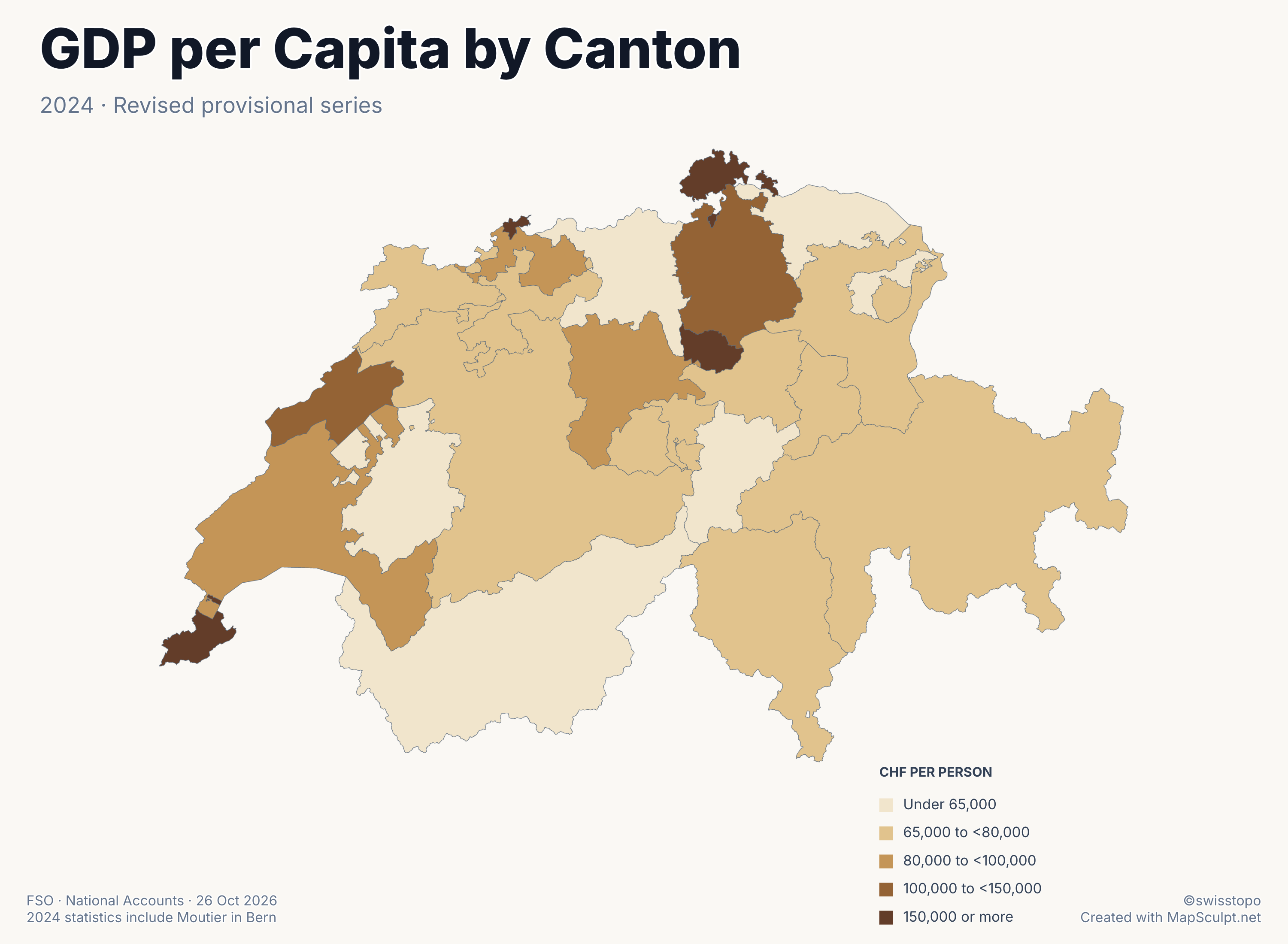
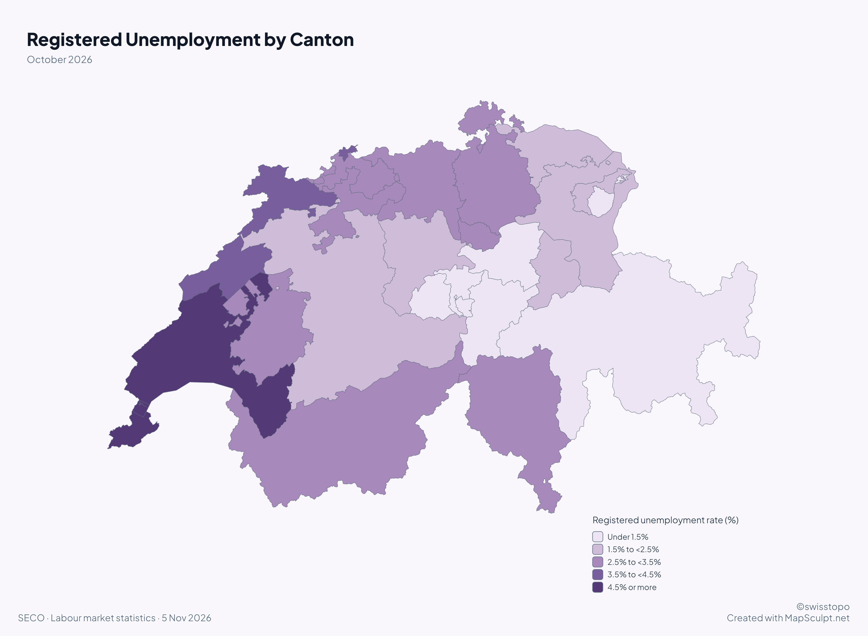
Compare official languages, economic output and registered unemployment using the same canton boundaries.

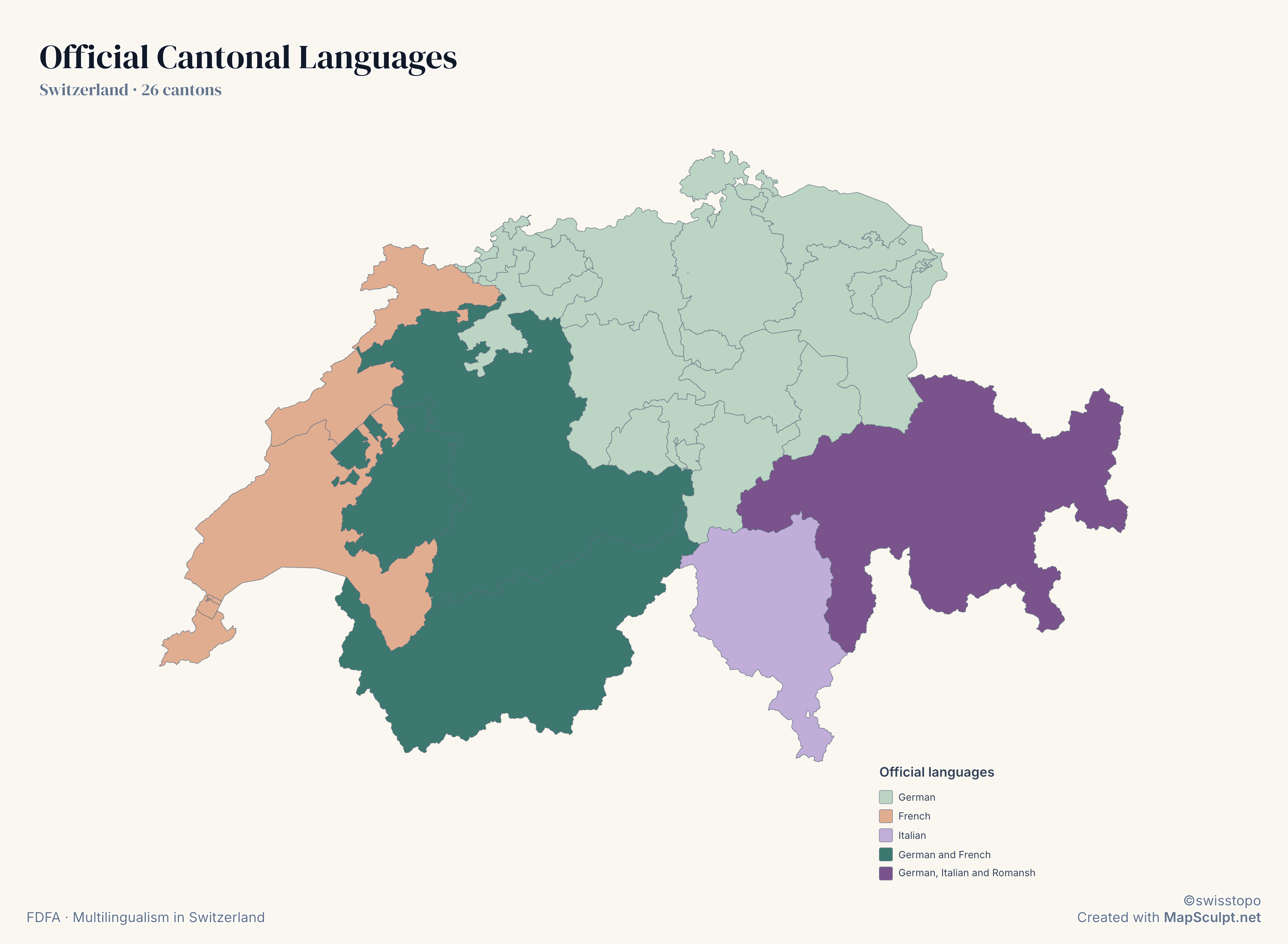
Categorical map of official Swiss cantonal languages, including three bilingual cantons and trilingual Graubünden.

Switzerland · 26 cantons

Four languages. One Switzerland.

Bern, Fribourg and Valais use German and French. Graubünden uses German, Italian and Romansh. Ticino uses Italian.

Official languages

  • German
  • French
  • Italian
  • German and French
  • German, Italian and Romansh

Colours show each canton’s official languages. They do not show where individual speakers live.

FDFA · Multilingualism in Switzerland

View full-size PNGCreate a Switzerland map

How it works

From canton outlines to a finished map

  1. Choose your cantons

    Open the editor and colour any of Switzerland’s 26 cantons.

  2. Import your CSV

    Match canton names or codes. Apply categories or a numerical colour scale.

  3. Customise your map

    Adjust colours, titles, legends, labels and data sources.

  4. Export your PNG

    Choose the layout, background and export resolution.

Try a CSV

From spreadsheet to Switzerland cantons map

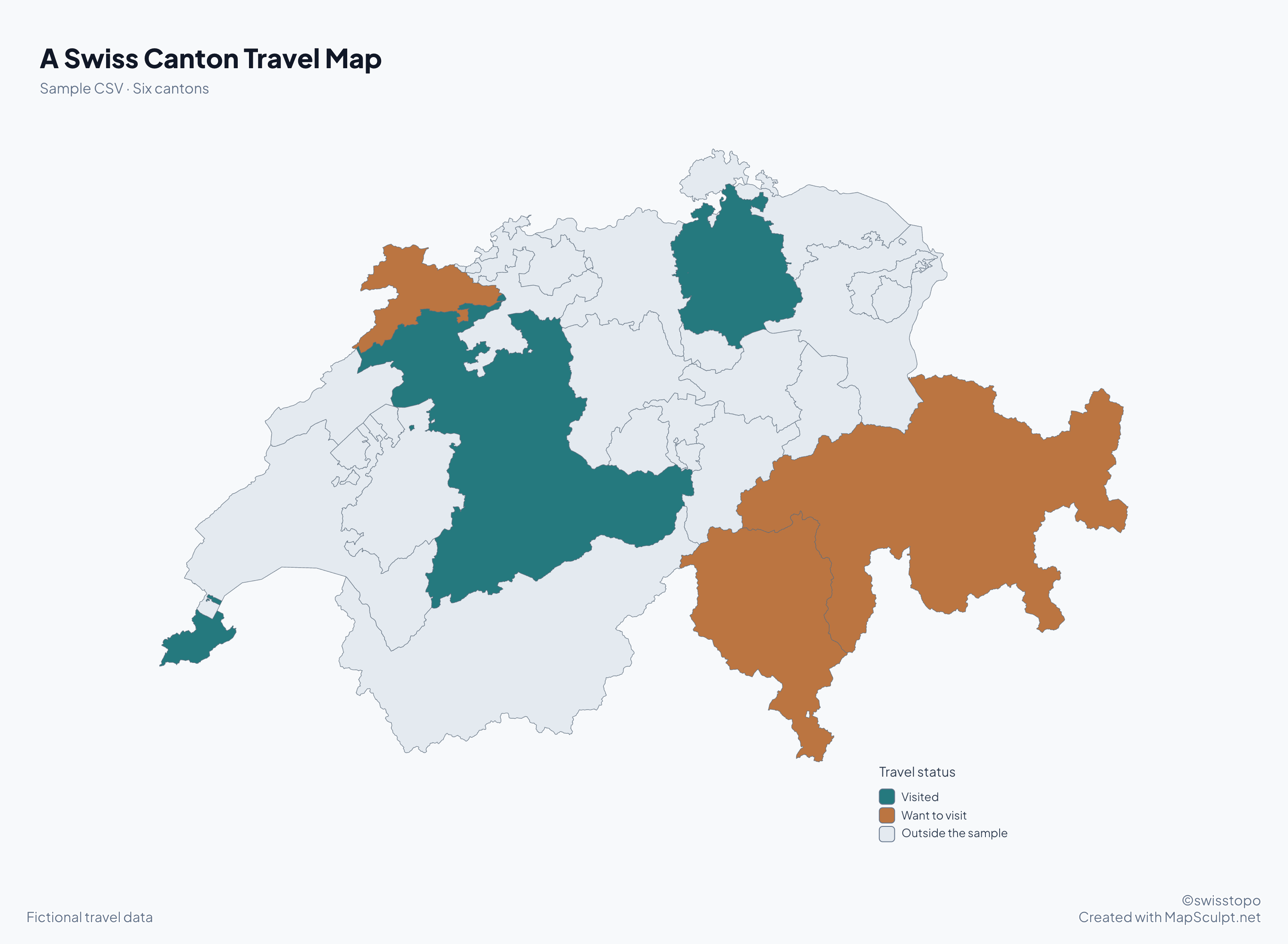
Download these six fictional travel entries and import them into the editor to reproduce the map.

Sample travel data
CantonCanton codeStatus
ZürichCH-ZHVisited
GenevaCH-GEVisited
BernCH-BEVisited
TicinoCH-TIWant to visit
GraubündenCH-GRWant to visit
JuraCH-JUWant to visit

Match the Canton code column and colour by Status. The sample uses the same canton codes as the editor.

Download the sample CSV

A Swiss Canton Travel Map

Swiss cantons map colouring three visited cantons and three to visit.
  • Visited
  • Want to visit
  • Outside the sample
View full-size PNG
Create a Switzerland map

Canton directory

Find any of Switzerland’s 26 cantons

Search names in different Swiss languages, or enter a code such as GR or CH-GR.

  • CH-AG
    AargauMain town or seat. AarauOfficial cantonal languages. German
  • CH-AR
    Appenzell AusserrhodenMain town or seat. Herisau / TrogenOfficial cantonal languages. German
  • CH-AI
    Appenzell InnerrhodenMain town or seat. AppenzellOfficial cantonal languages. German
  • CH-BL
    Basel-LandschaftMain town or seat. LiestalOfficial cantonal languages. German
  • CH-BS
    Basel-StadtMain town or seat. BaselOfficial cantonal languages. German
  • CH-BE
    BernMain town or seat. BernOfficial cantonal languages. German, French
  • CH-FR
    FribourgMain town or seat. Fribourg / FreiburgOfficial cantonal languages. German, French
  • CH-GE
    GenevaMain town or seat. GenèveOfficial cantonal languages. French
  • CH-GL
    GlarusMain town or seat. GlarusOfficial cantonal languages. German
  • CH-GR
    GraubündenMain town or seat. ChurOfficial cantonal languages. German, Italian, Romansh
  • CH-JU
    JuraMain town or seat. DelémontOfficial cantonal languages. French
  • CH-LU
    LucerneMain town or seat. LuzernOfficial cantonal languages. German
  • CH-NE
    NeuchâtelMain town or seat. NeuchâtelOfficial cantonal languages. French
  • CH-NW
    NidwaldenMain town or seat. StansOfficial cantonal languages. German
  • CH-OW
    ObwaldenMain town or seat. SarnenOfficial cantonal languages. German
  • CH-SH
    SchaffhausenMain town or seat. SchaffhausenOfficial cantonal languages. German
  • CH-SZ
    SchwyzMain town or seat. SchwyzOfficial cantonal languages. German
  • CH-SO
    SolothurnMain town or seat. SolothurnOfficial cantonal languages. German
  • CH-SG
    St. GallenMain town or seat. St. GallenOfficial cantonal languages. German
  • CH-TG
    ThurgauMain town or seat. FrauenfeldOfficial cantonal languages. German
  • CH-TI
    TicinoMain town or seat. BellinzonaOfficial cantonal languages. Italian
  • CH-UR
    UriMain town or seat. AltdorfOfficial cantonal languages. German
  • CH-VS
    ValaisMain town or seat. SionOfficial cantonal languages. German, French
  • CH-VD
    VaudMain town or seat. LausanneOfficial cantonal languages. French
  • CH-ZG
    ZugMain town or seat. ZugOfficial cantonal languages. German
  • CH-ZH
    ZürichMain town or seat. ZürichOfficial cantonal languages. German

Federal Statistical Office · Cantons and main towns, 1 January 2026

Herisau is the seat of government for Appenzell Ausserrhoden, while Trogen is the seat of its high court.

What’s the difference between a canton and a municipality?

A canton is a member state of the Swiss Confederation, with its own constitution and authorities. Municipalities govern at the local level within cantons. This map lets you edit cantons. To colour regional subdivisions across Germany, Austria and Switzerland in one map, open the DACH editor.

Open the DACH regions map

THE MAPSCULPT COLLECTION

Choose your map.

Find your geography. Add your perspective.

95 maps / 8 collections

Countries, regions and counties. Ready for your ideas.

Sort maps

California

Counties

Texas

Counties

Florida

Counties

New York

Counties

Pennsylvania

Counties

Illinois

Counties

Ohio

Counties

Georgia

Counties

North Carolina

Counties

Michigan

Counties

New Jersey

Counties

Virginia

Counties

1–12 of 50 state maps

Questions and answers

Frequently asked questions

How many cantons does Switzerland have?

Switzerland has 26 cantons. Each is a constituent unit of the Swiss Confederation.

Can I colour each Swiss canton separately?

Yes. Select any canton to give it a colour, or apply a whole dataset using CSV import.

Does the map use the updated 2026 boundaries?

Yes. The map is derived from swisstopo’s swissBOUNDARIES3D edition valid from 1 January 2026.

Is Moutier in Bern or Jura?

Moutier has been in the canton of Jura since 1 January 2026. Older tables may still include it in Bern for earlier reference years.

What are the six historical half-cantons?

Obwalden, Nidwalden, Basel-Stadt, Basel-Landschaft, Appenzell Ausserrhoden and Appenzell Innerrhoden each have half a cantonal vote when a federal vote requires a majority of cantons. All six are cantons.

Which cantons have multiple official languages?

Bern, Fribourg and Valais use German and French. Graubünden uses German, Italian and Romansh.
Can I import canton data from Excel or CSV?
Save your Excel sheet as CSV, then import that file. Use a canton name or a code such as CH-TI, then choose the column that contains the values or categories.

Can I download a blank map of Swiss cantons?
Open the editor and download the map before adding any colours or labels.
Can I export a high-resolution PNG?

Yes. Choose a preset or a custom resolution in the PNG download dialog.

Is MapSculpt free to use?

You can use the online editor, import CSV data and download a PNG without signing up.

Start mapping

Make Switzerland’s geography your own.

Colour all 26 cantons, turn your data into a map and export your finished design.

Create a Switzerland map