Skip to content
MapSculpt

GEOGRAPHIC MAP MAKER / WISCONSIN

Wisconsin
Counties Map Maker

Compare net domestic moves in Wisconsin’s Lake Michigan counties, the Madison area and the Northwoods. Then color, label and export your own map of all 72 counties.

Free online editor · No sign-up required

72counties
individually editable

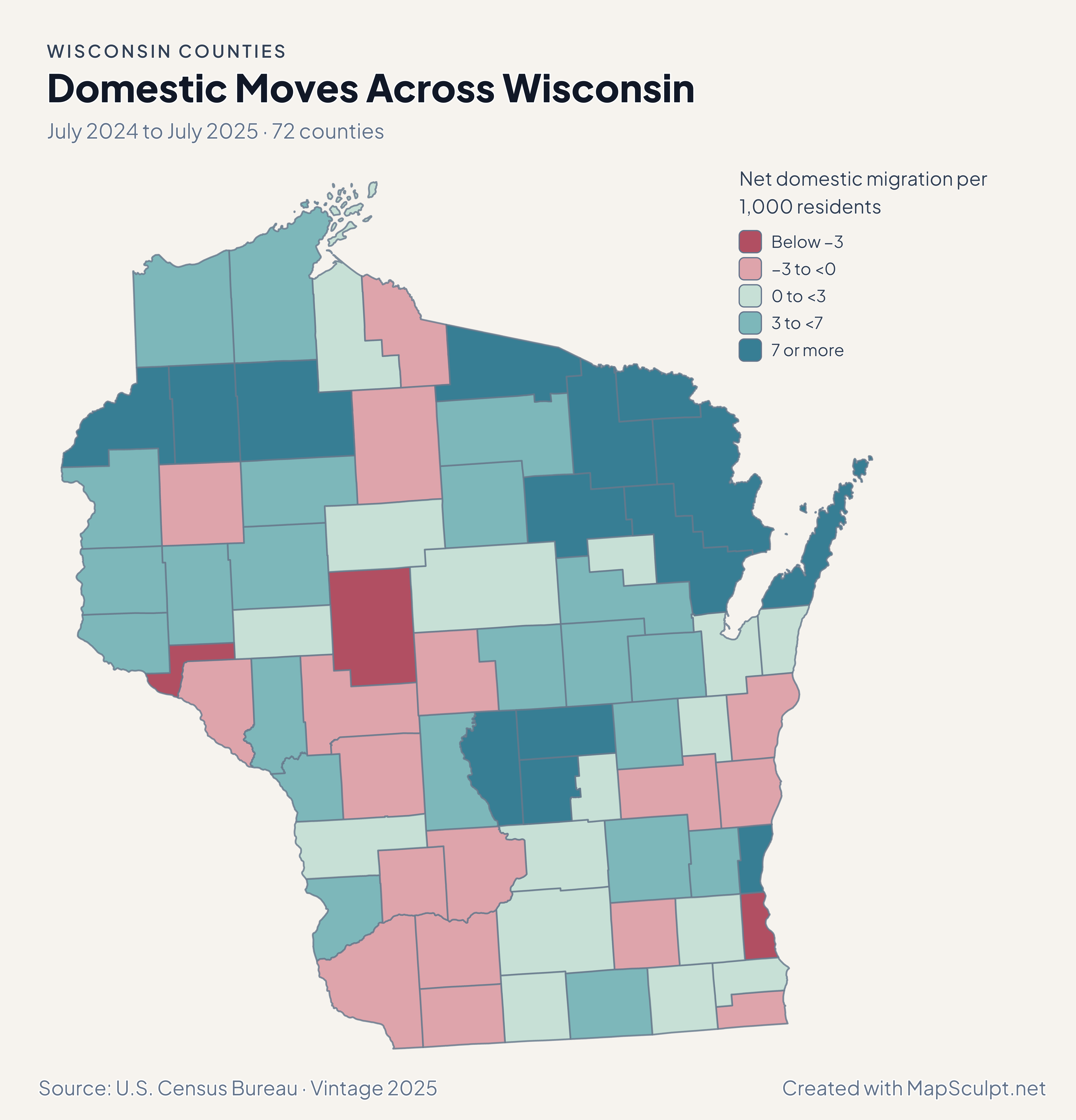
Domestic Moves Across Wisconsin

July 2024 to July 2025 · 72 counties

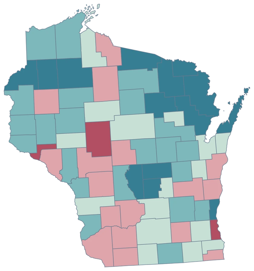
Wisconsin migration with a strong gain band in Florence and Door and a loss band in Milwaukee.

Net domestic migration per 1,000 residents

  • Below −3
  • −3 to <0
  • 0 to <3
  • 3 to <7
  • 7 or more
U.S. Census Bureau · Vintage 2025Download complete PNG Domestic migration rates compare net moves with the average of the two July populations. A high rate in a small county can represent few people.

KNOW YOUR GEOGRAPHY

From Lake Michigan to the Northwoods.

The editor preserves the generalized county geography along Lake Michigan, Green Bay and Lake Superior. Door County includes the peninsula and island pieces retained by the source.

Use counties for statewide joins. Milwaukee, Madison and Green Bay are cities within the county geography, so choose official GEOIDs for your county-wide records.

Browse all county GEOIDs ↗

2025 Census boundaries

OFFICIAL DATA

The Northwoods and the larger metros show different rates.

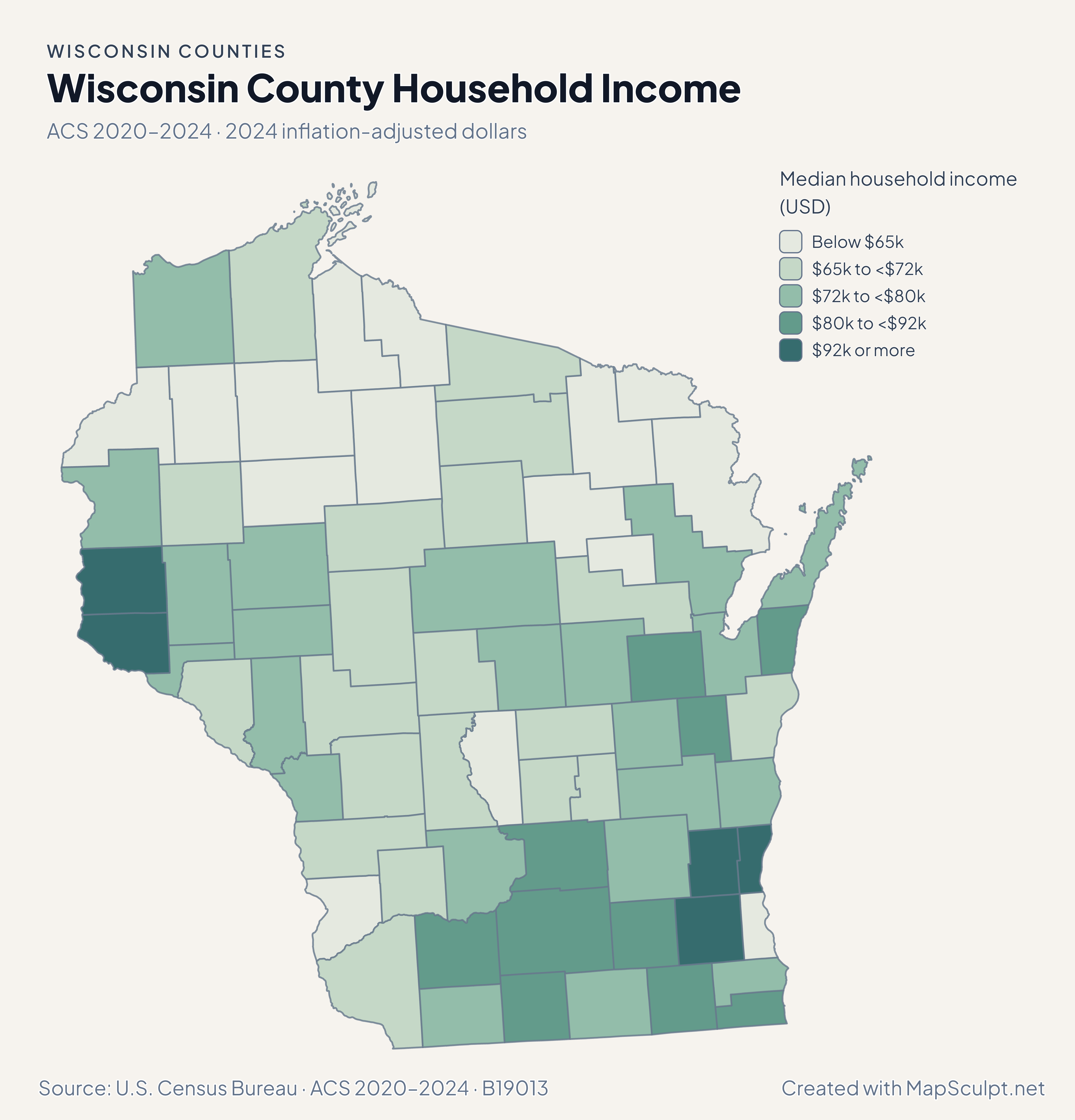
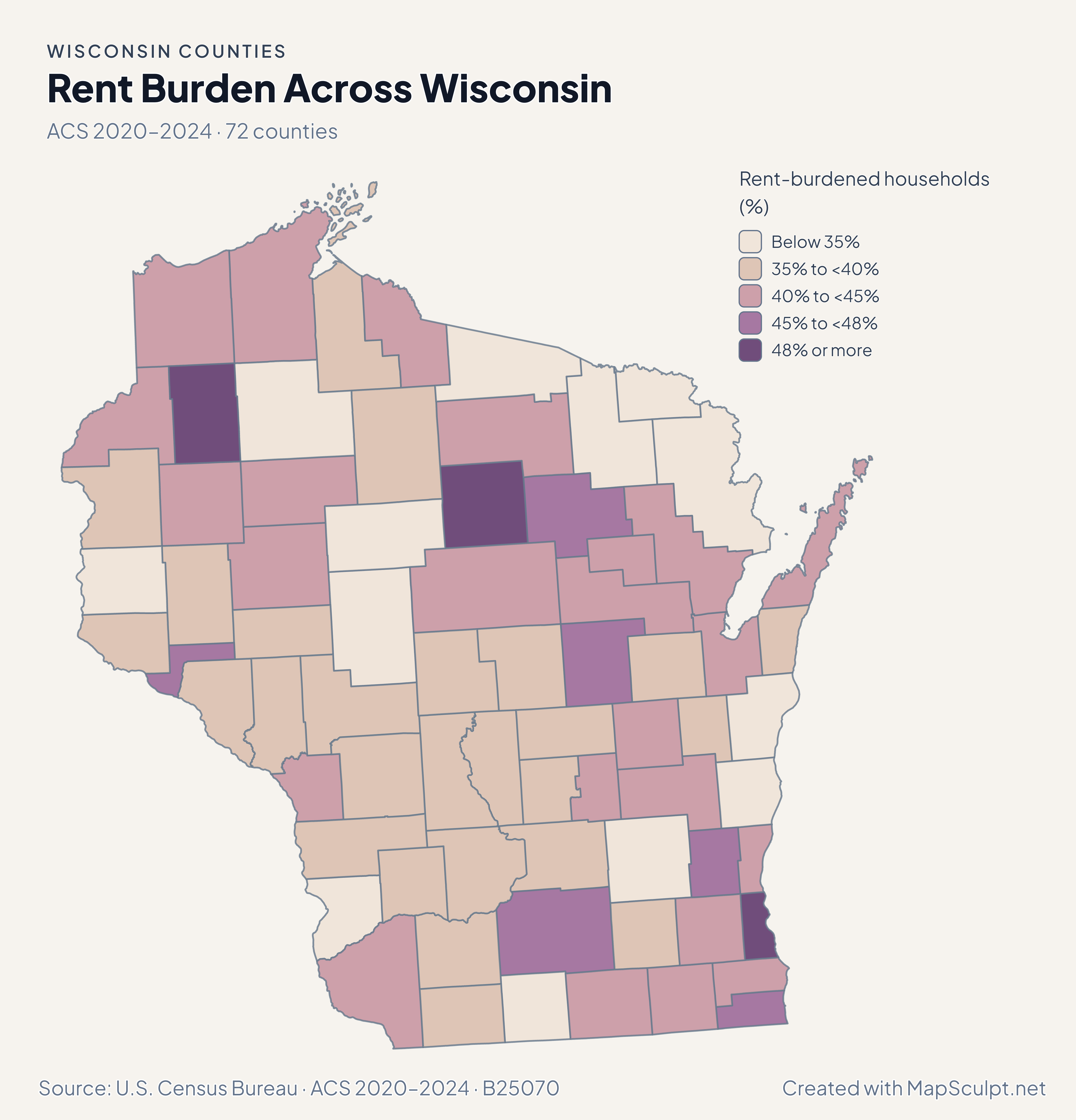
Read migration alongside total population change. Income and rent-burden maps add two ACS views of the same geography.

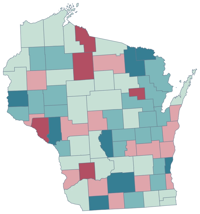
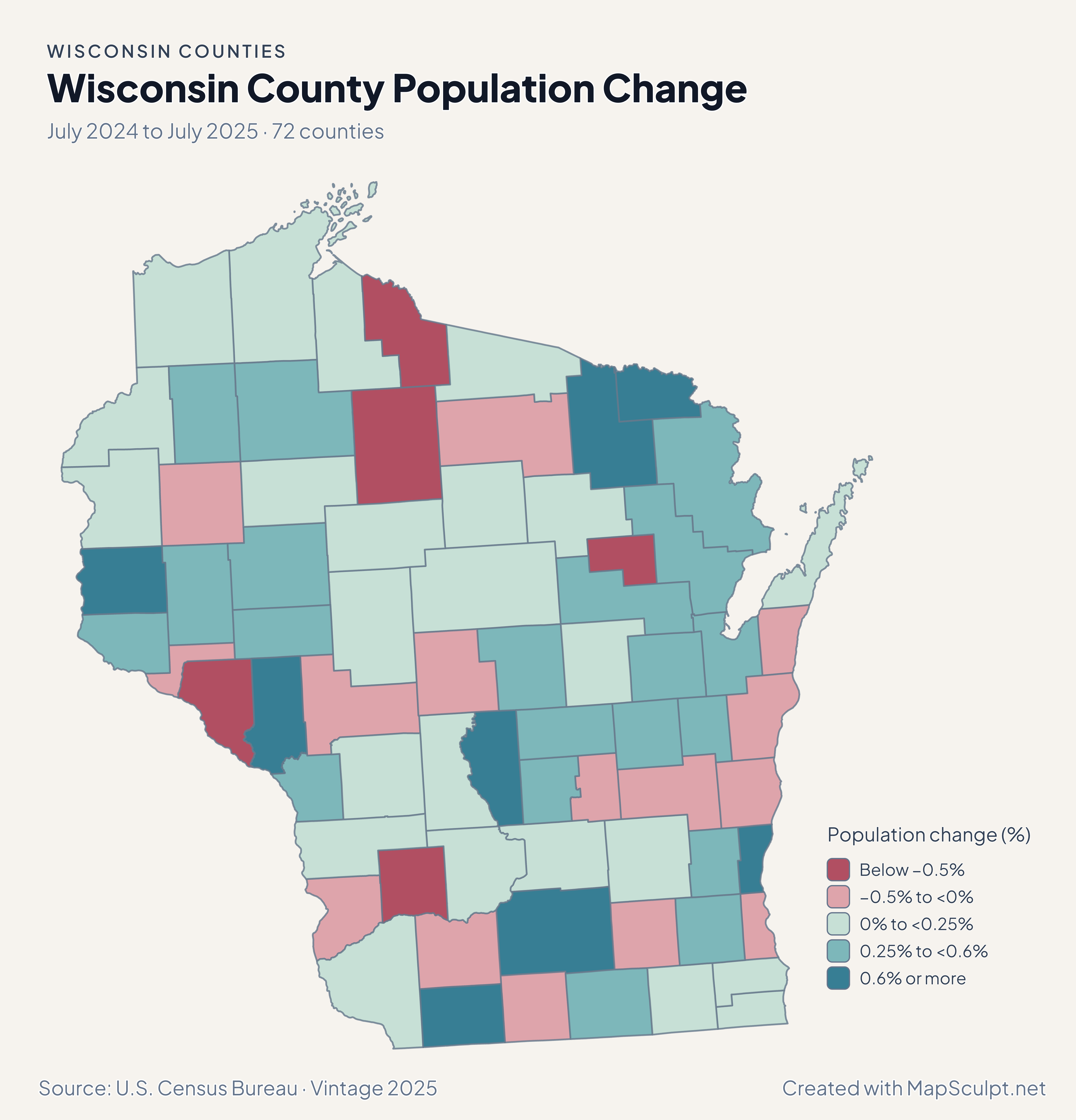
Wisconsin population change showing gains in Dane and Brown and small declines elsewhere.

July 2024 to July 2025 · 72 counties

Dane grew while Milwaukee was nearly unchanged.

Dane grew 0.69%, Brown gained 0.57%, and Milwaukee declined about 0.01%. Florence’s 1.41% increase was the largest percentage gain among Wisconsin counties in this period.

Population change (%)

  • Below −0.5%
  • −0.5% to <0%
  • 0% to <0.25%
  • 0.25% to <0.6%
  • 0.6% or more

U.S. Census Bureau · Vintage 2025

Download complete PNG

Florence had a net domestic gain of 20.57 per 1,000 residents, while Milwaukee had a net loss of 5.08 per 1,000. Door gained 7.03 and Dane 0.61. These are rates rather than counts. See the Census estimates ↗

MAKE IT YOURS

From county data to a finished map.

  1. Choose the editor

    Start in the Wisconsin editor to compare counties along a lakeshore or across the whole state.

  2. Match the county rows

    Add a GEOID column to your county data. Brown County uses 55009 and Door County uses 55029.

  3. Write the legend

    Use the same scale for Madison-area and Northwoods comparisons. Name the period in the subtitle.

  4. Export the map

    Preview the peninsula and island pieces around Door County before downloading a PNG.

TRY CSV IMPORT

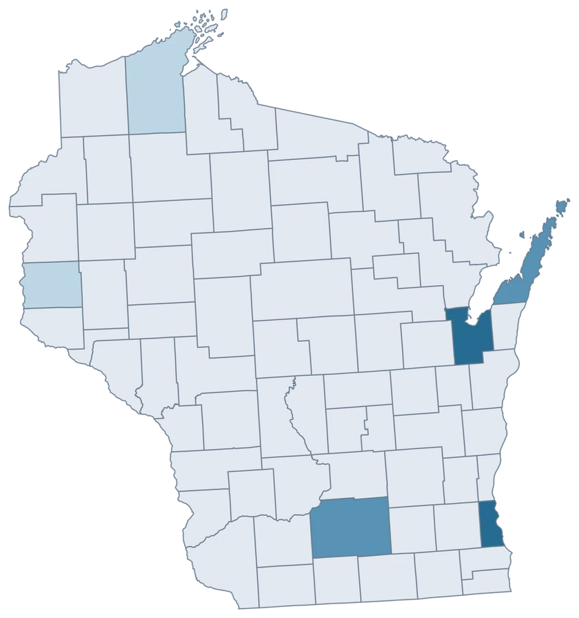
Practice a six-county join in Wisconsin.

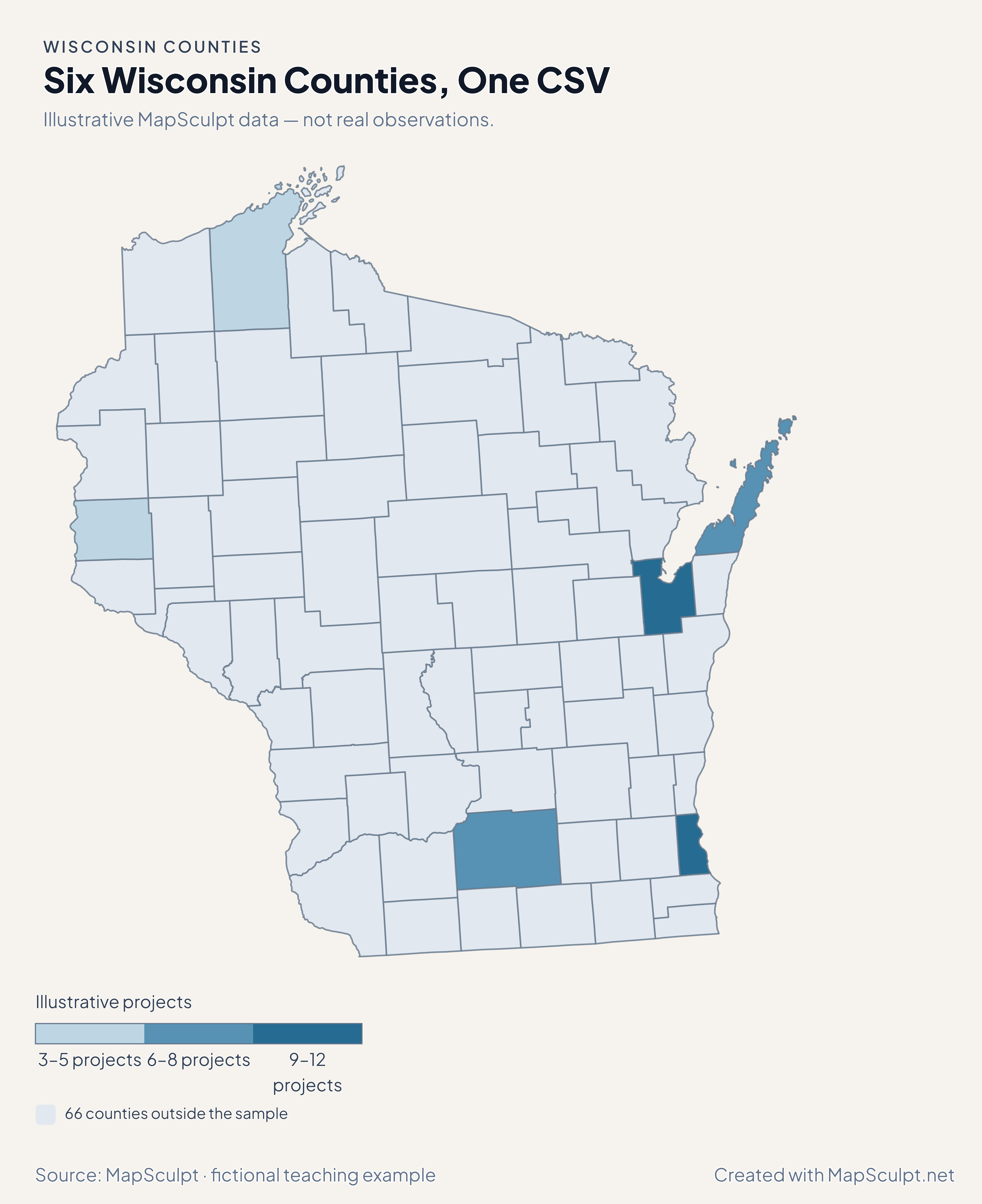
Import the fictional project counts, choose IllustrativeProjects, and set numeric boundaries of 3, 6, 9 and 12. The other 66 counties remain neutral.

Illustrative MapSculpt data — not real observations.
CountyGEOIDProjects
Milwaukee County5507912
Dane County550258
Brown County550099
Door County550296
Bayfield County550073
St. Croix County551095

Keep GEOIDs as text. The sample matches Milwaukee County with 55079. Check the directory for official names and codes before importing your data.

Download illustrative CSV ↓

Six Wisconsin Counties, One CSV

Illustrative MapSculpt data — not real observations.

Fictional project counts across six Wisconsin counties. The other 66 counties are neutral.

Illustrative projects

  • 3–5 projects
  • 6–8 projects
  • 9–12 projects
  • 66 counties outside the sample
Download complete PNG

CSV → Match 6 counties → Style → Export PNG Create a Wisconsin map

COUNTY REFERENCE

Find all 72 Wisconsin county GEOIDs.

Official county names and five-digit Census GEOIDs. Search by name or code.

  1. Adams CountyGEOID 55001
  2. Ashland CountyGEOID 55003
  3. Barron CountyGEOID 55005
  4. Bayfield CountyGEOID 55007
  5. Brown CountyGEOID 55009
  6. Buffalo CountyGEOID 55011
  7. Burnett CountyGEOID 55013
  8. Calumet CountyGEOID 55015
  9. Chippewa CountyGEOID 55017
  10. Clark CountyGEOID 55019
  11. Columbia CountyGEOID 55021
  12. Crawford CountyGEOID 55023
  13. Dane CountyGEOID 55025
  14. Dodge CountyGEOID 55027
  15. Door CountyGEOID 55029
  16. Douglas CountyGEOID 55031
  17. Dunn CountyGEOID 55033
  18. Eau Claire CountyGEOID 55035
  19. Florence CountyGEOID 55037
  20. Fond du Lac CountyGEOID 55039
  21. Forest CountyGEOID 55041
  22. Grant CountyGEOID 55043
  23. Green CountyGEOID 55045
  24. Green Lake CountyGEOID 55047
  25. Iowa CountyGEOID 55049
  26. Iron CountyGEOID 55051
  27. Jackson CountyGEOID 55053
  28. Jefferson CountyGEOID 55055
  29. Juneau CountyGEOID 55057
  30. Kenosha CountyGEOID 55059
  31. Kewaunee CountyGEOID 55061
  32. La Crosse CountyGEOID 55063
  33. Lafayette CountyGEOID 55065
  34. Langlade CountyGEOID 55067
  35. Lincoln CountyGEOID 55069
  36. Manitowoc CountyGEOID 55071
  37. Marathon CountyGEOID 55073
  38. Marinette CountyGEOID 55075
  39. Marquette CountyGEOID 55077
  40. Menominee CountyGEOID 55078
  41. Milwaukee CountyGEOID 55079
  42. Monroe CountyGEOID 55081
  43. Oconto CountyGEOID 55083
  44. Oneida CountyGEOID 55085
  45. Outagamie CountyGEOID 55087
  46. Ozaukee CountyGEOID 55089
  47. Pepin CountyGEOID 55091
  48. Pierce CountyGEOID 55093
  49. Polk CountyGEOID 55095
  50. Portage CountyGEOID 55097
  51. Price CountyGEOID 55099
  52. Racine CountyGEOID 55101
  53. Richland CountyGEOID 55103
  54. Rock CountyGEOID 55105
  55. Rusk CountyGEOID 55107
  56. Sauk CountyGEOID 55111
  57. Sawyer CountyGEOID 55113
  58. Shawano CountyGEOID 55115
  59. Sheboygan CountyGEOID 55117
  60. St. Croix CountyGEOID 55109
  61. Taylor CountyGEOID 55119
  62. Trempealeau CountyGEOID 55121
  63. Vernon CountyGEOID 55123
  64. Vilas CountyGEOID 55125
  65. Walworth CountyGEOID 55127
  66. Washburn CountyGEOID 55129
  67. Washington CountyGEOID 55131
  68. Waukesha CountyGEOID 55133
  69. Waupaca CountyGEOID 55135
  70. Waushara CountyGEOID 55137
  71. Winnebago CountyGEOID 55139
  72. Wood CountyGEOID 55141

U.S. Census Bureau · 2025 Cartographic Boundary Files

COMMON QUESTIONS

Wisconsin county map questions.

Does Door County keep its islands?

Island shapes represented in the 2025 cartographic source share Door County’s GEOID and fill.

Which county contains Madison?

Madison is in Dane County. Use 55025 for a county-wide record and retain a separate city dataset when the record covers Madison alone.

Can I compare places around Green Bay?

Join county-wide observations to counties such as Brown or Door. Use consistent years and units when comparing the bayshore.

Why does Florence stand out on the migration map?

Its net domestic migration rate was the highest in this release. The rate uses county population as a denominator.

How do I map counties across the St. Croix River?

Use the national county editor to put both Wisconsin and Minnesota counties on one map.

Does Milwaukee city have its own fill?

The editor selects Milwaukee County. A city-only value covers a smaller area and needs city geography.

YOUR NEXT MAP STARTS HERE

Map a Wisconsin corridor or the whole state.

Join official county identifiers to your values, choose a readable legend, and download your finished Wisconsin map.

Create a Wisconsin map