MapSculpt

Maps for Reddit / Data & Geography

Make a map worth sharing on Reddit.

Have a dataset, a geographic question, or just an idea? Create your own map, color countries and regions, add a clear title and legend, and download an image ready to share. No complicated mapping software required.

Create a Map

Free to use · CSV import on supported maps · High-resolution PNG

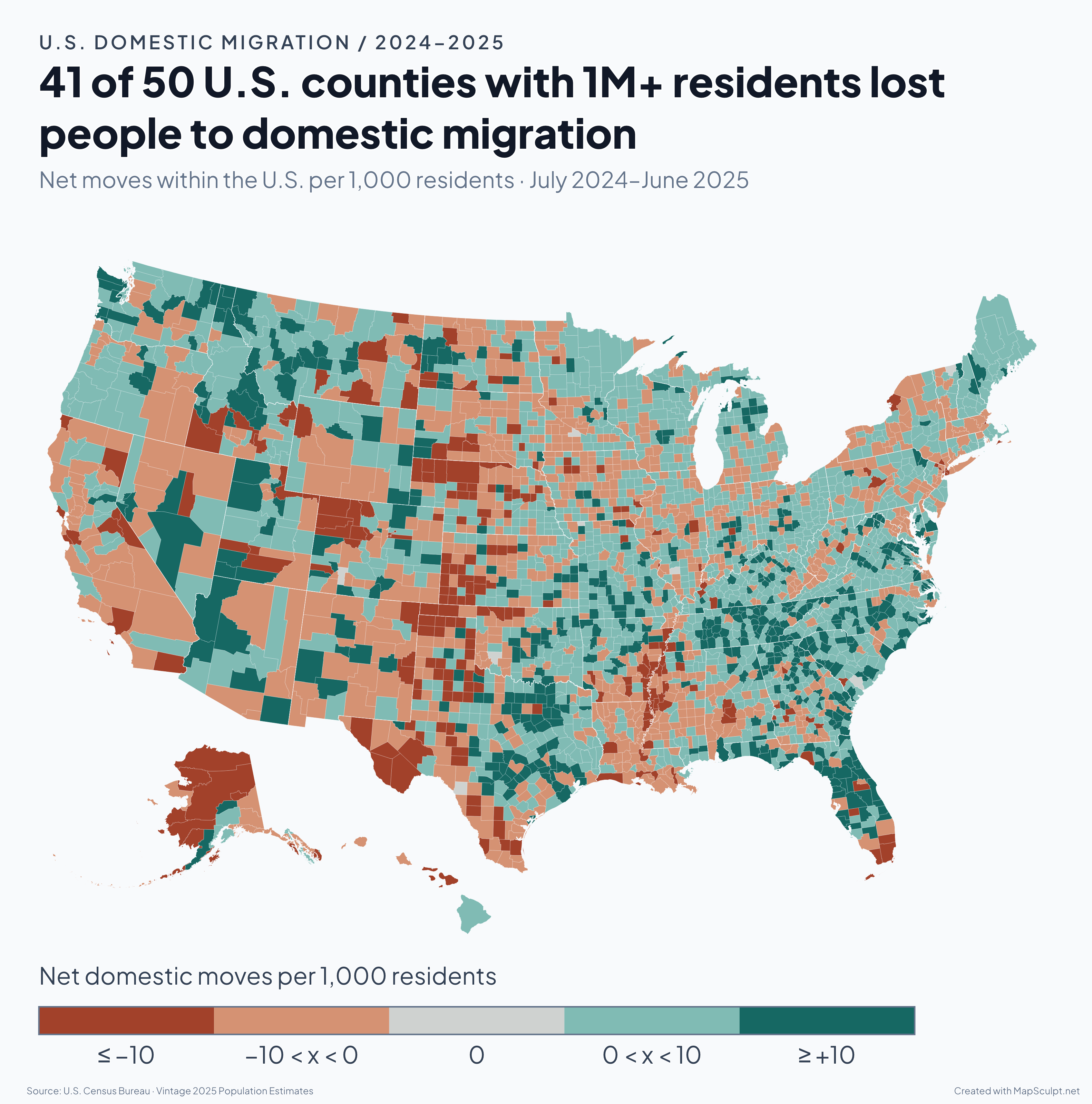
A diverging map of net domestic migration across 3,144 U.S. counties and equivalents from July 2024 through June 2025. Forty-one of the 50 counties with at least one million residents had more people move to other U.S. counties than move in.

Choose your starting point

What kind of map are you making?

From statistical maps to geographic comparisons, start with the kind of story you want to tell.

Map format / Data

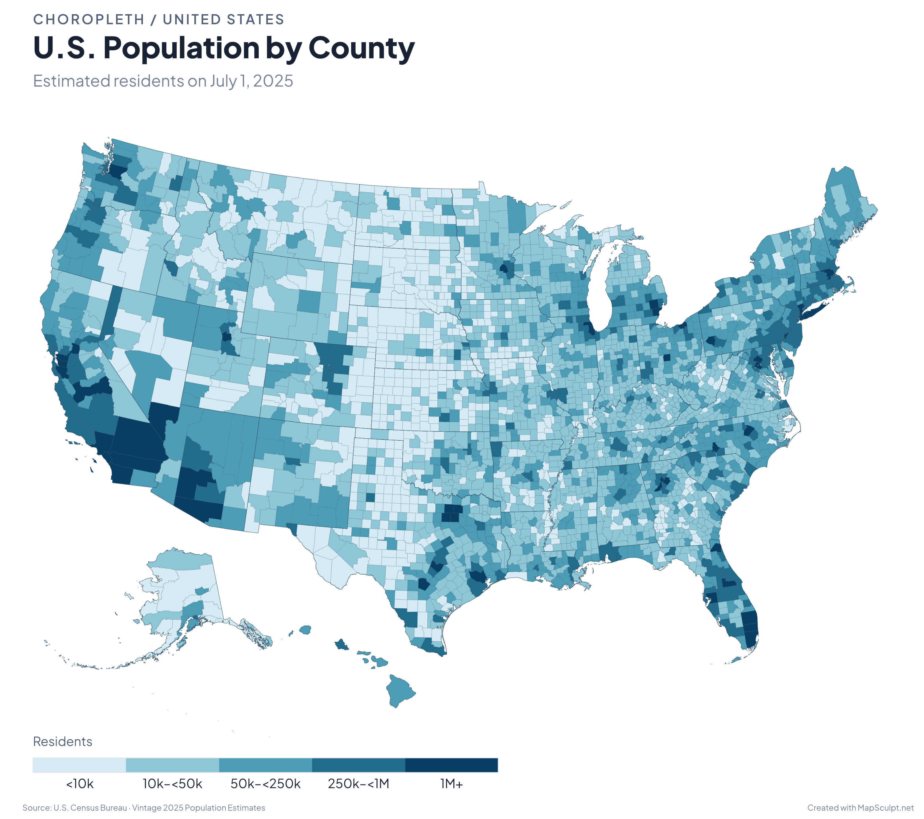
U.S. counties shaded by estimated population on July 1, 2025. The legend ranges from under 10,000 to 1 million or more residents.

Statistical & choropleth maps

Have numbers for different countries, states, or counties? Turn them into a color-coded map that makes geographic patterns easier to spot. Import CSV data on supported maps, choose your color scale, and add a legend that explains the values.

Create a data map

Map format / Comparison

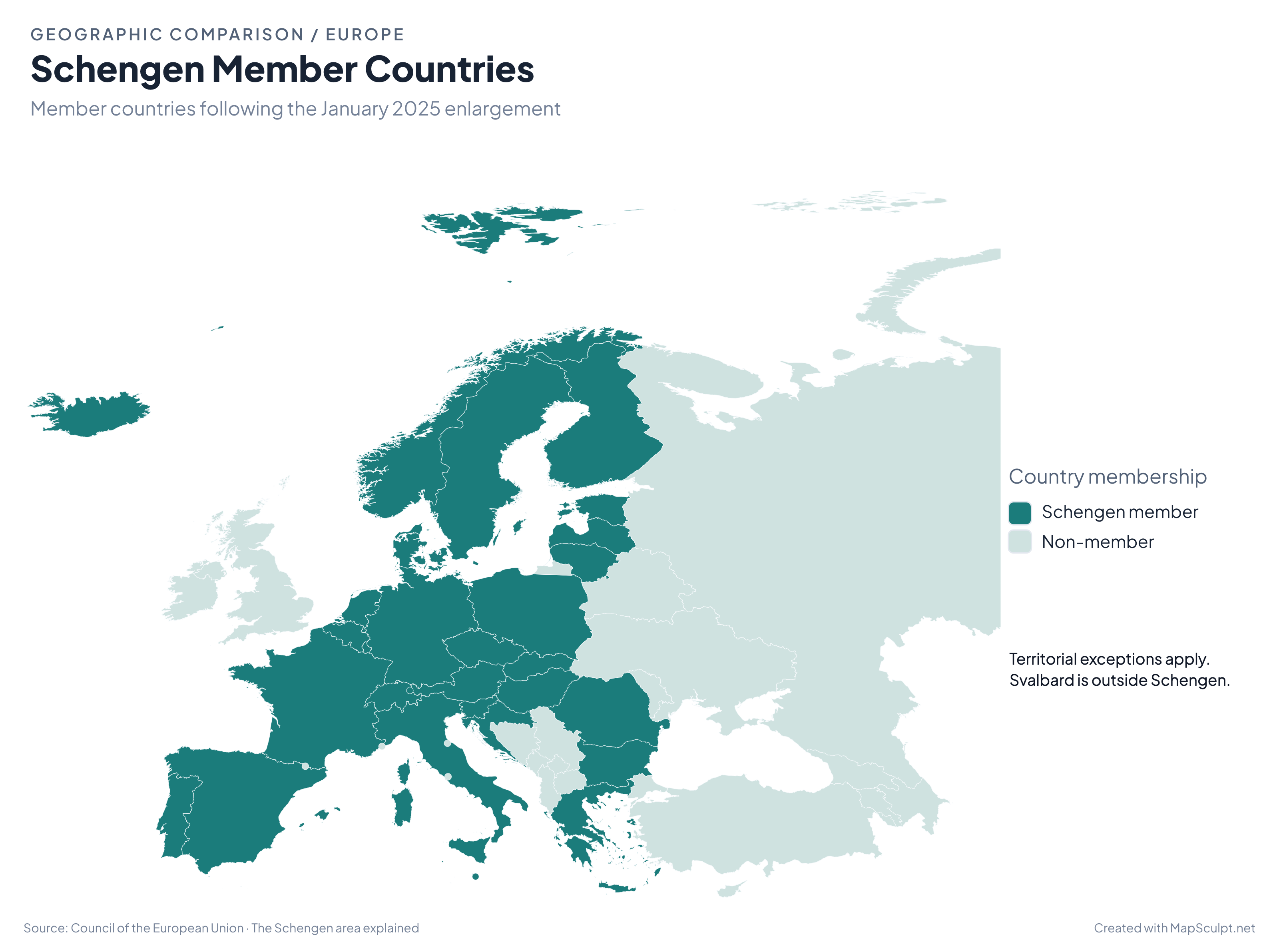
Schengen Area member countries after Bulgaria and Romania joined in full in January 2025. Members are highlighted in teal.

Geographic comparison maps

Show how countries or regions differ by language, policy, history, or another researched category. Use distinct colors to make comparisons clear without crowding the map.

Create a Europe map

Map format / Thematic

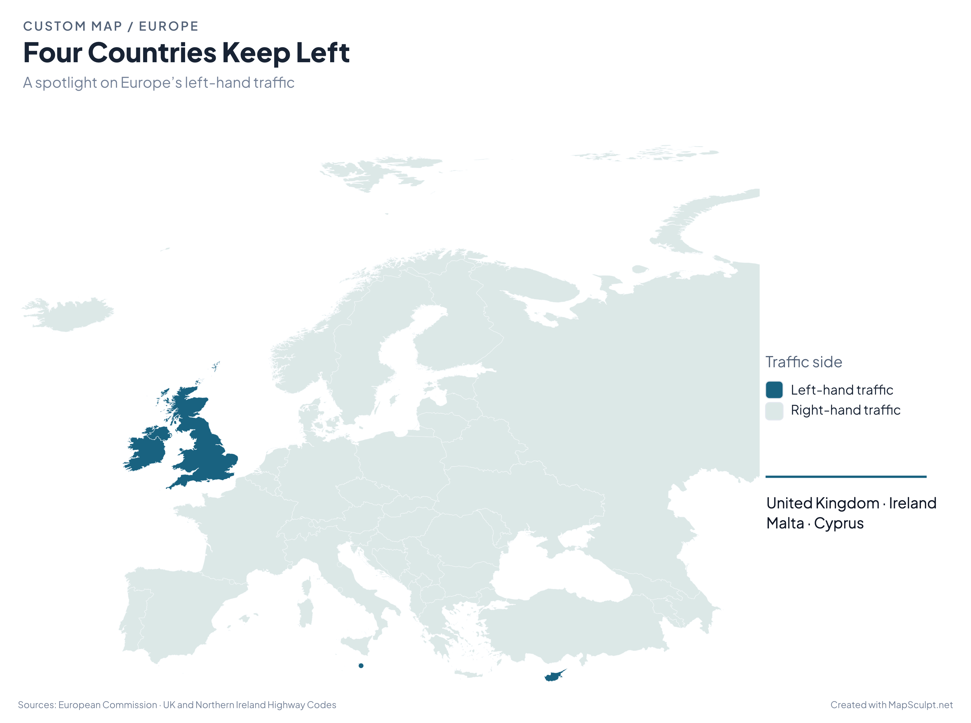
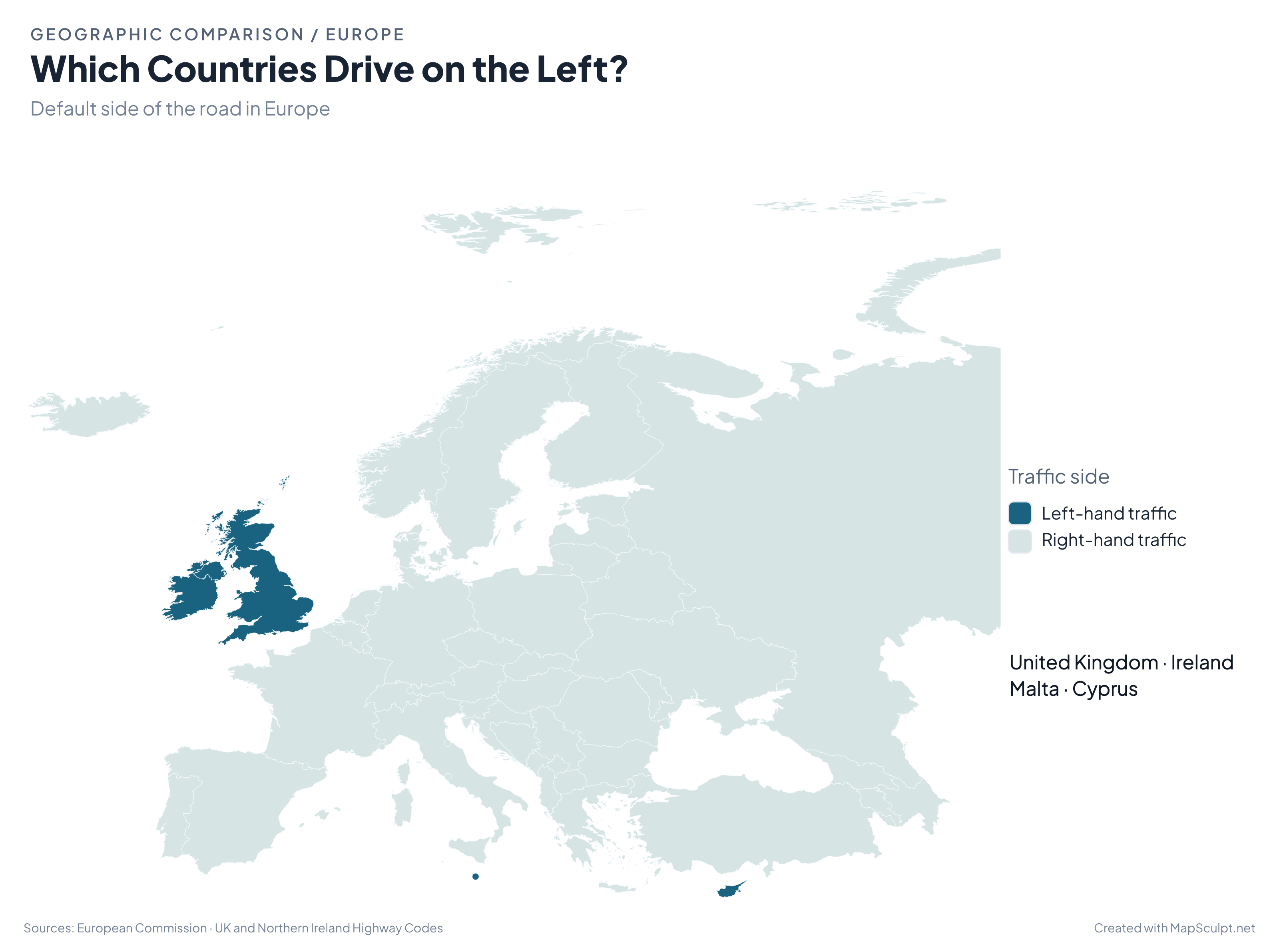
A thematic map highlighting the four countries that drive on the left: the United Kingdom, Ireland, Malta, and Cyprus.

Custom & thematic maps

Highlight countries, states, or regions to illustrate an idea or explore a pattern. Use color and a short annotation to draw attention to the places that matter to your story.

Create a custom map

Made with MapSculpt / Real examples

From data to a map worth discussing.

A good map gives people something to look at, understand, and discuss. Select a map to view its full-resolution PNG.

How it works

From idea to finished map.

Choose the geography, add your information, and make the result easy to understand.

  1. Choose your map

    Start with the world, Europe, US states, counties, or another supported geography. Pick the map that matches the places you want to compare.

  2. Add your data or colors

    Color regions individually, create categories, or import CSV files on supported maps. Choose colors that reflect the information.

  3. Make it readable

    Choose a map design, add a descriptive title, and explain your colors with a legend. Include the source and reference period when you use statistics.

  4. Export and share

    Download a high-resolution PNG. Check that the text and legend remain readable, then prepare your Reddit post.

Before you share

Before you post, check your map.

Check that readers can understand what they’re seeing and where the information came from.

  • Use a reliable source.

    Start with original research, your own observations, or data you are allowed to reuse.

  • Explain your colors.

    Give each category or numerical range a clear meaning.

  • Check the geography.

    Make sure the boundaries match your dataset and each value belongs to the right place.

  • Check mobile readability.

    Titles, labels, legends, and sources should remain legible on a phone.

  • Include the source and reference period.

    Help readers find the original data and understand when it was collected.

  • Keep missing data separate.

    Give zero, unavailable values, and cases where the metric does not apply their own treatment.

  • Use a descriptive title.

    Tell readers what the map shows without exaggerating the finding.

  • Read the community rules.

    Check original-content, source, format, and promotion requirements.

Sharing your work

Find the right community for your map.

r/MapPorn

Geographic patterns, interesting maps, and original cartographic work. Check the rules on sources and originality.

r/dataisbeautiful

Maps that tell a story with data. Explain your methodology, units, and sources, and check the original-content requirements.

r/europe

Maps about European topics. Share relevant geographic findings and check the current submission rules.

Subreddit rules can change. MapSculpt is independent of Reddit and its communities.

MapSculpt features

Everything you need to make a clear map.

Custom colors & categories

Highlight individual regions, create groups, and choose colors that suit your data or idea.

CSV data import

Bring numerical values or categories into supported maps without coloring every region by hand.

Titles, legends & sources

Give readers the context they need directly on the map.

Map designs

Choose a visual style, from restrained and minimal to bold and editorial.

Flexible canvas layouts

Choose a standard, portrait, or story layout to suit where you plan to share your map.

High-resolution PNG export

Download a finished image with your colors, labels, and layout.

Common questions

Frequently asked questions

How can I create a map for Reddit?

Choose a geographic map in MapSculpt, color the countries or regions you want to show, and add a title and legend. You can import a CSV file on supported maps. Export the finished image as a PNG, then upload it to Reddit according to your community’s rules.

Is MapSculpt free to use?

Yes. You can create, customize, and download maps using MapSculpt’s free browser-based editor.

Can I make choropleth maps for r/dataisbeautiful?

Yes. Import CSV data on supported maps or assign colors manually. When sharing a statistical map, explain your values, geographic units, color scale, and data source.

Can I create maps for r/MapPorn?

Yes. You can create original geographic maps, highlight countries and regions, and customize their appearance before exporting. Check r/MapPorn’s current rules before submitting.

Do I need to include my data source when posting a map?

Include the original source and reference period when your map uses statistics or someone else’s research. Check the community’s rules for any specific requirements about sources, original content, and software credits.

Can MapSculpt publish my map directly to Reddit?

MapSculpt exports your finished map as a PNG. Upload it to Reddit yourself and include the title, source, and context required by your community.

Ready to create?

Your next map starts here.

Start with a place, a question, or a dataset. Choose a map, add your perspective, and make something worth sharing.

Start Creating for Free