MapSculpt

GEOGRAPHIC MAP MAKER / CANADA

Canada Provinces & Territories Map Maker

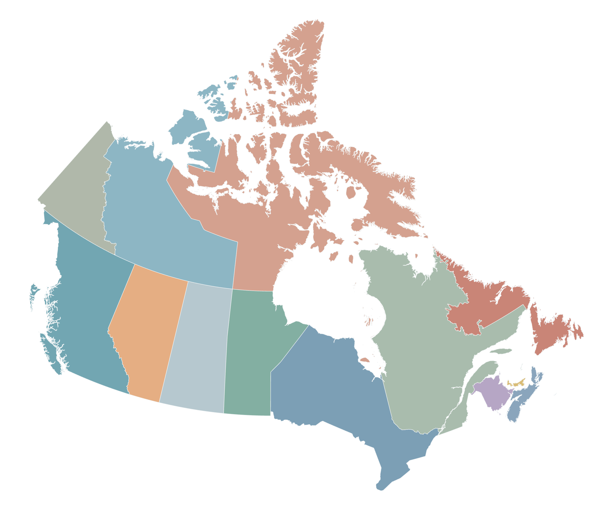
Colour Canada's 10 provinces and 3 territories individually, visualise regional data, add titles and legends, and export a high-quality map.

Free online editor · No sign-up required

13Individually editable
provinces and territories
Made in MapSculpt · Illustrative colours, not statistical data

01 / KNOW YOUR GEOGRAPHY

10 provinces. 3 territories. One map.

Canada has 10 provinces and 3 territories. Colour each independently, including Yukon, Northwest Territories and Nunavut. Provinces have constitutional powers; territorial powers are delegated by the federal government.

Cities, municipalities and census divisions are not individually selectable in this map.

See provinces, territories & capitals ↗

02 / MADE WITH MAPSCULPT

One country. Many stories to tell.

From population patterns to regional comparisons, turn Canadian geography and data into clear, expressive maps.

OFFICIAL DATA / STATISTICS CANADA · 2021 CENSUS

Where Canadians live.

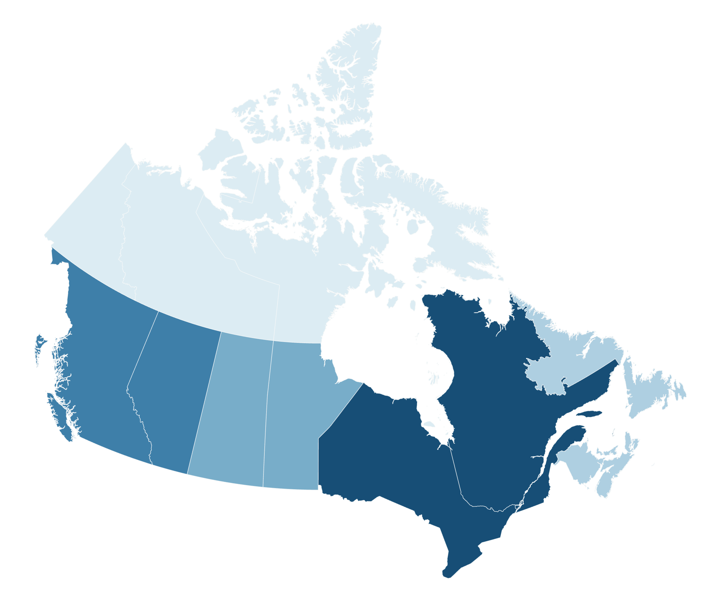
Population is concentrated in a few provinces. These colours show absolute 2021 Census counts, not population density.

Ontario · Most populous
14,223,942
Nunavut · Least populous
36,858

Population · people

  • Below 100,000
  • 100,000–999,999
  • 1,000,000–2,999,999
  • 3,000,000–5,999,999
  • 6,000,000+

Custom editorial bands · not official classifications.

Statistics Canada · 2021 Census · Table 98-10-0001-01

View full-size export ↗

OFFICIAL DATA / STATISTICS CANADA · 2016–2021

A country in motion.

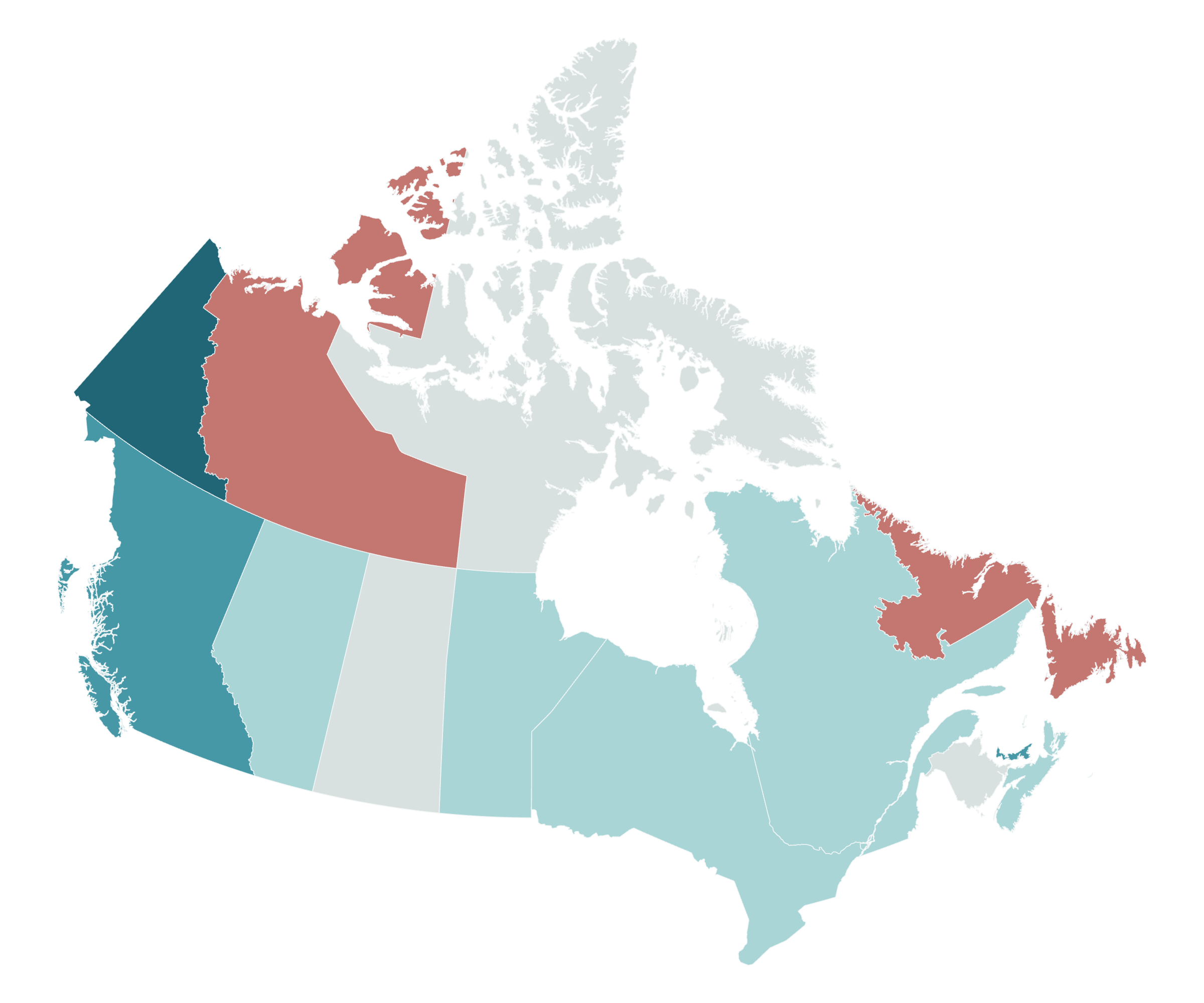
Yukon grew fastest (+12.1%). Newfoundland and Labrador (−1.8%) and the Northwest Territories (−1.7%) declined. These are percentage changes, not absolute increases.

Population change · 2016–2021

  • Below 0%
  • 0% to below 4%
  • 4% to below 6%
  • 6% to below 9%
  • 9% or higher

Custom bands · unequal percentage ranges.

Statistics Canada · 2016 and 2021 Censuses · Table 98-10-0001-01

View full-size export ↗

CUSTOM CATEGORIES / ILLUSTRATIVE

Your regions. Your perspective.

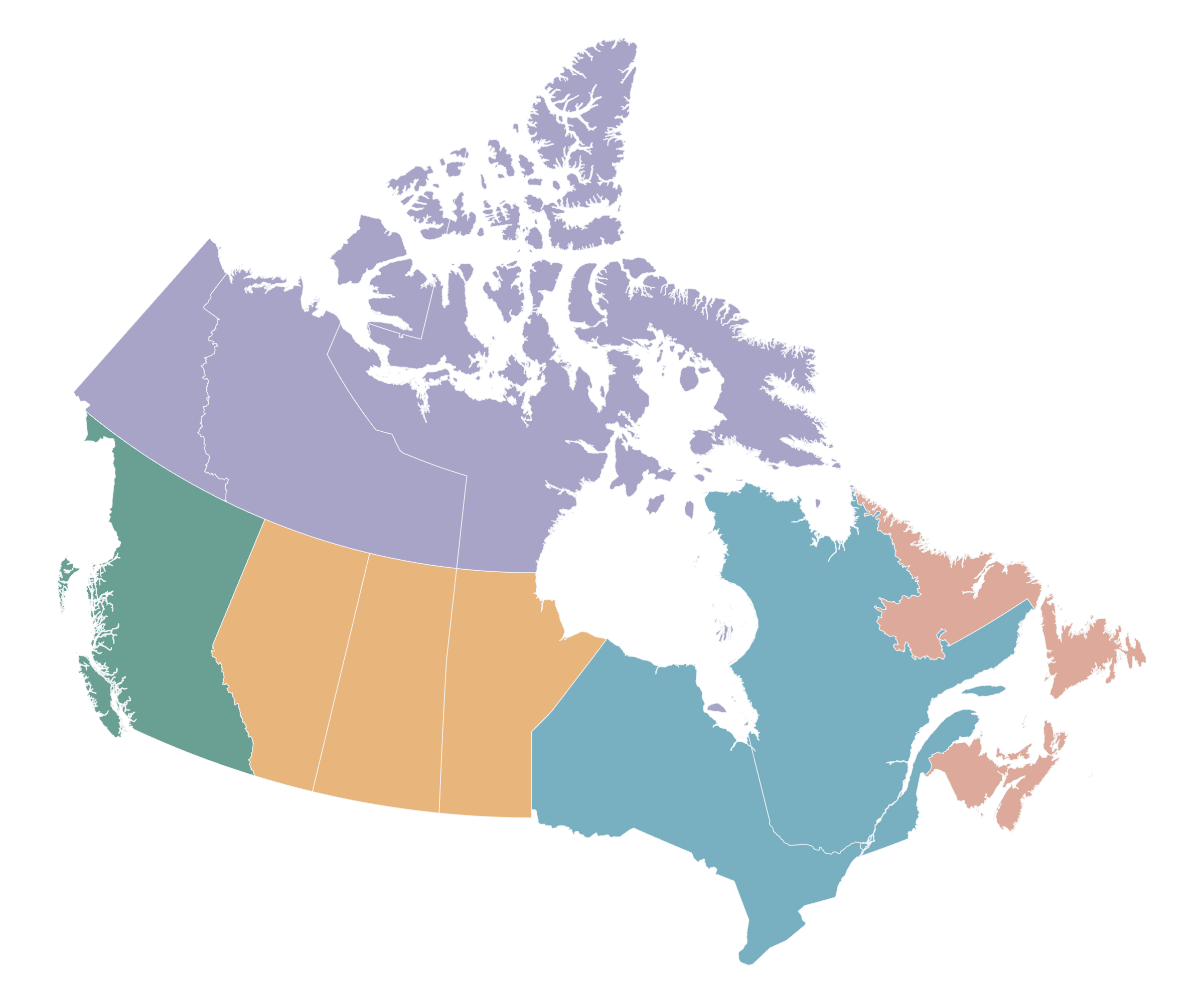
Create custom categories and colour schemes for education, travel planning or regional storytelling.

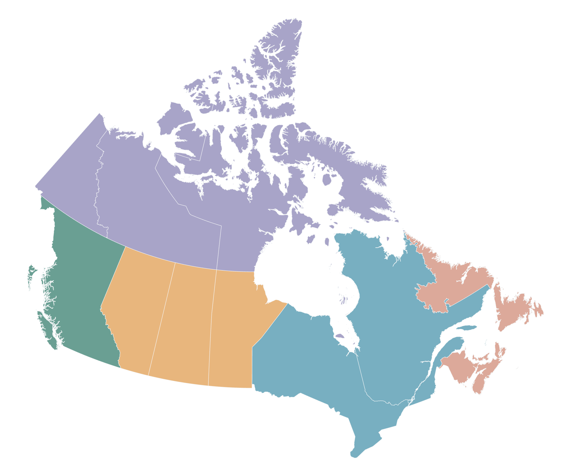
Illustrative custom regions

  • Atlantic Canada
  • Central Canada
  • Prairies
  • Pacific Coast
  • Northern Territories

Illustrative custom groups, not an official or universal regional classification.

Illustrative custom grouping · Created with MapSculpt

View full-size export ↗

03 / HOW IT WORKS

Your Canada map, in four steps.

  1. 01

    Choose your regions

    Open the Canada editor and select any province or territory.

  2. 02

    Bring your data

    Colour regions manually, use grouping shortcuts or import a CSV with regional statistics.

  3. 03

    Add context

    Create a title, annotations, source information and a readable legend.

  4. 04

    Export your PNG

    Download your finished map for presentations, reports, articles or social media.

04 / EDITING CAPABILITIES

A clear map, with your point of view.

Individual colours & categories

Colour provinces and territories and organise them into custom groups.

Titles, text & sources

Add useful context without obscuring the geography.

Styles & PNG export

Choose a suitable appearance and export a high-resolution image.

05 / GEOGRAPHIC REFERENCE

Provinces, territories & capitals.

Explore all 13 Canadian provinces and territories, their standard postal abbreviations and their capital cities.

10 provinces

  • AB
    AlbertaEdmonton
  • BC
    British ColumbiaVictoria
  • MB
    ManitobaWinnipeg
  • NB
    New BrunswickFredericton
  • NL
    Newfoundland and LabradorSt. John's
  • NS
    Nova ScotiaHalifax
  • ON
    OntarioToronto
  • PE
    Prince Edward IslandCharlottetown
  • QC
    QuebecQuébec City
  • SK
    SaskatchewanRegina

3 territories

  • NT
    Northwest TerritoriesYellowknife
  • NU
    NunavutIqaluit
  • YT
    YukonWhitehorse

Sources: Government of Canada · Provinces and territories; Canada Post · Postal abbreviations.

COMMON QUESTIONS

Canada map questions, answered.

How can I colour Canada's provinces and territories on a map?

Open the Canada editor, select a province or territory and choose its colour. Add a title and legend, then export your map as a PNG.

How many provinces and territories does Canada have?

Canada has 10 provinces and 3 territories, for 13 individually editable regions.

What is the difference between a province and a territory?

Provinces have constitutional powers in their own right. Territorial powers are delegated by the federal government, with responsibilities devolved to territorial governments.

Can I import CSV data to create a Canada choropleth map?

Yes. Import a CSV with regional names or codes and numerical or categorical values. Review the regional matches before applying colours.

Does the map include Yukon, Nunavut and the Northwest Territories?

Yes. All three territories are included and can be coloured independently, alongside the 10 provinces.

Can I change individual province colours?

Yes. Select any province or territory and assign its own colour, or organise several regions into a custom group.

Can I add a title, legend and source?

Yes. Add a title, a readable legend and source information. Use text annotations to provide useful context.

Can I download the finished map as a PNG?

Yes. Export your finished map as a high-resolution PNG for presentations, reports, articles or social media.

Can I create a map of Canadian cities or census divisions?

This map covers provinces and territories. Cities, municipalities and census divisions are not individually selectable.

Is the Canada map maker free?

Yes. The Canada map maker is free to use online, with no sign-up required.

YOUR MAP STARTS HERE

Make Canada your canvas.

Thirteen regions. Endless ways to tell a story. Start colouring, add your own data, and create a map worth sharing.

Create a Canada Map

Free online editor · No sign-up required