PERSONAL / TRAVEL
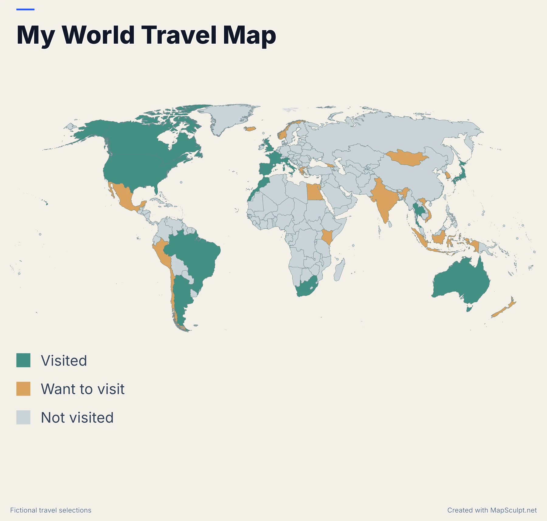
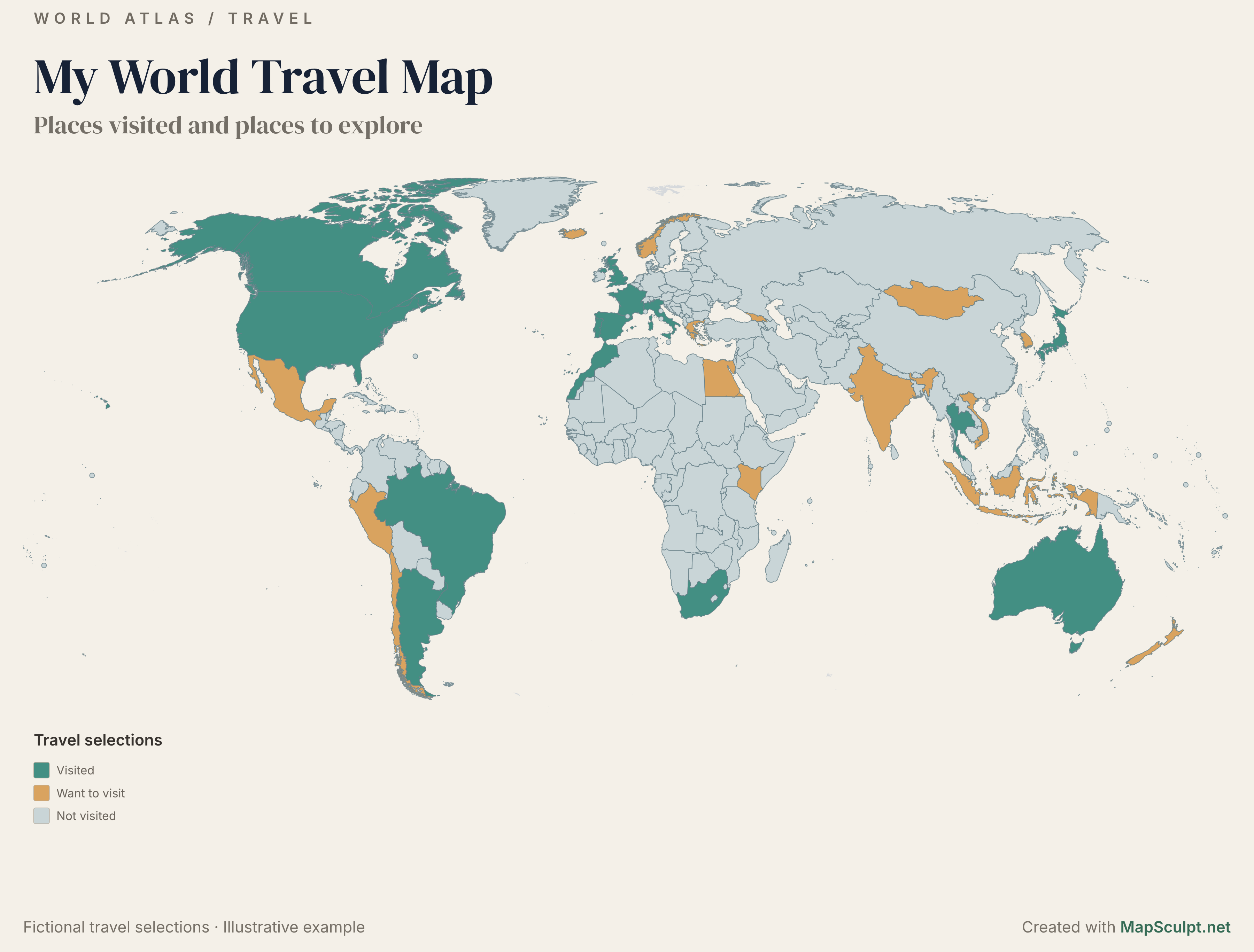
Mark the countries you've visited and those you'd like to visit.Mark places you have visited and want to visit.
Fictional travel selections · Created with MapSculpt


WORLD MAP MAKER
Color countries, import CSV data, add a title and legend, then export your world map as a high-resolution PNG.Color countries, add a legend or import CSV data. Download the result as a PNG.
Create a World MapFree online editor · No signup required
MADE WITH MAPSCULPT / EXAMPLESWORLD MAP EXAMPLES
Create maps for travel, data comparisons or custom country groups.Travel, statistics and custom country groups.
PERSONAL / TRAVEL
Mark the countries you've visited and those you'd like to visit.Mark places you have visited and want to visit.
Fictional travel selections · Created with MapSculpt
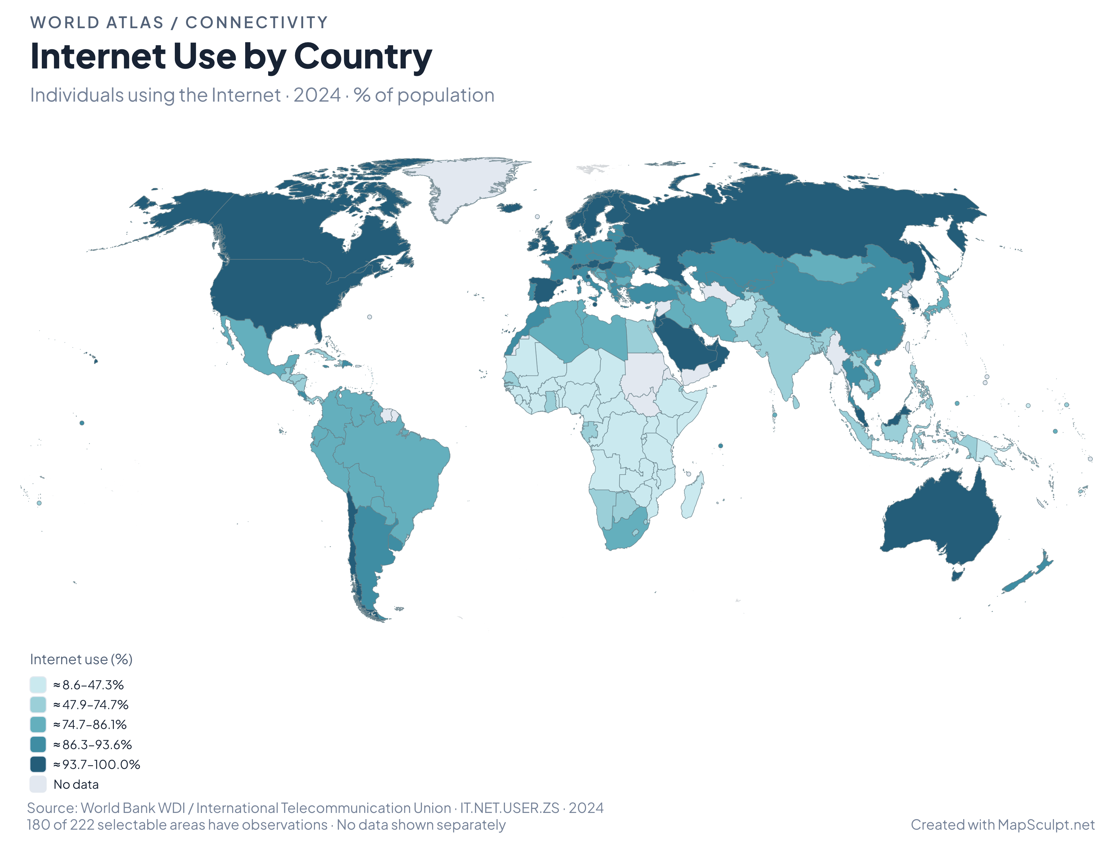
WORLD BANK / CONNECTIVITY
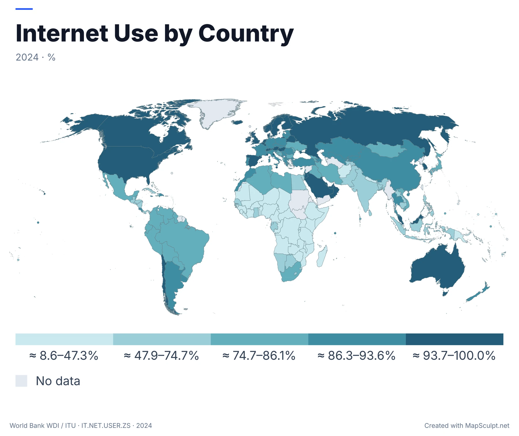
Percentage of the population using the internet in 2024. The map groups 180 observations into five quantiles.
World Bank WDI / ITU · IT.NET.USER.ZS · 2024 · MapSculpt
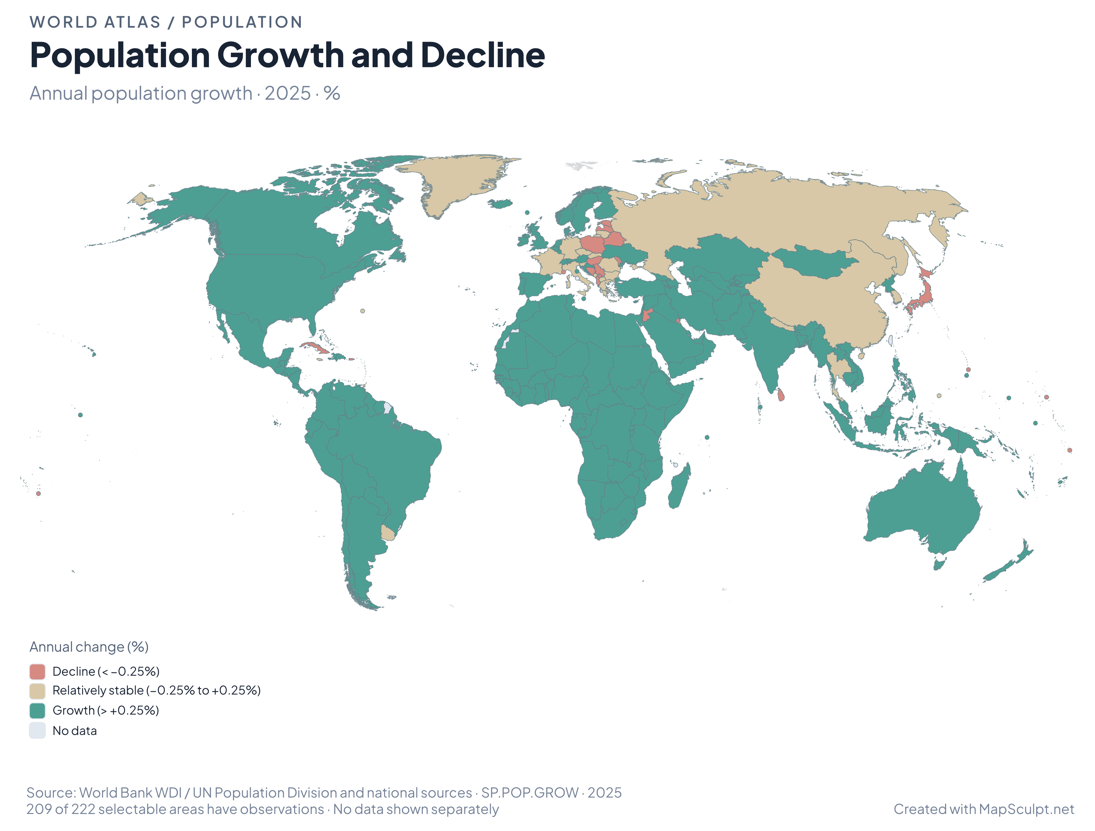
WORLD BANK / POPULATION
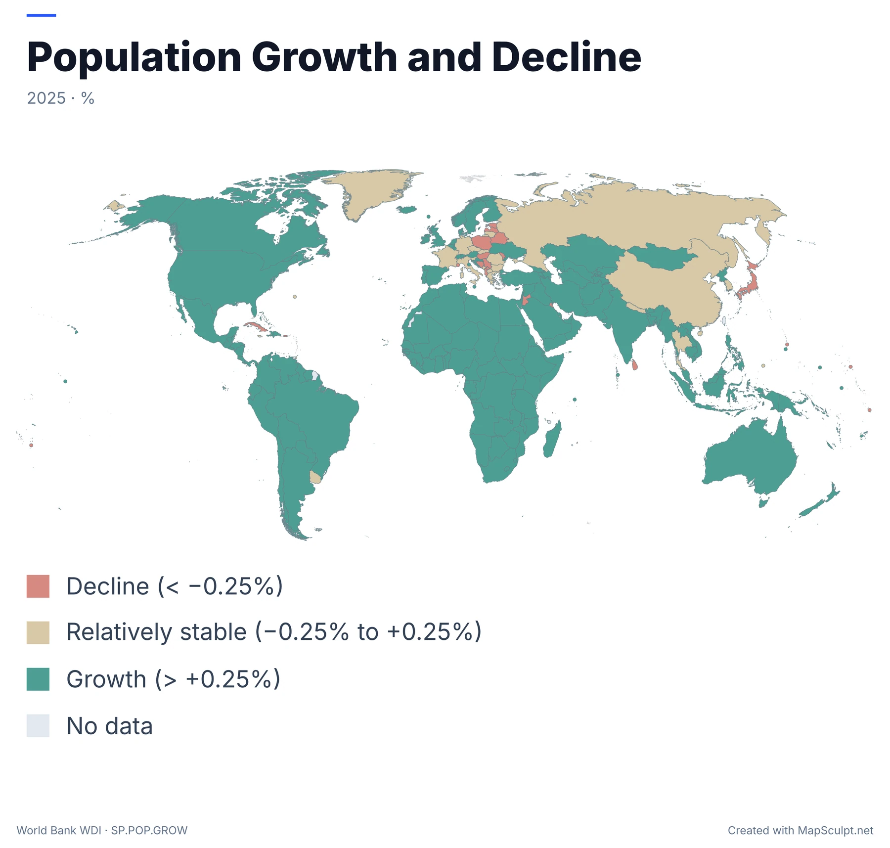
Annual population growth in 2025, grouped by decline, relative stability or growth. Data is available for 209 of 222 areas.
World Bank WDI · SP.POP.GROW · 2025 · MapSculpt
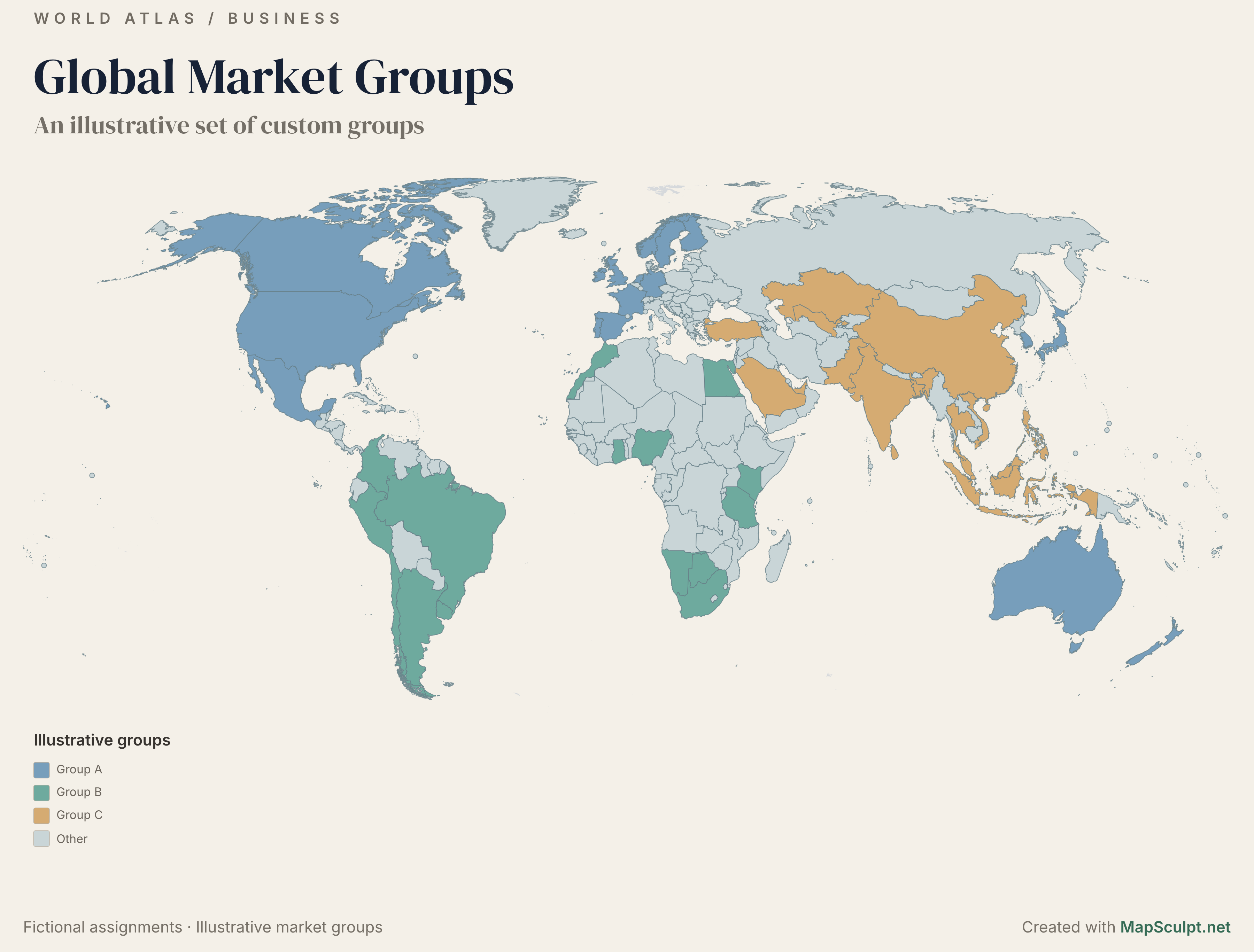
BUSINESS / CUSTOM MAPPING
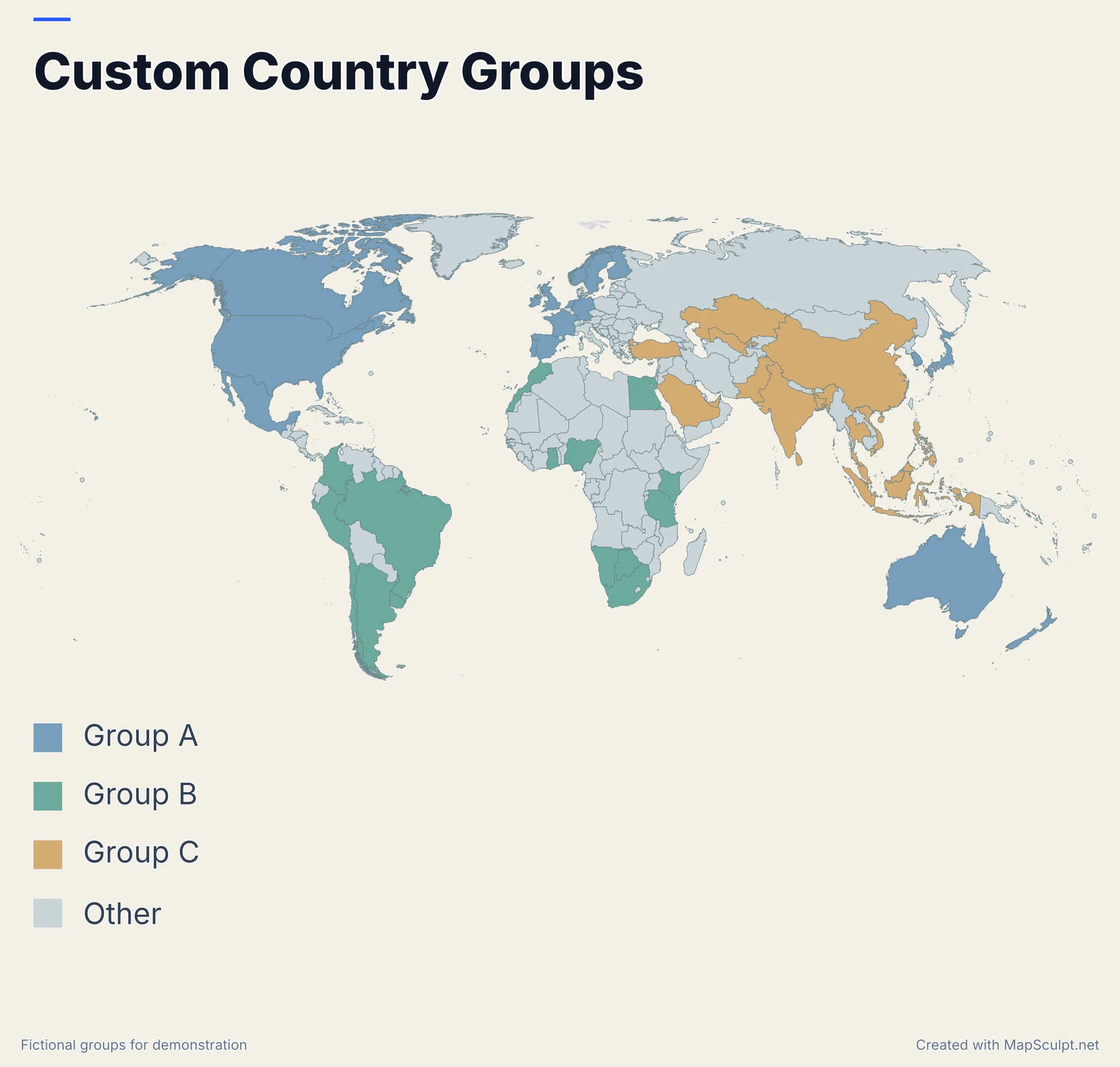
Color countries by sales territory, research group or any other category.Group countries for business or research.
Fictional groups for demonstration · Created with MapSculpt
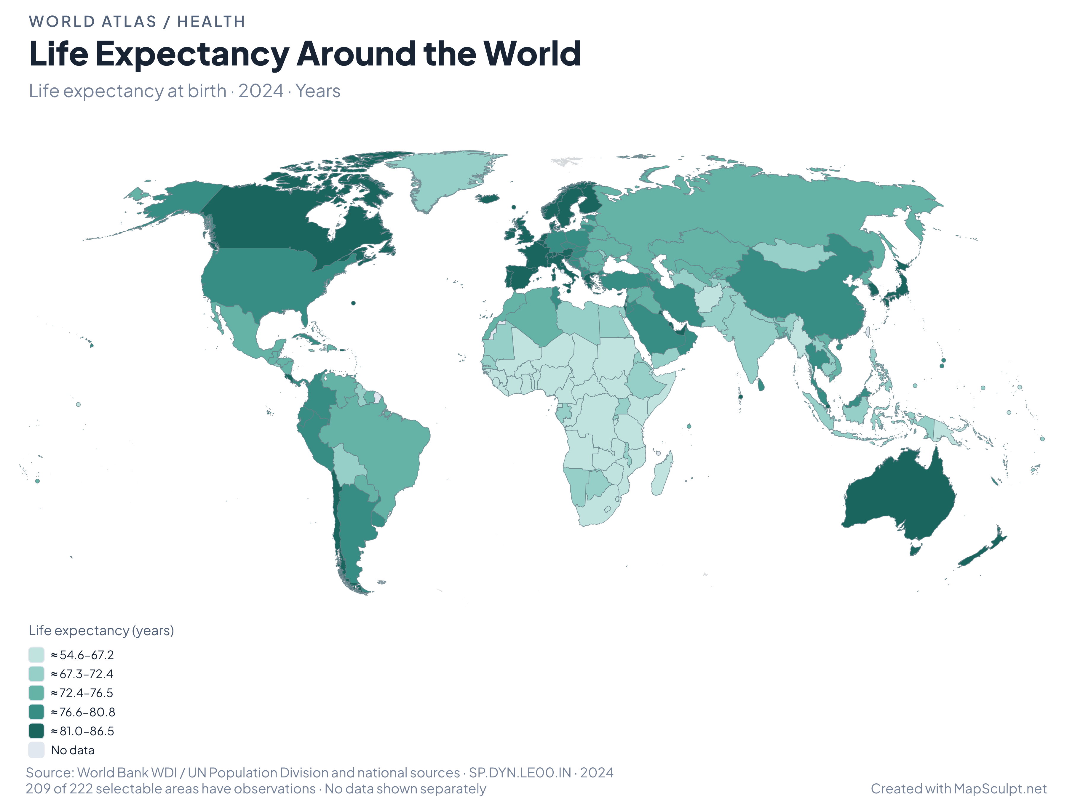
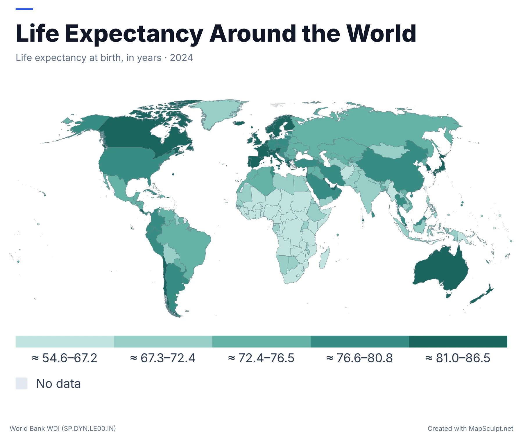
WORLD BANK / CHOROPLETH
Percentage of the population using the internet in 2024. The map groups 180 observations into five quantiles.
The legend shows the approximate observed range in each group. Areas without a published observation have their own category.
HOW IT WORKS
Open the World editor, color countries and download your map.
Open the World template in MapSculpt.Open the free World map template.
Color countries manually or import a CSV with country data.Color countries or import a CSV.
Add labels and cite a source when your map uses data.Add a title, labels and legend.
Download a high-resolution PNG for presentations, reports or sharing.Export a high-resolution map.
MAKE IT YOUR OWNEDITOR FEATURES
Apply your own colors to individual countries.Color individual countries.
Match country data from a CSV file.Import country data from CSV.
Create groups and add a matching legend.Add a legend for your colors.
Add a title, text and labels where needed.Add a title or text.
Adjust backgrounds, borders and layout.Change the background and layout.
Export a PNG for documents, slides or online posts.Export a high-resolution PNG.
CSV DATA IMPORT
Upload country values, check the matches and choose your colors.Import a CSV, then check which countries match.
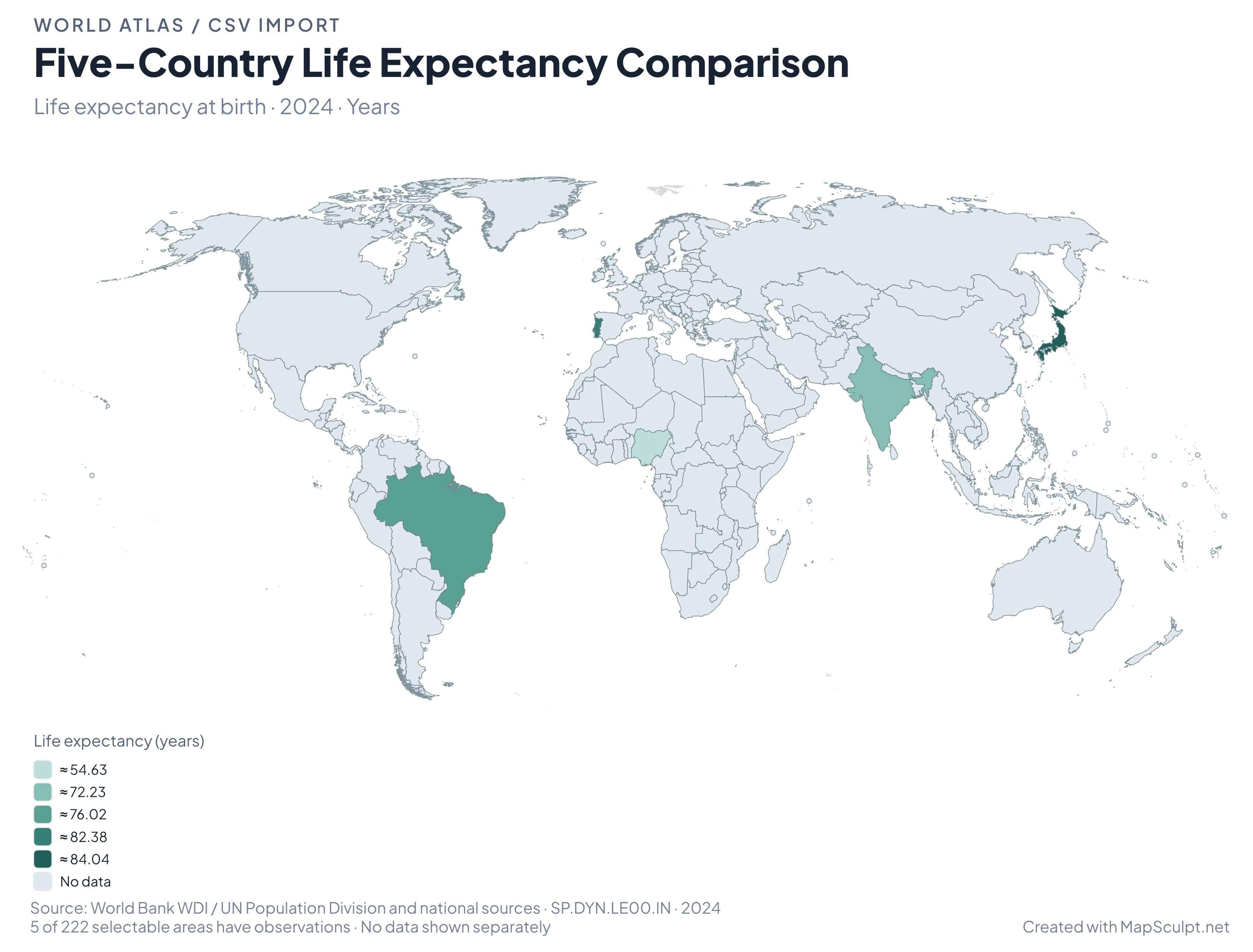
2024 LIFE EXPECTANCY CSV
Region,Value
PT,82.3829268292683
BR,76.023
JP,84.0363414634146
IN,72.235
NG,54.635
Life expectancy at birth in years · World Bank WDI (SP.DYN.LE00.IN) · 2024
MATCH RESULTS
Five observations from the 2024 World Bank life-expectancy series. All other areas are shown as no data in this example.
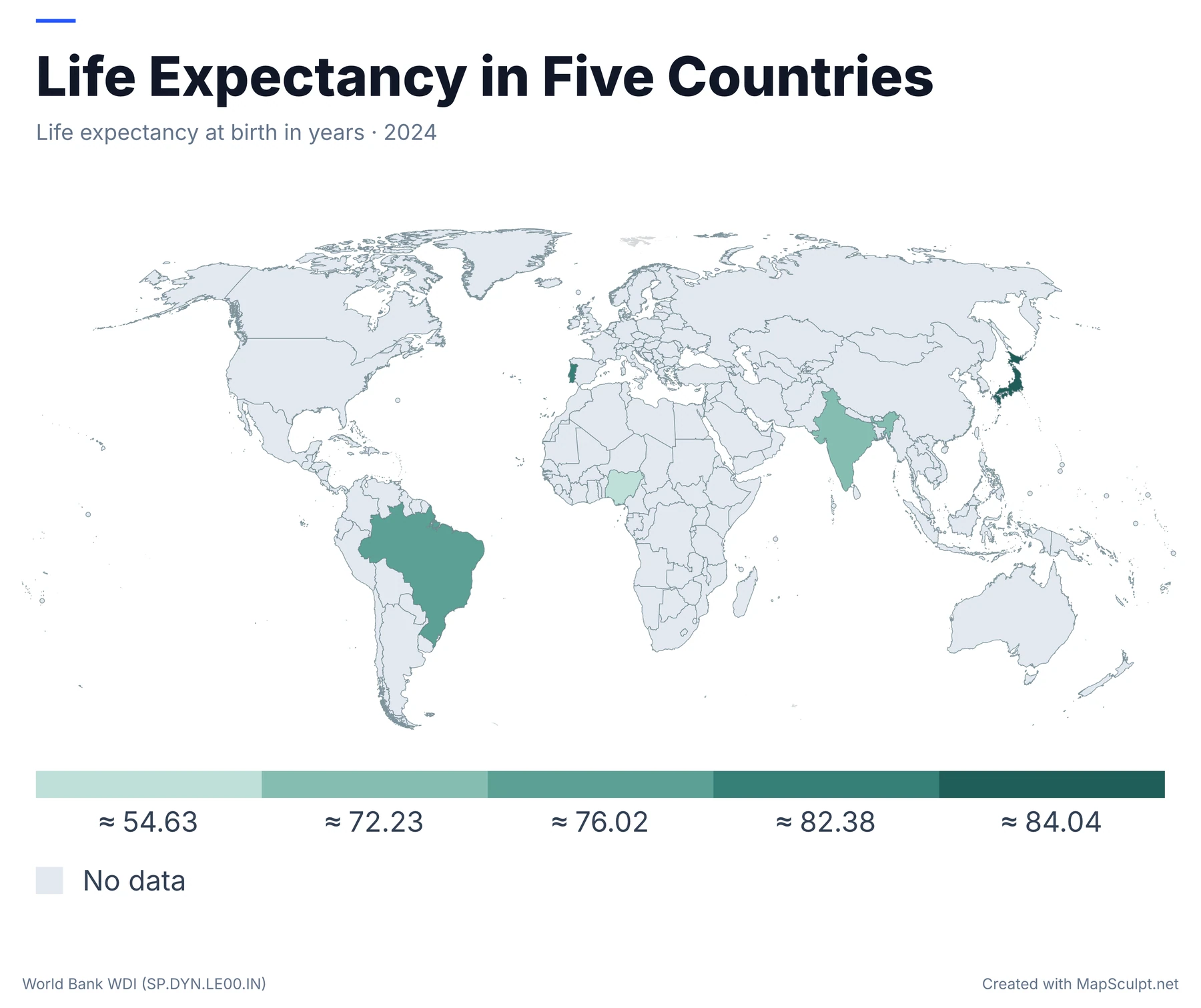
Five matched countries · World Bank WDI, 2024 · MapSculpt
MAP COVERAGE
The World map supports country-level coloring, with some territories represented separately.The World template contains 222 selectable geographic areas, including some territories.
SELECTABLE AREAS
The current World template lists 222 selectable geographic areas.
This is not a count of sovereign countries.
BOUNDARIES AND SMALL AREAS
Some microstates and territories cannot be selected separately.
Some very small countries and territories cannot be selected separately.
COMMON QUESTIONS
Open the World editor, color countries, add a title and legend, then download your map as a PNG.
Yes. Create and download custom world maps using MapSculpt's free online editor.
Yes. Select supported countries and geographic areas and apply your own colors or categories.
Yes. Make categories for visited, want-to-visit and not-yet-visited countries, then color them on the map.
Yes. Import supported geographic CSV data, review country matches and map values or categories.
Yes. Add country labels, custom colors, titles and legends in the editor.
Yes. Export a high-resolution PNG for reports, presentations or online sharing.
The current World template lists 222 selectable geographic identities. This is not the number of sovereign states, and some small countries or territories are not selectable.
Yes. With MapSculpt, you can create custom world maps for data visualizations, geographic comparisons and original map posts. Color countries and supported territories using reliable data, such as statistics from the World Bank or the United Nations, then add a clear title, legend and source before exporting a high-resolution PNG.
Before posting to r/MapPorn, r/dataisbeautiful or another subreddit, check the community's rules, verify your data and explain your sources and methodology where relevant.
START MAPPING
Open the editor, choose your colors and export a PNG.Color countries and download a PNG.
Create a World Map