Skip to content
MapSculpt

GEOGRAPHIC MAP MAKER / MAINE

Maine
Counties Map Maker

Build a Maine map from Aroostook to the southern coast. Compare population change in Cumberland and York with northern and eastern counties, then style all 16 Census areas.

Free online editor · No sign-up required

16counties
individually editable

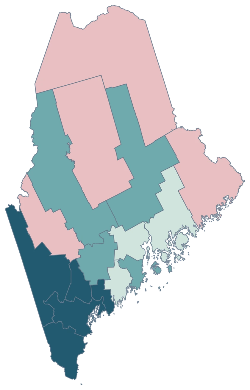
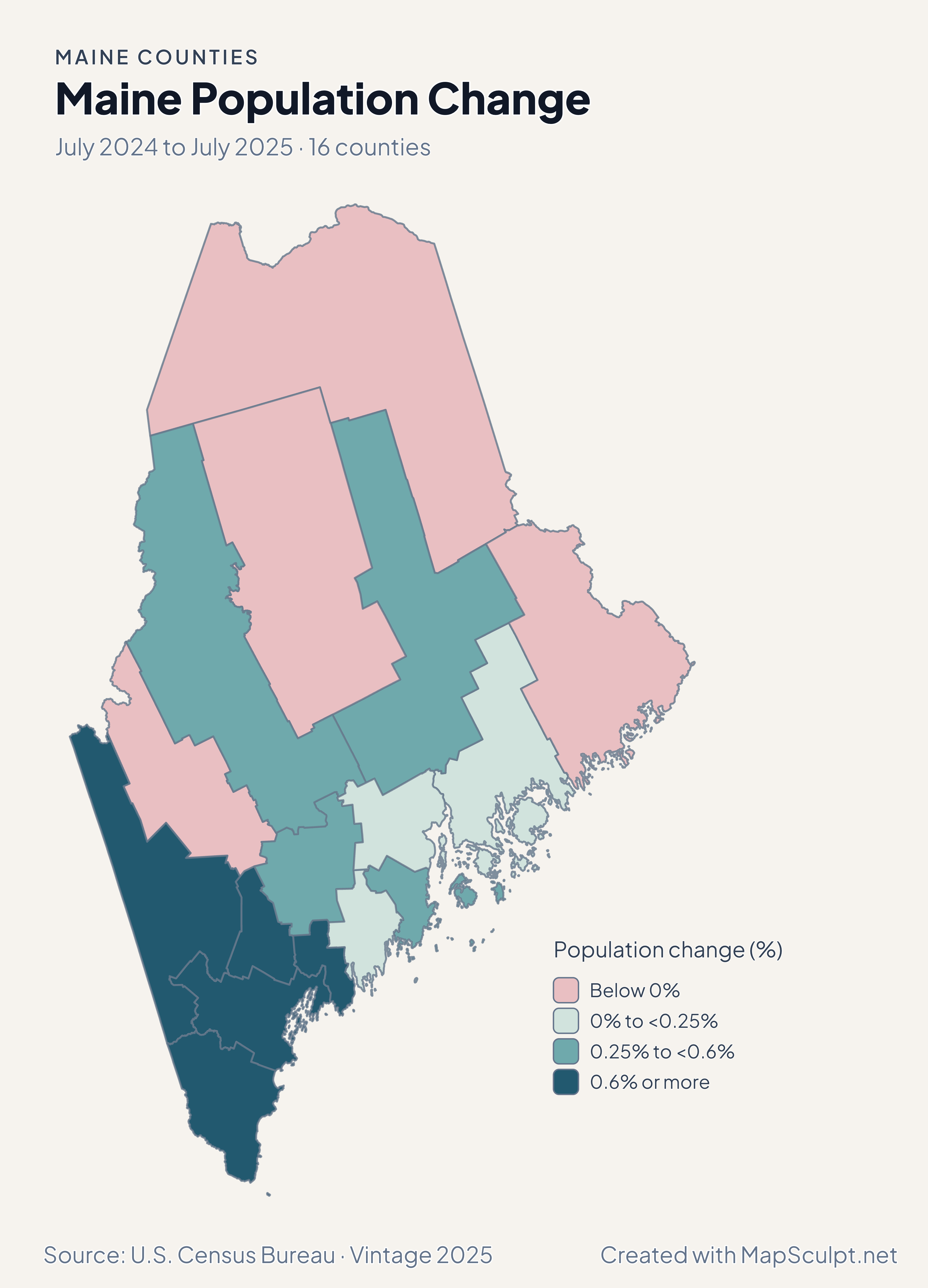
Maine Population Change

July 2024 to July 2025 · 16 counties

Maine population change map contrasting growth in the south with a decline in Aroostook.

Population change (%)

  • Below 0%
  • 0% to <0.25%
  • 0.25% to <0.6%
  • 0.6% or more
U.S. Census Bureau · Vintage 2025Download complete PNG Total population change from July 2024 to July 2025, divided by the starting population.

KNOW YOUR GEOGRAPHY

Maine county boundaries from the coast to Aroostook

The map preserves the northern reach of Aroostook and the coastal islands represented in the Census cartographic file. Portland is within Cumberland County and Bangor is in Penobscot County.

Down East and the Maine coast are useful regional descriptions. Use the specific Census county GEOID when assigning a value to an editable area.

Browse all county GEOIDs ↗

2025 Census boundaries

OFFICIAL DATA

County growth and domestic migration tell different stories

Cumberland grew faster than York in percentage terms, while York had a higher rate of net domestic moves. Aroostook lost population overall while recording net domestic gains.

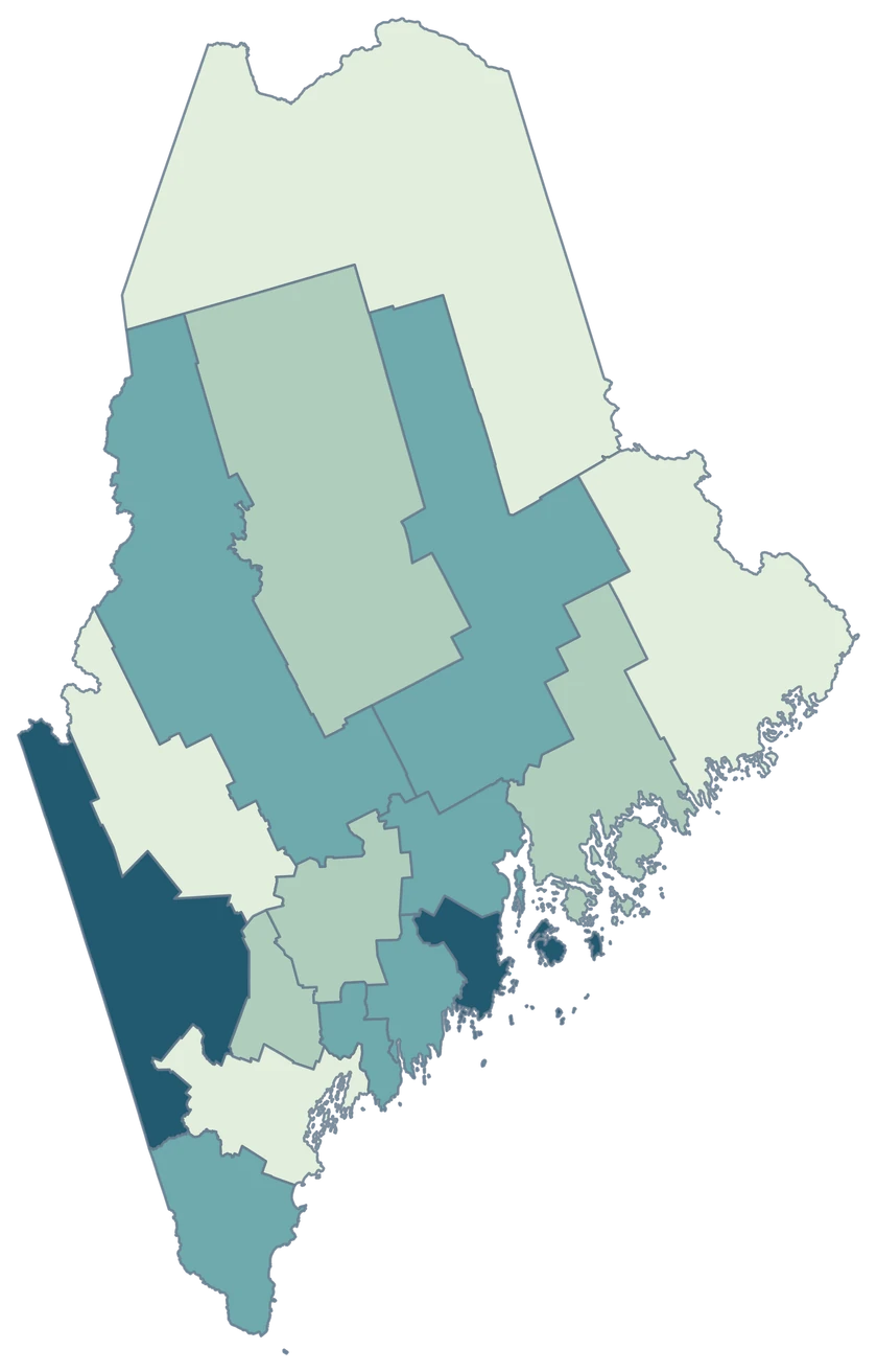
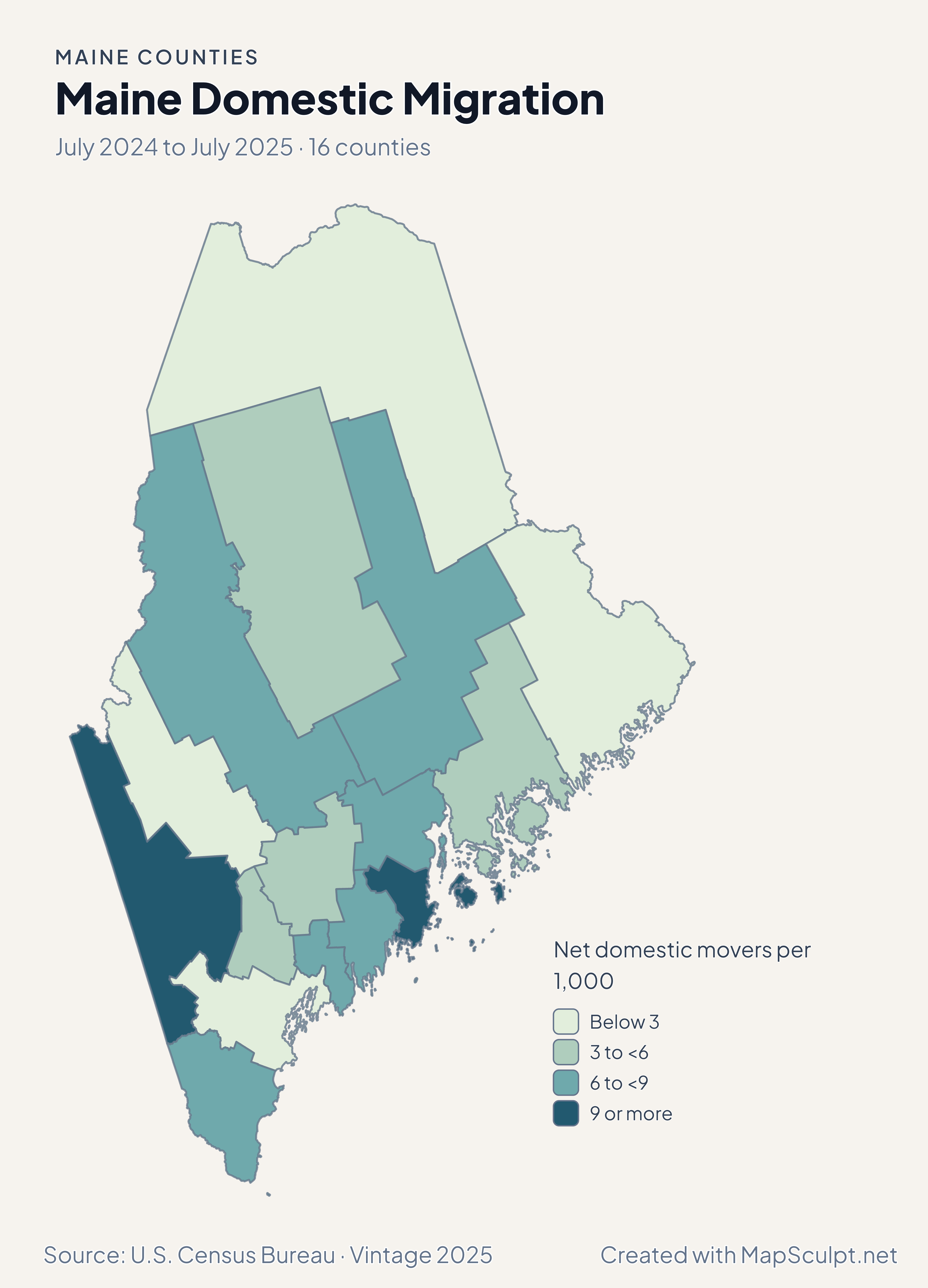
Maine migration map placing Oxford and Knox in the highest rate band.

July 2024 to July 2025 · 16 counties

Oxford and Knox had higher rates than Cumberland

Oxford registered +11.89 net domestic movers per 1,000 and Knox +10.38, compared with +2.55 in Cumberland and +2.50 in Aroostook. Domestic migration excludes moves to or from other countries.

Net domestic movers per 1,000

  • Below 3
  • 3 to <6
  • 6 to <9
  • 9 or more

U.S. Census Bureau · Vintage 2025

Download complete PNG

Cumberland grew 0.81% and York 0.60%. Penobscot grew 0.43% and Kennebec 0.31%, while Aroostook declined 0.47%. The year’s rates compare population changes on the same scale. See the Census estimates ↗

MAKE IT YOURS

From county data to a finished map.

  1. Open the Maine counties editor

    Start with the 16 county areas already on the canvas.

  2. Join your observations by GEOID

    Use 23005 for Cumberland County. Keep the measurement in a separate column.

  3. Choose ranges and check your legend

    Use a neutral color for counties outside your data and label the units and period.

  4. Download your county map

    Review the title, source and legend in the preview, then export the PNG.

TRY CSV IMPORT

Try matching 6 Maine counties

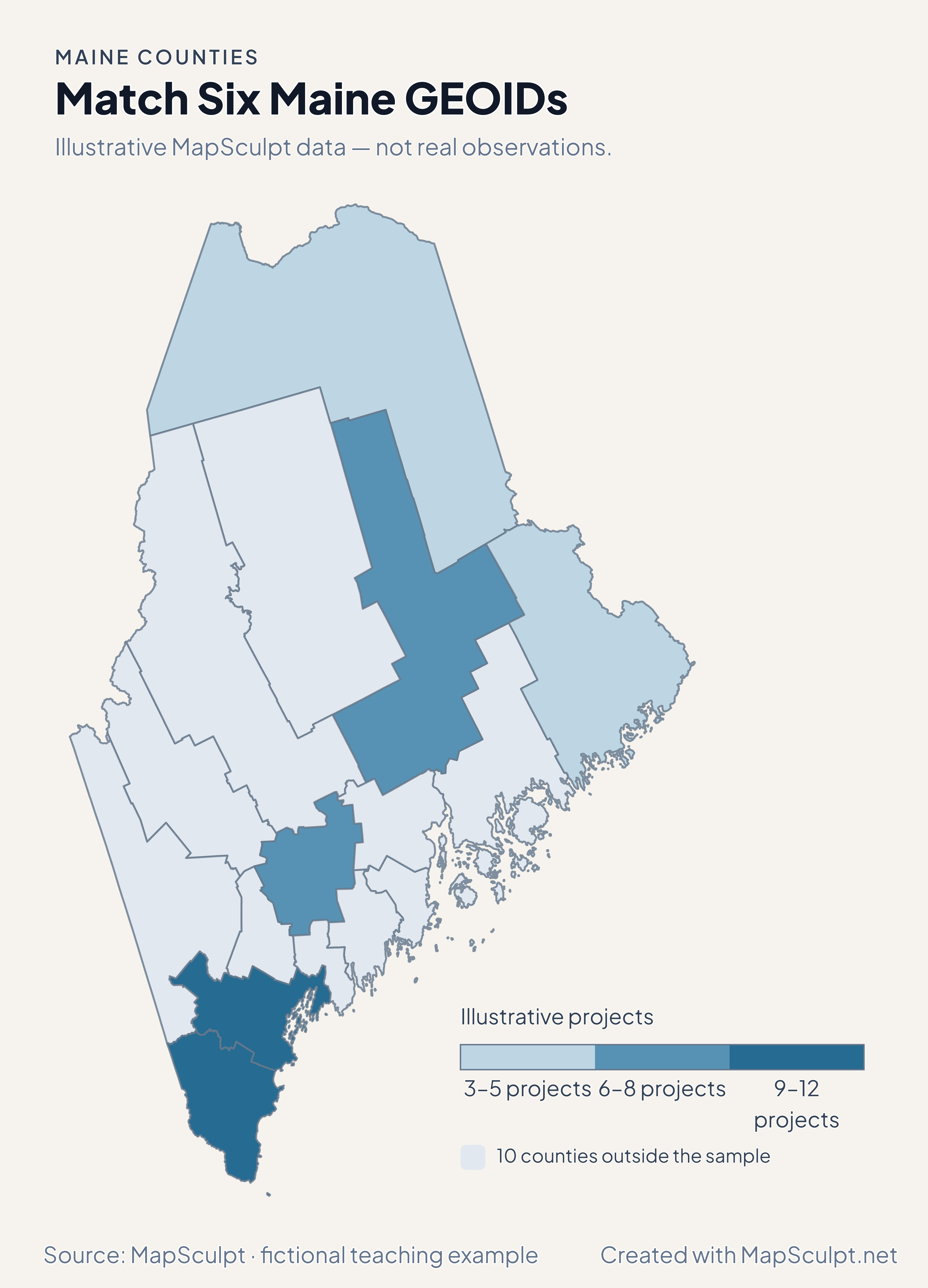
Try six GEOIDs from southern, central, northern and eastern Maine. The other ten counties keep the neutral color.

Illustrative MapSculpt data — not real observations.
CountyGEOIDProjects
Cumberland County2300512
York County230319
Aroostook County230035
Penobscot County230198
Kennebec County230116
Washington County230293

Match the GEOID column (23005 for Cumberland County) and use IllustrativeProjects as the numeric value. Start with boundaries of 3, 6, 9 and 12.

Download illustrative CSV ↓

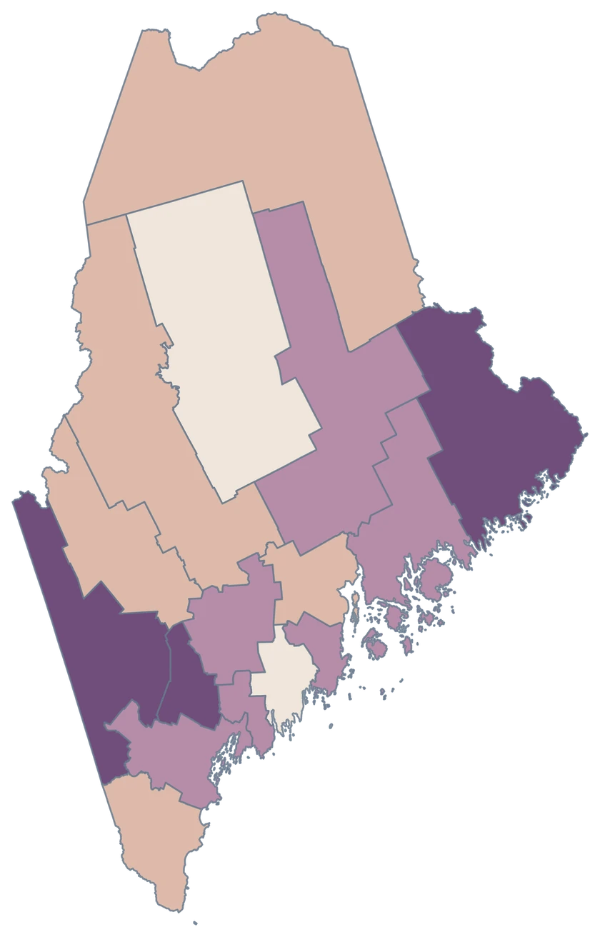
Match Six Maine GEOIDs

Illustrative MapSculpt data — not real observations.

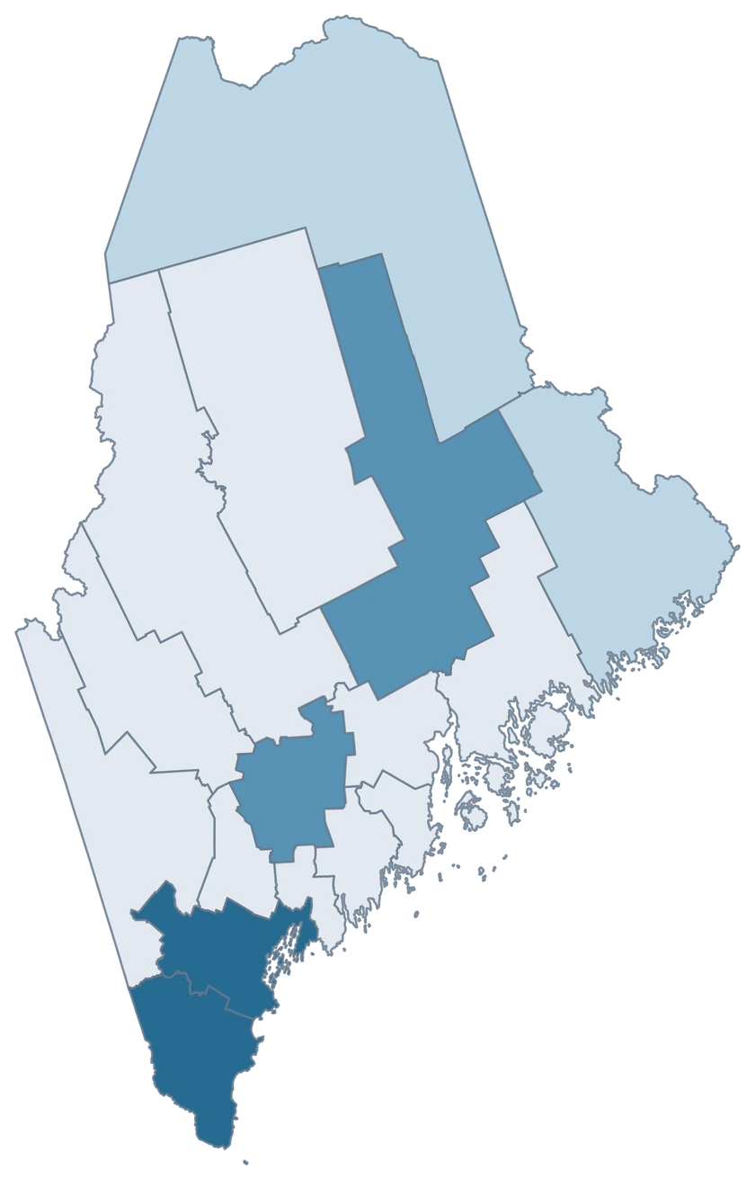
Illustrative Maine map with 6 styled counties and 10 neutral counties.

Illustrative projects

  • 3–5 projects
  • 6–8 projects
  • 9–12 projects
  • 10 counties outside the sample
Download complete PNG

CSV → Match 6 counties → Style → Export PNG Create a Maine map

COUNTY REFERENCE

Find all 16 Maine counties and GEOIDs.

Official county names and five-digit Census GEOIDs. Search by name or code.

  1. Androscoggin CountyGEOID 23001
  2. Aroostook CountyGEOID 23003
  3. Cumberland CountyGEOID 23005
  4. Franklin CountyGEOID 23007
  5. Hancock CountyGEOID 23009
  6. Kennebec CountyGEOID 23011
  7. Knox CountyGEOID 23013
  8. Lincoln CountyGEOID 23015
  9. Oxford CountyGEOID 23017
  10. Penobscot CountyGEOID 23019
  11. Piscataquis CountyGEOID 23021
  12. Sagadahoc CountyGEOID 23023
  13. Somerset CountyGEOID 23025
  14. Waldo CountyGEOID 23027
  15. Washington CountyGEOID 23029
  16. York CountyGEOID 23031

U.S. Census Bureau · 2025 Cartographic Boundary Files

COMMON QUESTIONS

Maine county map questions.

Which county contains Portland, Maine?

Portland is in Cumberland County. Use 23005 for a county-level join.

Which county should I use for Bangor?

Bangor is within Penobscot County, which has GEOID 23019.

Can I select Down East as one region?

The editor selects individual counties. To show a regional group, give the relevant counties a shared color and explain your definition in the legend.

Why does Washington County appear with an eastern coastline?

This is Washington County, Maine, at the eastern edge of the state. The GEOID 23029 identifies it independently of other Washington counties.

Do the colors cover every Maine island?

The Census cartographic file generalizes shorelines and omits some small features. Islands represented in the editor share the fill of their county.

How do I tell population change from domestic migration?

Population change compares the total from two dates. Domestic migration measures net moves within the United States. Check the map’s units and dates before sharing it.

YOUR NEXT MAP STARTS HERE

Make your data readable across Maine

Color the counties that matter to your story and download a map with a clear title, legend and source.

Create a Maine map