Skip to content
MapSculpt

GEOGRAPHIC MAP MAKER / NEW HAMPSHIRE

New Hampshire
Counties Map Maker

Map New Hampshire’s 10 counties from the Massachusetts border to Coos County. Compare southern population growth with the domestic migration rates recorded in Carroll and the far north.

Free online editor · No sign-up required

10counties
individually editable

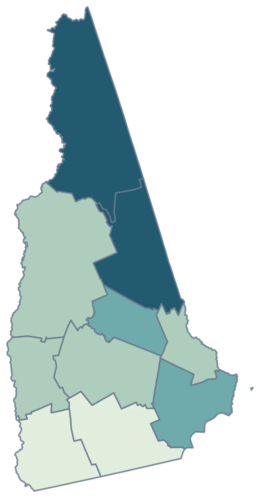
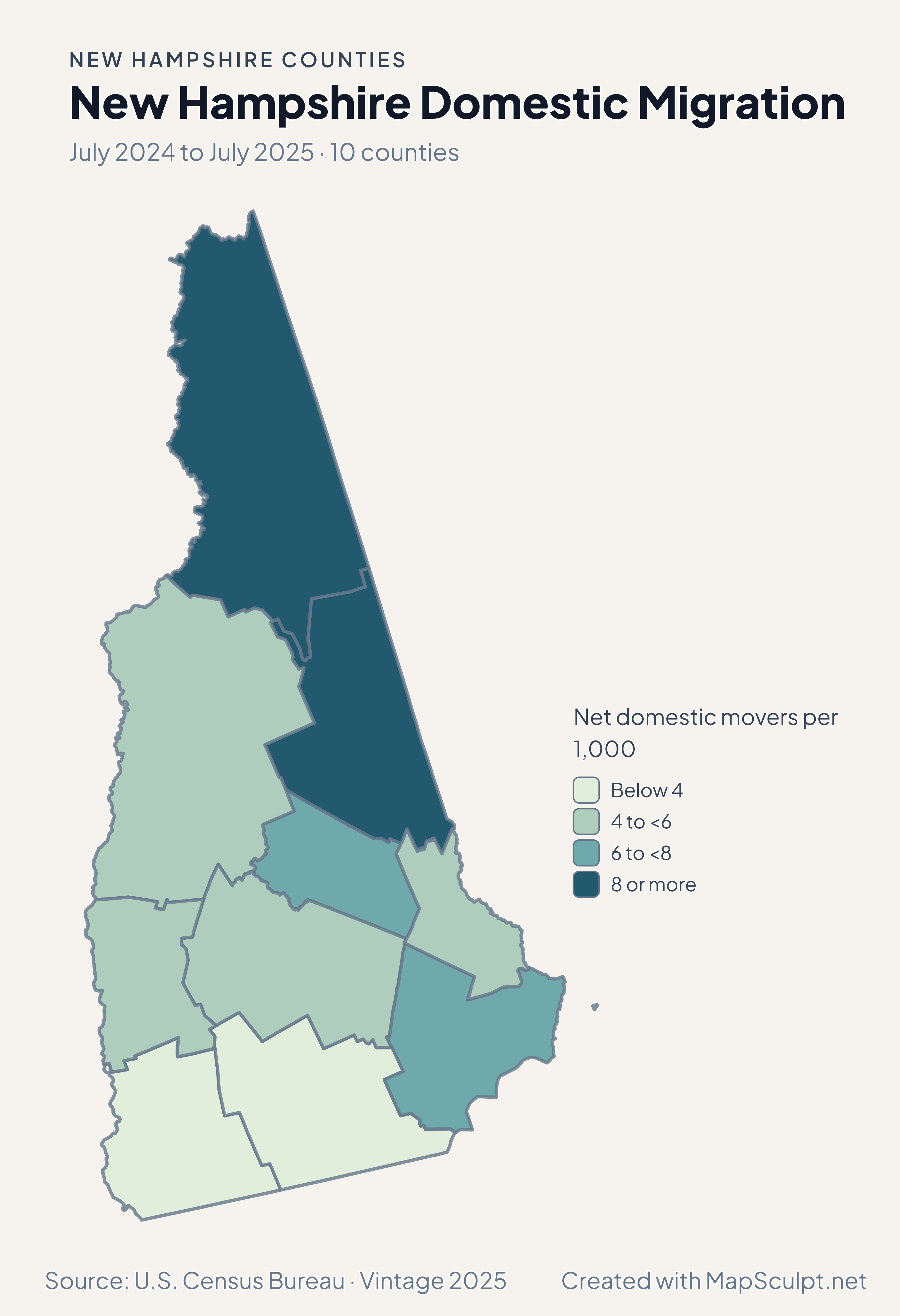
New Hampshire Domestic Migration

July 2024 to July 2025 · 10 counties

New Hampshire migration map with Carroll and Coos in the highest rate band.

Net domestic movers per 1,000

  • Below 4
  • 4 to <6
  • 6 to <8
  • 8 or more
U.S. Census Bureau · Vintage 2025Download complete PNG Net moves within the United States per 1,000 residents.

KNOW YOUR GEOGRAPHY

From the seacoast to New Hampshire’s northern border

The mapped counties reach Massachusetts in the south, Vermont in the west, Maine in the east and Canada in the north. Coos is the long northern county and remains fully within the outline.

Hillsborough County contains Manchester and Nashua. Rockingham reaches the seacoast. County color applies across the full Census area, including its cities and towns.

Browse all county GEOIDs ↗

2025 Census boundaries

OFFICIAL DATA

Higher migration rates reached north of the largest counties

Every county had positive net domestic migration in the period. The map highlights differences in the rate, while the total population map shows where growth was strongest.

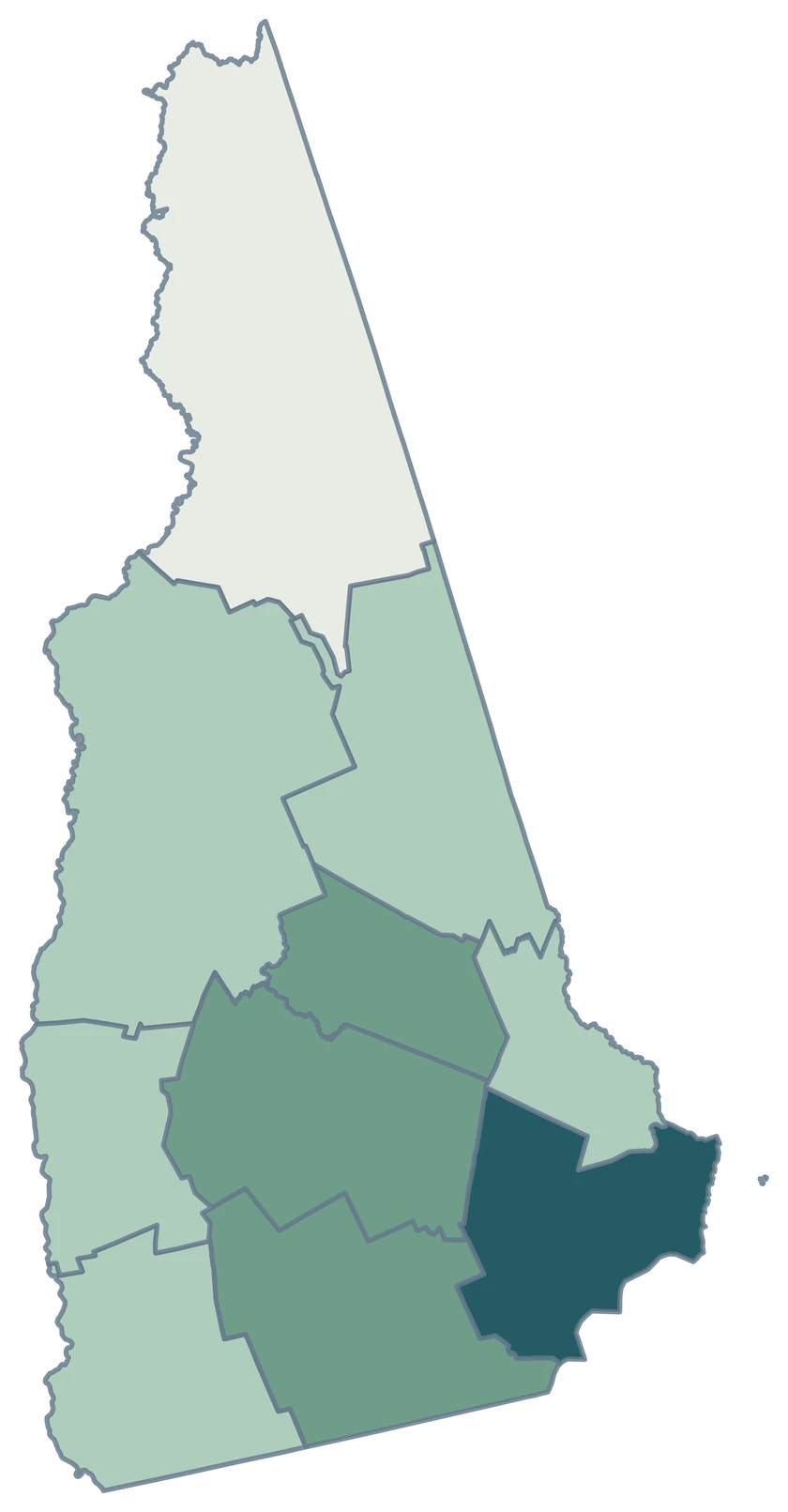
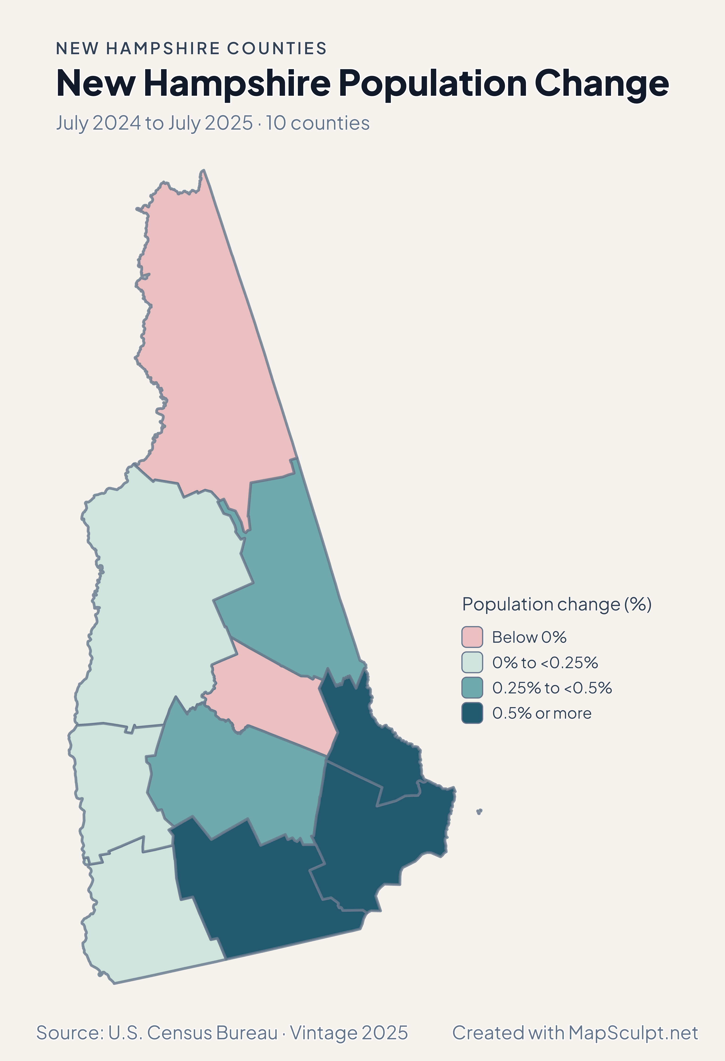
New Hampshire population change map with Hillsborough, Rockingham and Strafford in the highest band.

July 2024 to July 2025 · 10 counties

The strongest percentage gains were in the south and southeast

Hillsborough grew 0.69%, Rockingham 0.64%, and Strafford 0.53%. Coos declined 0.11%. The population series captures total estimated change.

Population change (%)

  • Below 0%
  • 0% to <0.25%
  • 0.25% to <0.5%
  • 0.5% or more

U.S. Census Bureau · Vintage 2025

Download complete PNG

Carroll had +10.57 net domestic movers per 1,000 and Coos +8.77. Hillsborough’s rate was +1.82. Positive domestic migration can coexist with population decline, as it did in Coos. See the Census estimates ↗

MAKE IT YOURS

From county data to a finished map.

  1. Open the New Hampshire counties editor

    Start with the 10 county areas already on the canvas.

  2. Join your observations by GEOID

    Use 33011 for Hillsborough County. Keep the measurement in a separate column.

  3. Choose ranges and check your legend

    Use a neutral color for counties outside your data and label the units and period.

  4. Download your county map

    Review the title, source and legend in the preview, then export the PNG.

TRY CSV IMPORT

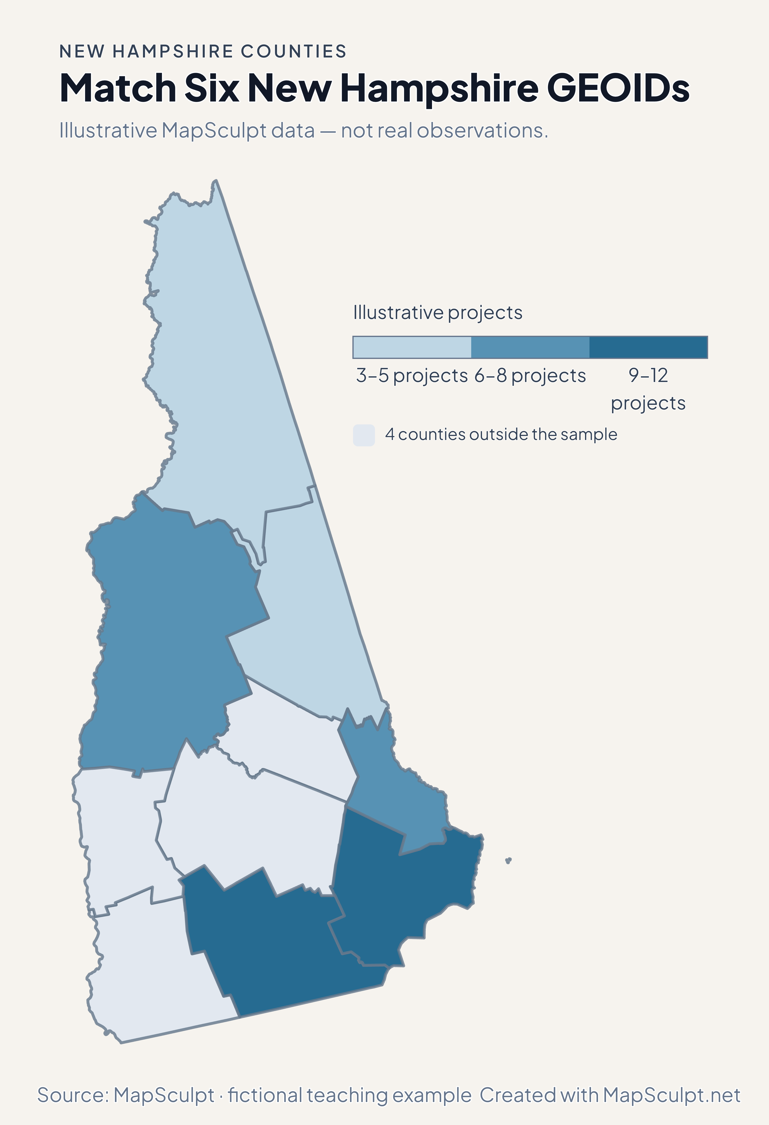
Try matching 6 New Hampshire counties

These six fictional rows span southern metros, the seacoast and northern counties. Four counties remain neutral.

Illustrative MapSculpt data — not real observations.
CountyGEOIDProjects
Hillsborough County3301112
Rockingham County330159
Coos County330073
Grafton County330096
Carroll County330035
Strafford County330178

Match the GEOID column (33011 for Hillsborough County) and use IllustrativeProjects as the numeric value. Start with boundaries of 3, 6, 9 and 12.

Download illustrative CSV ↓

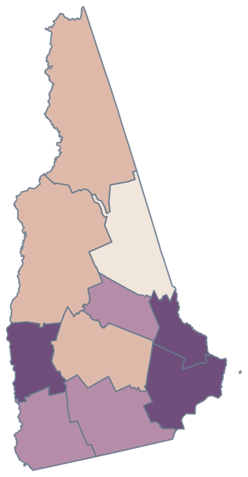
Match Six New Hampshire GEOIDs

Illustrative MapSculpt data — not real observations.

Illustrative New Hampshire map with 6 styled counties and 4 neutral counties.

Illustrative projects

  • 3–5 projects
  • 6–8 projects
  • 9–12 projects
  • 4 counties outside the sample
Download complete PNG

CSV → Match 6 counties → Style → Export PNG Create a New Hampshire map

COUNTY REFERENCE

Find all 10 New Hampshire counties and GEOIDs.

Official county names and five-digit Census GEOIDs. Search by name or code.

  1. Belknap CountyGEOID 33001
  2. Carroll CountyGEOID 33003
  3. Cheshire CountyGEOID 33005
  4. Coos CountyGEOID 33007
  5. Grafton CountyGEOID 33009
  6. Hillsborough CountyGEOID 33011
  7. Merrimack CountyGEOID 33013
  8. Rockingham CountyGEOID 33015
  9. Strafford CountyGEOID 33017
  10. Sullivan CountyGEOID 33019

U.S. Census Bureau · 2025 Cartographic Boundary Files

COMMON QUESTIONS

New Hampshire county map questions.

Which county should I use for Manchester or Nashua?

Both cities are in Hillsborough County. A county join assigns a single fill across Hillsborough.

Can a New Hampshire county map show individual town data?

The editable units are counties. Aggregate compatible town observations to counties before importing, or use a town-boundary map for town-level comparisons.

How do I find the northernmost county in a CSV?

Use Coos County’s Census GEOID, 33007. The directory follows the Census spelling used in the pinned data.

How can Coos have positive domestic migration and a declining population?

Domestic migration is one component of population change. Births, deaths, international migration and statistical adjustments also affect the total.

Which county contains the New Hampshire seacoast?

Rockingham County contains the state’s Atlantic shoreline. Strafford sits just to its north.

Which columns work for a county CSV?

Use the five-digit GEOID as the match column and put your measurements in a separate column. A short formatted CSV with county names is provided on this page.

YOUR NEXT MAP STARTS HERE

Build a map around your New Hampshire data

Join county GEOIDs, set the colors and export a map for your report or presentation.

Create a New Hampshire map