Skip to content
MapSculpt

GEOGRAPHIC MAP MAKER / NEVADA

Nevada
Counties Map Maker

Compare domestic moves in Clark and Washoe with western Nevada county equivalents. Map all 16 counties and independent Carson City using their own Census GEOIDs.

Free online editor · No sign-up required

17county equivalents
individually editable

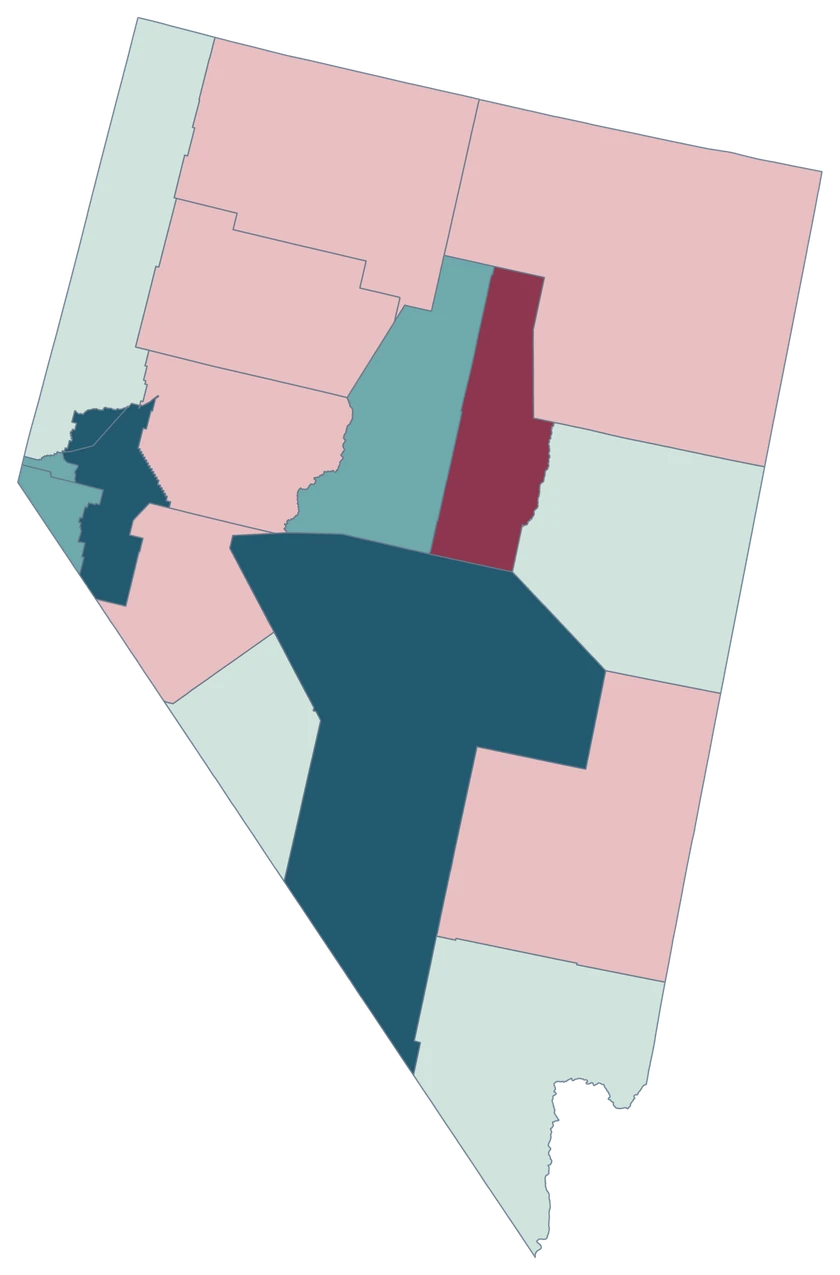
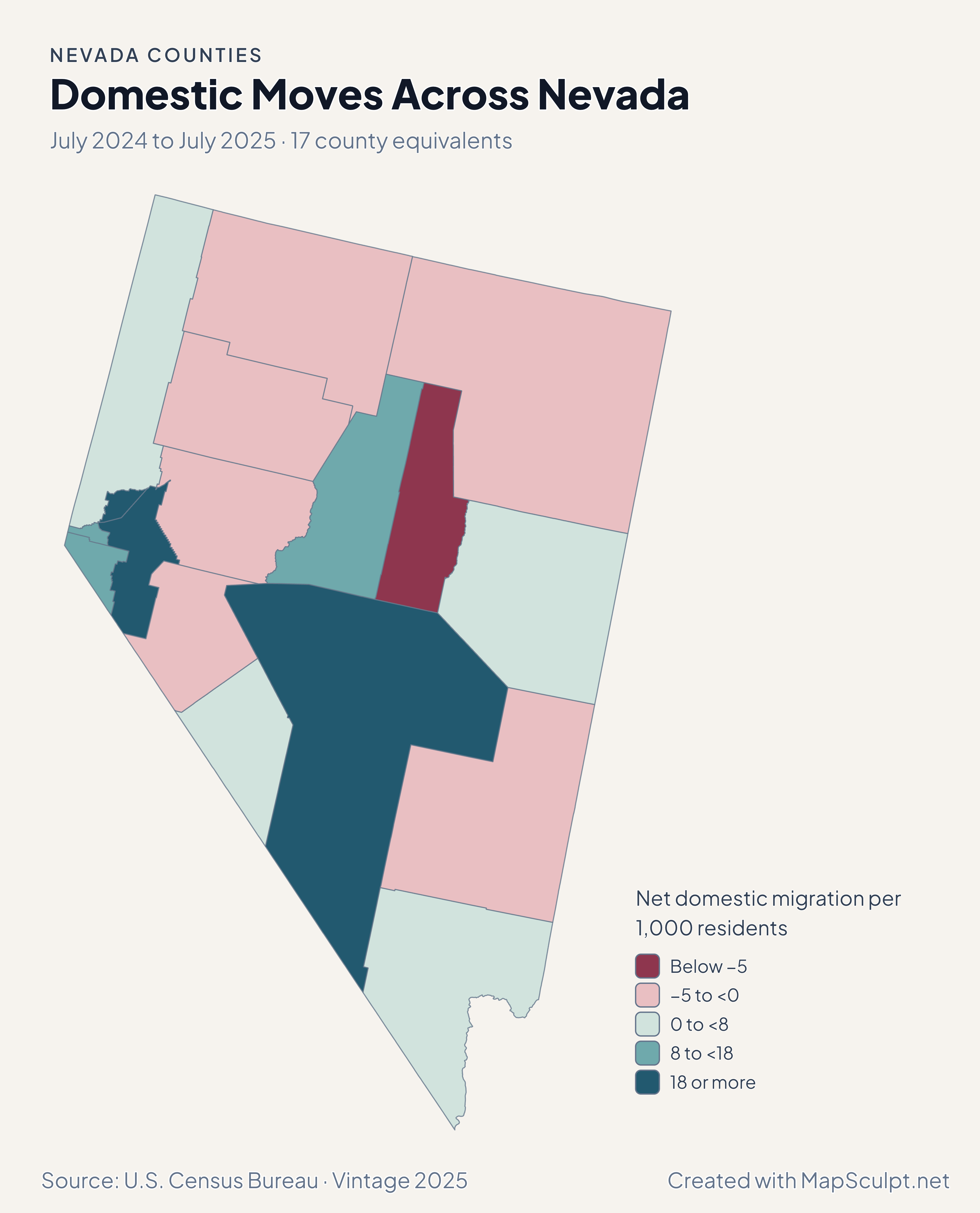
Domestic Moves Across Nevada

July 2024 to July 2025 · 17 county equivalents

Nevada domestic migration map showing higher rates in Lyon and Nye than in Clark and Washoe, with Carson City separately mapped.

Net domestic migration per 1,000 residents

  • Below −5
  • −5 to <0
  • 0 to <8
  • 8 to <18
  • 18 or more
U.S. Census Bureau · Vintage 2025Download complete PNG Net moves within the United States per 1,000 residents.

KNOW YOUR GEOGRAPHY

Sixteen counties and Carson City

Carson City is an independent city that the Census Bureau treats as a county equivalent. Its county-level GEOID is 32510, and it remains separately selectable beside Douglas, Lyon and Washoe.

The outlines on this map follow county-level boundaries across Nevada’s basins and mountain ranges. Las Vegas is within Clark County and Reno is within Washoe County. Their city boundaries are outside this editor’s coverage.

Browse all county GEOIDs ↗

2025 Census boundaries

OFFICIAL DATA

Western Nevada’s domestic migration rates vary by county equivalent

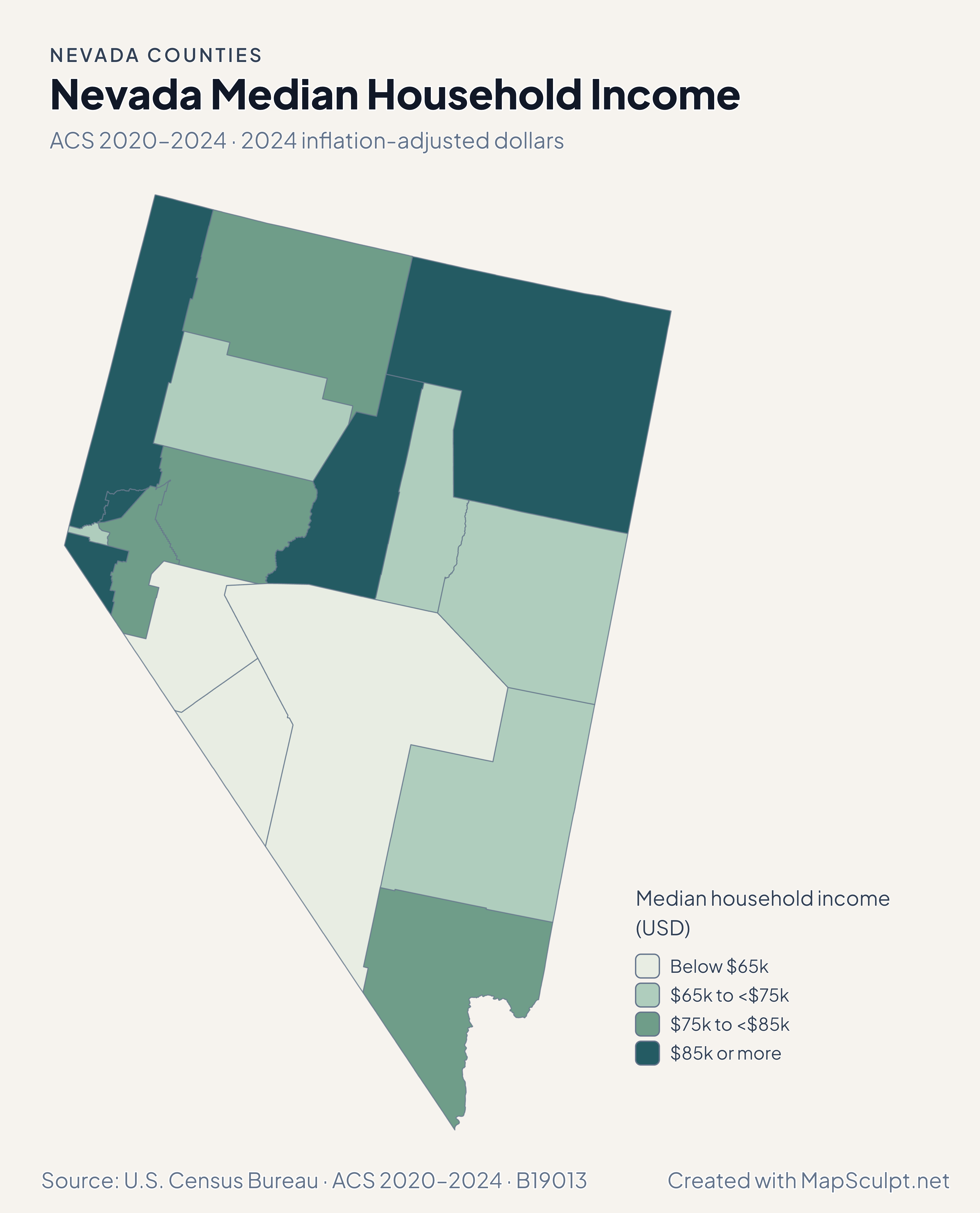
Compare rates per 1,000 residents before looking at percentage population growth and the separate ACS estimates.

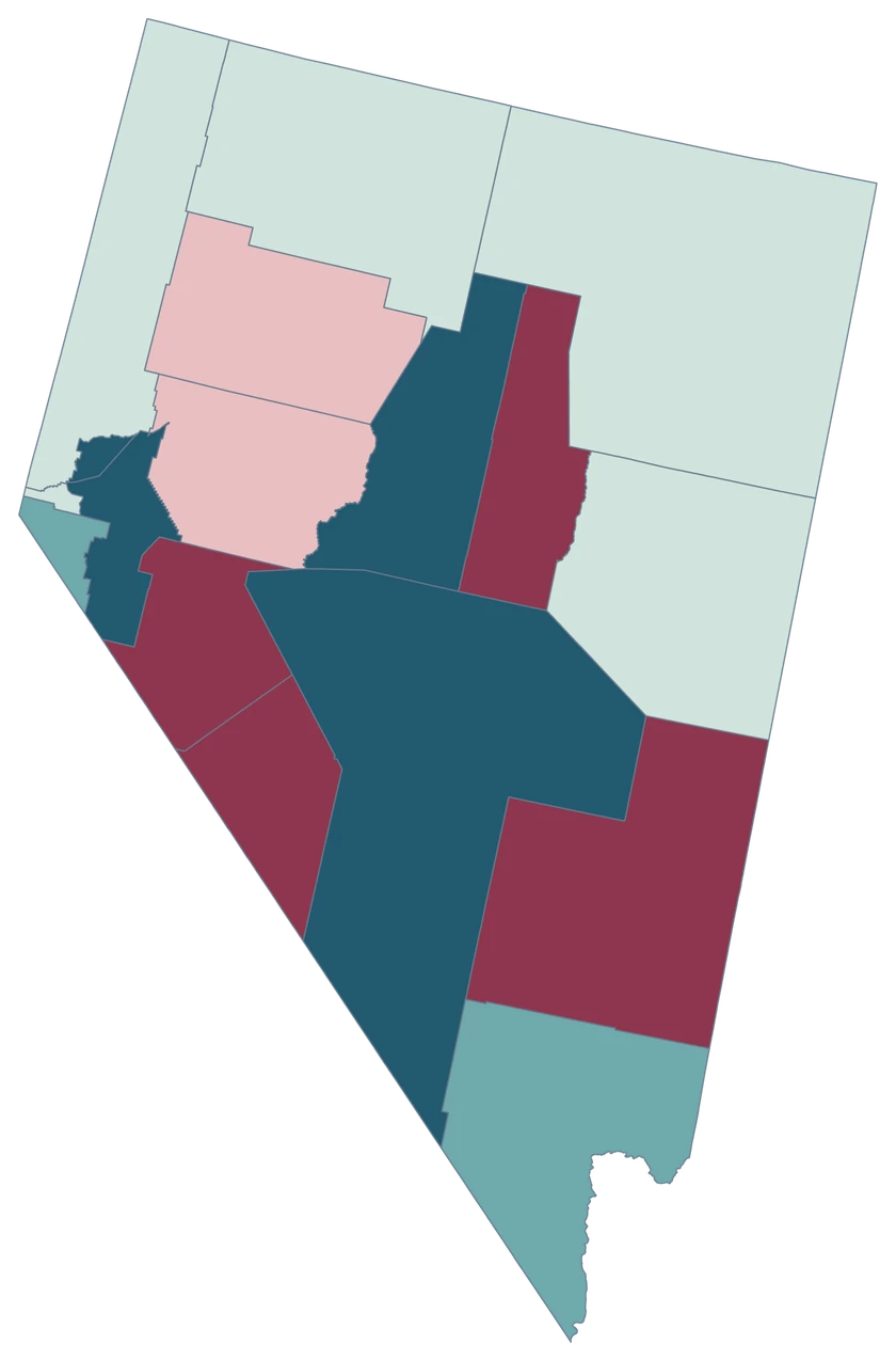
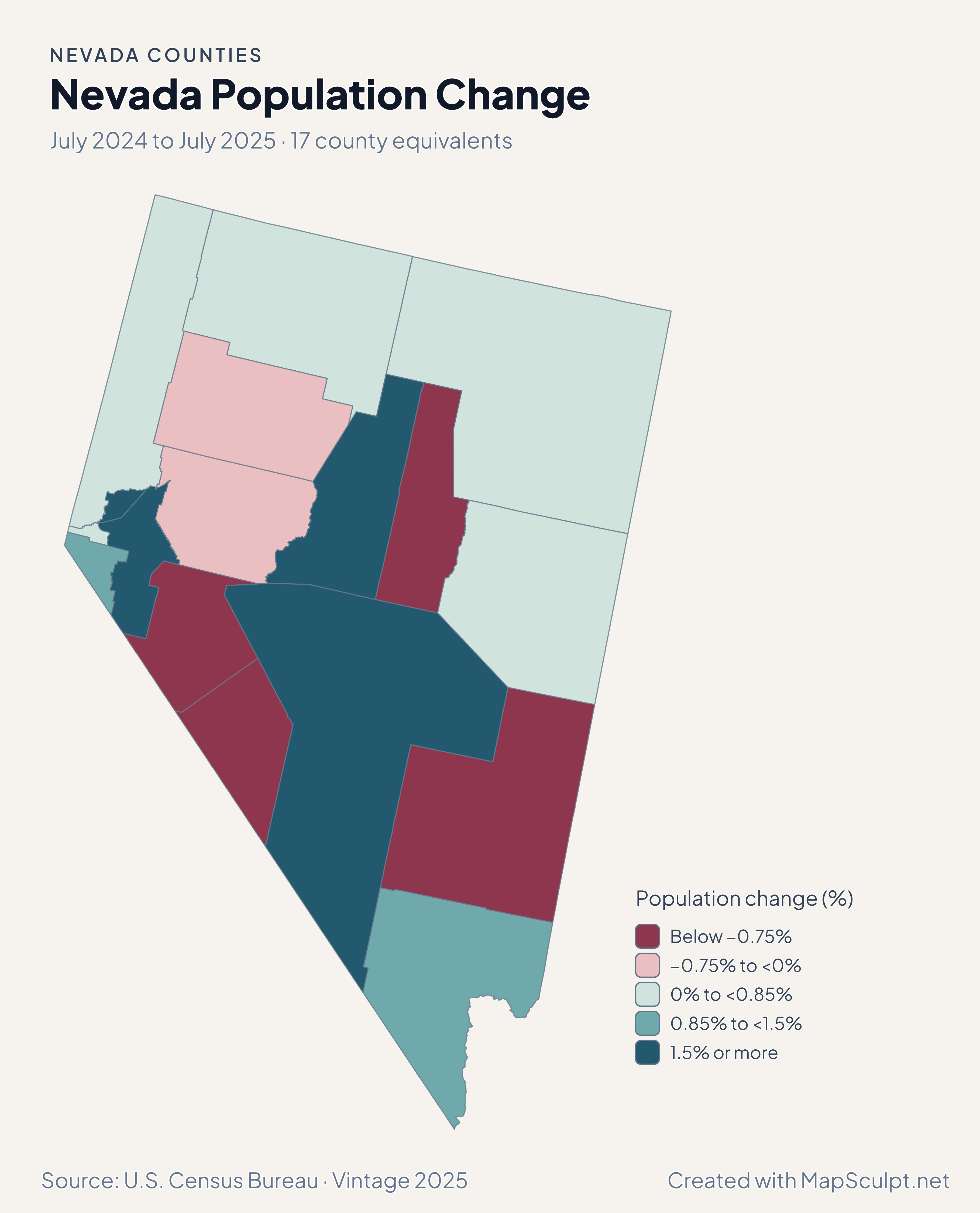
Nevada population-change map highlighting Lyon’s gain and showing Carson City separately.

July 2024 to July 2025 · 17 county equivalents

Lyon posted the largest percentage gain

Lyon grew 2.06%, Clark 0.90%, Washoe 0.79%, and Carson City 0.46% from July 2024 to July 2025. A percentage is measured relative to each place’s starting population.

Population change (%)

  • Below −0.75%
  • −0.75% to <0%
  • 0% to <0.85%
  • 0.85% to <1.5%
  • 1.5% or more

U.S. Census Bureau · Vintage 2025

Download complete PNG

Lyon recorded +21.26 net domestic movers per 1,000 residents and Nye +27.76. Carson City recorded +9.81, Washoe +4.22, and Clark +3.53. These rates compare places with different population sizes. See the Census estimates ↗

MAKE IT YOURS

From county data to a finished map.

  1. Open the Nevada editor

    Start with the full county-level geography.

  2. Match your rows by GEOID

    Carson City uses 32510. The editor can match it without adding “County” to the name.

  3. Choose colors a reader can interpret

    Label each class and include a date and units for numerical data.

  4. Export the annotated map

    Preview the title, legend and source, then download the PNG.

TRY CSV IMPORT

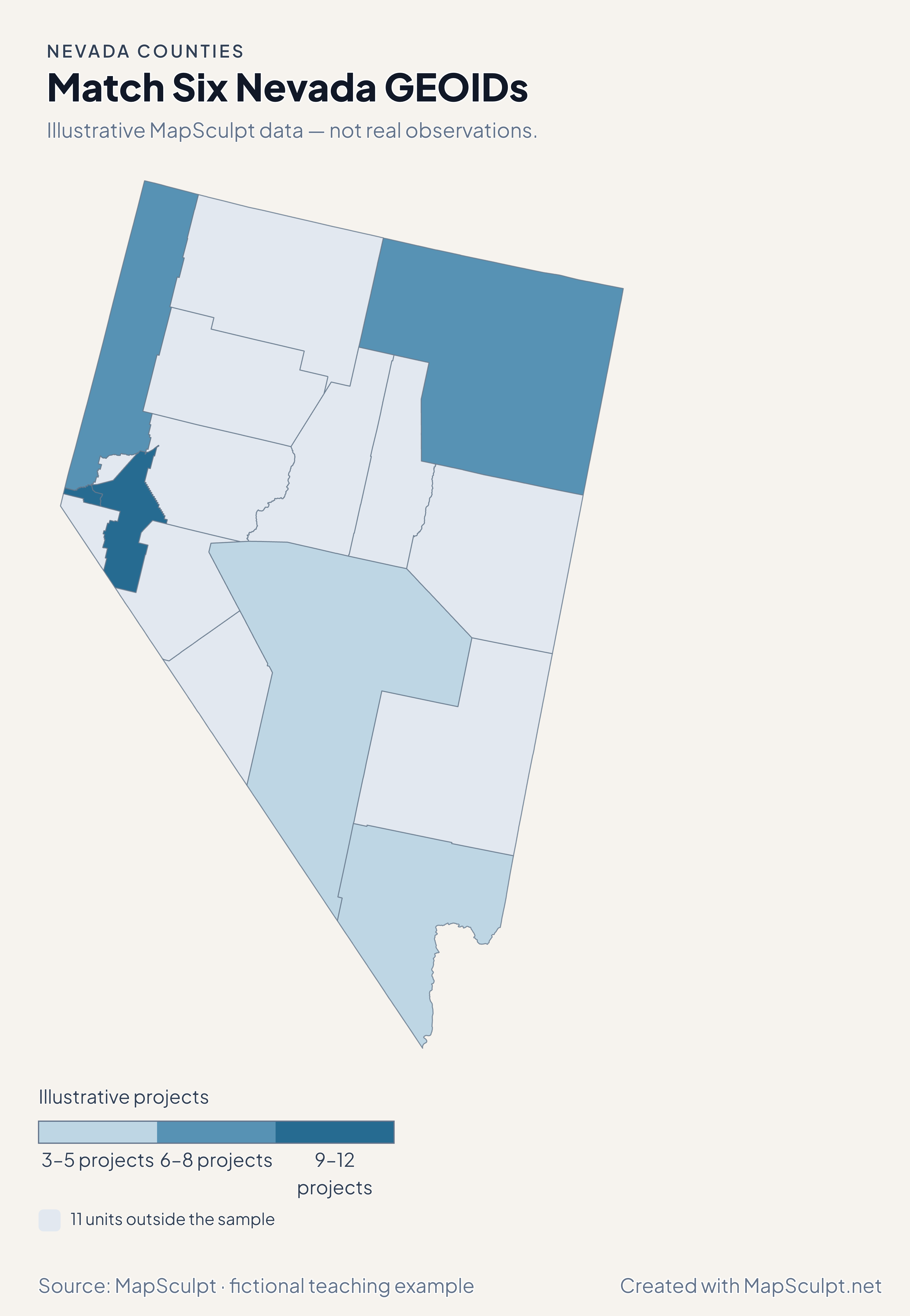
Try joining six official GEOIDs.

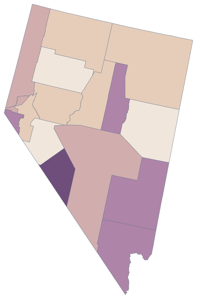
The fictional project values exercise three numeric bands. The remaining 11 county-level units keep the neutral fill.

Illustrative MapSculpt data — not real observations.
CountyGEOIDProjects
Carson City3251012
Clark County320035
Washoe County320318
Lyon County320199
Nye County320233
Elko County320076

Carson City uses 32510. The editor can match it without adding “County” to the name. Set custom boundaries of 3, 6, 9 and 12.

Download illustrative CSV ↓

Match Six Nevada GEOIDs

Illustrative MapSculpt data — not real observations.

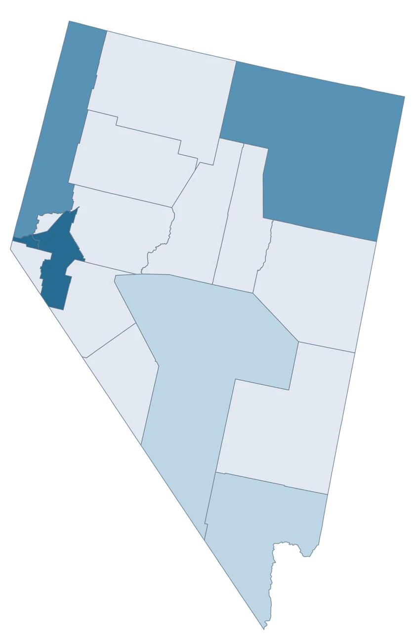
Illustrative Nevada map highlighting six GEOIDs and leaving 11 areas neutral.

Illustrative projects

  • 3–5 projects
  • 6–8 projects
  • 9–12 projects
  • 11 units outside the sample
Download complete PNG

CSV → Match 6 county equivalents → Style → Export PNG Create a Nevada map

GEOGRAPHY NOTES

Carson City has its own county-level identity

For a Census county-level join, use 32510 for Carson City. The separate incorporated-place identifier describes a different layer in Census files. Keep the county-level GEOID in this editor.

U.S. Census Bureau · Nevada county and equivalent identifiers

COUNTY REFERENCE

Find all 17 Nevada county equivalents and GEOIDs.

Official county and independent city names and five-digit Census GEOIDs. Search by name or code.

  1. Carson CityGEOID 32510
  2. Churchill CountyGEOID 32001
  3. Clark CountyGEOID 32003
  4. Douglas CountyGEOID 32005
  5. Elko CountyGEOID 32007
  6. Esmeralda CountyGEOID 32009
  7. Eureka CountyGEOID 32011
  8. Humboldt CountyGEOID 32013
  9. Lander CountyGEOID 32015
  10. Lincoln CountyGEOID 32017
  11. Lyon CountyGEOID 32019
  12. Mineral CountyGEOID 32021
  13. Nye CountyGEOID 32023
  14. Pershing CountyGEOID 32027
  15. Storey CountyGEOID 32029
  16. Washoe CountyGEOID 32031
  17. White Pine CountyGEOID 32033

U.S. Census Bureau · 2025 Cartographic Boundary Files

COMMON QUESTIONS

Nevada county map questions.

Why are there 17 selectable areas when Nevada has 16 counties?

The Census counts independent Carson City as a county equivalent. It is a separate selectable area alongside the 16 counties.

Which code should I use for Carson City?

Use the county-level GEOID 32510 in the Nevada editor. Keep the official name “Carson City” and avoid appending “County.”

Can I color Las Vegas and Reno independently?

This editor selects Clark and Washoe counties. For estimates reported only for Las Vegas or Reno, use a municipal boundary source.

Why compare Clark and Lyon per 1,000 residents?

Rates scale net domestic moves to each county’s population. Counts answer a different question about the number of people moving in or out on net.

What should I look for around Lake Tahoe?

Use the generalized Nevada county outlines for Washoe, Carson City and Douglas. This editor covers Nevada. A cross-state view needs the nationwide county map.

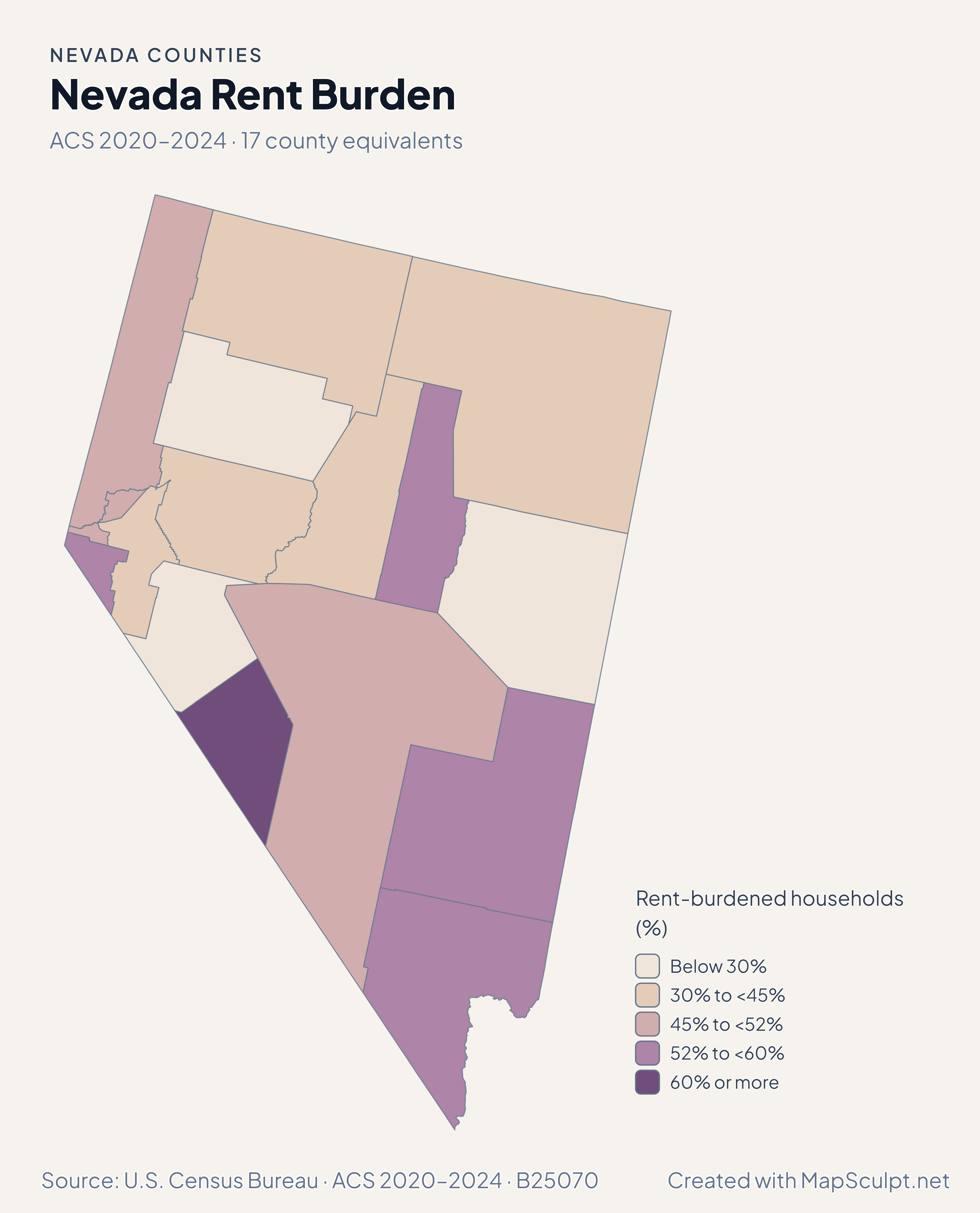
How should I interpret unusual rent estimates in sparsely populated counties?

Read the ACS margins of error and the estimated denominator. A small estimated number of computable renter households can make a percentage sensitive to relatively small changes.

YOUR NEXT MAP STARTS HERE

Map Nevada down to the county equivalent.

Give Carson City its own fill, then customize the legend and export the complete map.

Create a Nevada map