Skip to content
MapSculpt

Geographic map maker / France

France Departments Map Maker

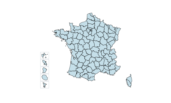
Color all 101 French departments, including Corsica and overseas France. Import CSV data, customize colors and legends, and export a polished map.

Free online editor · No sign-up required

101departments individually editable

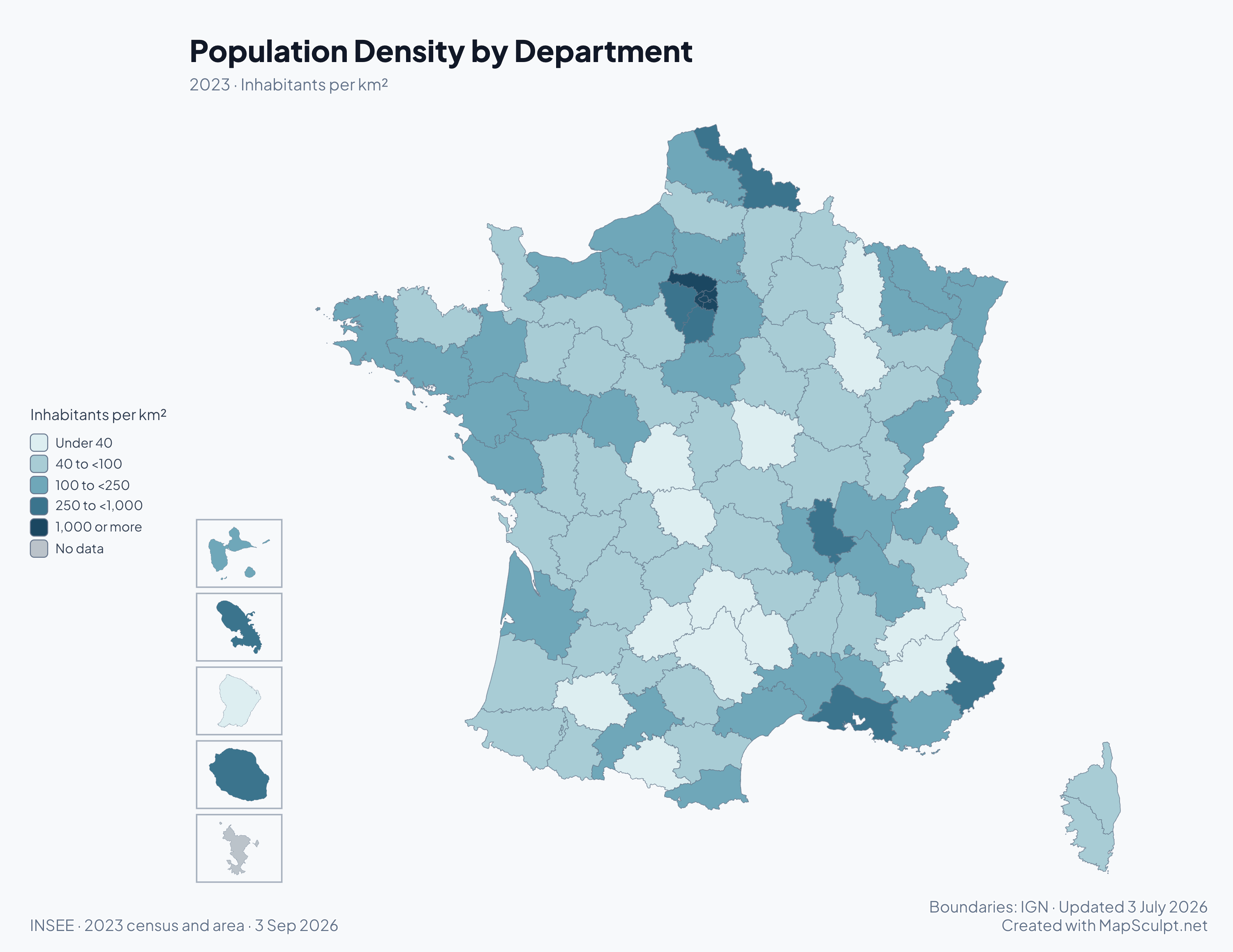
Population Density by Department

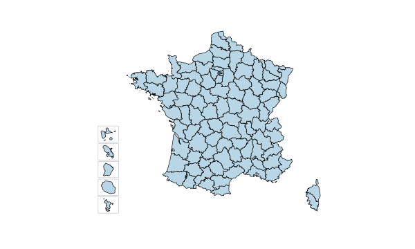
Population density map of French departments in 2023, with five overseas insets and class breaks in inhabitants per square kilometre.

Inhabitants per km²

  • Under 40
  • 40 to <100
  • 100 to <250
  • 250 to <1,000
  • 1,000 or more
  • No data

2023 · Inhabitants per km². Paris had about 19,960 inhabitants per km². The highest band starts at 1,000 so that lower densities remain distinguishable. The harmonized 2023 census series excludes Mayotte.

Know your geography

101 departments. One France.

Metropolitan France has 96 departments, including Corse-du-Sud (2A) and Haute-Corse (2B). Five more are overseas. You can color each one independently.

The map uses official IGN 2026 department boundaries. Municipalities, arrondissements and cantons are finer divisions. The overseas insets are drawn at different scales. IGN · ADMIN EXPRESS COG 2026

Find a department and its INSEE code

Official data · Map examples

France’s departments in four maps

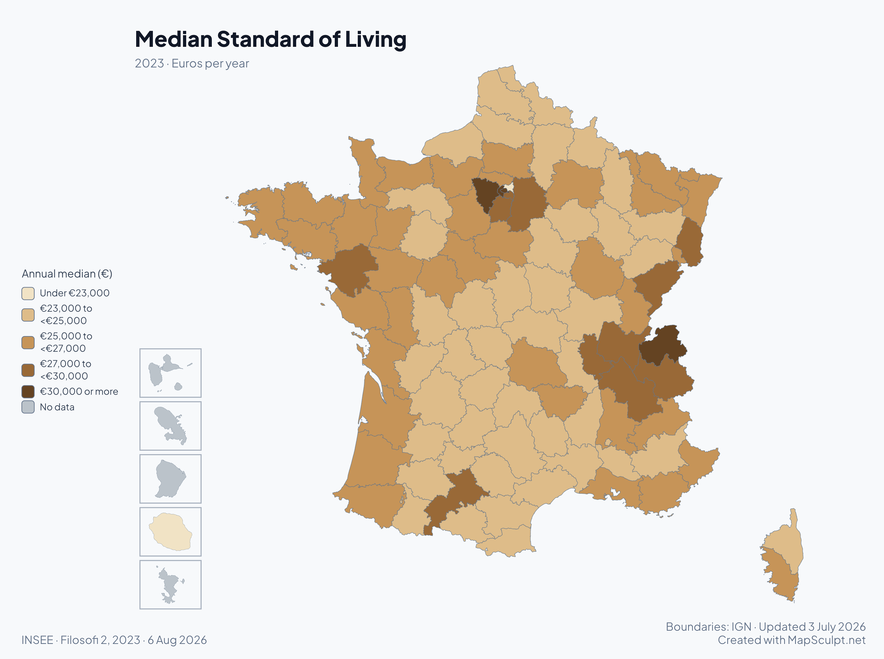
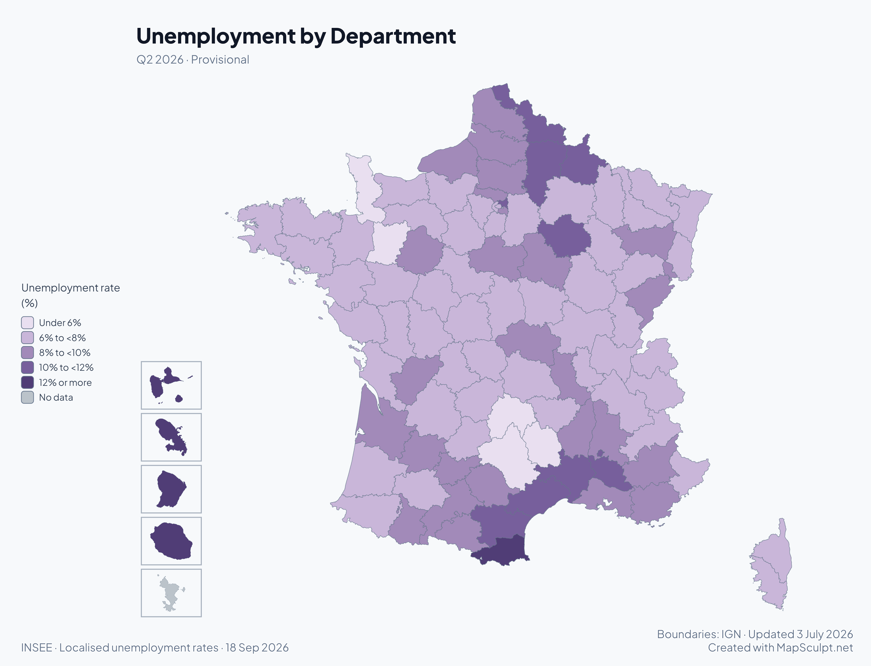
The density map above and the three maps below use official INSEE data. Each illustrates a different way to compare departments.

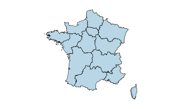
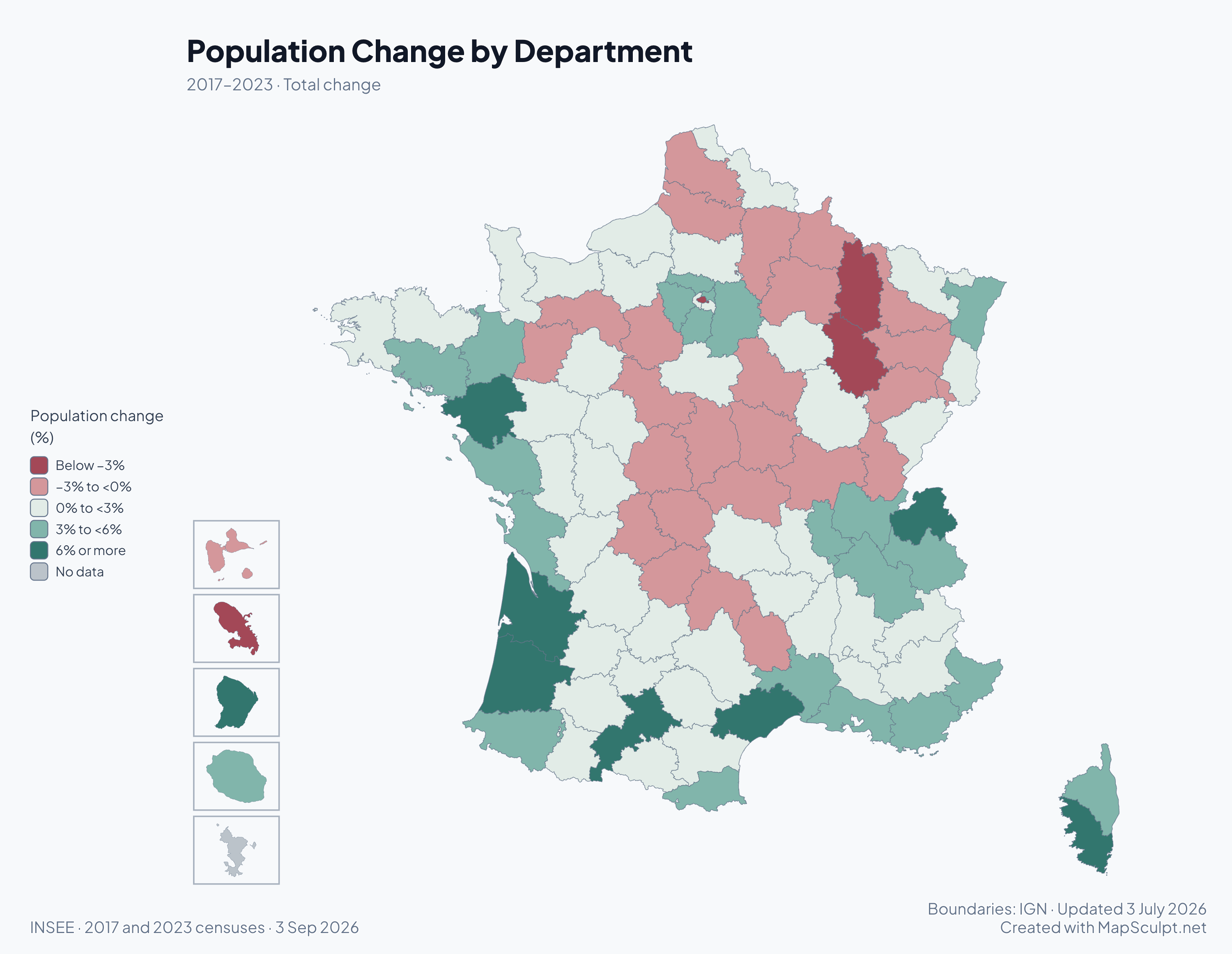
Diverging map of total departmental population change from 2017 to 2023.

2017–2023 · Total change

Where France is growing — and shrinking

Between 2017 and 2023, Guyane grew by 9.4% while Haute-Marne’s population fell by 4.2%. The map shows total percentage change between the two censuses on 2026 boundaries.

  • Below −3%
  • −3% to <0%
  • 0% to <3%
  • 3% to <6%
  • 6% or more
  • No data

Mayotte is outside this comparable census series.

INSEE · 2017 and 2023 censuses · 3 Sep 2026

View full-size PNGCreate a France map

How it works

From department data to a finished map

  1. Choose your departments

    Open the editor and color any of the 101 departments, or leave the map blank.

  2. Import your CSV

    Match rows by department code or name. Review matches, then apply categories or a numeric color scale.

  3. Customize your map

    Set your colors and add a title, a readable legend and a data source.

  4. Export your PNG

    Choose your canvas format, background and resolution, then download the map.

Illustrative CSV

From spreadsheet to France departments map

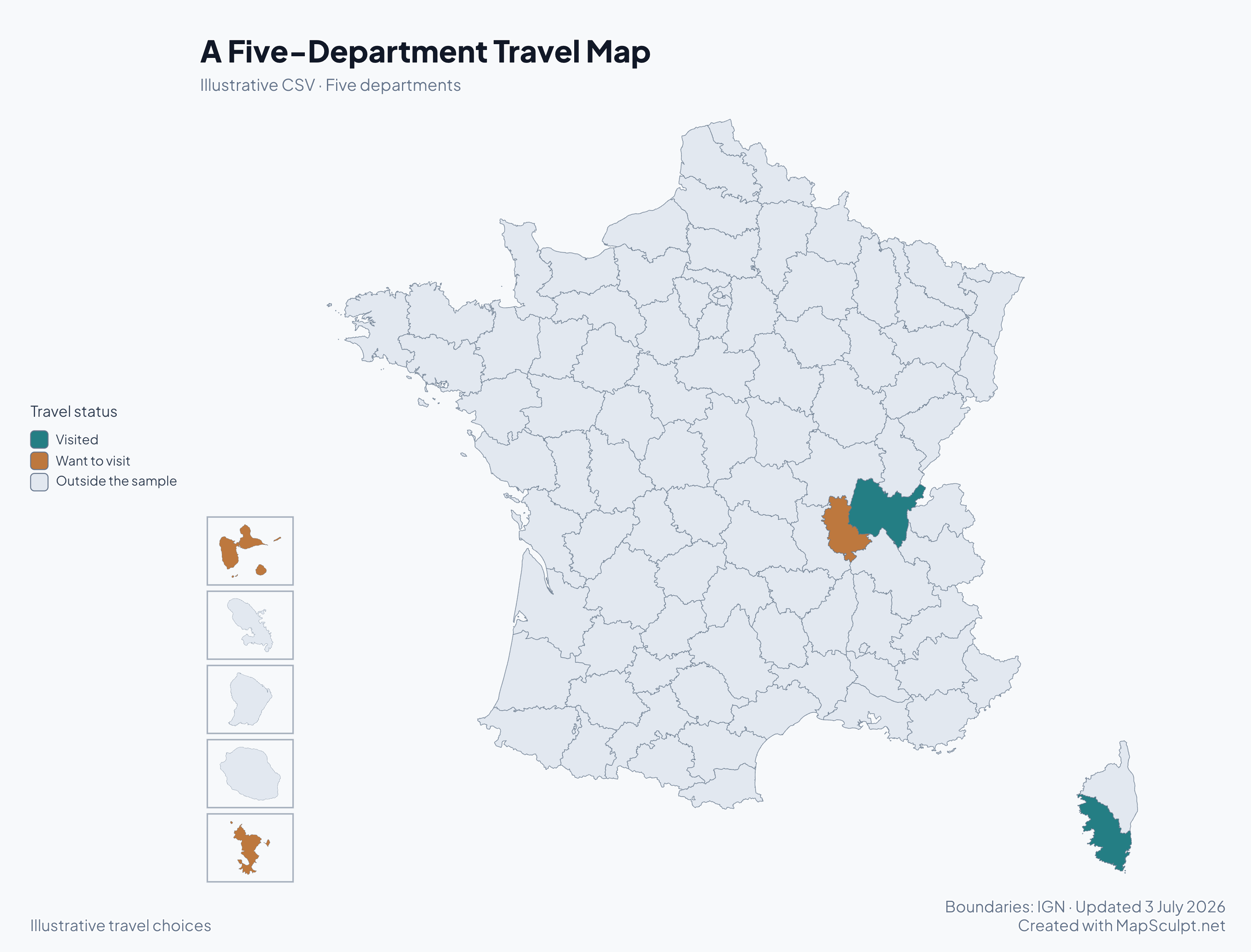
Try these fictional travel choices. Download the CSV and import it into the editor to color the same five departments.

Sample CSV contents
DepartmentDEPStatus
Ain01Visited
Corse-du-Sud2AVisited
Rhône69Want to visit
Guadeloupe971Want to visit
Mayotte976Want to visit

Keep INSEE codes as text to preserve the zero in 01 and the letters in 2A and 2B. Code 69 covers the whole Rhône department, including Lyon. The name Rhône alone may require confirmation. Codes 69D and 69M identify separate territorial authorities.

Download sample CSV

A Five-Department Travel Map

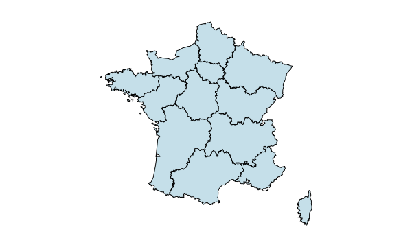
Illustrative MapSculpt export showing two visited and three planned destinations.
  • Visited
  • Want to visit
  • Outside the sample
View full-size PNG
Create a France map

Official INSEE codes · 2026

France’s 101 departments

Look up names, official department numbers and their regions. Use the code when matching your CSV.

  1. 01
    AinAuvergne-Rhône-AlpesMetropolitan France
  2. 02
    AisneHauts-de-FranceMetropolitan France
  3. 03
    AllierAuvergne-Rhône-AlpesMetropolitan France
  4. 04
    Alpes-de-Haute-ProvenceProvence-Alpes-Côte d'AzurMetropolitan France
  5. 05
    Hautes-AlpesProvence-Alpes-Côte d'AzurMetropolitan France
  6. 06
    Alpes-MaritimesProvence-Alpes-Côte d'AzurMetropolitan France
  7. 07
    ArdècheAuvergne-Rhône-AlpesMetropolitan France
  8. 08
    ArdennesGrand EstMetropolitan France
  9. 09
    AriègeOccitanieMetropolitan France
  10. 10
    AubeGrand EstMetropolitan France
  11. 11
    AudeOccitanieMetropolitan France
  12. 12
    AveyronOccitanieMetropolitan France
  13. 13
    Bouches-du-RhôneProvence-Alpes-Côte d'AzurMetropolitan France
  14. 14
    CalvadosNormandieMetropolitan France
  15. 15
    CantalAuvergne-Rhône-AlpesMetropolitan France
  16. 16
    CharenteNouvelle-AquitaineMetropolitan France
  17. 17
    Charente-MaritimeNouvelle-AquitaineMetropolitan France
  18. 18
    CherCentre-Val de LoireMetropolitan France
  19. 19
    CorrèzeNouvelle-AquitaineMetropolitan France
  20. 21
    Côte-d'OrBourgogne-Franche-ComtéMetropolitan France
  21. 22
    Côtes-d'ArmorBretagneMetropolitan France
  22. 23
    CreuseNouvelle-AquitaineMetropolitan France
  23. 24
    DordogneNouvelle-AquitaineMetropolitan France
  24. 25
    DoubsBourgogne-Franche-ComtéMetropolitan France
  25. 26
    DrômeAuvergne-Rhône-AlpesMetropolitan France
  26. 27
    EureNormandieMetropolitan France
  27. 28
    Eure-et-LoirCentre-Val de LoireMetropolitan France
  28. 29
    FinistèreBretagneMetropolitan France
  29. 2A
    Corse-du-SudCorseMetropolitan France
  30. 2B
    Haute-CorseCorseMetropolitan France
  31. 30
    GardOccitanieMetropolitan France
  32. 31
    Haute-GaronneOccitanieMetropolitan France
  33. 32
    GersOccitanieMetropolitan France
  34. 33
    GirondeNouvelle-AquitaineMetropolitan France
  35. 34
    HéraultOccitanieMetropolitan France
  36. 35
    Ille-et-VilaineBretagneMetropolitan France
  37. 36
    IndreCentre-Val de LoireMetropolitan France
  38. 37
    Indre-et-LoireCentre-Val de LoireMetropolitan France
  39. 38
    IsèreAuvergne-Rhône-AlpesMetropolitan France
  40. 39
    JuraBourgogne-Franche-ComtéMetropolitan France
  41. 40
    LandesNouvelle-AquitaineMetropolitan France
  42. 41
    Loir-et-CherCentre-Val de LoireMetropolitan France
  43. 42
    LoireAuvergne-Rhône-AlpesMetropolitan France
  44. 43
    Haute-LoireAuvergne-Rhône-AlpesMetropolitan France
  45. 44
    Loire-AtlantiquePays de la LoireMetropolitan France
  46. 45
    LoiretCentre-Val de LoireMetropolitan France
  47. 46
    LotOccitanieMetropolitan France
  48. 47
    Lot-et-GaronneNouvelle-AquitaineMetropolitan France
  49. 48
    LozèreOccitanieMetropolitan France
  50. 49
    Maine-et-LoirePays de la LoireMetropolitan France
  51. 50
    MancheNormandieMetropolitan France
  52. 51
    MarneGrand EstMetropolitan France
  53. 52
    Haute-MarneGrand EstMetropolitan France
  54. 53
    MayennePays de la LoireMetropolitan France
  55. 54
    Meurthe-et-MoselleGrand EstMetropolitan France
  56. 55
    MeuseGrand EstMetropolitan France
  57. 56
    MorbihanBretagneMetropolitan France
  58. 57
    MoselleGrand EstMetropolitan France
  59. 58
    NièvreBourgogne-Franche-ComtéMetropolitan France
  60. 59
    NordHauts-de-FranceMetropolitan France
  61. 60
    OiseHauts-de-FranceMetropolitan France
  62. 61
    OrneNormandieMetropolitan France
  63. 62
    Pas-de-CalaisHauts-de-FranceMetropolitan France
  64. 63
    Puy-de-DômeAuvergne-Rhône-AlpesMetropolitan France
  65. 64
    Pyrénées-AtlantiquesNouvelle-AquitaineMetropolitan France
  66. 65
    Hautes-PyrénéesOccitanieMetropolitan France
  67. 66
    Pyrénées-OrientalesOccitanieMetropolitan France
  68. 67
    Bas-RhinGrand EstMetropolitan France
  69. 68
    Haut-RhinGrand EstMetropolitan France
  70. 69
    RhôneAuvergne-Rhône-AlpesMetropolitan France
  71. 70
    Haute-SaôneBourgogne-Franche-ComtéMetropolitan France
  72. 71
    Saône-et-LoireBourgogne-Franche-ComtéMetropolitan France
  73. 72
    SarthePays de la LoireMetropolitan France
  74. 73
    SavoieAuvergne-Rhône-AlpesMetropolitan France
  75. 74
    Haute-SavoieAuvergne-Rhône-AlpesMetropolitan France
  76. 75
    ParisÎle-de-FranceMetropolitan France
  77. 76
    Seine-MaritimeNormandieMetropolitan France
  78. 77
    Seine-et-MarneÎle-de-FranceMetropolitan France
  79. 78
    YvelinesÎle-de-FranceMetropolitan France
  80. 79
    Deux-SèvresNouvelle-AquitaineMetropolitan France
  81. 80
    SommeHauts-de-FranceMetropolitan France
  82. 81
    TarnOccitanieMetropolitan France
  83. 82
    Tarn-et-GaronneOccitanieMetropolitan France
  84. 83
    VarProvence-Alpes-Côte d'AzurMetropolitan France
  85. 84
    VaucluseProvence-Alpes-Côte d'AzurMetropolitan France
  86. 85
    VendéePays de la LoireMetropolitan France
  87. 86
    VienneNouvelle-AquitaineMetropolitan France
  88. 87
    Haute-VienneNouvelle-AquitaineMetropolitan France
  89. 88
    VosgesGrand EstMetropolitan France
  90. 89
    YonneBourgogne-Franche-ComtéMetropolitan France
  91. 90
    Territoire de BelfortBourgogne-Franche-ComtéMetropolitan France
  92. 91
    EssonneÎle-de-FranceMetropolitan France
  93. 92
    Hauts-de-SeineÎle-de-FranceMetropolitan France
  94. 93
    Seine-Saint-DenisÎle-de-FranceMetropolitan France
  95. 94
    Val-de-MarneÎle-de-FranceMetropolitan France
  96. 95
    Val-d'OiseÎle-de-FranceMetropolitan France
  97. 971
    GuadeloupeGuadeloupeOverseas France
  98. 972
    MartiniqueMartiniqueOverseas France
  99. 973
    GuyaneGuyaneOverseas France
  100. 974
    La RéunionLa RéunionOverseas France
  101. 976
    MayotteMayotteOverseas France

INSEE · Official Geographic Code 2026

What’s the difference between a French region and a department?

France has 18 regions and 101 departments. Compare broader areas on a regional map, or use departments for a more local view. The MapSculpt France Regions editor covers the 13 metropolitan regions.

THE MAPSCULPT COLLECTION

Choose your map.

Find your geography. Add your perspective.

95 maps / 8 collections

Countries, regions and counties. Ready for your ideas.

Sort maps

California

Counties

Texas

Counties

Florida

Counties

New York

Counties

Pennsylvania

Counties

Illinois

Counties

Ohio

Counties

Georgia

Counties

North Carolina

Counties

Michigan

Counties

New Jersey

Counties

Virginia

Counties

1–12 of 50 state maps

Common questions

France department map questions
How many departments does France have?
France has 101 departments. The 96 metropolitan departments include the two in Corsica. Five departments are overseas.
What are the five overseas departments?

Guadeloupe (971), Martinique (972), Guyane or French Guiana (973), La Réunion (974) and Mayotte (976). Each is editable in its own inset.

Can I color individual departments?

Yes. Select a color and click or tap a department, including any overseas inset. You can find departments by name or INSEE code in the editor’s region picker.

Can I make a blank departments map?

Yes. Open the editor and export the uncolored map, or erase previously applied colors. Department boundaries are included by default.

Can I import CSV data using INSEE codes?

Yes. Add a DEP column, preserve codes such as 01 as text and review the matches before applying your values or categories.

What is the difference between regions and departments?

Regions cover larger areas. Department boundaries let you show more local differences, for example population density within Île-de-France.

How do Corsican codes 2A and 2B work?

2A is Corse-du-Sud and 2B is Haute-Corse. Enter them as text. Uppercase and lowercase are both accepted.

How does Rhône 69 differ from 69D and 69M?

69 covers the entire department, including Lyon. 69D refers to the departmental authority outside Métropole de Lyon and 69M to the metropolitan authority. Use 69 for figures covering the whole department.

Can I export a high-resolution PNG?

Yes. The export dialog offers resolution presets and a custom longest side. You can include your title and legend and choose the background.

Is MapSculpt free to use?

You can open the editor, color departments and export a PNG without signing up.

Start mapping

Make France’s geography your own.

Start with 101 editable departments. Build a map worth sharing.

Create a France map