Skip to content
MapSculpt

GEOGRAPHIC MAP MAKER / RHODE ISLAND

Rhode Island
Counties Map Maker

Map Rhode Island’s five Census counties from Providence to Block Island. Compare Kent’s net domestic gains with Providence County’s losses, then style the official county areas.

Free online editor · No sign-up required

5counties
individually editable

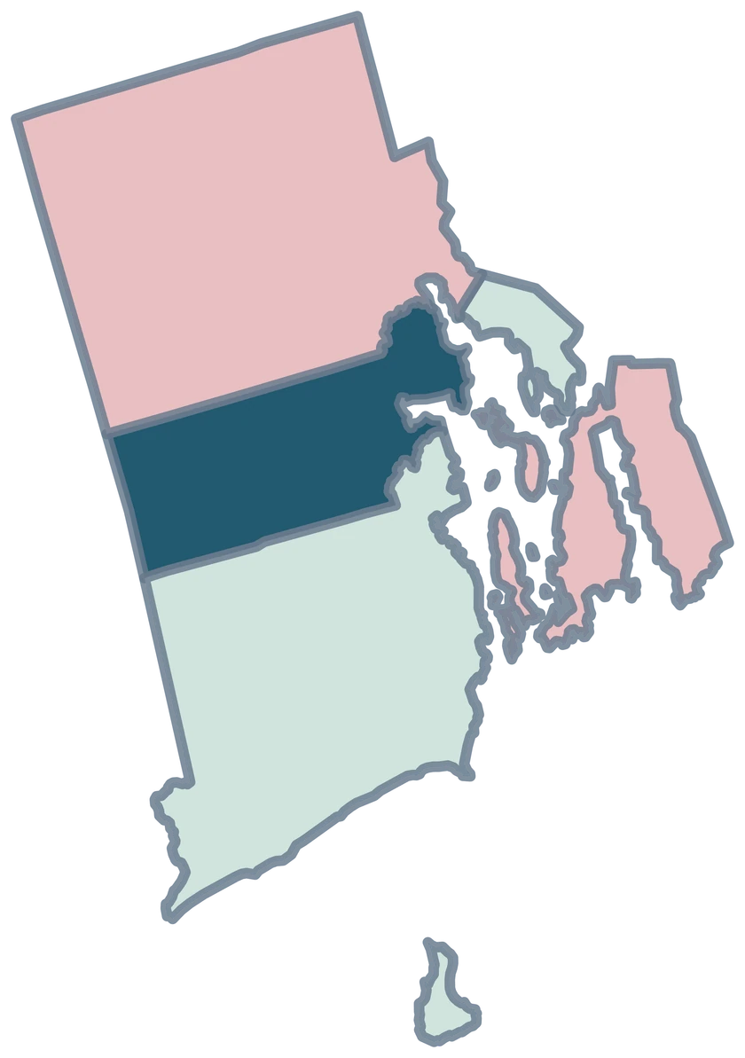
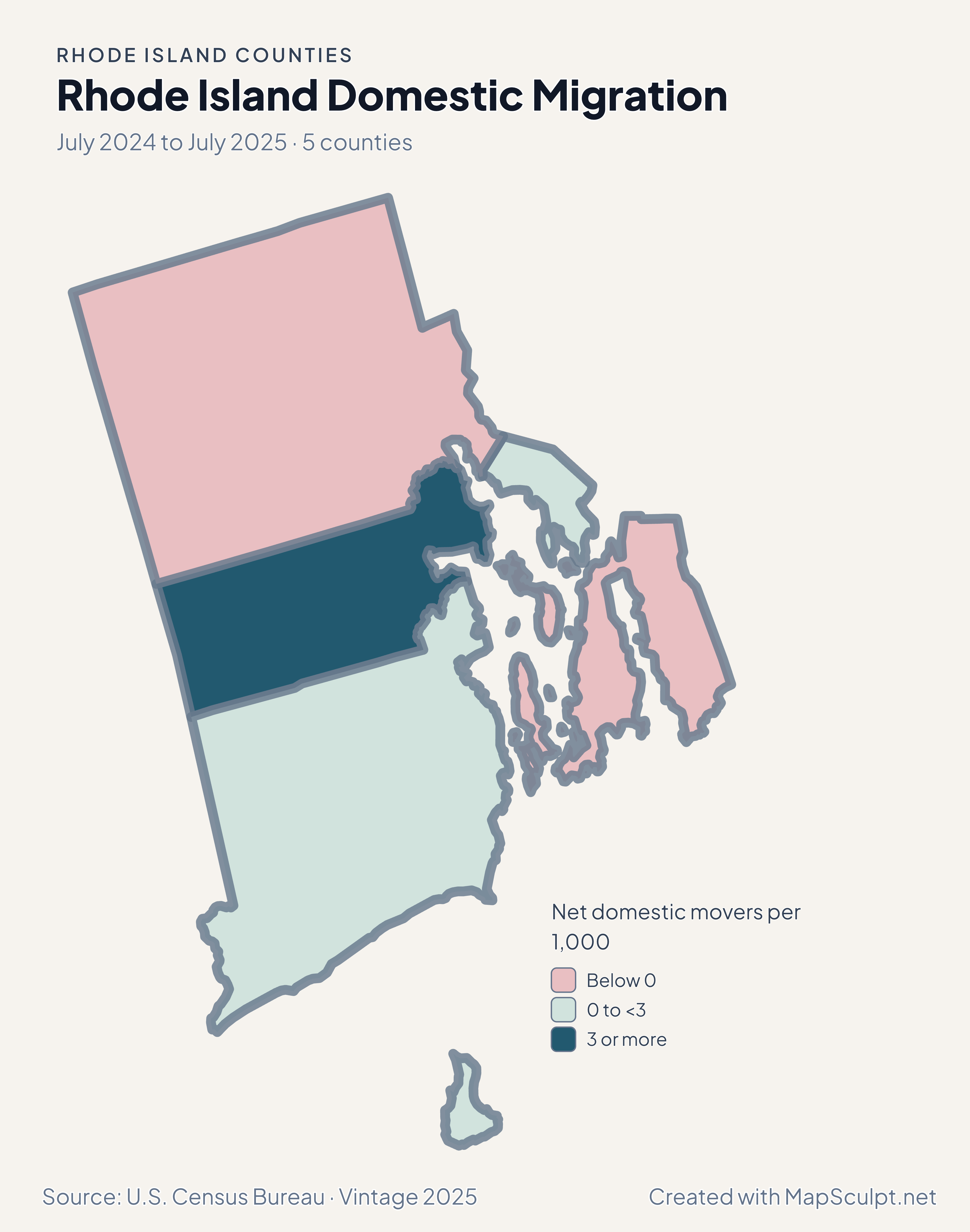
Rhode Island Domestic Migration

July 2024 to July 2025 · 5 counties

Rhode Island migration map showing gains in Kent and losses in Providence and Newport counties.

Net domestic movers per 1,000

  • Below 0
  • 0 to <3
  • 3 or more
U.S. Census Bureau · Vintage 2025Download complete PNG Net domestic moves per 1,000 residents, July 2024 to July 2025.

KNOW YOUR GEOGRAPHY

Five Census counties across Rhode Island’s coast and islands

Rhode Island’s five counties remain Census geographic areas. Local government is organized through its cities and towns. County color spans every mapped part of the Census county.

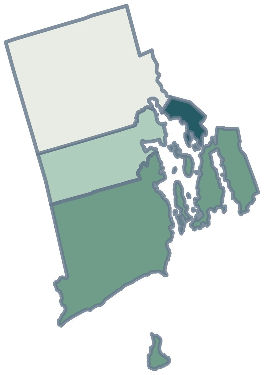
Newport County includes several parts around Narragansett Bay. Block Island belongs to Washington County. The map preserves the coastal pieces represented in the Census cartographic file.

Browse all county GEOIDs ↗

2025 Census boundaries

OFFICIAL DATA

Kent and Providence show different domestic movement patterns

Kent’s net domestic rate was positive, while Providence County’s was negative. Both counties grew overall in the same period.

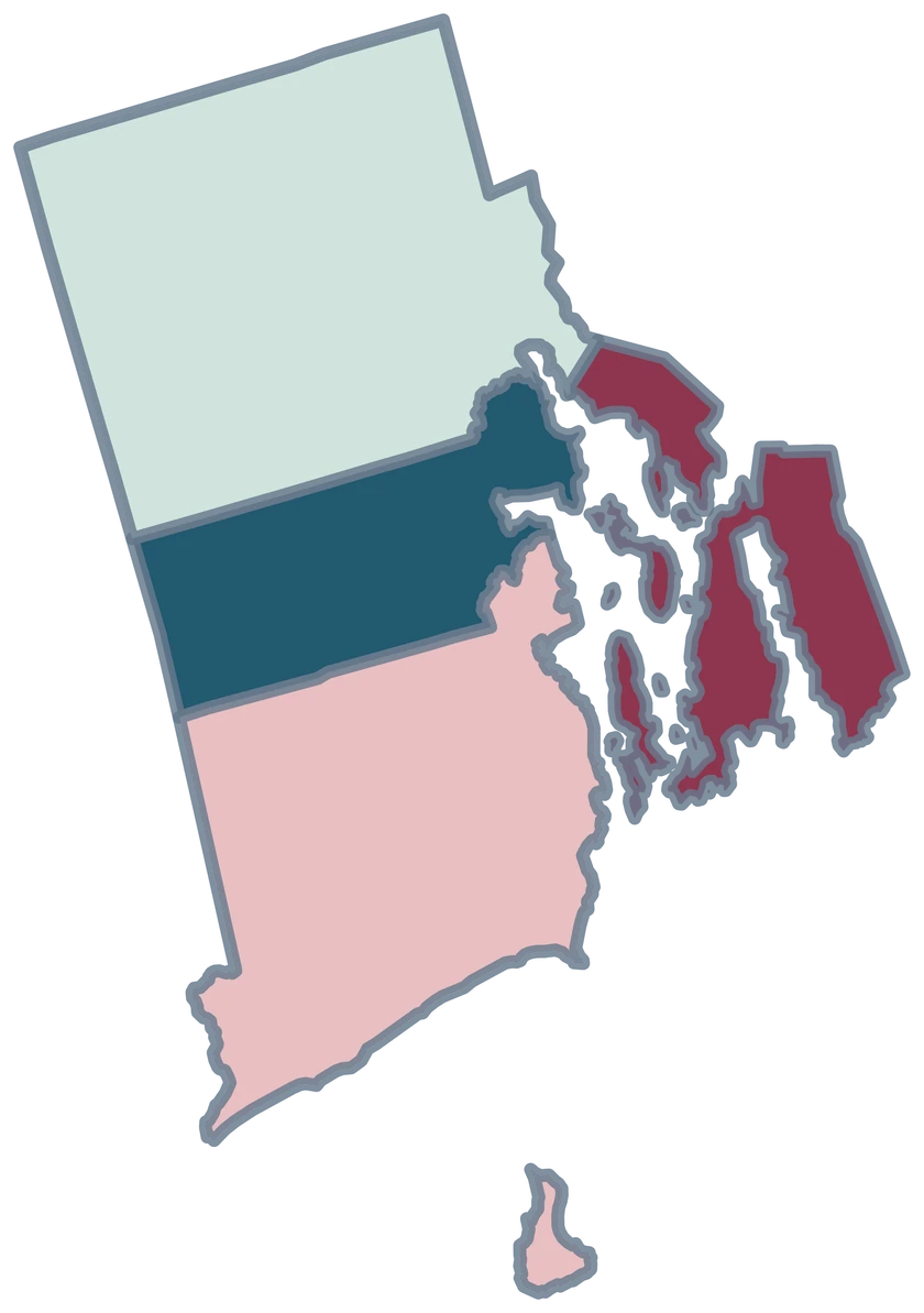
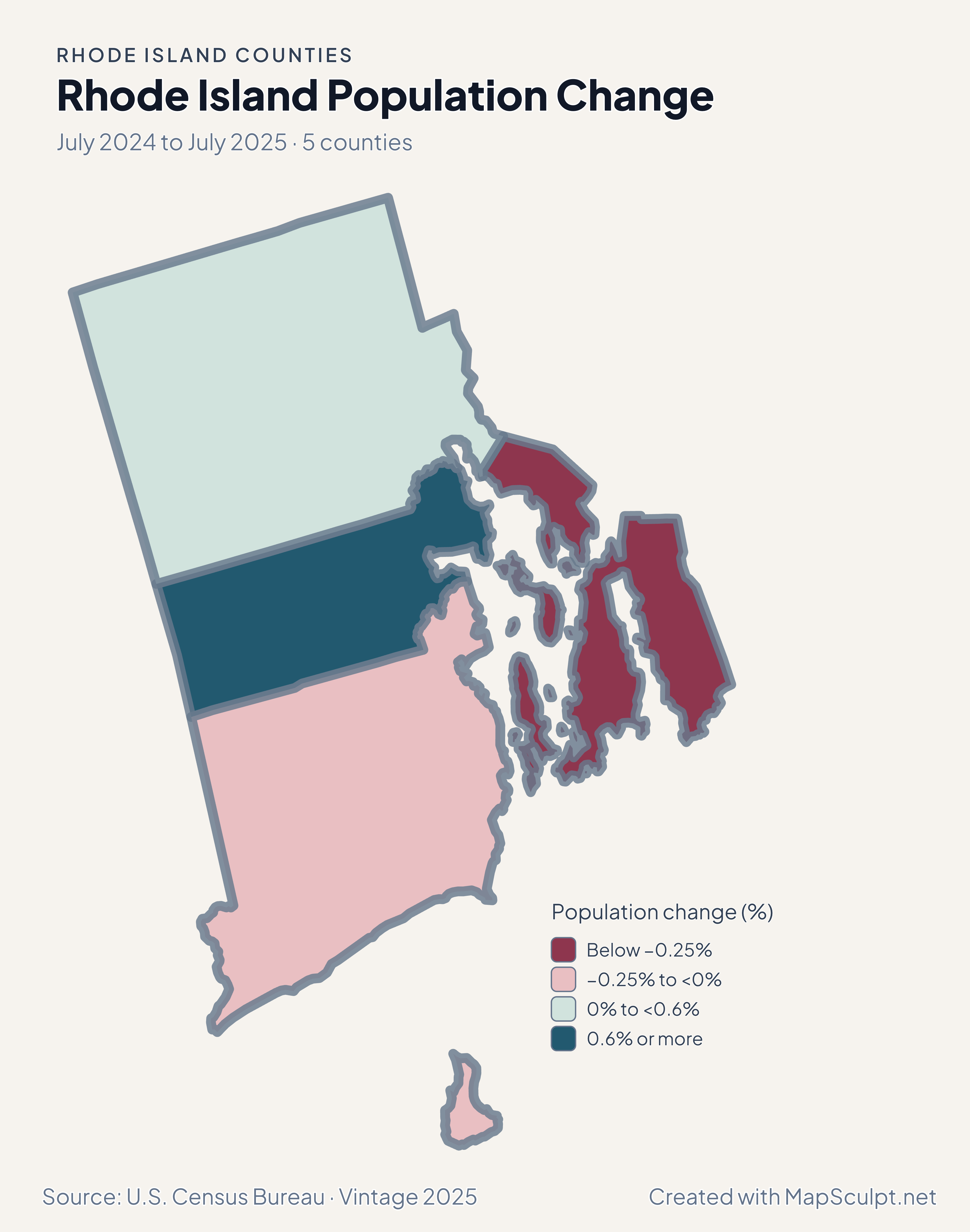
Rhode Island population change map highlighting growth in Kent and Providence and decline in Newport.

July 2024 to July 2025 · 5 counties

Kent and Providence grew overall

Kent grew 0.71%, and Providence County grew 0.52%. Newport declined 0.37%. Total change includes components beyond domestic migration.

Population change (%)

  • Below −0.25%
  • −0.25% to <0%
  • 0% to <0.6%
  • 0.6% or more

U.S. Census Bureau · Vintage 2025

Download complete PNG

Kent recorded +7.17 net domestic movers per 1,000. Providence County recorded −4.09 and Newport −2.84. Bristol and Washington had small positive rates. See the Census estimates ↗

MAKE IT YOURS

From county data to a finished map.

  1. Open the Rhode Island counties editor

    Start with the 5 county areas already on the canvas.

  2. Join your observations by GEOID

    Use 44001 for Bristol County. Keep the measurement in a separate column.

  3. Choose ranges and check your legend

    Use a neutral color for counties outside your data and label the units and period.

  4. Download your county map

    Review the title, source and legend in the preview, then export the PNG.

TRY CSV IMPORT

Try matching 4 Rhode Island counties

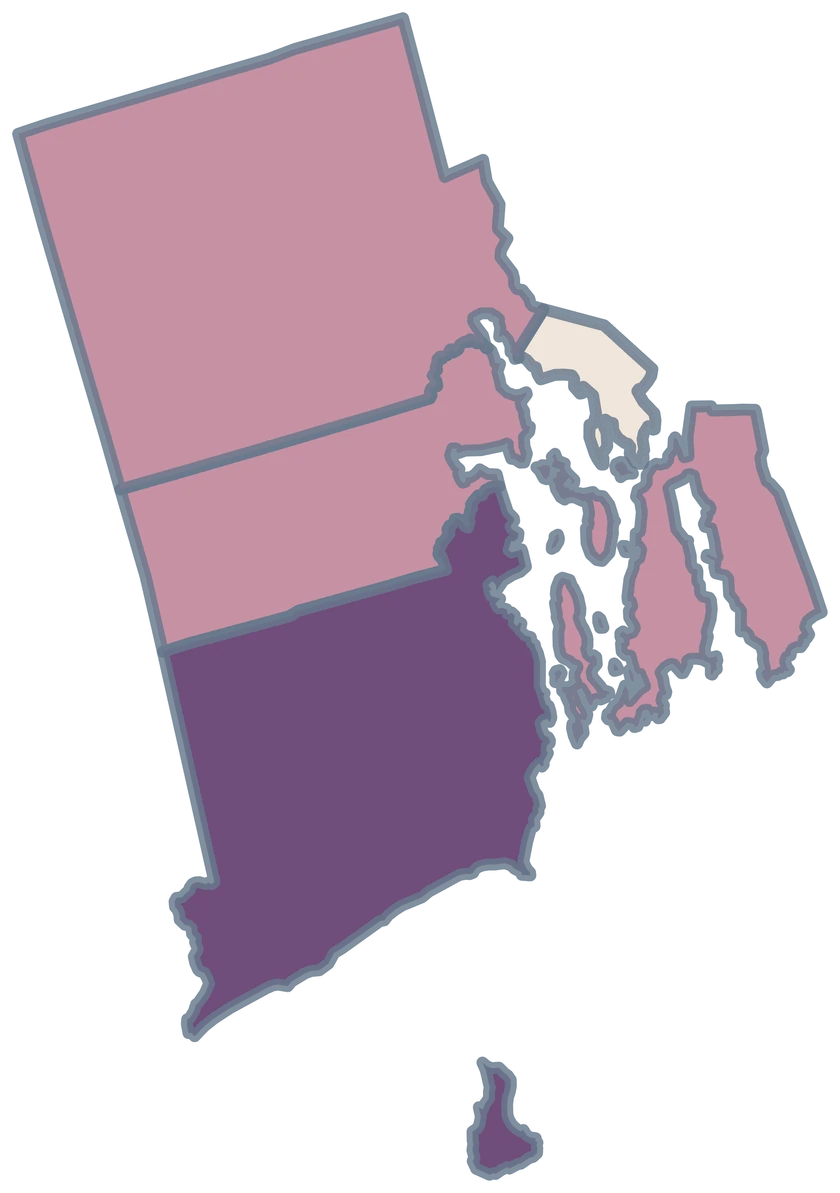
Import four Rhode Island county GEOIDs with fictional project values. Washington County, including Block Island, remains neutral.

Illustrative MapSculpt data — not real observations.
CountyGEOIDProjects
Bristol County440015
Kent County440039
Newport County440056
Providence County4400712

Match the GEOID column (44001 for Bristol County) and use IllustrativeProjects as the numeric value. Start with boundaries of 3, 6, 9 and 12.

Download illustrative CSV ↓

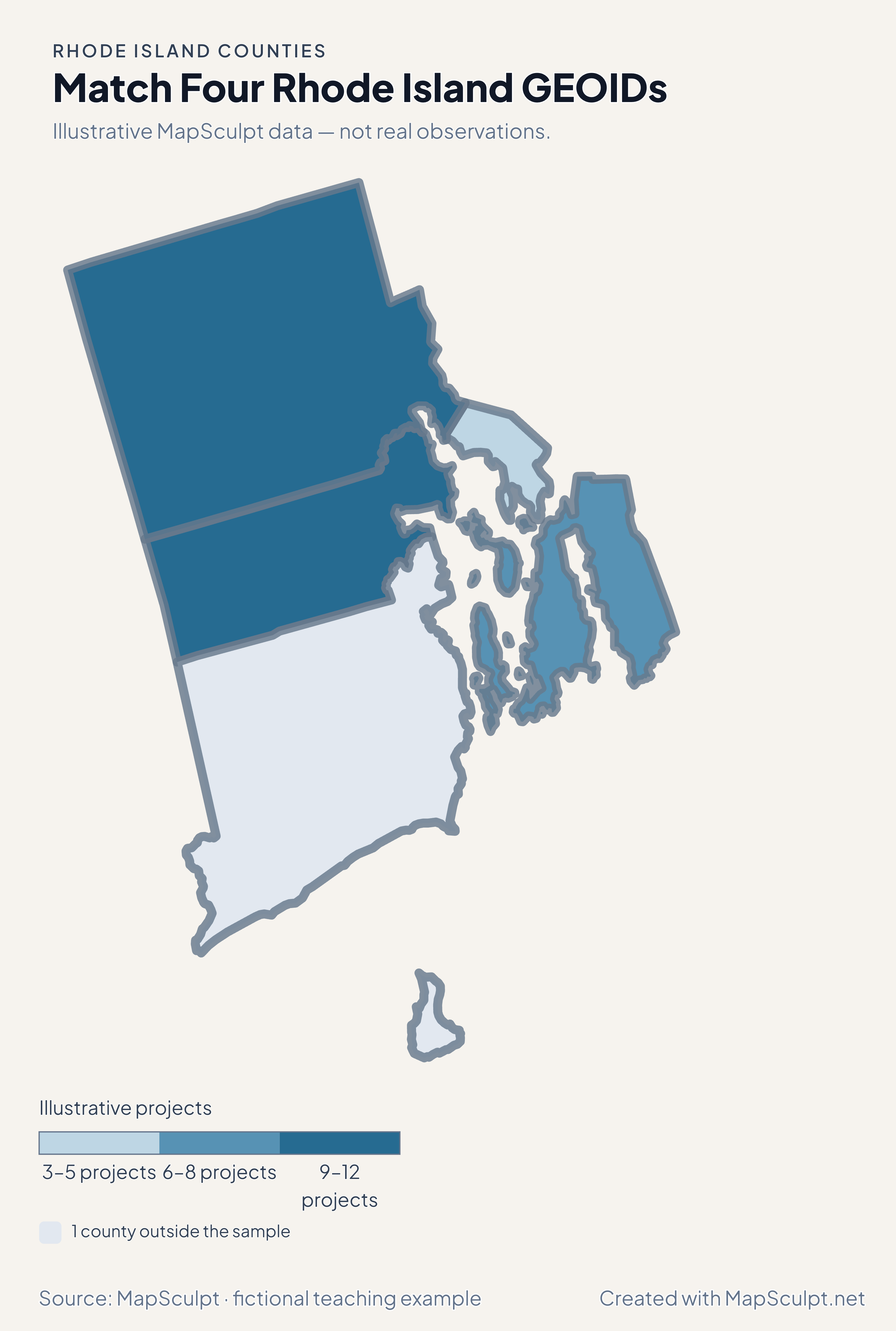
Match Four Rhode Island GEOIDs

Illustrative MapSculpt data — not real observations.

Illustrative Rhode Island map with 4 styled counties and 1 neutral county.

Illustrative projects

  • 3–5 projects
  • 6–8 projects
  • 9–12 projects
  • 1 county outside the sample
Download complete PNG

CSV → Match 4 counties → Style → Export PNG Create a Rhode Island map

GEOGRAPHY NOTES

Census counties and local government

County-level statistics use the five geographic areas. Municipal services are organized by Rhode Island’s cities and towns.

U.S. Census Bureau · Rhode Island government structure

GEOGRAPHY NOTES

Block Island shares Washington County’s fill

New Shoreham is in Washington County. A single GEOID styles both Rhode Island’s mainland and island parts of Washington County as represented by this map.

State of Rhode Island · New Shoreham

COUNTY REFERENCE

Find all five Rhode Island counties and GEOIDs.

Official county names and five-digit Census GEOIDs. Search by name or code.

  1. Bristol CountyGEOID 44001
  2. Kent CountyGEOID 44003
  3. Newport CountyGEOID 44005
  4. Providence CountyGEOID 44007
  5. Washington CountyGEOID 44009

U.S. Census Bureau · 2025 Cartographic Boundary Files

COMMON QUESTIONS

Rhode Island county map questions.

Why does Rhode Island have counties in Census statistics?

The five counties are valid areas for Census tabulation, even though they have no county-level government.

Which county contains Block Island?

Block Island is the town of New Shoreham, within Washington County. Use 44009 for the county fill.

Is Providence city the same area as Providence County?

The city is within Providence County, which contains other municipalities. Use 44007 only when your data describes the whole county.

How do I color Newport County’s islands consistently?

Select Newport County or join GEOID 44005. Every displayed part of the county uses its fill.

Can I import a five-county file even though the example has four rows?

Yes. The example leaves Washington neutral to demonstrate partial coverage. Add 44009 with a value to cover all five.

Why can Providence County gain population while losing net domestic movers?

Domestic migration measures net moves within the United States. Population also changes through births, deaths, international migration and statistical adjustments.

YOUR NEXT MAP STARTS HERE

Build a Rhode Island county map for your data

Assign one fill to each Census county, including its coastal parts, and export with the legend.

Create a Rhode Island map