Skip to content
MapSculpt

GEOGRAPHIC MAP MAKER / GEORGIA

Georgia
Counties Map Maker

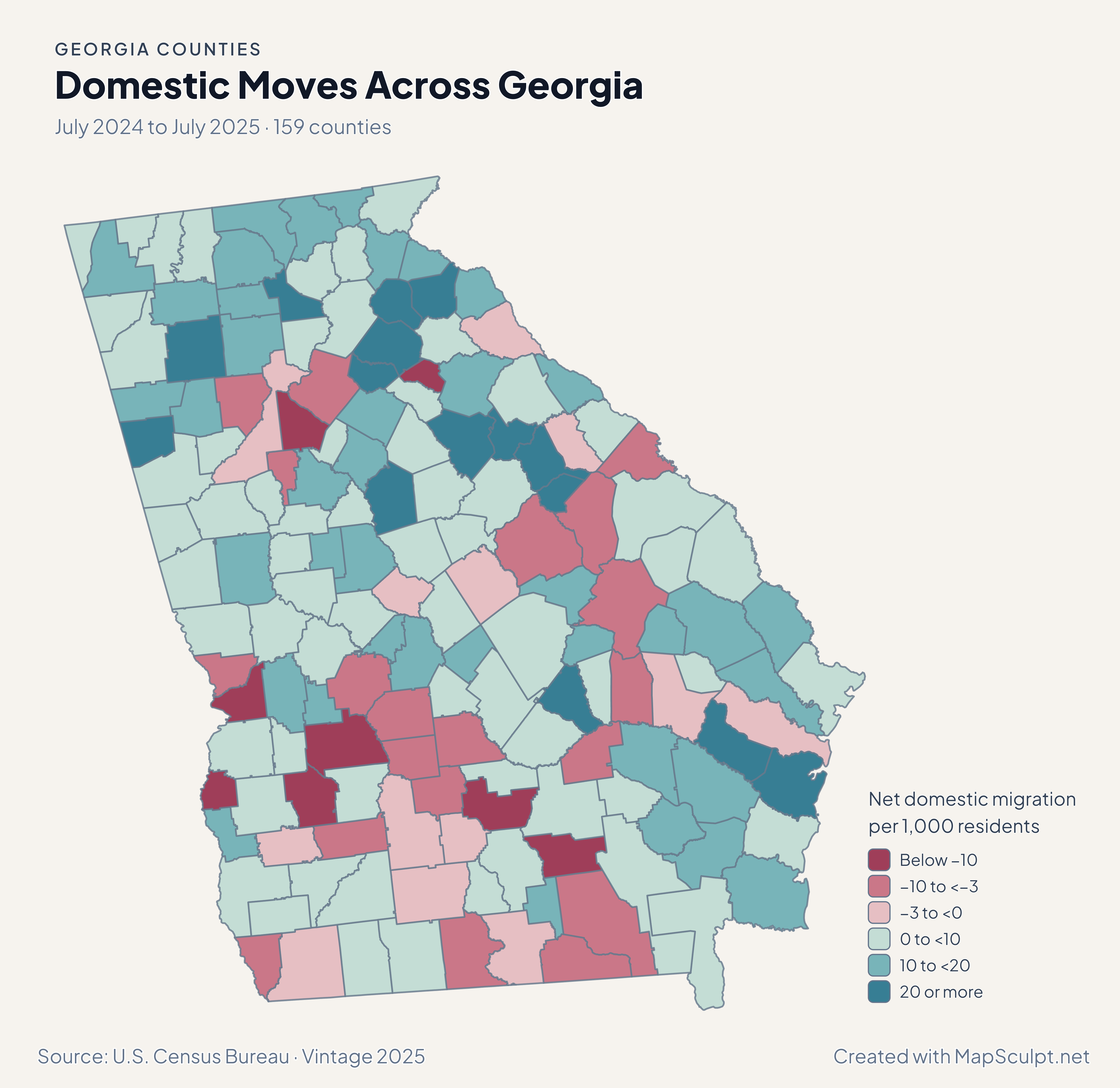
Follow the geography of domestic moves around Atlanta, northeast Georgia and the coast. Compare those patterns with household income or bring your own county figures into the editor.

Free online editor · No sign-up required

159counties
individually editable

Domestic Moves Across Georgia

July 2024 to July 2025 · 159 counties

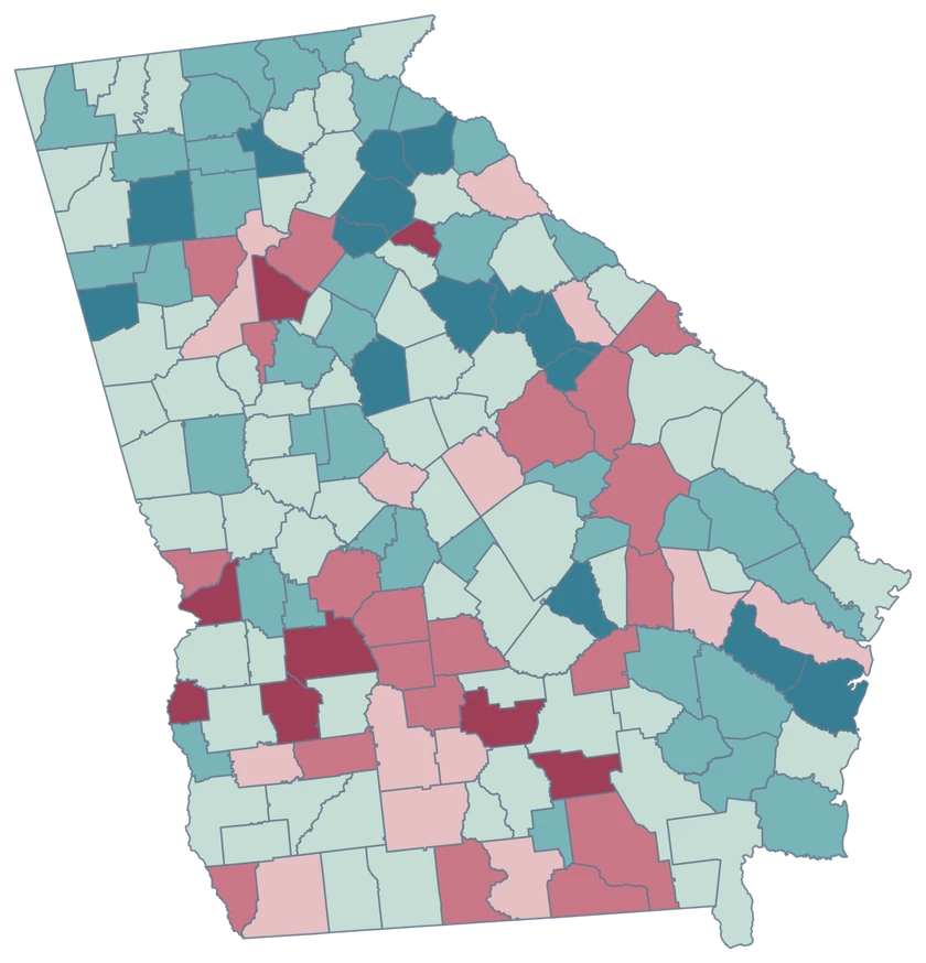
Georgia net domestic migration map with Jackson in the strongest gain band and Fulton and Gwinnett in loss bands.

Net domestic migration per 1,000 residents

  • Below −10
  • −10 to <−3
  • −3 to <0
  • 0 to <10
  • 10 to <20
  • 20 or more
U.S. Census Bureau · Vintage 2025Download complete PNG Domestic migration tracks net moves within the United States, per 1,000 residents.

KNOW YOUR GEOGRAPHY

A fine-grained county map, from the mountains to the coast.

Georgia has 159 counties, including small neighboring counties across the Atlanta region and multipart coastal geography. The editor keeps one selectable identity for each county, even where its shape includes separate pieces.

Atlanta and Savannah are city names. Use county GEOIDs when a dataset covers Fulton, DeKalb, Chatham or another entire county. Generalized shorelines are suited to a statewide overview.

Browse all county GEOIDs ↗

2025 Census boundaries

OFFICIAL DATA

Migration patterns from metro Atlanta to the coast.

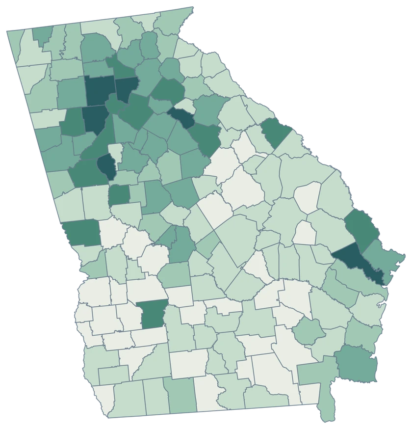
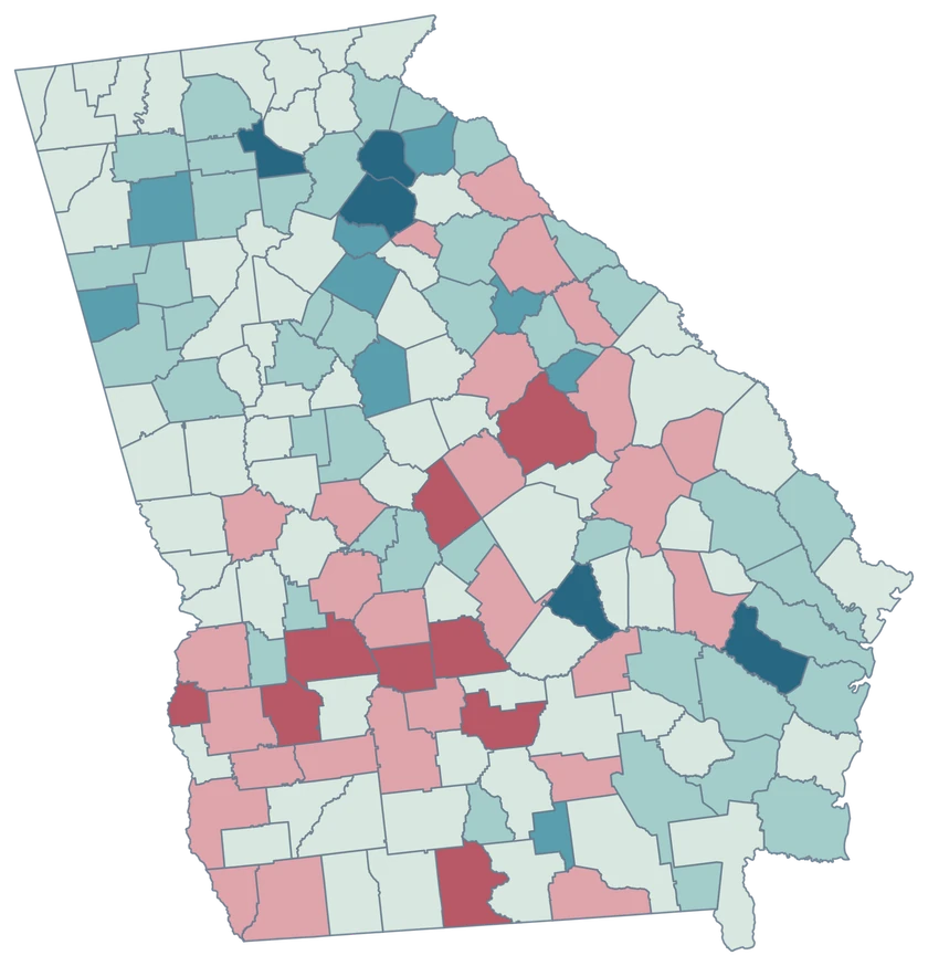
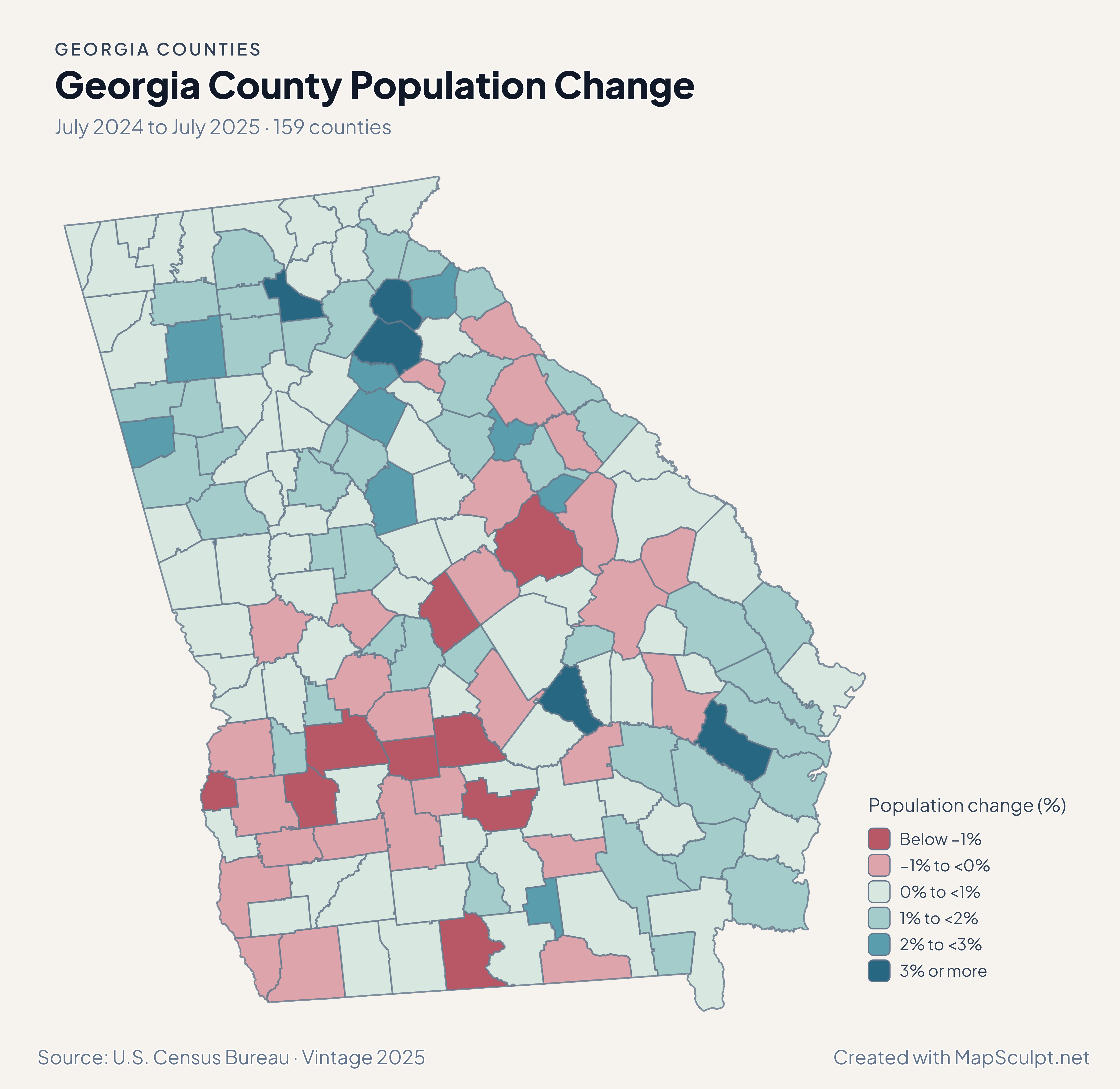
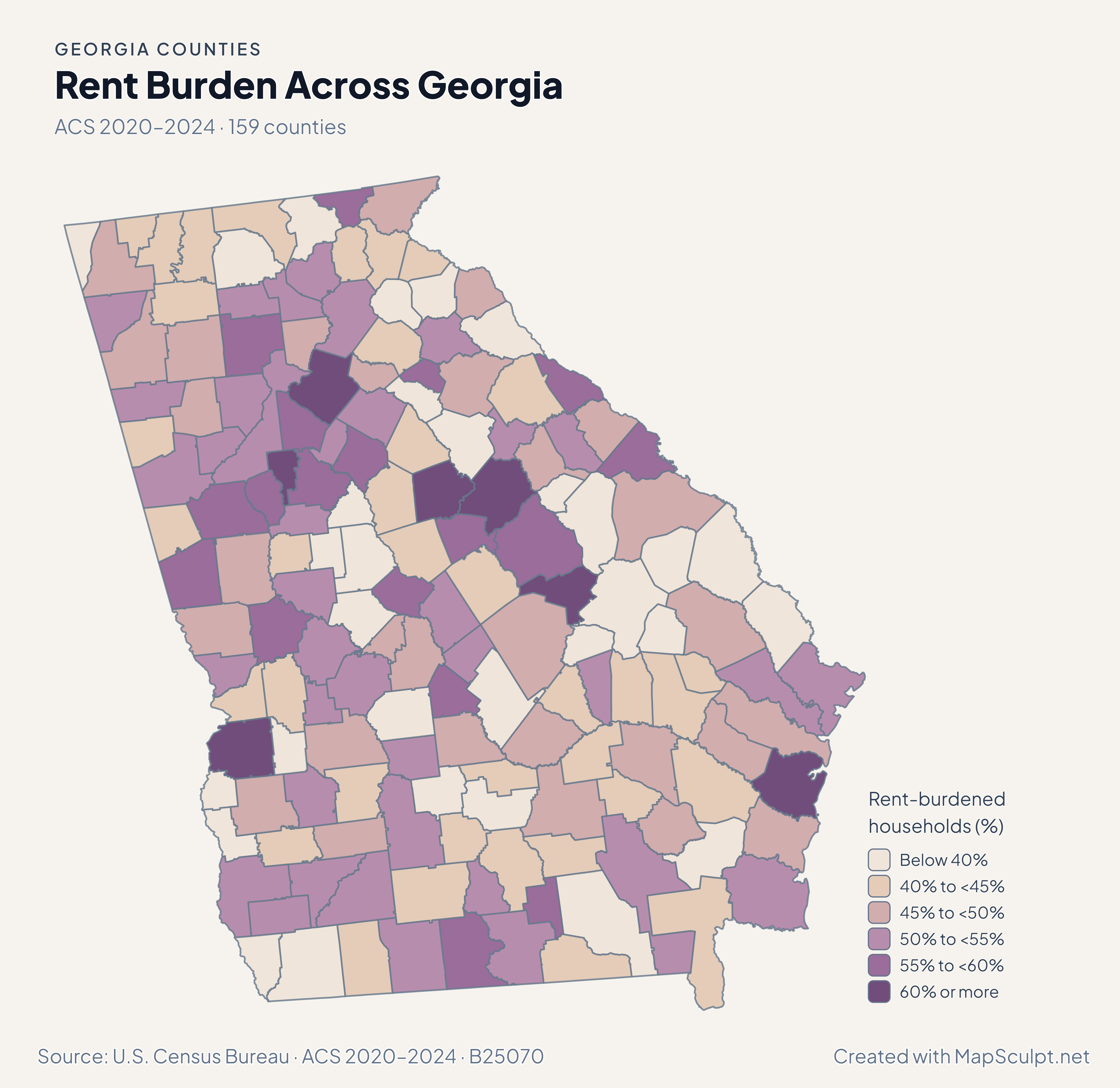
Compare Atlanta-area and coastal migration, then check how overall growth, household income and renter costs vary across Georgia’s 159 counties.

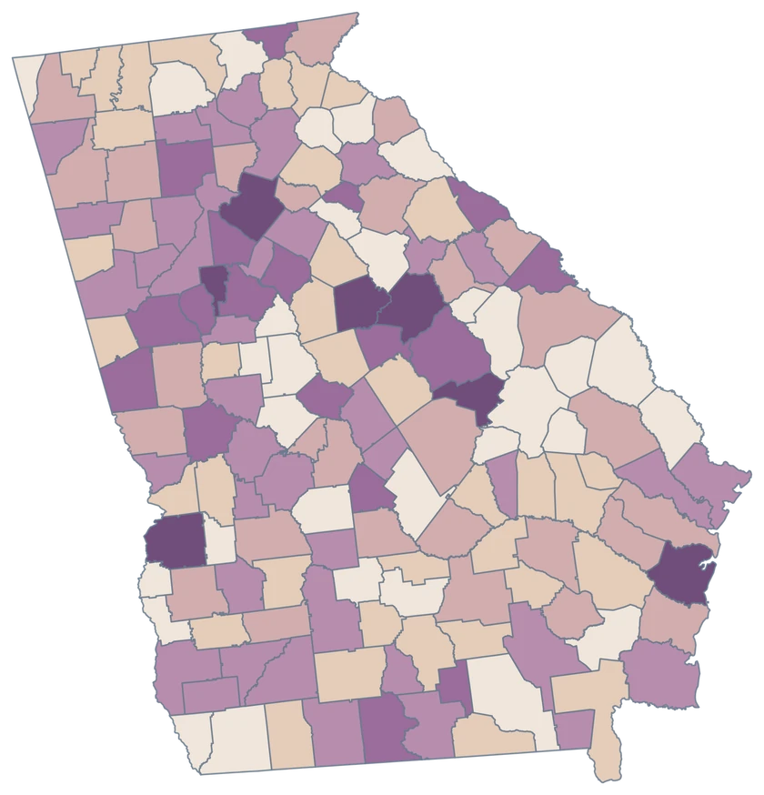
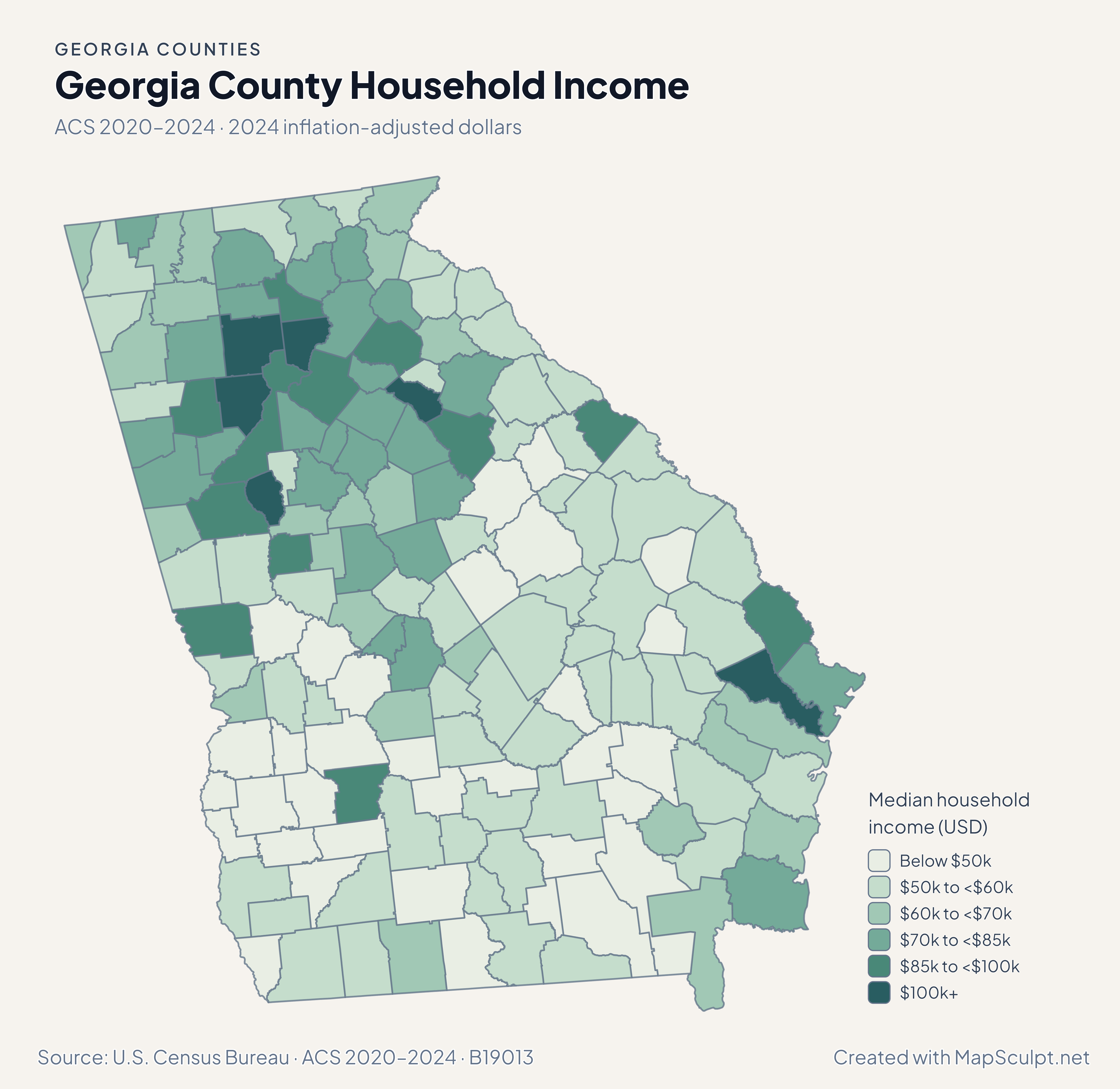
Georgia household income map with Forsyth and Bryan in the highest displayed class.

ACS 2020–2024 · 2024 inflation-adjusted dollars

High income estimates appear in distinct areas.

Forsyth had Georgia’s highest county median household income estimate, $143,784. Along the coast, Bryan’s estimate was $103,408 and Chatham’s was $71,097. These are survey estimates for whole counties.

Median household income (USD)

  • Below $50k
  • $50k to <$60k
  • $60k to <$70k
  • $70k to <$85k
  • $85k to <$100k
  • $100k+

U.S. Census Bureau · ACS 2020–2024 · B19013

Download complete PNG

Jackson led at 46.49 net domestic movers per 1,000 residents. Bryan recorded a coastal gain of 12.82 per 1,000. Fulton and Gwinnett both recorded net domestic losses while gaining residents overall. See the Census estimates ↗

MAKE IT YOURS

From county data to a finished map.

  1. Open the Georgia editor

    Start with the 159 official county features.

  2. Match county GEOIDs

    Use a dedicated five-digit county column, such as 13121 for Fulton County.

  3. Build a readable legend

    Choose class breaks that fit your measure and write the period and units beside the map.

  4. Export the finished map

    Check the full composition, then download a high-resolution PNG with your title and source.

TRY CSV IMPORT

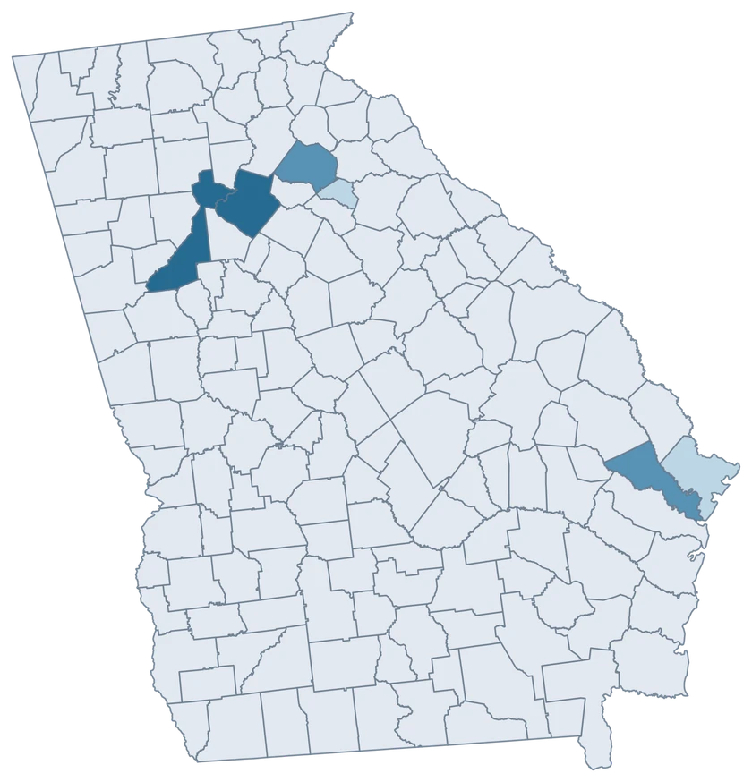
Practice with six Georgia counties.

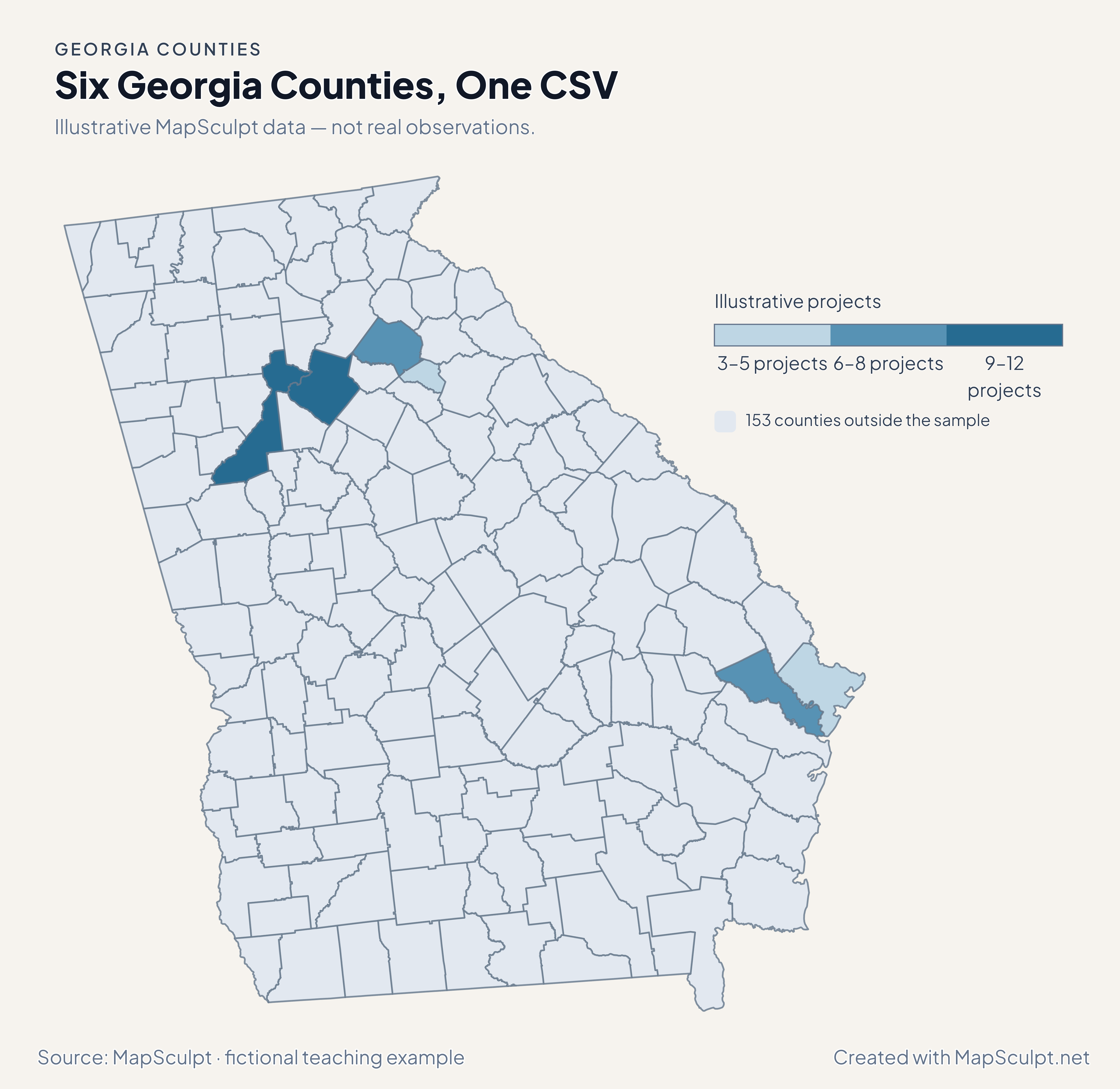
Import the fictional project counts, choose IllustrativeProjects and set numeric boundaries of 3, 6, 9 and 12. The 153 counties outside the sample share a neutral fill.

Illustrative MapSculpt data — not real observations.
CountyGEOIDProjects
Fulton County131219
Gwinnett County1313512
Jackson County131577
Bryan County130296
Chatham County130514
Clarke County130593

Keep GEOIDs as text. In this sample Fulton County is 13121 and Clarke County is 13059. Use the directory when preparing a larger county join.

Download illustrative CSV ↓

Six Georgia Counties, One CSV

Illustrative MapSculpt data — not real observations.

Illustrative Georgia map highlighting six sampled counties, with the remaining 153 counties in a neutral shade.

Illustrative projects

  • 3–5 projects
  • 6–8 projects
  • 9–12 projects
  • 153 counties outside the sample
Download complete PNG

CSV → Match 6 counties → Style → Export PNG Create a Georgia map

COUNTY REFERENCE

Find all 159 Georgia county GEOIDs.

Official county names and five-digit Census GEOIDs. Search by name or code.

  1. Appling CountyGEOID 13001
  2. Atkinson CountyGEOID 13003
  3. Bacon CountyGEOID 13005
  4. Baker CountyGEOID 13007
  5. Baldwin CountyGEOID 13009
  6. Banks CountyGEOID 13011
  7. Barrow CountyGEOID 13013
  8. Bartow CountyGEOID 13015
  9. Ben Hill CountyGEOID 13017
  10. Berrien CountyGEOID 13019
  11. Bibb CountyGEOID 13021
  12. Bleckley CountyGEOID 13023
  13. Brantley CountyGEOID 13025
  14. Brooks CountyGEOID 13027
  15. Bryan CountyGEOID 13029
  16. Bulloch CountyGEOID 13031
  17. Burke CountyGEOID 13033
  18. Butts CountyGEOID 13035
  19. Calhoun CountyGEOID 13037
  20. Camden CountyGEOID 13039
  21. Candler CountyGEOID 13043
  22. Carroll CountyGEOID 13045
  23. Catoosa CountyGEOID 13047
  24. Charlton CountyGEOID 13049
  25. Chatham CountyGEOID 13051
  26. Chattahoochee CountyGEOID 13053
  27. Chattooga CountyGEOID 13055
  28. Cherokee CountyGEOID 13057
  29. Clarke CountyGEOID 13059
  30. Clay CountyGEOID 13061
  31. Clayton CountyGEOID 13063
  32. Clinch CountyGEOID 13065
  33. Cobb CountyGEOID 13067
  34. Coffee CountyGEOID 13069
  35. Colquitt CountyGEOID 13071
  36. Columbia CountyGEOID 13073
  37. Cook CountyGEOID 13075
  38. Coweta CountyGEOID 13077
  39. Crawford CountyGEOID 13079
  40. Crisp CountyGEOID 13081
  41. Dade CountyGEOID 13083
  42. Dawson CountyGEOID 13085
  43. Decatur CountyGEOID 13087
  44. DeKalb CountyGEOID 13089
  45. Dodge CountyGEOID 13091
  46. Dooly CountyGEOID 13093
  47. Dougherty CountyGEOID 13095
  48. Douglas CountyGEOID 13097
  49. Early CountyGEOID 13099
  50. Echols CountyGEOID 13101
  51. Effingham CountyGEOID 13103
  52. Elbert CountyGEOID 13105
  53. Emanuel CountyGEOID 13107
  54. Evans CountyGEOID 13109
  55. Fannin CountyGEOID 13111
  56. Fayette CountyGEOID 13113
  57. Floyd CountyGEOID 13115
  58. Forsyth CountyGEOID 13117
  59. Franklin CountyGEOID 13119
  60. Fulton CountyGEOID 13121
  61. Gilmer CountyGEOID 13123
  62. Glascock CountyGEOID 13125
  63. Glynn CountyGEOID 13127
  64. Gordon CountyGEOID 13129
  65. Grady CountyGEOID 13131
  66. Greene CountyGEOID 13133
  67. Gwinnett CountyGEOID 13135
  68. Habersham CountyGEOID 13137
  69. Hall CountyGEOID 13139
  70. Hancock CountyGEOID 13141
  71. Haralson CountyGEOID 13143
  72. Harris CountyGEOID 13145
  73. Hart CountyGEOID 13147
  74. Heard CountyGEOID 13149
  75. Henry CountyGEOID 13151
  76. Houston CountyGEOID 13153
  77. Irwin CountyGEOID 13155
  78. Jackson CountyGEOID 13157
  79. Jasper CountyGEOID 13159
  80. Jeff Davis CountyGEOID 13161
  81. Jefferson CountyGEOID 13163
  82. Jenkins CountyGEOID 13165
  83. Johnson CountyGEOID 13167
  84. Jones CountyGEOID 13169
  85. Lamar CountyGEOID 13171
  86. Lanier CountyGEOID 13173
  87. Laurens CountyGEOID 13175
  88. Lee CountyGEOID 13177
  89. Liberty CountyGEOID 13179
  90. Lincoln CountyGEOID 13181
  91. Long CountyGEOID 13183
  92. Lowndes CountyGEOID 13185
  93. Lumpkin CountyGEOID 13187
  94. Macon CountyGEOID 13193
  95. Madison CountyGEOID 13195
  96. Marion CountyGEOID 13197
  97. McDuffie CountyGEOID 13189
  98. McIntosh CountyGEOID 13191
  99. Meriwether CountyGEOID 13199
  100. Miller CountyGEOID 13201
  101. Mitchell CountyGEOID 13205
  102. Monroe CountyGEOID 13207
  103. Montgomery CountyGEOID 13209
  104. Morgan CountyGEOID 13211
  105. Murray CountyGEOID 13213
  106. Muscogee CountyGEOID 13215
  107. Newton CountyGEOID 13217
  108. Oconee CountyGEOID 13219
  109. Oglethorpe CountyGEOID 13221
  110. Paulding CountyGEOID 13223
  111. Peach CountyGEOID 13225
  112. Pickens CountyGEOID 13227
  113. Pierce CountyGEOID 13229
  114. Pike CountyGEOID 13231
  115. Polk CountyGEOID 13233
  116. Pulaski CountyGEOID 13235
  117. Putnam CountyGEOID 13237
  118. Quitman CountyGEOID 13239
  119. Rabun CountyGEOID 13241
  120. Randolph CountyGEOID 13243
  121. Richmond CountyGEOID 13245
  122. Rockdale CountyGEOID 13247
  123. Schley CountyGEOID 13249
  124. Screven CountyGEOID 13251
  125. Seminole CountyGEOID 13253
  126. Spalding CountyGEOID 13255
  127. Stephens CountyGEOID 13257
  128. Stewart CountyGEOID 13259
  129. Sumter CountyGEOID 13261
  130. Talbot CountyGEOID 13263
  131. Taliaferro CountyGEOID 13265
  132. Tattnall CountyGEOID 13267
  133. Taylor CountyGEOID 13269
  134. Telfair CountyGEOID 13271
  135. Terrell CountyGEOID 13273
  136. Thomas CountyGEOID 13275
  137. Tift CountyGEOID 13277
  138. Toombs CountyGEOID 13279
  139. Towns CountyGEOID 13281
  140. Treutlen CountyGEOID 13283
  141. Troup CountyGEOID 13285
  142. Turner CountyGEOID 13287
  143. Twiggs CountyGEOID 13289
  144. Union CountyGEOID 13291
  145. Upson CountyGEOID 13293
  146. Walker CountyGEOID 13295
  147. Walton CountyGEOID 13297
  148. Ware CountyGEOID 13299
  149. Warren CountyGEOID 13301
  150. Washington CountyGEOID 13303
  151. Wayne CountyGEOID 13305
  152. Webster CountyGEOID 13307
  153. Wheeler CountyGEOID 13309
  154. White CountyGEOID 13311
  155. Whitfield CountyGEOID 13313
  156. Wilcox CountyGEOID 13315
  157. Wilkes CountyGEOID 13317
  158. Wilkinson CountyGEOID 13319
  159. Worth CountyGEOID 13321

U.S. Census Bureau · 2025 Cartographic Boundary Files

COMMON QUESTIONS

Georgia county map questions.

Can I select Atlanta as a single shape?

The editor selects county features. Atlanta reaches into Fulton and DeKalb, and both counties can be colored separately. Start with the geographic coverage of the underlying data.

How do I distinguish Fulton and Gwinnett in a CSV?

Use 13121 for Fulton and 13135 for Gwinnett. The county directory provides the codes for the other 157 features.

Does Savannah use the same identifier as Chatham County?

Use Chatham County’s GEOID 13051 for county-wide observations. Savannah city figures alone cover a different area.

What is the difference between the Jackson and Gwinnett growth stories?

Jackson led Georgia’s percentage growth and net domestic migration rate. Gwinnett’s population also increased, while its net domestic moves were negative.

Can a coastal county contain separate shapes on this map?

Yes. County pieces represented in the generalized source share the county’s fill and GEOID. Use higher-resolution shoreline data for fine coastal detail.

How should I read very low or high rent-burden estimates in small Georgia counties?

Look at the estimated renter denominator and the ACS margins of error. A small base can make a county’s estimated share especially sensitive to sampling variation.

YOUR NEXT MAP STARTS HERE

Build a Georgia map around your own data.

Choose a county-level measure, join it to Georgia’s boundaries and export a map that carries its units and source.

Create a Georgia map