Skip to content
MapSculpt

GEOGRAPHIC MAP MAKER / OREGON

Oregon
Counties Map Maker

Follow county-to-county contrasts from the Portland area and the Pacific shore to central Oregon. The domestic migration map shows where moves within the U.S. added to or subtracted from county populations.

Free online editor · No sign-up required

36counties
individually editable

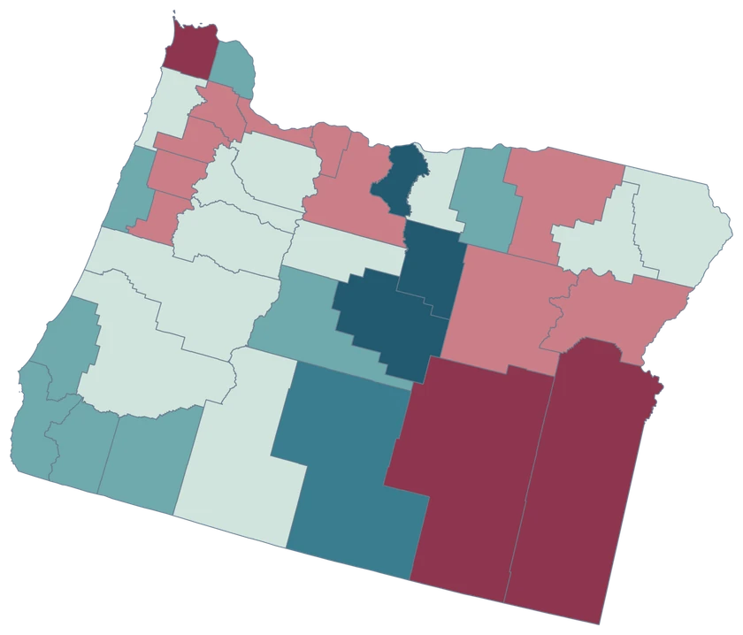
Domestic Moves in Oregon

July 2024 to July 2025 · 36 counties

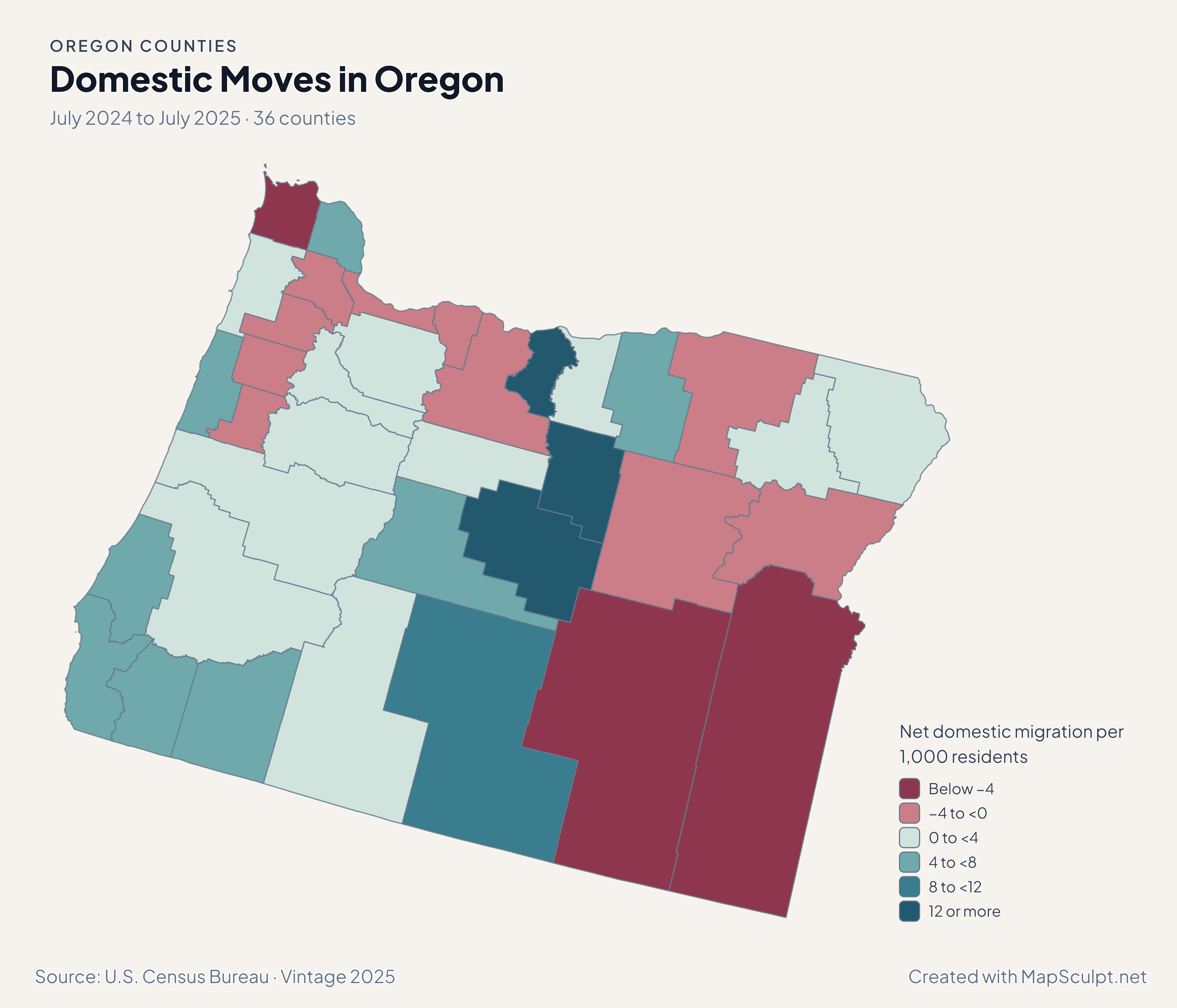
Oregon net domestic migration, contrasting Multnomah and Washington with Clackamas and Deschutes.

Net domestic migration per 1,000 residents

  • Below −4
  • −4 to <0
  • 0 to <4
  • 4 to <8
  • 8 to <12
  • 12 or more
U.S. Census Bureau · Vintage 2025Download complete PNG Net domestic moves within the United States are scaled per 1,000 residents.

KNOW YOUR GEOGRAPHY

The coast, the Columbia and the interior.

Oregon’s 36 counties include the Pacific coast, the Willamette Valley and the eastern interior. The Columbia River follows much of the northern boundary in this generalized Census source.

Washington County is part of Oregon and has GEOID 41067. It is distinct from Washington State across the Columbia. The map’s selectable boundaries are counties rather than river basins or metro areas.

Browse all county GEOIDs ↗

2025 Census boundaries

OFFICIAL DATA

Compare moves, growth and renter costs across Oregon.

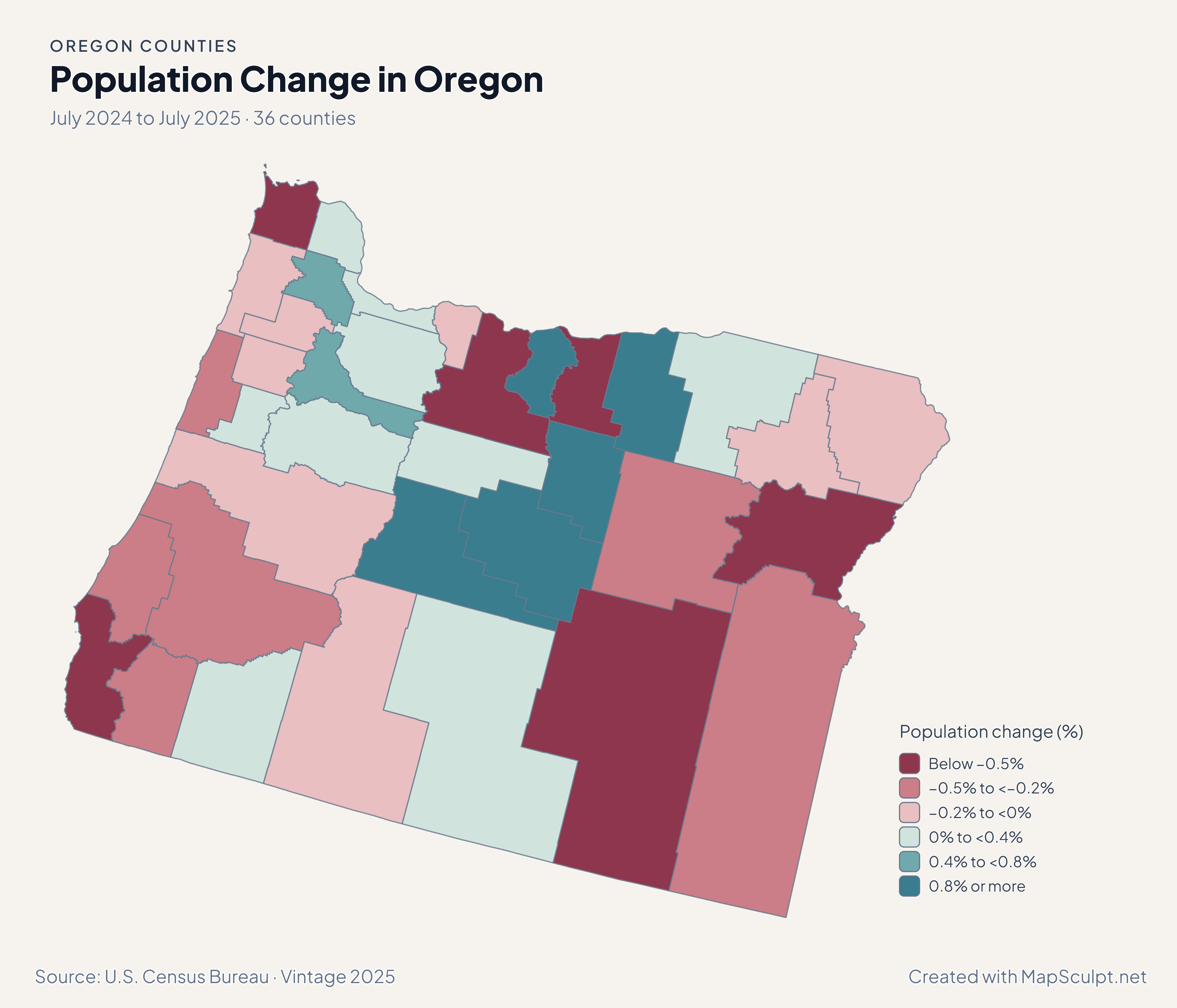
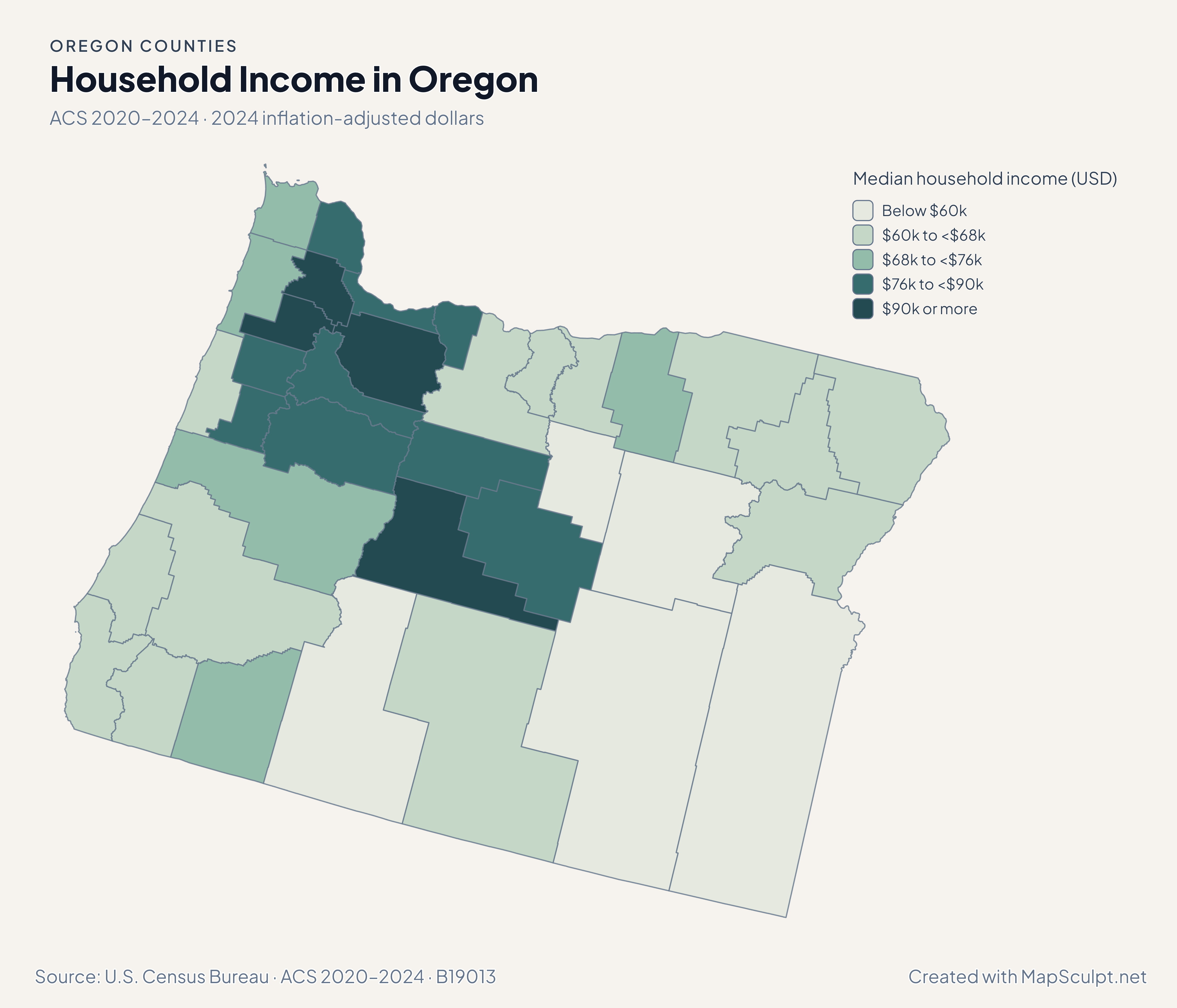
Population and domestic moves use the July 2024–July 2025 estimates. Income and renter costs use the 2020–2024 American Community Survey.

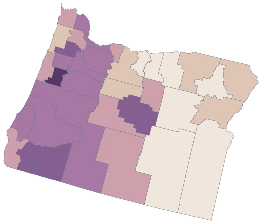
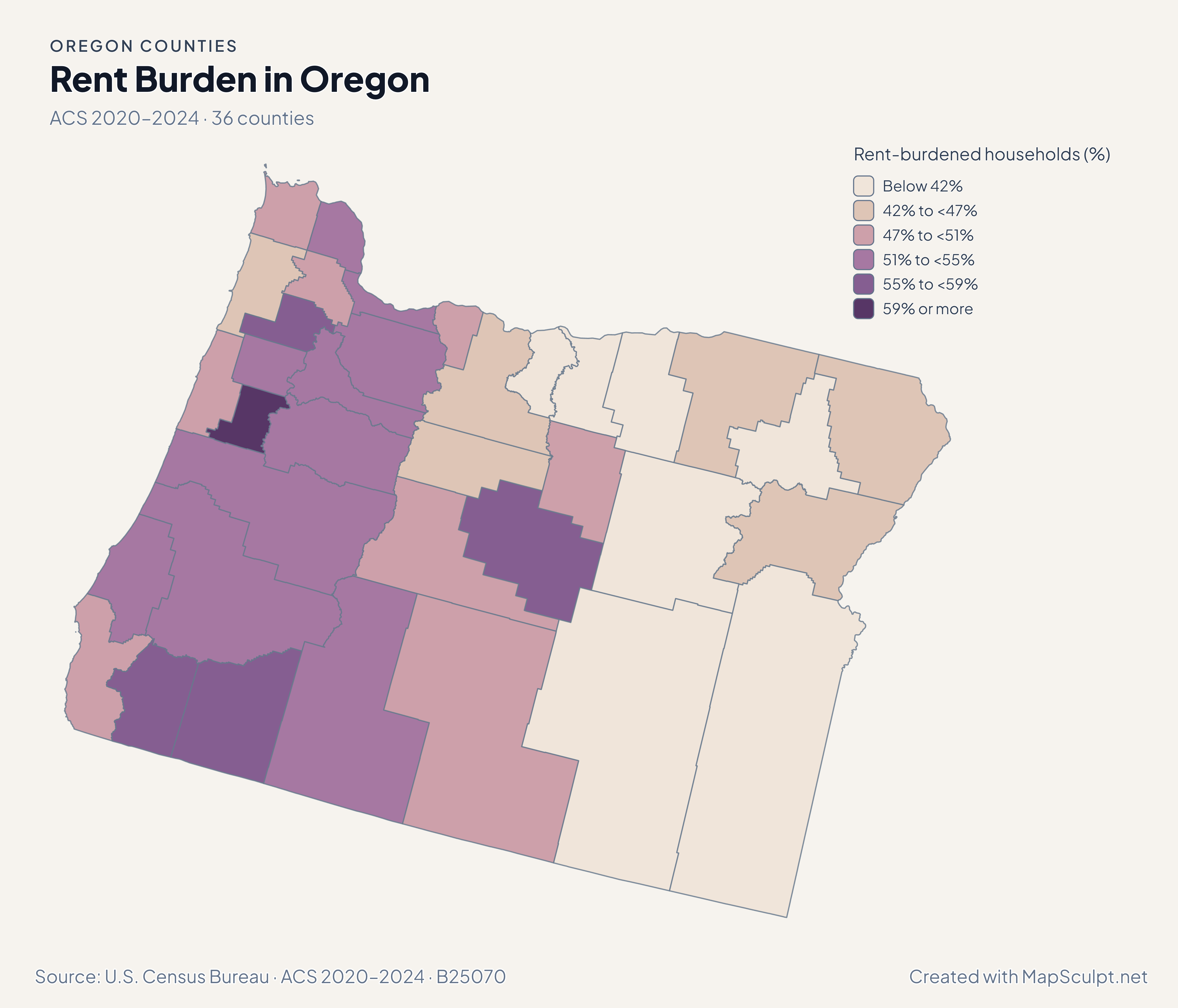
Oregon rent-burden estimates, showing Benton in the highest class and Multnomah below it.

ACS 2020–2024 · 36 counties

Benton’s rent-burden estimate stands out in the valley.

An estimated 62.6% of Benton County renter households with computable ratios spent at least 30% of income on gross rent, compared with 53.0% in Multnomah. Both estimates are subject to sampling uncertainty.

Rent-burdened households (%)

  • Below 42%
  • 42% to <47%
  • 47% to <51%
  • 51% to <55%
  • 55% to <59%
  • 59% or more

U.S. Census Bureau · ACS 2020–2024 · B25070

Download complete PNG

Multnomah and Washington recorded −2.43 and −3.39 net domestic moves per 1,000 residents. Clackamas recorded +1.48, and Deschutes in central Oregon recorded +7.76. These net balances cover moves within the United States. See the Census estimates ↗

MAKE IT YOURS

From county data to a finished map.

  1. Open the Oregon editor

    Start with all 36 selectable counties.

  2. Match your county records

    Use 41051 for Multnomah County. Review the match list before applying colors.

  3. Choose a scale

    Use a palette and class boundaries suited to the units in your data.

  4. Export with a legend

    Include the source and reference period alongside a complete high-resolution PNG.

TRY CSV IMPORT

Try six Oregon records.

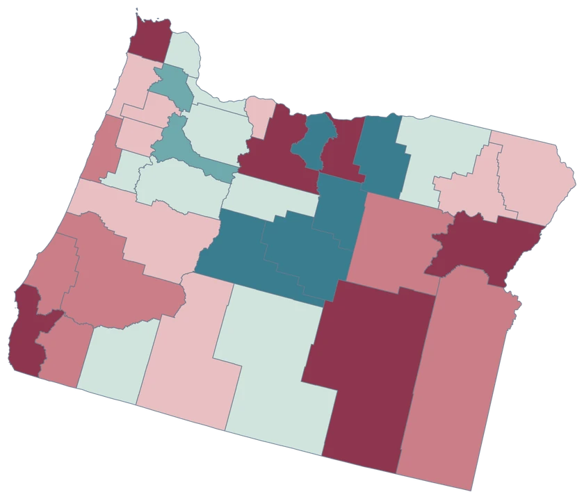
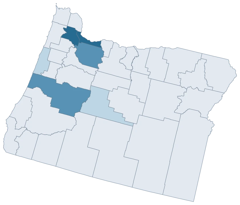
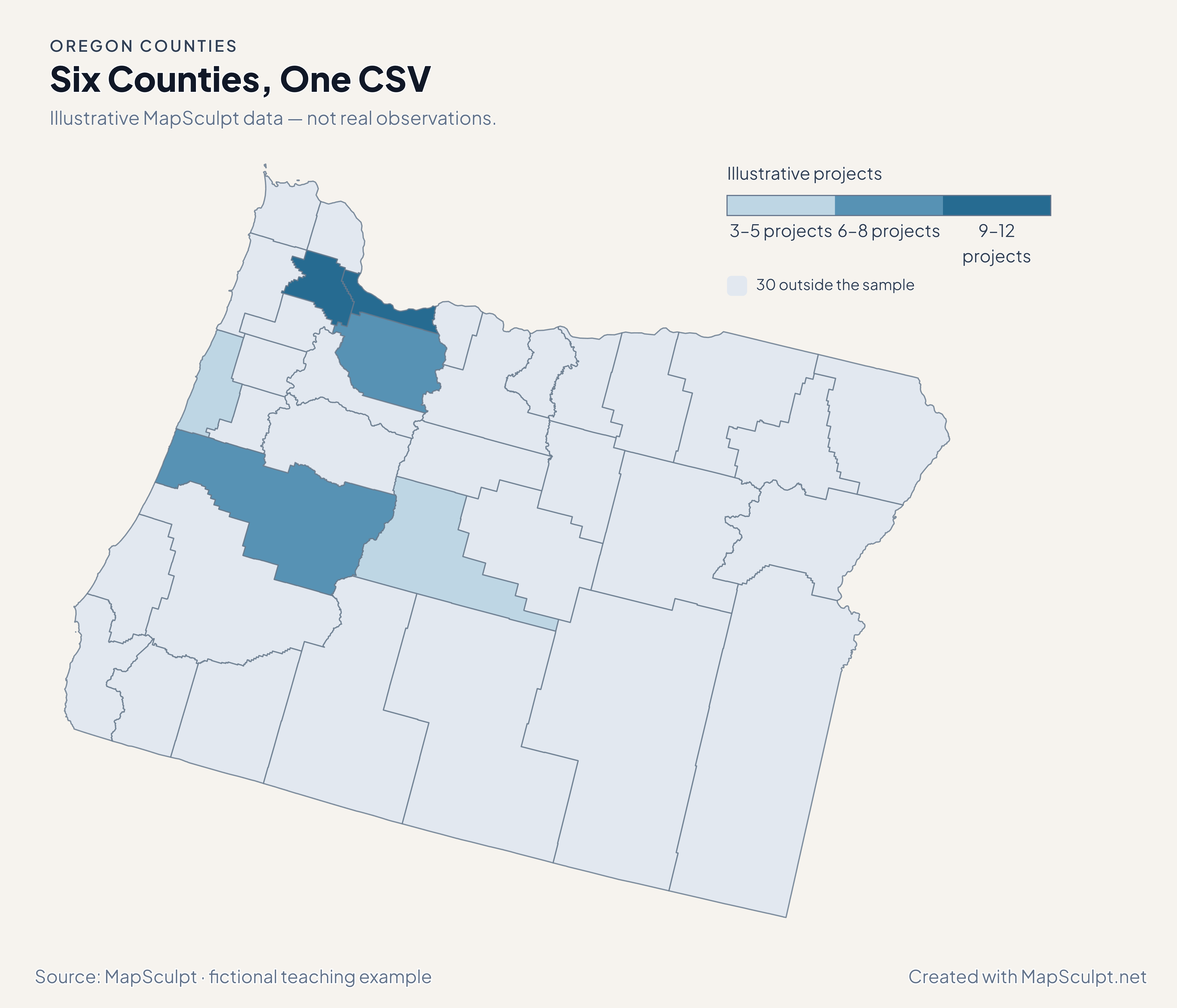
Import the fictional project counts and apply three custom classes. The other 30 counties stay neutral.

Illustrative MapSculpt data — not real observations.
CountyGEOIDProjects
Multnomah County4105112
Washington County410679
Clackamas County410057
Deschutes County410173
Lane County410398
Lincoln County410415

Keep five-digit GEOIDs as text. The sample uses 41051 for Multnomah County.

Download illustrative CSV ↓

Six Counties, One CSV

Illustrative MapSculpt data — not real observations.

Oregon illustrative project counts for six counties; 30 counties remain neutral.

Illustrative projects

  • 3–5 projects
  • 6–8 projects
  • 9–12 projects
  • 30 outside the sample
Download complete PNG

CSV → Match 6 counties → Style → Export PNG Create a Oregon map

COUNTY REFERENCE

All 36 Oregon counties and GEOIDs.

Official county names and five-digit Census GEOIDs. Search by name or code.

  1. Baker CountyGEOID 41001
  2. Benton CountyGEOID 41003
  3. Clackamas CountyGEOID 41005
  4. Clatsop CountyGEOID 41007
  5. Columbia CountyGEOID 41009
  6. Coos CountyGEOID 41011
  7. Crook CountyGEOID 41013
  8. Curry CountyGEOID 41015
  9. Deschutes CountyGEOID 41017
  10. Douglas CountyGEOID 41019
  11. Gilliam CountyGEOID 41021
  12. Grant CountyGEOID 41023
  13. Harney CountyGEOID 41025
  14. Hood River CountyGEOID 41027
  15. Jackson CountyGEOID 41029
  16. Jefferson CountyGEOID 41031
  17. Josephine CountyGEOID 41033
  18. Klamath CountyGEOID 41035
  19. Lake CountyGEOID 41037
  20. Lane CountyGEOID 41039
  21. Lincoln CountyGEOID 41041
  22. Linn CountyGEOID 41043
  23. Malheur CountyGEOID 41045
  24. Marion CountyGEOID 41047
  25. Morrow CountyGEOID 41049
  26. Multnomah CountyGEOID 41051
  27. Polk CountyGEOID 41053
  28. Sherman CountyGEOID 41055
  29. Tillamook CountyGEOID 41057
  30. Umatilla CountyGEOID 41059
  31. Union CountyGEOID 41061
  32. Wallowa CountyGEOID 41063
  33. Wasco CountyGEOID 41065
  34. Washington CountyGEOID 41067
  35. Wheeler CountyGEOID 41069
  36. Yamhill CountyGEOID 41071

U.S. Census Bureau · 2025 Cartographic Boundary Files

COMMON QUESTIONS

Oregon county map questions.

Which GEOID identifies Washington County, Oregon?

Use 41067. The 41 prefix identifies Oregon. The Washington State counties have the 53 prefix.

Does Portland have its own shape here?

The editor colors counties. A record for Portland alone does not cover an entire county. Use county-wide estimates or a separate city boundary source.

Can I show county data on both sides of the Columbia?

Open the national county editor and join Oregon and Washington records using their full GEOIDs.

Do Oregon coastal counties include detailed Pacific shorelines?

The map follows generalized Census boundaries. Consult higher-detail data for shoreline, estuary or parcel work.

Does the domestic moves map show everyone who moved?

It shows net domestic moves relative to county population. Check Census components of change for totals and other components.

How do I compare small eastern counties?

Keep the units and period constant. For small populations, compare both counts and rates, since a small number of moves can produce a large rate.

YOUR NEXT MAP STARTS HERE

Build your own Oregon map.

Join your records by GEOID, check the counties that matched, and export with a legend and source.

Create a Oregon map