Skip to content
MapSculpt

GEOGRAPHIC MAP MAKER / SOUTH DAKOTA

South Dakota
Counties Map Maker

Compare growth around Sioux Falls and Rapid City, then build your own map of all 66 South Dakota counties using the same official five-digit GEOIDs.

Free online editor · No sign-up required

66counties
individually editable

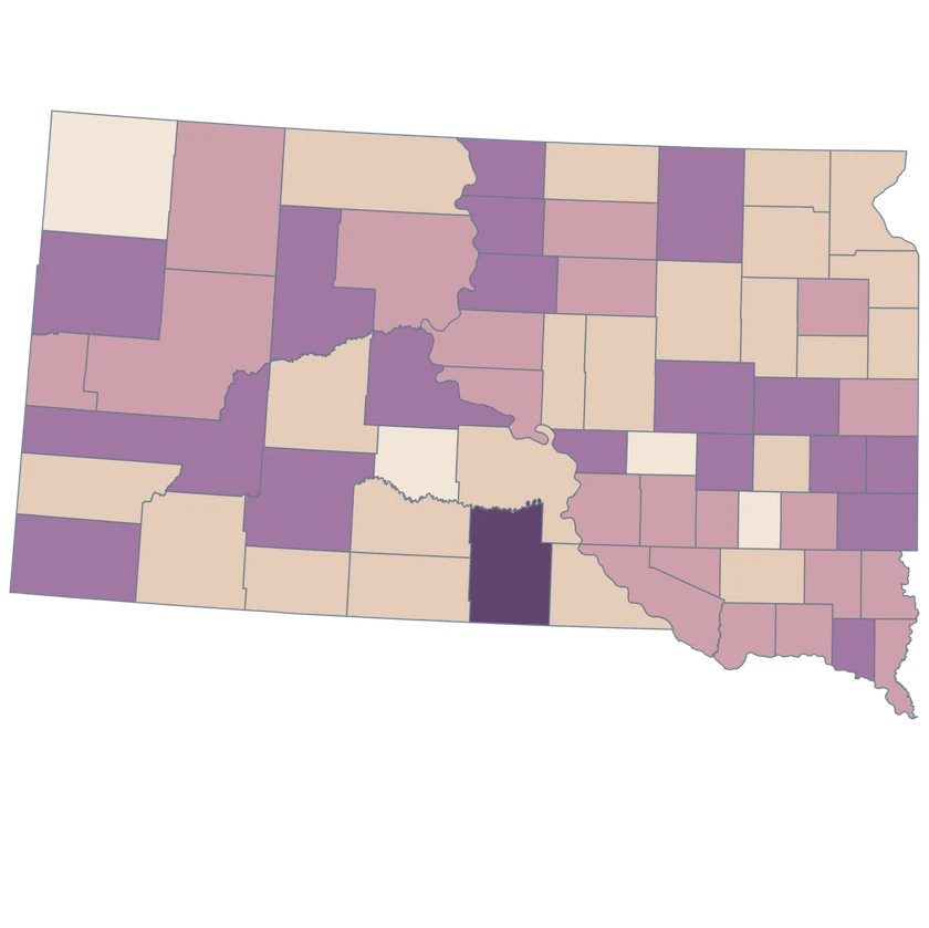
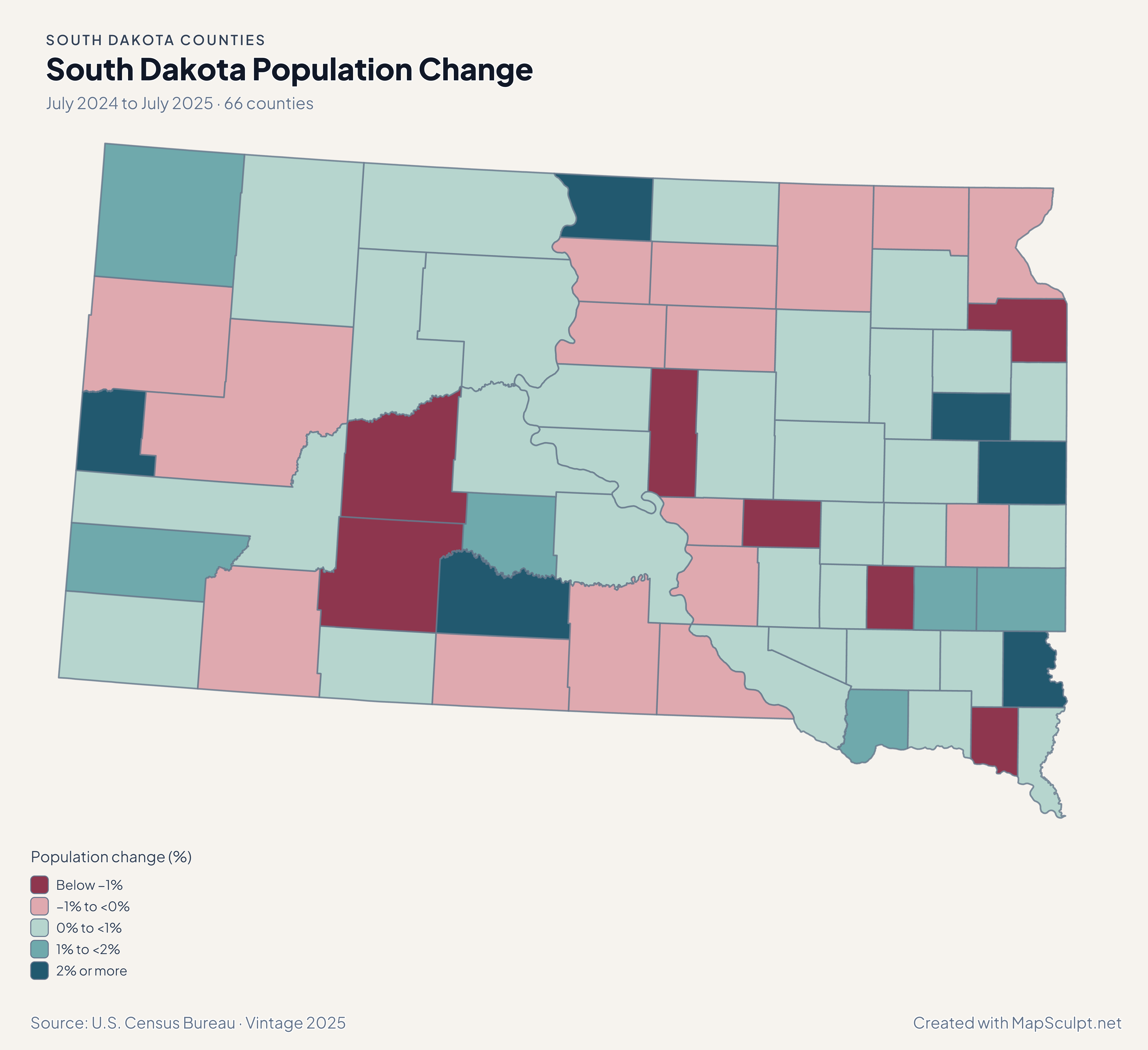
South Dakota Population Change

July 2024 to July 2025 · 66 counties

South Dakota population change map. Lincoln in a higher growth band than Minnehaha and Pennington.

Population change (%)

  • Below −1%
  • −1% to <0%
  • 0% to <1%
  • 1% to <2%
  • 2% or more
U.S. Census Bureau · Vintage 2025Download complete PNG Census population estimates for July 2024 and July 2025.

KNOW YOUR GEOGRAPHY

South Dakota counties on the Census map

The editor uses the Census county layer from the Black Hills to the eastern state line. The western county outlines retain their Census geometry.

Minnehaha and Lincoln are useful county units for a Sioux Falls-area comparison, and Pennington covers the Rapid City area. Reservation and Tribal jurisdiction boundaries describe separate geographies.

Browse all county GEOIDs ↗

2025 Census boundaries

OFFICIAL DATA

Lincoln, Minnehaha and Pennington grew at different rates

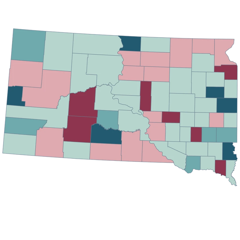
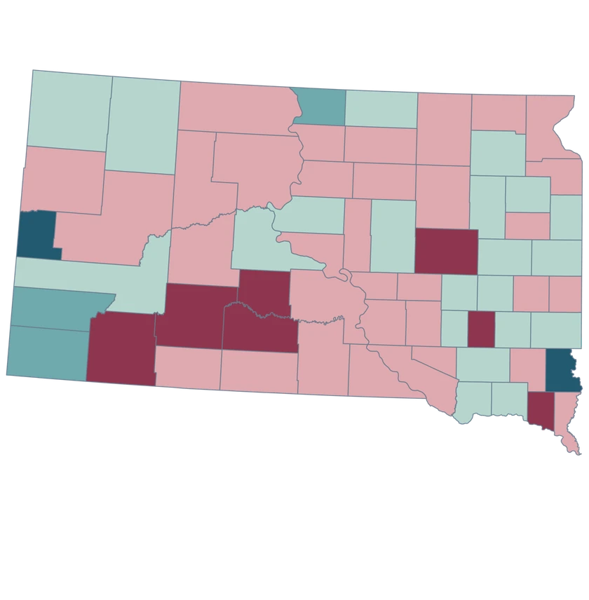
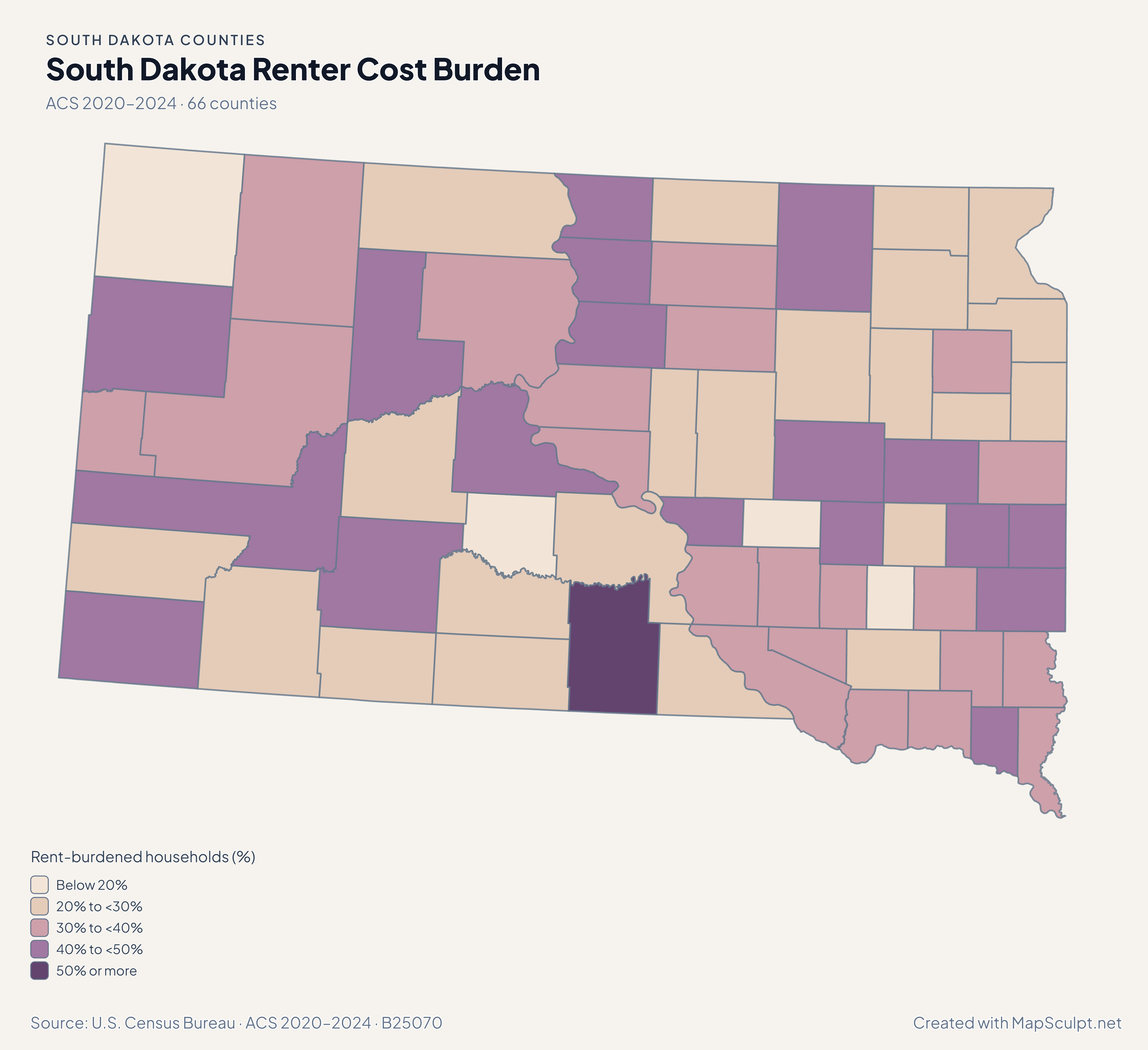
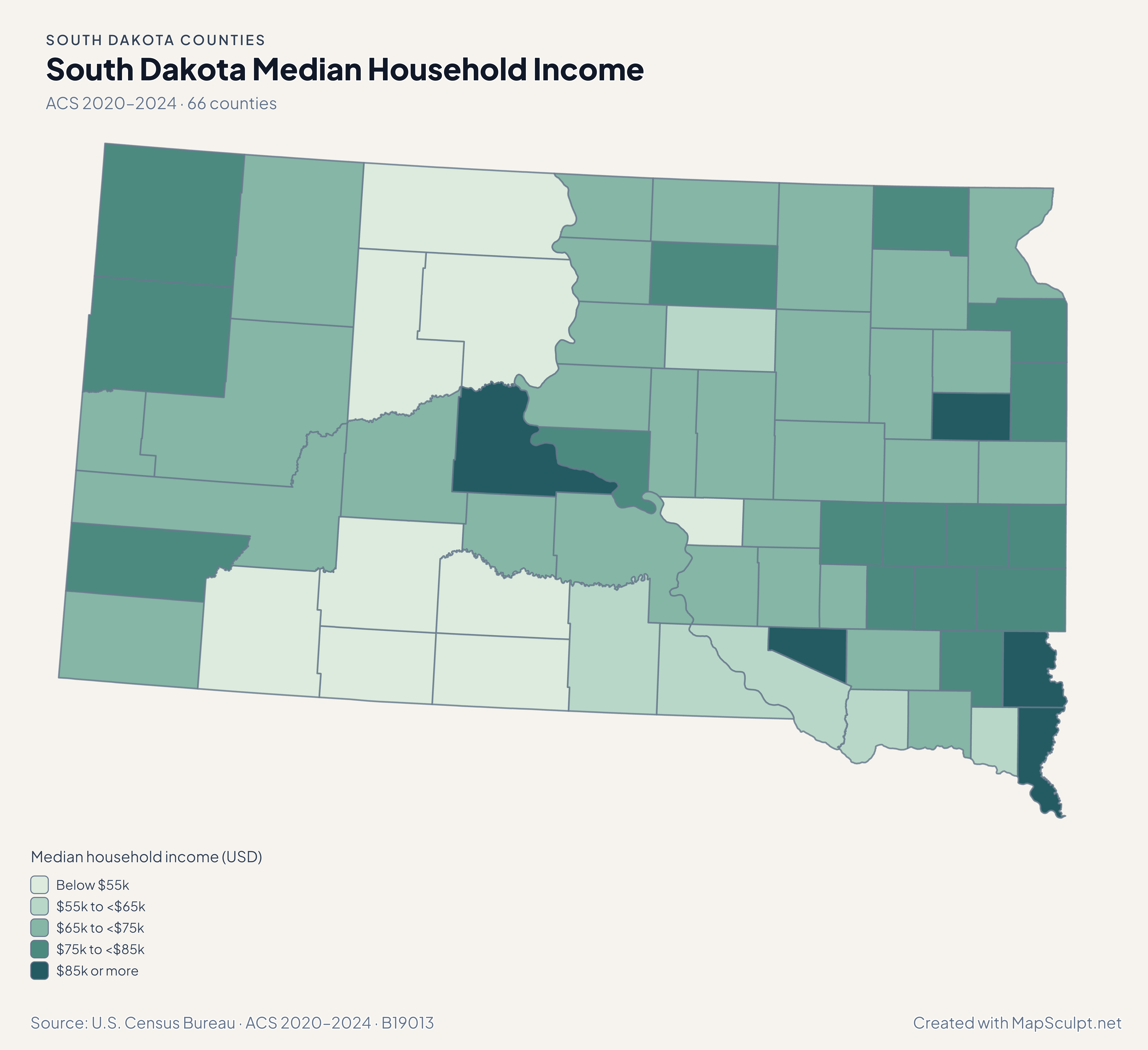
Use the four maps to compare July-to-July population estimates with the separate 2020–2024 ACS household estimates.

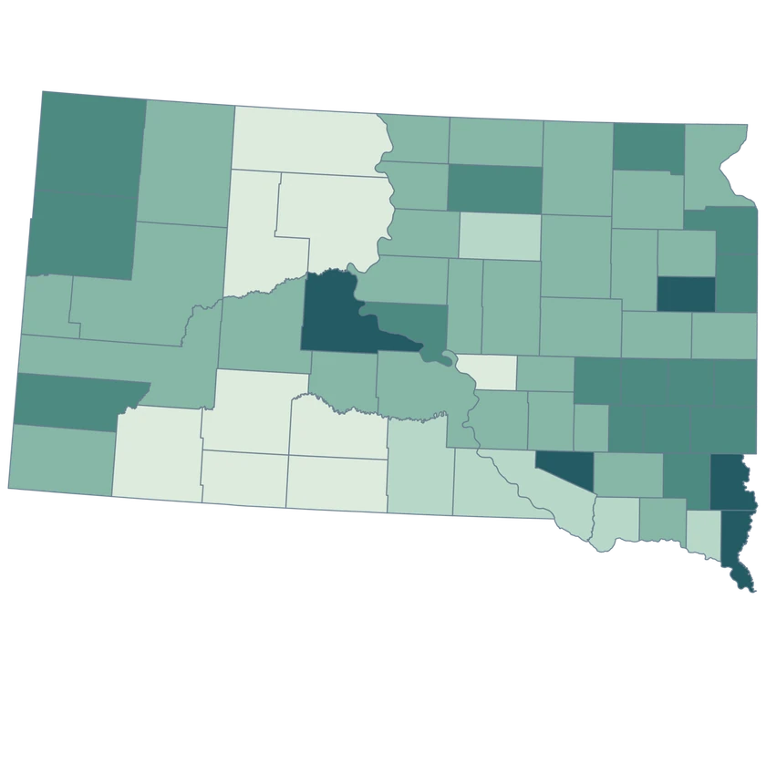
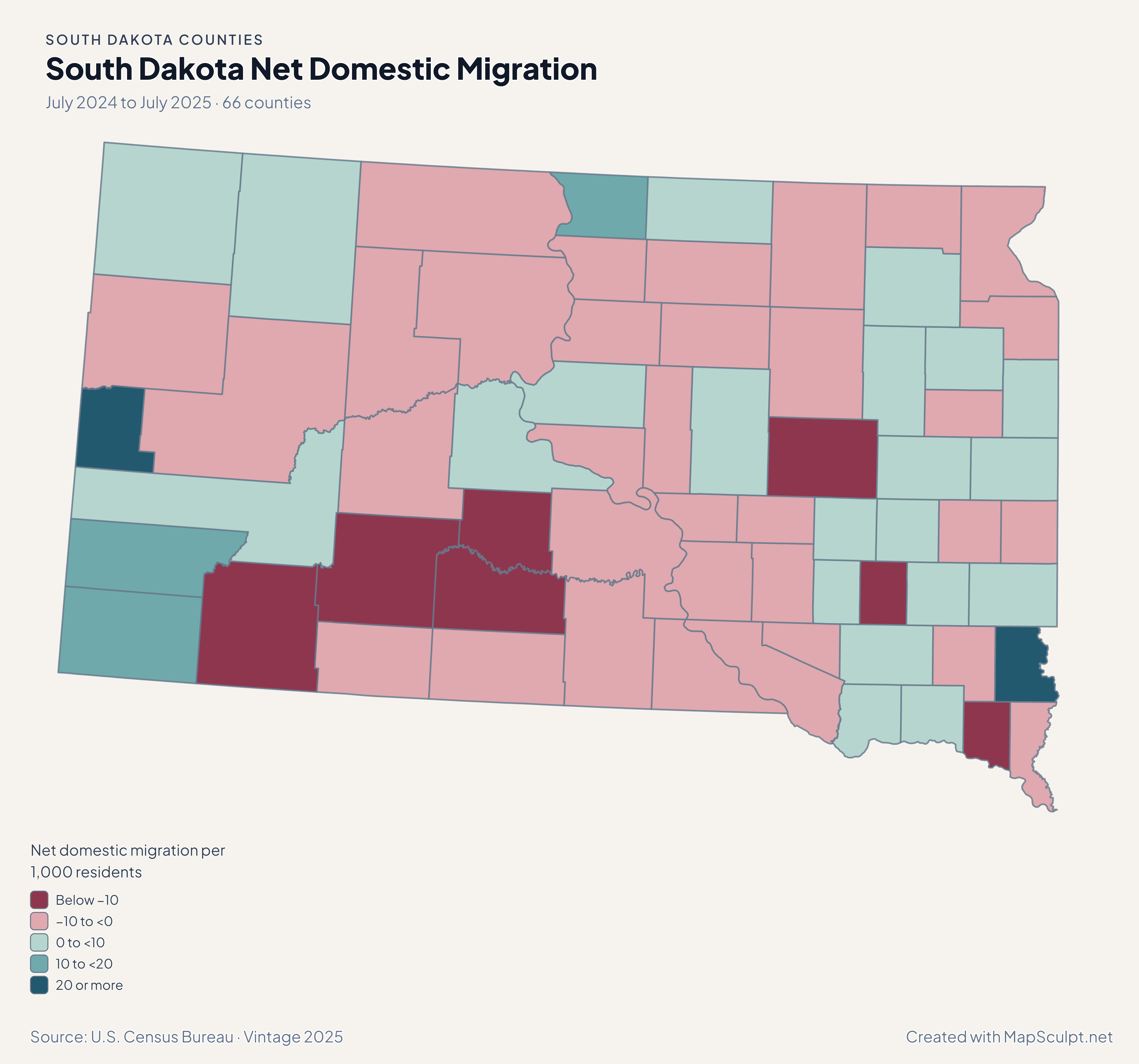
South Dakota net domestic migration map. Lincoln in the highest positive migration band and Minnehaha and Pennington in a lower positive band.

July 2024 to July 2025 · 66 counties

Lincoln recorded a higher net domestic migration rate

Lincoln gained 20.53 people per 1,000 residents through net domestic migration, versus 4.16 in Minnehaha and 0.43 in Pennington. Check the population base before comparing rates for the smallest counties.

Net domestic migration per 1,000 residents

  • Below −10
  • −10 to <0
  • 0 to <10
  • 10 to <20
  • 20 or more

U.S. Census Bureau · Vintage 2025

Download complete PNG

Lincoln County grew 2.69%, Minnehaha 1.56%, and Pennington 0.41%. These are July-to-July changes for whole counties. See the Census estimates ↗

MAKE IT YOURS

From county data to a finished map.

  1. Open the South Dakota editor

    Start with all 66 counties individually selectable.

  2. Match rows by GEOID

    Import a CSV using the five-character county GEOIDs from the directory.

  3. Style the counties

    Set readable class labels and keep the neutral fill visible for unmatched areas.

  4. Export the annotated map

    Preview the full geography, legend and source before downloading a PNG.

TRY CSV IMPORT

Trail repair projects in South Dakota

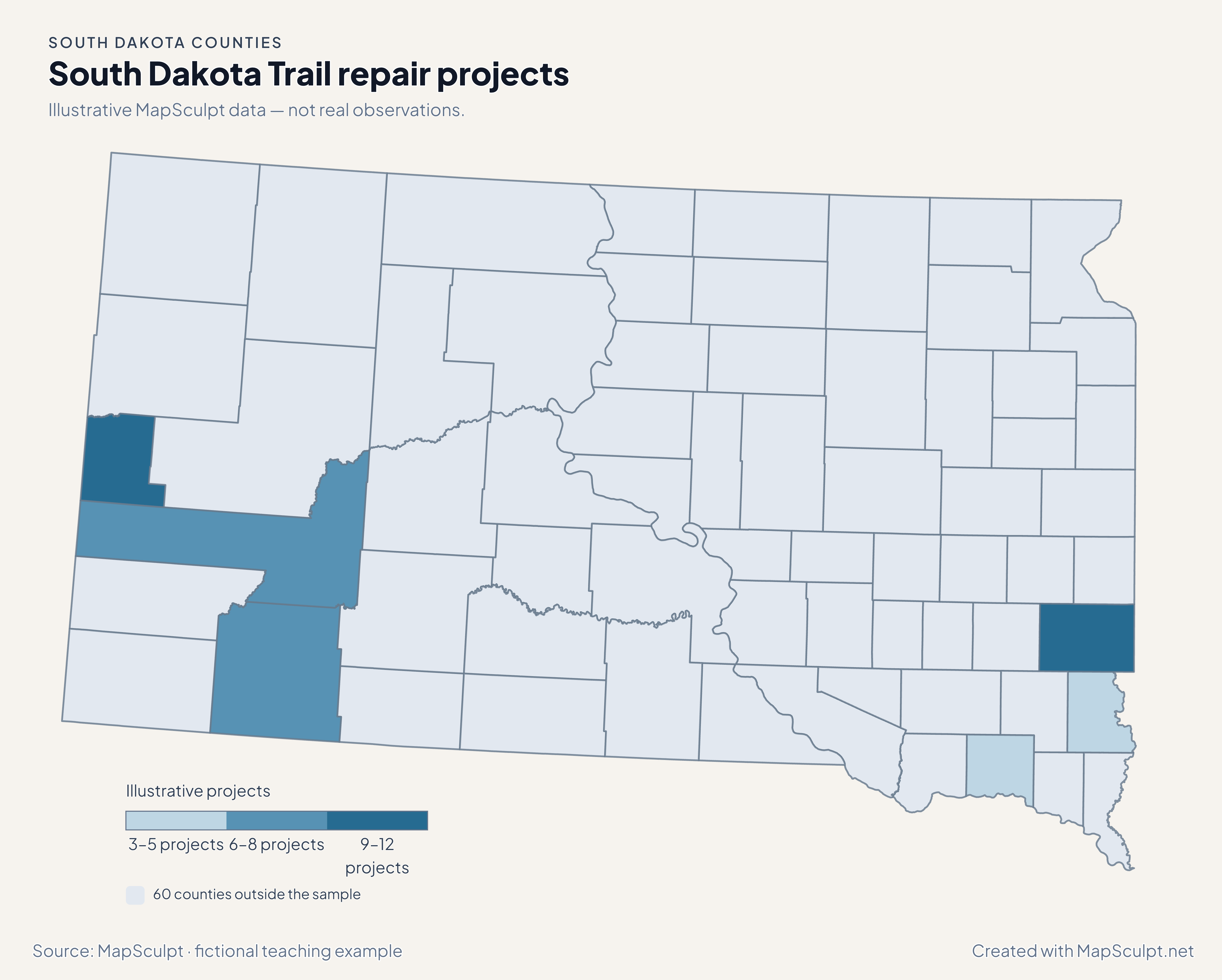
Illustrative MapSculpt data — not real observations. The file joins 6 official GEOIDs and leaves 60 counties neutral.

Illustrative MapSculpt data — not real observations.
CountyGEOIDProjects
Minnehaha County4609910
Pennington County461037
Lincoln County460834
Oglala Lakota County461026
Lawrence County4608111
Yankton County461353

Match on GEOID, select IllustrativeProjects, and enter custom boundaries 3, 6, 9 and 12.

Download illustrative CSV ↓

South Dakota Trail repair projects

Illustrative MapSculpt data — not real observations.

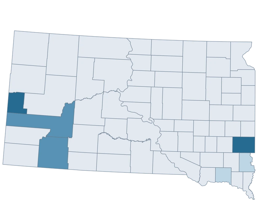
Fictional South Dakota trail repair projects map showing 6 sampled counties with the rest neutral.

Illustrative projects

  • 3–5 projects
  • 6–8 projects
  • 9–12 projects
  • 60 counties outside the sample
Download complete PNG

CSV → Match 6 counties → Style → Export PNG Create a South Dakota map

COUNTY REFERENCE

Find all 66 South Dakota counties and GEOIDs

Official county names and five-digit Census GEOIDs. Search by name or code.

  1. Aurora CountyGEOID 46003
  2. Beadle CountyGEOID 46005
  3. Bennett CountyGEOID 46007
  4. Bon Homme CountyGEOID 46009
  5. Brookings CountyGEOID 46011
  6. Brown CountyGEOID 46013
  7. Brule CountyGEOID 46015
  8. Buffalo CountyGEOID 46017
  9. Butte CountyGEOID 46019
  10. Campbell CountyGEOID 46021
  11. Charles Mix CountyGEOID 46023
  12. Clark CountyGEOID 46025
  13. Clay CountyGEOID 46027
  14. Codington CountyGEOID 46029
  15. Corson CountyGEOID 46031
  16. Custer CountyGEOID 46033
  17. Davison CountyGEOID 46035
  18. Day CountyGEOID 46037
  19. Deuel CountyGEOID 46039
  20. Dewey CountyGEOID 46041
  21. Douglas CountyGEOID 46043
  22. Edmunds CountyGEOID 46045
  23. Fall River CountyGEOID 46047
  24. Faulk CountyGEOID 46049
  25. Grant CountyGEOID 46051
  26. Gregory CountyGEOID 46053
  27. Haakon CountyGEOID 46055
  28. Hamlin CountyGEOID 46057
  29. Hand CountyGEOID 46059
  30. Hanson CountyGEOID 46061
  31. Harding CountyGEOID 46063
  32. Hughes CountyGEOID 46065
  33. Hutchinson CountyGEOID 46067
  34. Hyde CountyGEOID 46069
  35. Jackson CountyGEOID 46071
  36. Jerauld CountyGEOID 46073
  37. Jones CountyGEOID 46075
  38. Kingsbury CountyGEOID 46077
  39. Lake CountyGEOID 46079
  40. Lawrence CountyGEOID 46081
  41. Lincoln CountyGEOID 46083
  42. Lyman CountyGEOID 46085
  43. Marshall CountyGEOID 46091
  44. McCook CountyGEOID 46087
  45. McPherson CountyGEOID 46089
  46. Meade CountyGEOID 46093
  47. Mellette CountyGEOID 46095
  48. Miner CountyGEOID 46097
  49. Minnehaha CountyGEOID 46099
  50. Moody CountyGEOID 46101
  51. Oglala Lakota CountyGEOID 46102
  52. Pennington CountyGEOID 46103
  53. Perkins CountyGEOID 46105
  54. Potter CountyGEOID 46107
  55. Roberts CountyGEOID 46109
  56. Sanborn CountyGEOID 46111
  57. Spink CountyGEOID 46115
  58. Stanley CountyGEOID 46117
  59. Sully CountyGEOID 46119
  60. Todd CountyGEOID 46121
  61. Tripp CountyGEOID 46123
  62. Turner CountyGEOID 46125
  63. Union CountyGEOID 46127
  64. Walworth CountyGEOID 46129
  65. Yankton CountyGEOID 46135
  66. Ziebach CountyGEOID 46137

U.S. Census Bureau · 2025 Cartographic Boundary Files

COMMON QUESTIONS

South Dakota county map questions.

Which GEOIDs cover the Sioux Falls area at county scale?

Use 46099 for Minnehaha and 46083 for Lincoln. Each represents an entire county.

Where is Rapid City on the county map?

Use Pennington County, GEOID 46103, for a county-level comparison.

What name should I use for GEOID 46102?

Use Oglala Lakota County, the name in the Census inventory used by this editor.

Can I use county shapes as reservation boundaries?

Use a source with the specific Tribal geography for that analysis. This editor contains the 66 official counties.

Why check the denominator in small counties?

A few moves can change a per-1,000 rate sharply when the underlying population is small. Check the absolute count alongside the rate.

How can I distinguish an unmatched county from zero projects?

Leave unmatched counties neutral and include reported zeroes as numeric values in your CSV. Label the two cases clearly in the legend.

YOUR NEXT MAP STARTS HERE

Map a South Dakota county comparison

Use the official county shapes to highlight a local comparison, join your own rows, or export a map for a presentation.

Create a South Dakota map