Skip to content
MapSculpt

GEOGRAPHIC MAP MAKER / NORTH DAKOTA

North Dakota
Counties Map Maker

Follow county population change from Fargo and Grand Forks to McKenzie and Williams, then map your own North Dakota data across all 53 counties.

Free online editor · No sign-up required

53counties
individually editable

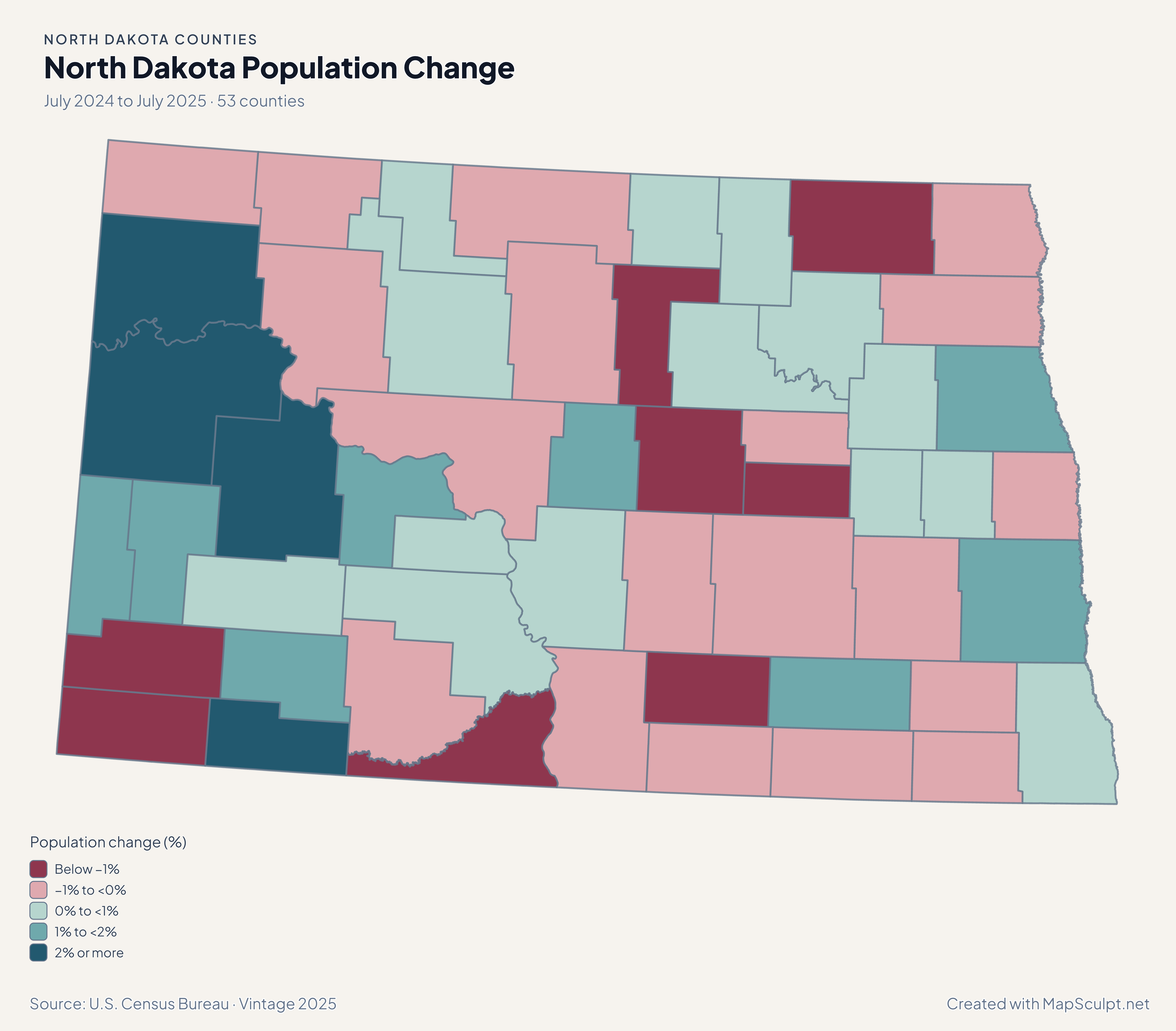
North Dakota Population Change

July 2024 to July 2025 · 53 counties

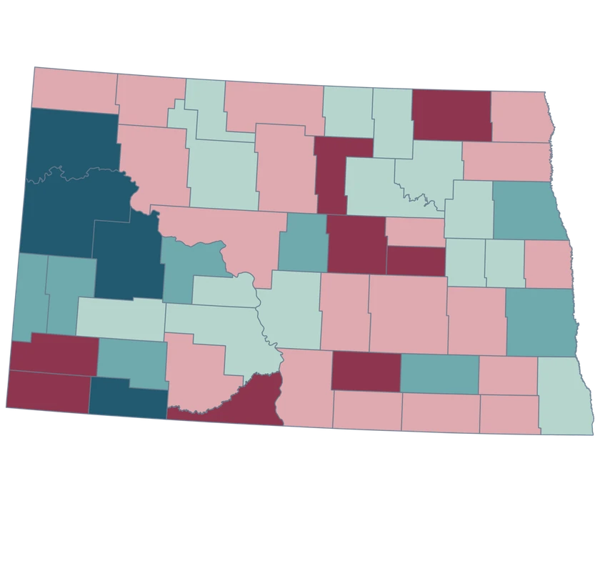
North Dakota population change map. McKenzie and Williams in the highest growth band and Cass in the next band.

Population change (%)

  • Below −1%
  • −1% to <0%
  • 0% to <1%
  • 1% to <2%
  • 2% or more
U.S. Census Bureau · Vintage 2025Download complete PNG Census population estimates for July 2024 and July 2025.

KNOW YOUR GEOGRAPHY

North Dakota counties on the Census map

The statewide map retains each official county from the Red River boundary to the Montana line and keeps the generalized Census borders used by the editor.

Use Cass for Fargo-area county data, Burleigh for Bismarck-area county data, and Ward for the Minot-area comparison. Keep the state prefix in a CSV where county names can repeat across state lines.

Browse all county GEOIDs ↗

2025 Census boundaries

OFFICIAL DATA

McKenzie and Williams grew faster than Cass

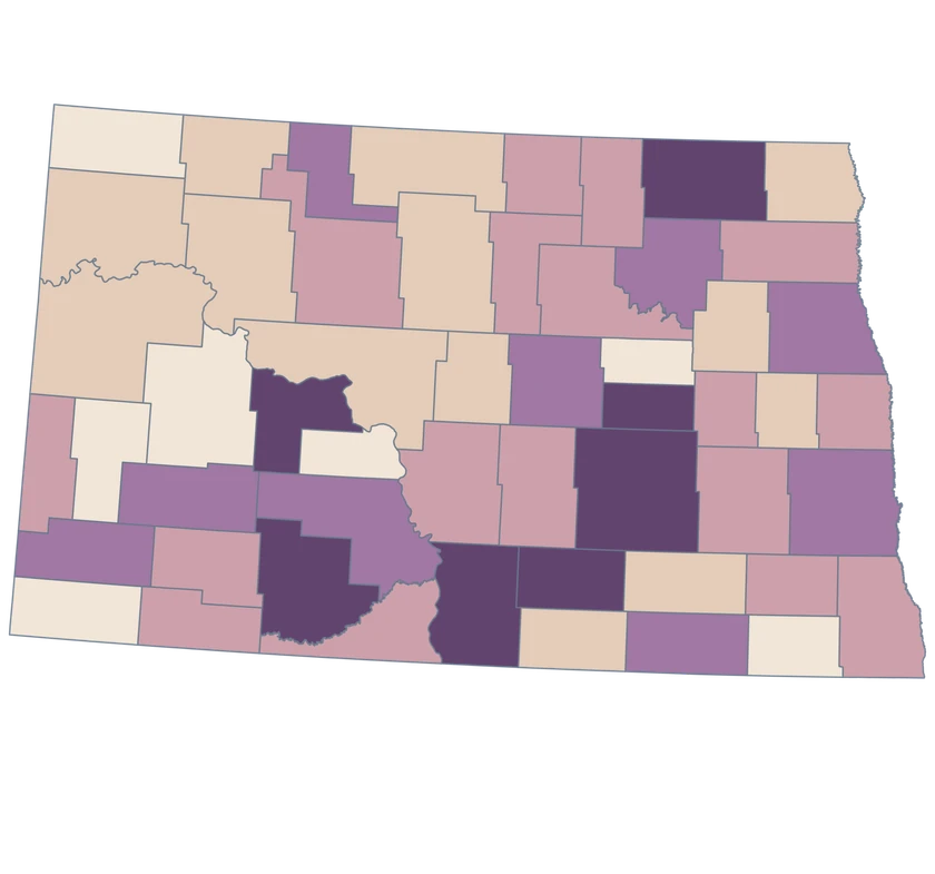
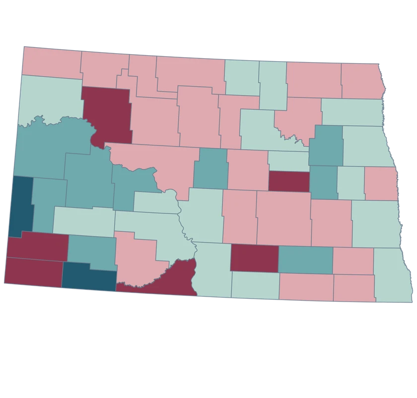
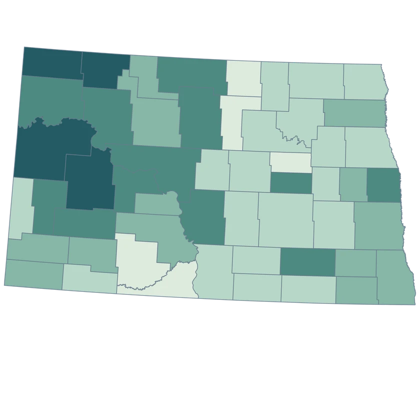
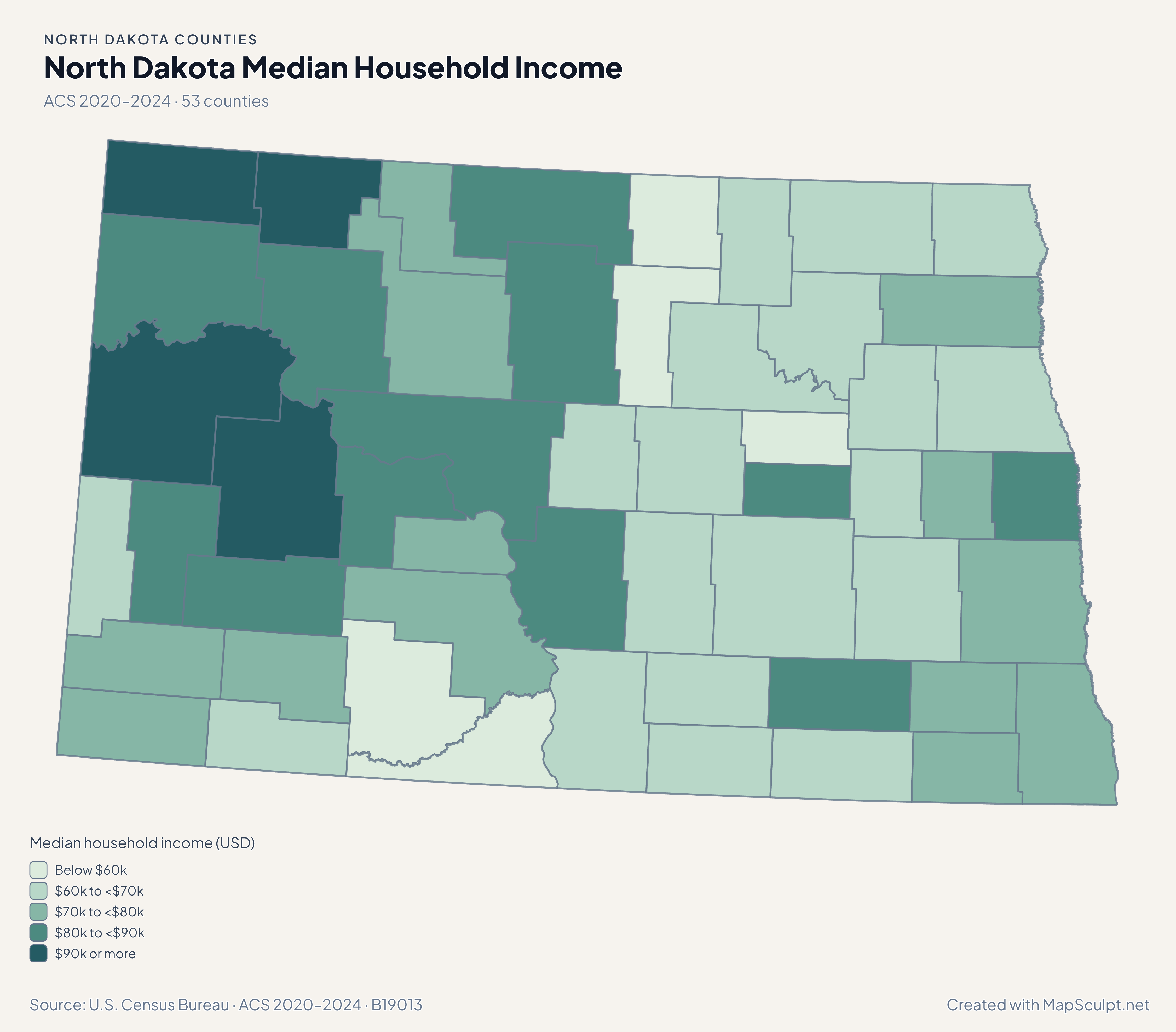
Use the four maps to compare July-to-July population estimates with the separate 2020–2024 ACS household estimates.

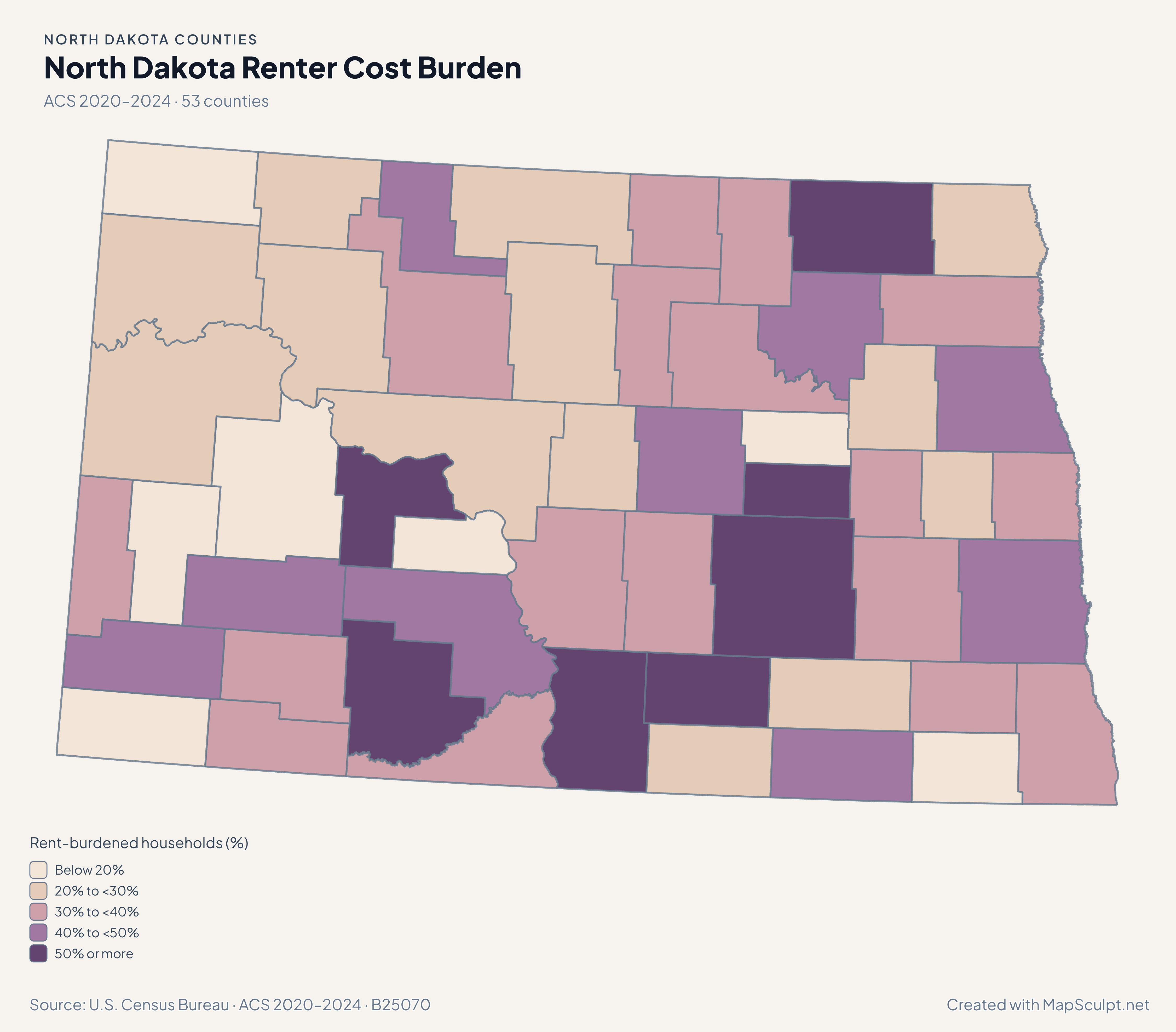
North Dakota renter cost burden map. Grand Forks in a higher estimated renter burden band than McKenzie.

ACS 2020–2024 · 53 counties

Grand Forks and McKenzie show different renter estimates

Among households with a calculable gross-rent ratio, an estimated 44.53% in Grand Forks and 22.20% in McKenzie spent at least 30% of income on gross rent. Sampling uncertainty applies to both figures.

Rent-burdened households (%)

  • Below 20%
  • 20% to <30%
  • 30% to <40%
  • 40% to <50%
  • 50% or more

U.S. Census Bureau · ACS 2020–2024 · B25070

Download complete PNG

From July 2024 to July 2025, McKenzie grew 2.66%, Williams 2.48% and Cass 1.27%. The scale compares relative change from different starting populations. See the Census estimates ↗

MAKE IT YOURS

From county data to a finished map.

  1. Open the North Dakota editor

    Start with all 53 counties individually selectable.

  2. Match rows by GEOID

    Import a CSV using the five-character county GEOIDs from the directory.

  3. Style the counties

    Set readable class labels and keep the neutral fill visible for unmatched areas.

  4. Export the annotated map

    Preview the full geography, legend and source before downloading a PNG.

TRY CSV IMPORT

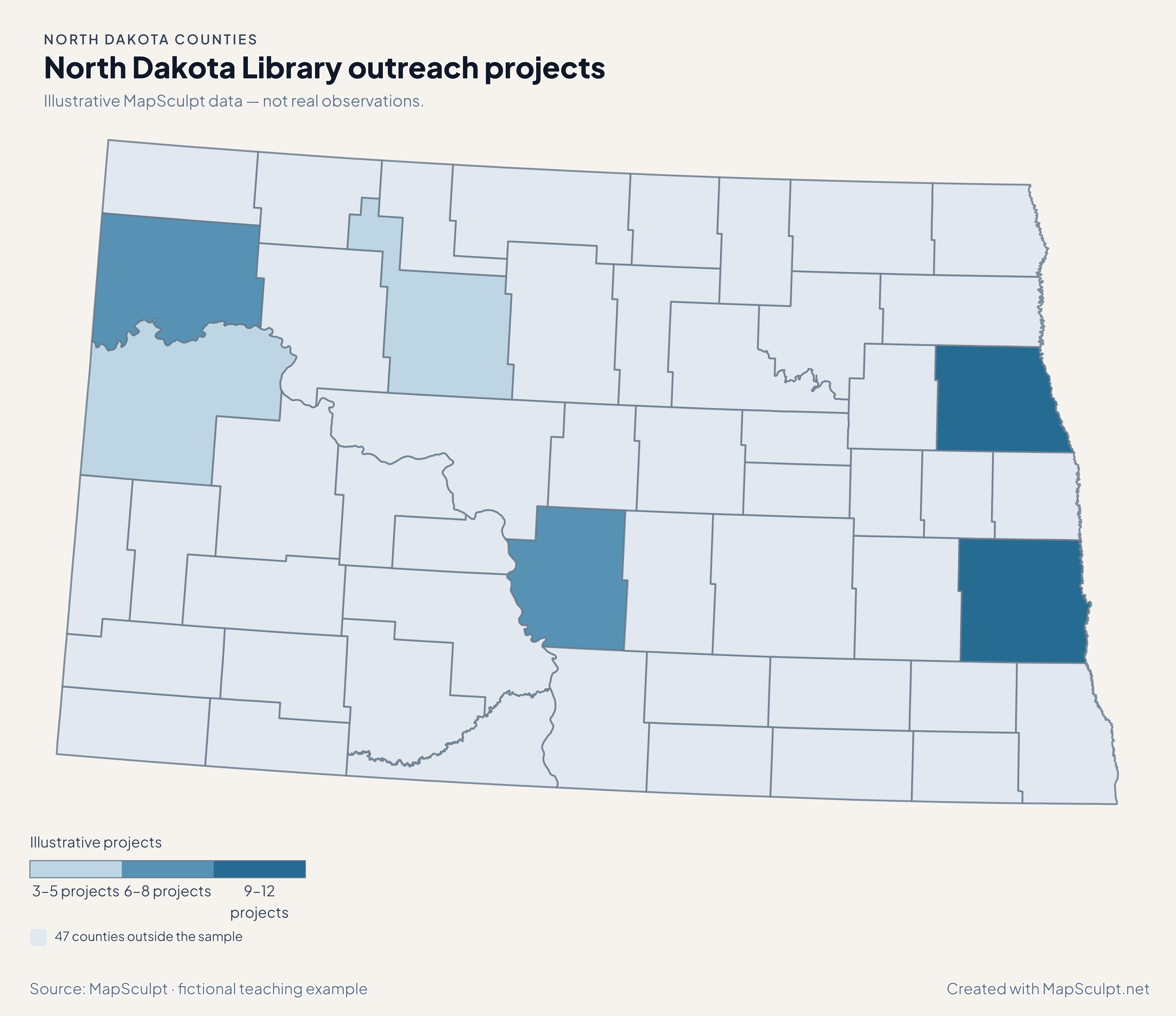
Library outreach projects in North Dakota

Illustrative MapSculpt data — not real observations. The file joins 6 official GEOIDs and leaves 47 counties neutral.

Illustrative MapSculpt data — not real observations.
CountyGEOIDProjects
Cass County3801712
Burleigh County380158
Grand Forks County3803510
Ward County381015
McKenzie County380533
Williams County381056

Match on GEOID, select IllustrativeProjects, and enter custom boundaries 3, 6, 9 and 12.

Download illustrative CSV ↓

North Dakota Library outreach projects

Illustrative MapSculpt data — not real observations.

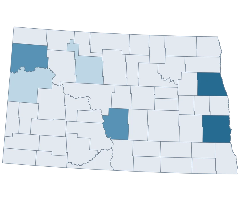
Fictional North Dakota library outreach projects map showing 6 sampled counties with the rest neutral.

Illustrative projects

  • 3–5 projects
  • 6–8 projects
  • 9–12 projects
  • 47 counties outside the sample
Download complete PNG

CSV → Match 6 counties → Style → Export PNG Create a North Dakota map

COUNTY REFERENCE

Find all 53 North Dakota counties and GEOIDs

Official county names and five-digit Census GEOIDs. Search by name or code.

  1. Adams CountyGEOID 38001
  2. Barnes CountyGEOID 38003
  3. Benson CountyGEOID 38005
  4. Billings CountyGEOID 38007
  5. Bottineau CountyGEOID 38009
  6. Bowman CountyGEOID 38011
  7. Burke CountyGEOID 38013
  8. Burleigh CountyGEOID 38015
  9. Cass CountyGEOID 38017
  10. Cavalier CountyGEOID 38019
  11. Dickey CountyGEOID 38021
  12. Divide CountyGEOID 38023
  13. Dunn CountyGEOID 38025
  14. Eddy CountyGEOID 38027
  15. Emmons CountyGEOID 38029
  16. Foster CountyGEOID 38031
  17. Golden Valley CountyGEOID 38033
  18. Grand Forks CountyGEOID 38035
  19. Grant CountyGEOID 38037
  20. Griggs CountyGEOID 38039
  21. Hettinger CountyGEOID 38041
  22. Kidder CountyGEOID 38043
  23. LaMoure CountyGEOID 38045
  24. Logan CountyGEOID 38047
  25. McHenry CountyGEOID 38049
  26. McIntosh CountyGEOID 38051
  27. McKenzie CountyGEOID 38053
  28. McLean CountyGEOID 38055
  29. Mercer CountyGEOID 38057
  30. Morton CountyGEOID 38059
  31. Mountrail CountyGEOID 38061
  32. Nelson CountyGEOID 38063
  33. Oliver CountyGEOID 38065
  34. Pembina CountyGEOID 38067
  35. Pierce CountyGEOID 38069
  36. Ramsey CountyGEOID 38071
  37. Ransom CountyGEOID 38073
  38. Renville CountyGEOID 38075
  39. Richland CountyGEOID 38077
  40. Rolette CountyGEOID 38079
  41. Sargent CountyGEOID 38081
  42. Sheridan CountyGEOID 38083
  43. Sioux CountyGEOID 38085
  44. Slope CountyGEOID 38087
  45. Stark CountyGEOID 38089
  46. Steele CountyGEOID 38091
  47. Stutsman CountyGEOID 38093
  48. Towner CountyGEOID 38095
  49. Traill CountyGEOID 38097
  50. Walsh CountyGEOID 38099
  51. Ward CountyGEOID 38101
  52. Wells CountyGEOID 38103
  53. Williams CountyGEOID 38105

U.S. Census Bureau · 2025 Cartographic Boundary Files

COMMON QUESTIONS

North Dakota county map questions.

Which GEOID should I use for Fargo-area county data?

Cass County is 38017. Fargo city estimates refer to a smaller geography.

Does Bismarck have its own shape here?

For Bismarck-area county data, choose Burleigh County, 38015. The shapes follow the Census county layer.

How do I identify Grand Forks County in a spreadsheet?

Join on 38035 to distinguish the county record from a Grand Forks city row.

What does the growth map say about the cause of county change?

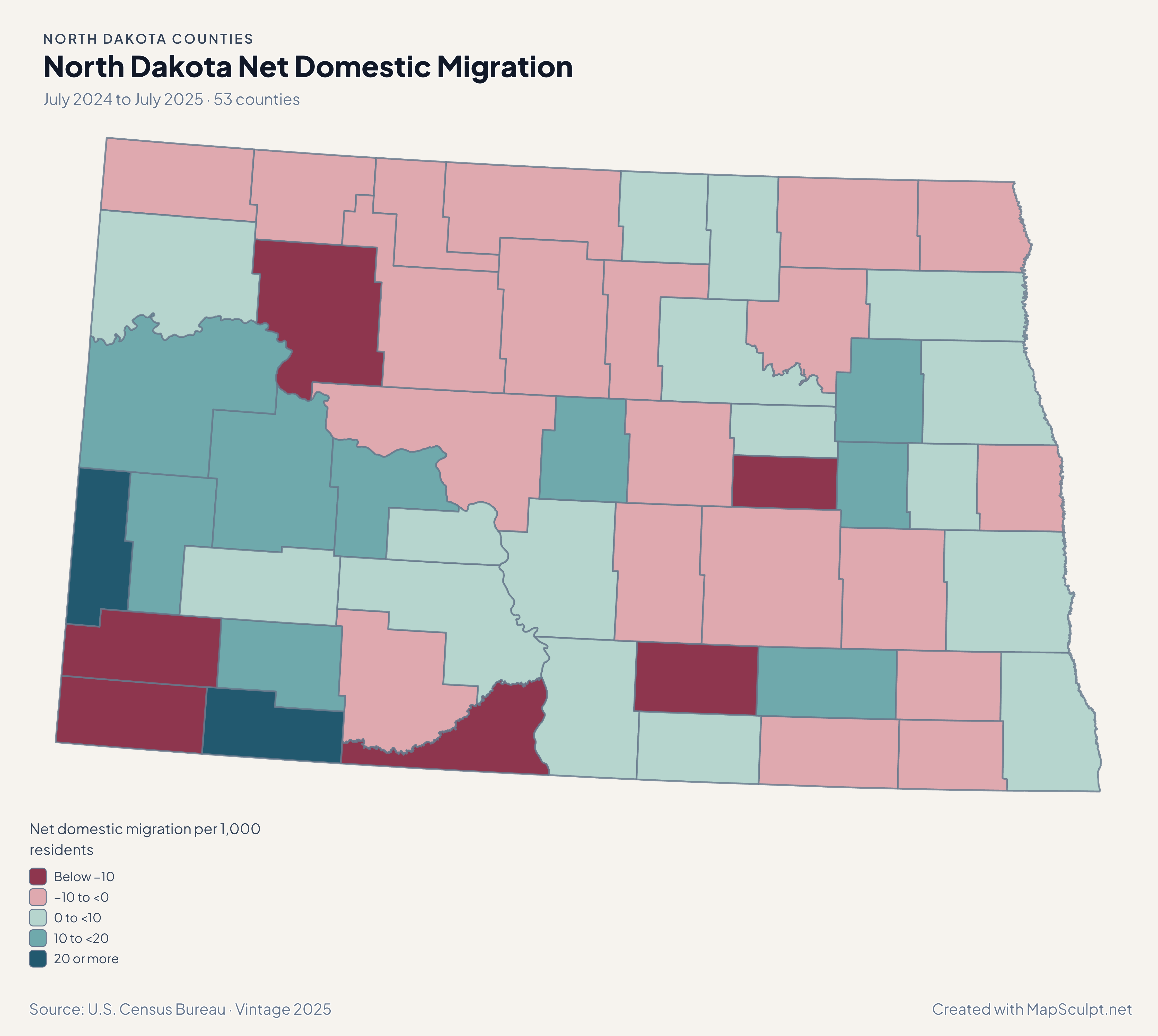
It shows the change between two July population estimates. The separate migration map can help you compare one component of that change.

Why show rates and counts together for small counties?

A small number of moves can produce a large rate where few people live. Adding the counts gives the reader the scale of the change.

Can I join rows from North and South Dakota together?

Use the national U.S. Counties editor and keep each full five-digit GEOID. The state prefixes distinguish the two states.

YOUR NEXT MAP STARTS HERE

Start a North Dakota county map

Use the official county shapes to highlight a local comparison, join your own rows, or export a map for a presentation.

Create a North Dakota map