Standard Map
Flexible layout
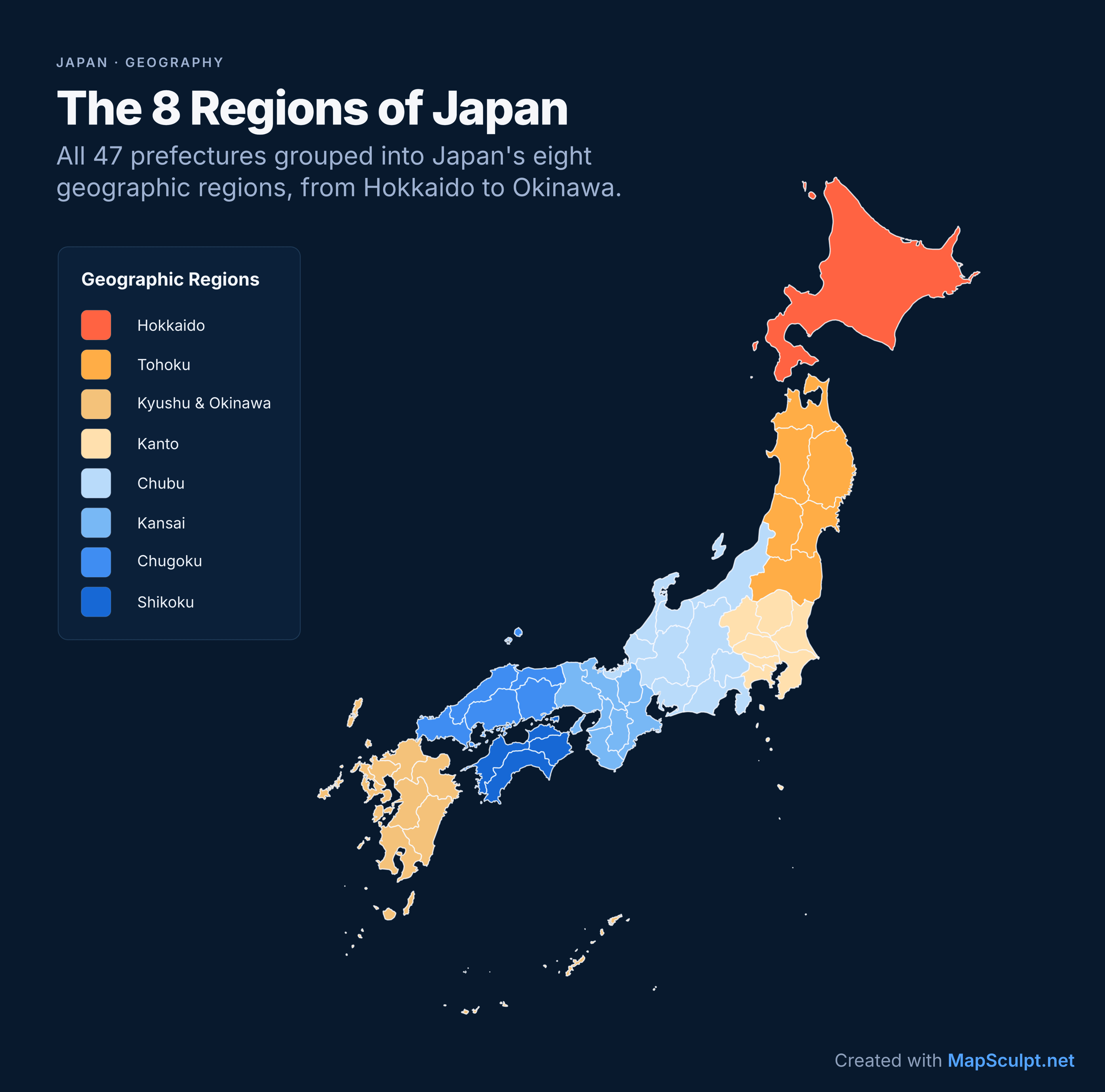
Perfect for reports, presentations and detailed geographic visualisations.


JAPAN / 47 PREFECTURES
Colour all 47 Japanese prefectures, add titles and legends, import CSV data, and download a high-resolution PNG. Perfect for statistics, education and travel maps.
Create Japan MapFree online map editor · No sign-up required
EXPORT FORMATS
Create a map of Japan's 47 prefectures and choose the format that fits your project — from presentations to social media posts and vertical stories.
Flexible layout
Perfect for reports, presentations and detailed geographic visualisations.
3:4 · 1080 × 1440
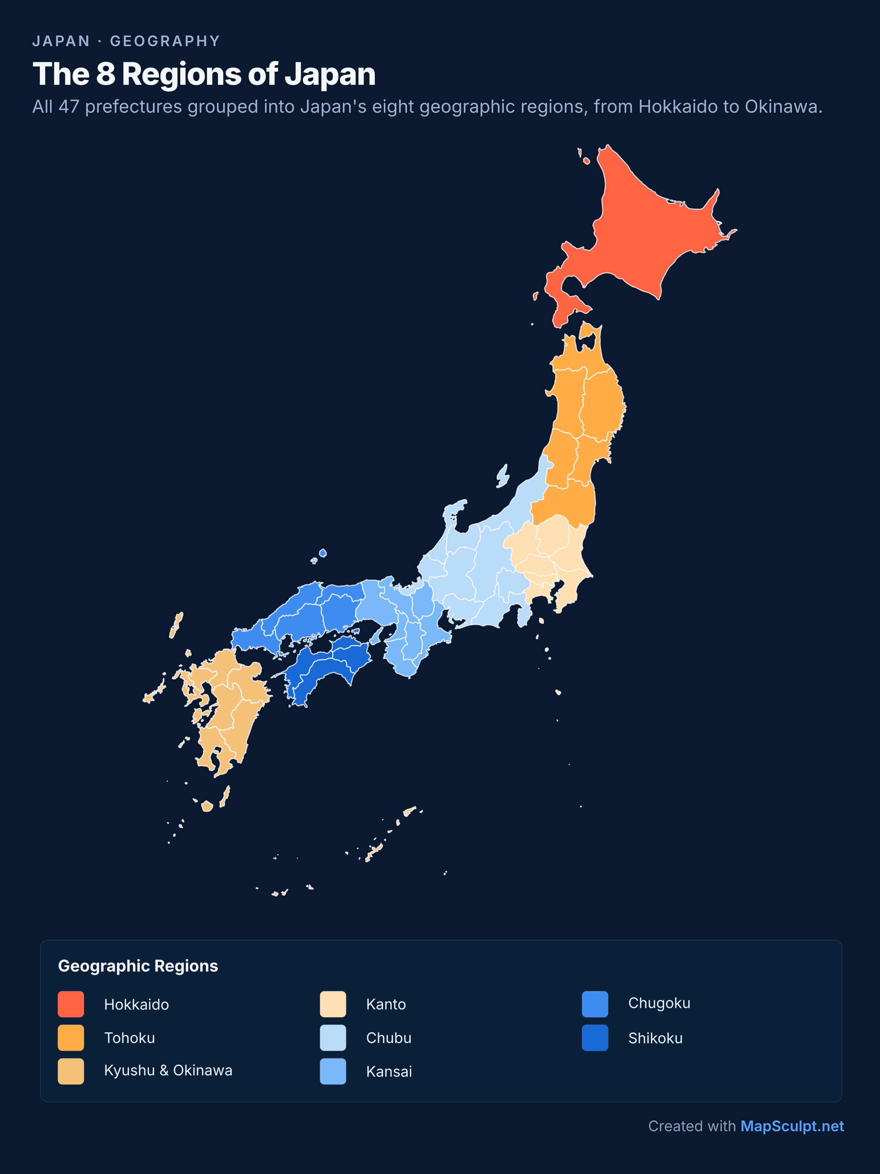
A portrait layout for sharing maps on social media, with room for titles, legends and sources.
9:16 · 1080 × 1920
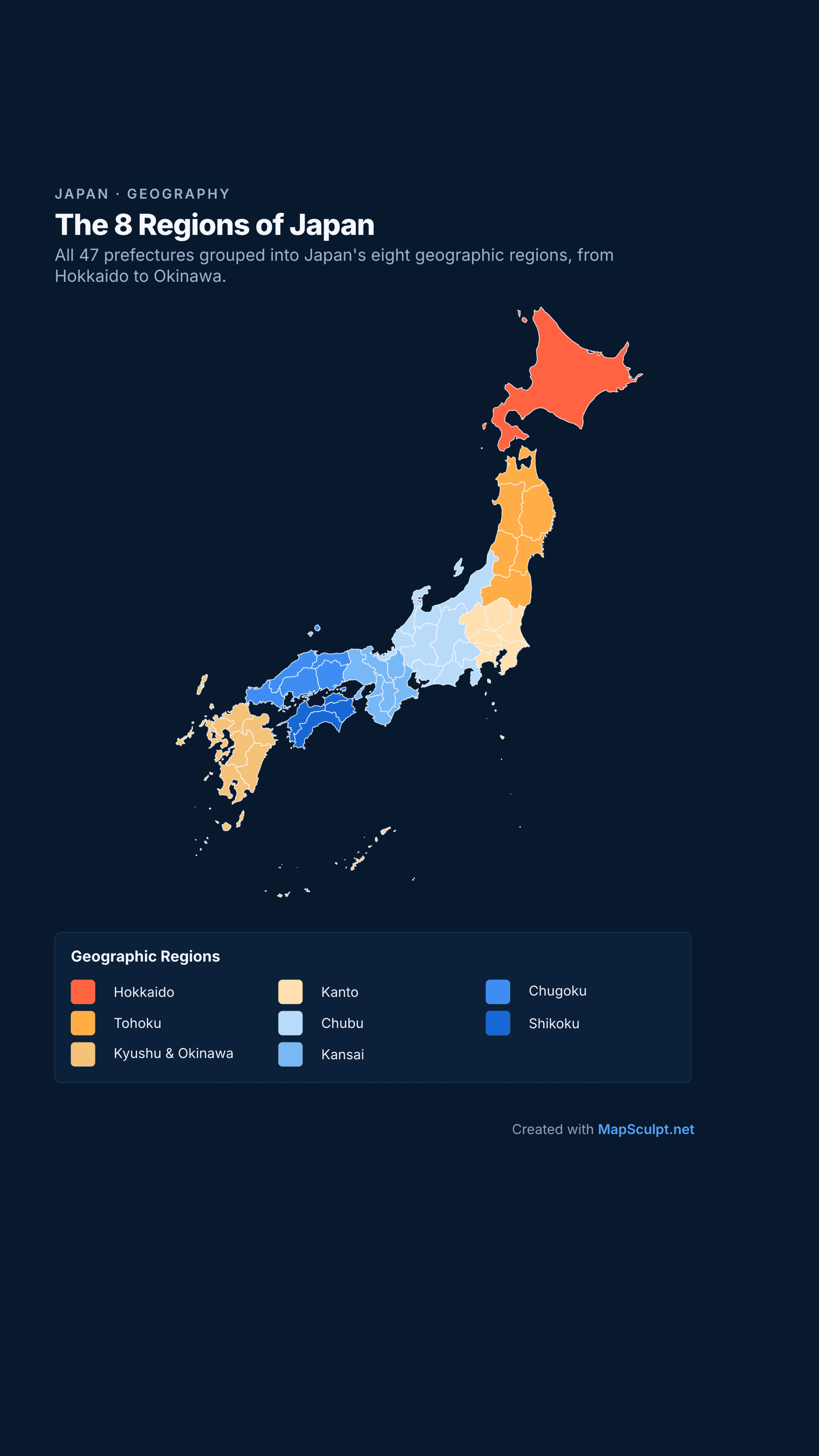
A vertical layout designed for stories, reels and video-sized content.
Maps created with MapSculpt using Japan's prefecture template. The same eight-region colour grouping is shown in three static export formats.
MADE WITH MAPSCULPT / EXAMPLES
From prefecture colouring to census trends, travel and tourism data: see what you can make.
EXAMPLE / GEOGRAPHY
47 PREFECTURES · 8 GEOGRAPHIC REGIONS
Explore Japan's 47 prefectures grouped into eight geographic regions.
Illustrative geographic map · 47 prefectures · 8 regions
Create your own Japan mapEXAMPLE / POPULATION
2020–2025 · FIVE-YEAR CHANGE
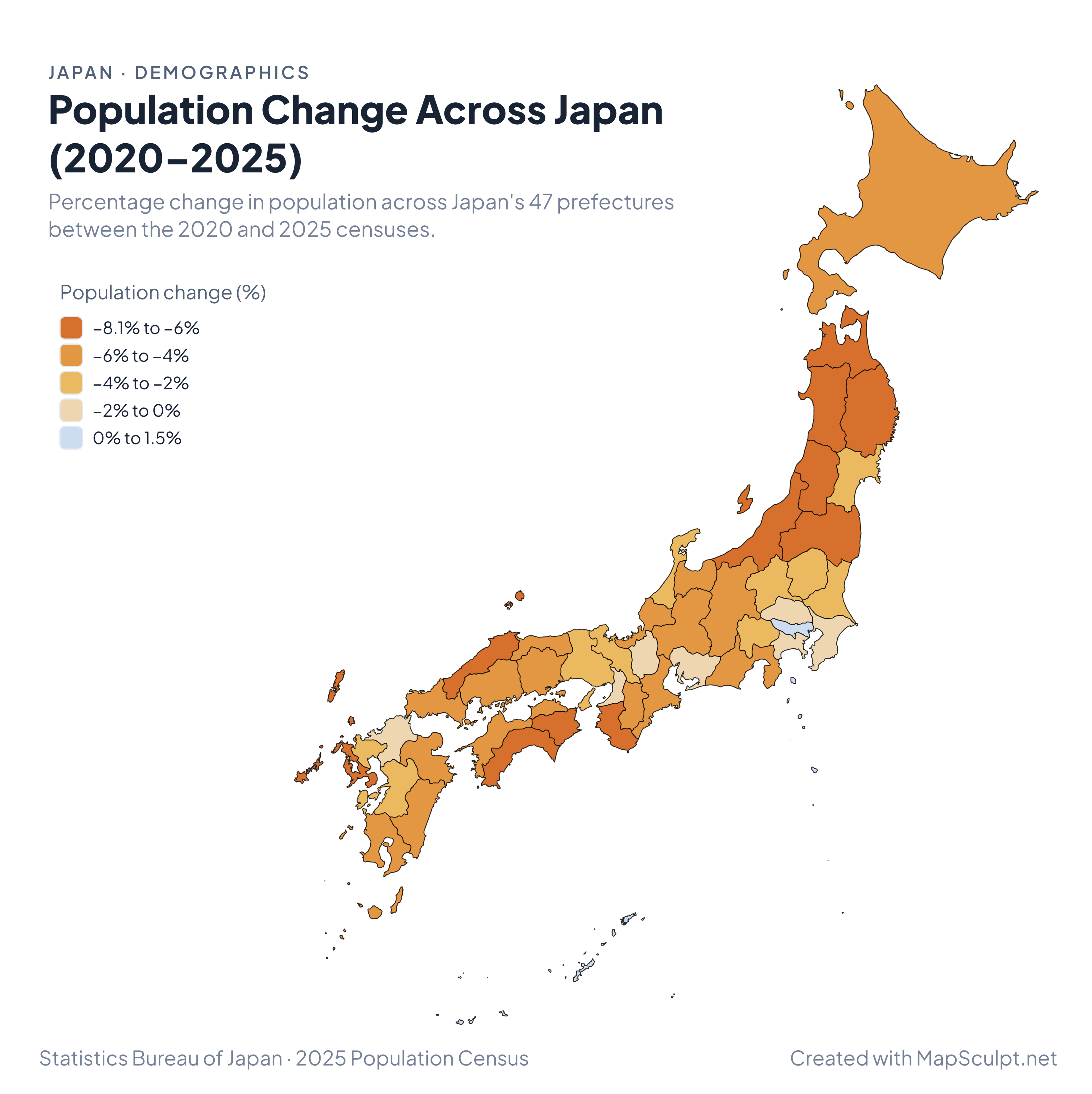
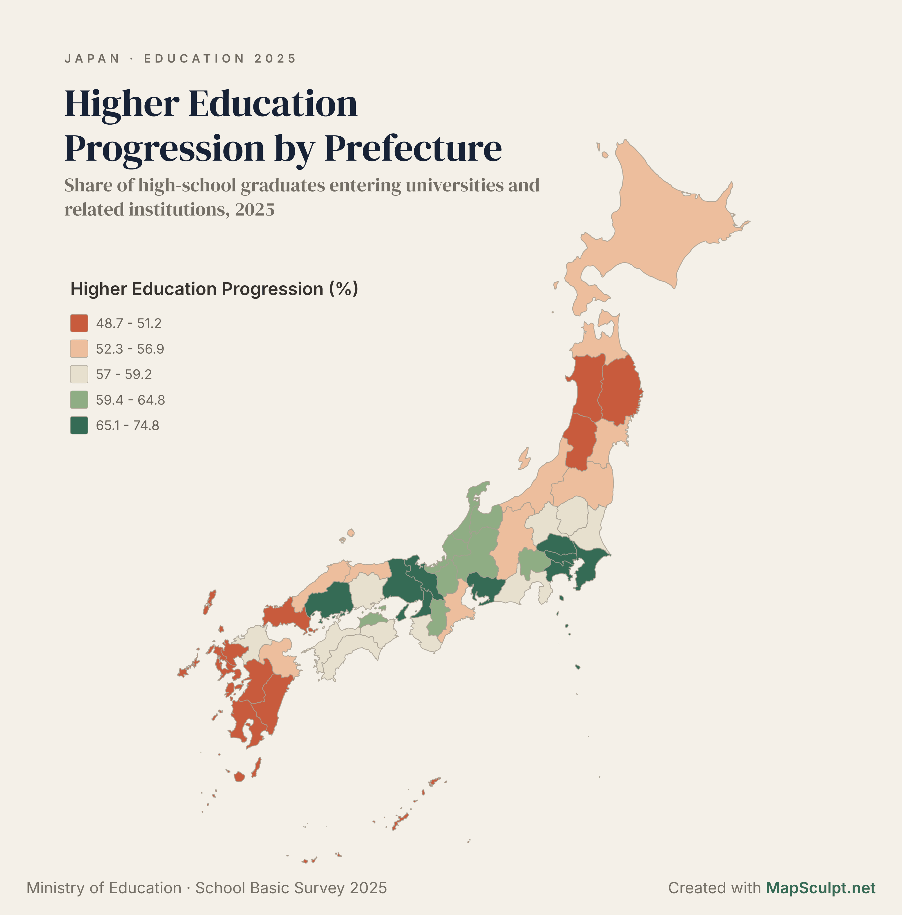
Compare population change from 2020 to 2025 across Japan's 47 prefectures.
Statistics Bureau of Japan · 2025 Population Census (preliminary results)
Create a population mapEXAMPLE / TOURISM
2025 · FOREIGN GUEST NIGHTS
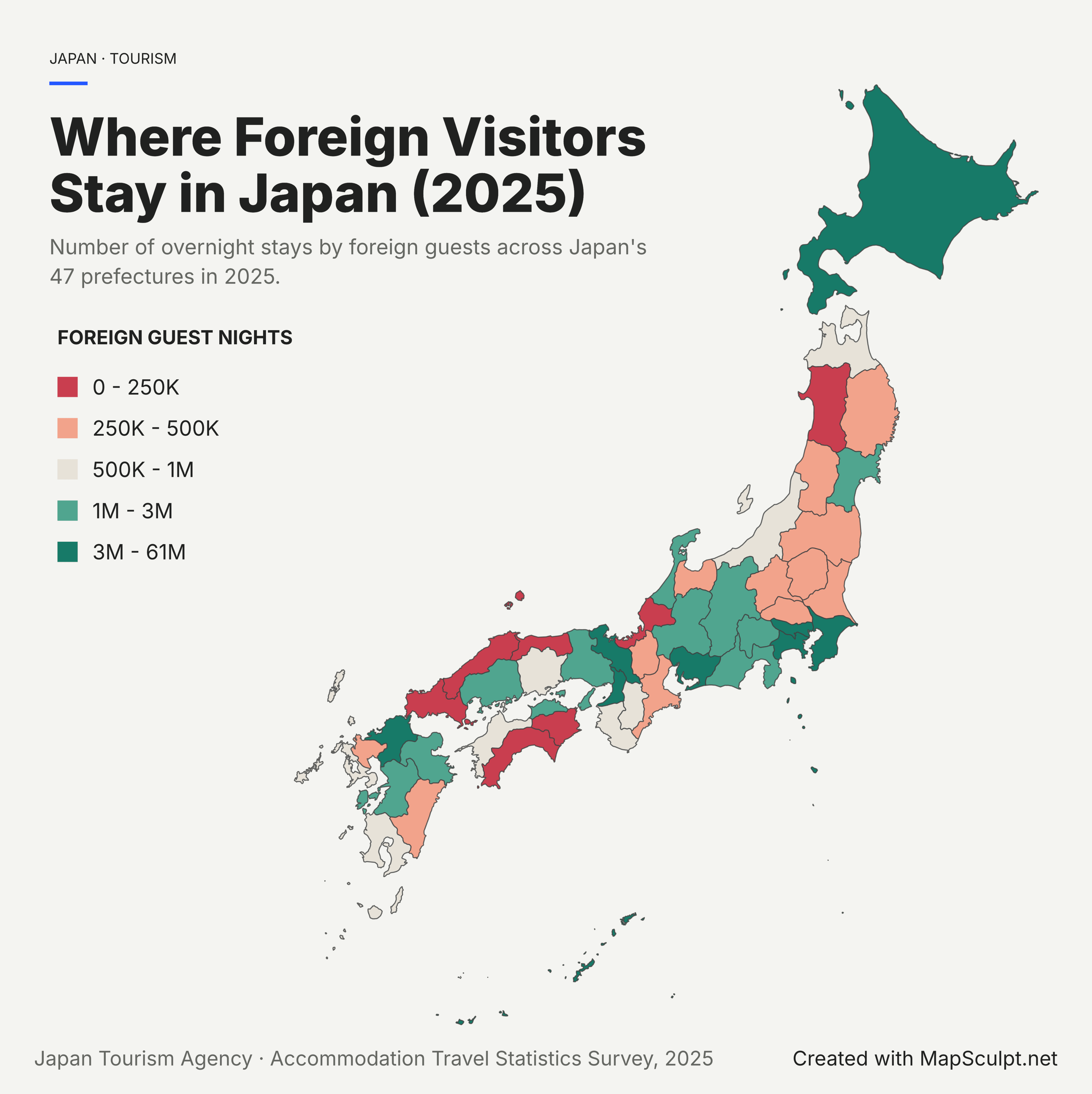
Discover where foreign visitors spent the most nights across Japan's 47 prefectures.
Japan Tourism Agency · Accommodation Travel Statistics Survey · 2025
Map tourism statisticsEXAMPLE / TRAVEL
PERSONAL MAP · PREFECTURES VISITED
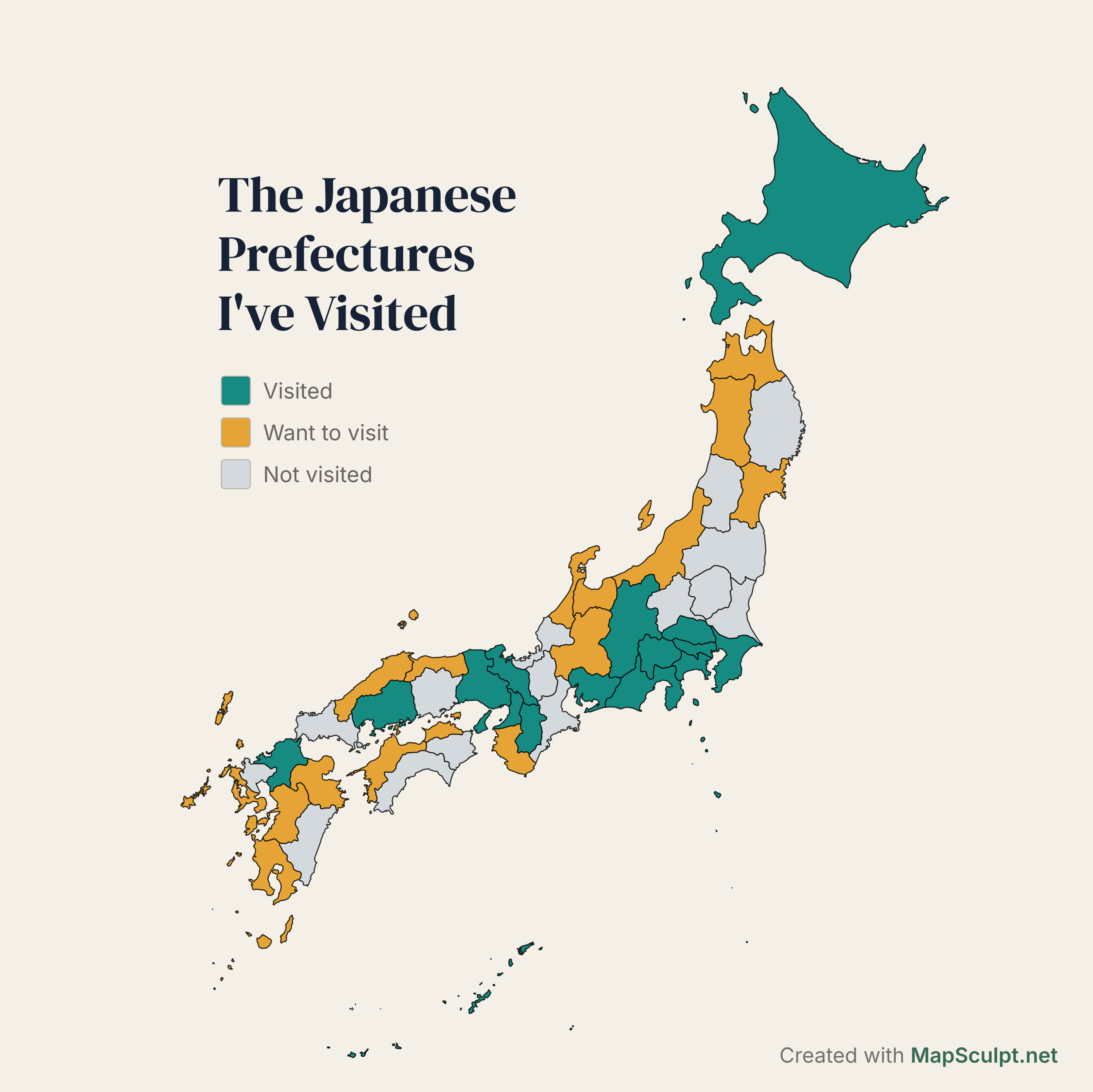
Track places visited, future travel plans and destinations still to explore.
Illustrative personal travel map · Not real user data
Make a travel mapPOPULATION CENSUS / 2020–2025
Between 2020 and 2025, Tokyo and Okinawa were the only two prefectures to gain population. Explore the changes across all 47 prefectures.
These are total population changes over five years, not annual rates. The map uses four population-decline bands and one growth band, from 0% to +1.5%.
Source: Statistics Bureau of Japan · 2025 Population Census (preliminary results).
Create a population mapHOW IT WORKS
Four simple steps to customise Japan, add information and export a map.
Start with the 47-prefecture template in MapSculpt.
Choose individual prefectures and assign your colours.
Add a title and legend, or import CSV data. On desktop, use the Text tool to place names or notes manually.
Export a high-resolution PNG for your project.
CUSTOMISE YOUR MAP
Edit all 47 prefectures individually.
Organise prefectures into meaningful colour groups.
Add titles and data citations. On desktop, place names or notes manually with the Text tool.
Adjust backgrounds, borders and map styling.
Import prefecture values to build a choropleth.
Download a polished PNG to share.
UNDERSTANDING THE DATA
Population change and foreign guest nights measure different things. Check the reference period, units and official source.
JAPAN’S OFFICIAL STATISTICS
Population change measures the percentage change in residents from 2020 to 2025, not annual growth.
Foreign guest nights count overnight stays, not distinct international tourists.
Japan recorded 179.92 million foreign guest nights in 2025 (final survey), a 9.4% increase over 2024.
Sequential colours show increasing quantities; diverging colours distinguish decline from growth. Read each map’s legend: its class boundaries and measurement units apply only to that indicator.
METRICS & SOURCES
2025 Census: Statistics Bureau of Japan (preliminary results)
Accommodation Survey: Japan Tourism Agency · 2025 final results
GEOGRAPHIC COVERAGE
Japan has 47 prefecture-level jurisdictions: Tokyo Metropolis, Hokkaido, Kyoto and Osaka prefectures, and 43 other prefectures. Cities, municipalities and wards are not independently editable.
THE JAPAN PREFECTURE MAP
Colour each prefecture from Hokkaido to Okinawa.
Tokyo Metropolis (to), Hokkaido (do), Kyoto and Osaka (fu), and the other 43 prefectures (ken) are all prefecture-level jurisdictions. The template edits prefectures individually, not municipalities or Tokyo’s special wards.
ADMINISTRATIVE UNITS
Source: MapSculpt · Japan prefectures template
PREFECTURES AND CAPITALS
Japan’s 47 prefectures, grouped into eight geographic regions, with official two-digit JIS codes and prefectural government seats.
| Code | Prefecture | Government seat |
|---|---|---|
| 01 | Hokkaido | Sapporo |
| Code | Prefecture | Government seat |
|---|---|---|
| 02 | Aomori | Aomori |
| 03 | Iwate | Morioka |
| 04 | Miyagi | Sendai |
| 05 | Akita | Akita |
| 06 | Yamagata | Yamagata |
| 07 | Fukushima | Fukushima |
| Code | Prefecture | Government seat |
|---|---|---|
| 08 | Ibaraki | Mito |
| 09 | Tochigi | Utsunomiya |
| 10 | Gunma | Maebashi |
| 11 | Saitama | Saitama |
| 12 | Chiba | Chiba |
| 13 | Tokyo | Shinjuku (Met. Gov.) |
| 14 | Kanagawa | Yokohama |
| Code | Prefecture | Government seat |
|---|---|---|
| 15 | Niigata | Niigata |
| 16 | Toyama | Toyama |
| 17 | Ishikawa | Kanazawa |
| 18 | Fukui | Fukui |
| 19 | Yamanashi | Kofu |
| 20 | Nagano | Nagano |
| 21 | Gifu | Gifu |
| 22 | Shizuoka | Shizuoka |
| 23 | Aichi | Nagoya |
| Code | Prefecture | Government seat |
|---|---|---|
| 24 | Mie | Tsu |
| 25 | Shiga | Otsu |
| 26 | Kyoto | Kyoto |
| 27 | Osaka | Osaka |
| 28 | Hyogo | Kobe |
| 29 | Nara | Nara |
| 30 | Wakayama | Wakayama |
| Code | Prefecture | Government seat |
|---|---|---|
| 31 | Tottori | Tottori |
| 32 | Shimane | Matsue |
| 33 | Okayama | Okayama |
| 34 | Hiroshima | Hiroshima |
| 35 | Yamaguchi | Yamaguchi |
| Code | Prefecture | Government seat |
|---|---|---|
| 36 | Tokushima | Tokushima |
| 37 | Kagawa | Takamatsu |
| 38 | Ehime | Matsuyama |
| 39 | Kochi | Kochi |
| Code | Prefecture | Government seat |
|---|---|---|
| 40 | Fukuoka | Fukuoka |
| 41 | Saga | Saga |
| 42 | Nagasaki | Nagasaki |
| 43 | Kumamoto | Kumamoto |
| 44 | Oita | Oita |
| 45 | Miyazaki | Miyazaki |
| 46 | Kagoshima | Kagoshima |
| 47 | Okinawa | Naha |
All 47 prefectures are editable. Cities, municipalities and Tokyo wards are not independently selectable.
FREQUENTLY ASKED QUESTIONS
Open Japan Prefectures in MapSculpt, choose a colour for each prefecture, add a title and legend, and export a PNG.
Japan has 47: Tokyo (to), Hokkaido (do), Kyoto and Osaka (fu), and 43 other prefectures (ken).
Yes. Start with a neutral map and customise the prefecture fills and borders before downloading.
On desktop, select the Text tool, click the map, and type a prefecture name or note. Position each text annotation manually. There is no automatic prefecture-name toggle. On mobile, you can edit the title, subtitle, source and legend; the Text tool is currently desktop-only.
Yes. Hokkaido and Okinawa are included as editable prefectures. Published maps may use a clearly labelled Okinawa inset for readability.
Yes. Import prefecture names and values, confirm the matching and choose a numerical colour scale.
Yes. Create categories such as Visited, Want to visit and Not yet visited, then colour prefectures accordingly.
Yes. Export a high-resolution PNG with the map, legend and any additional text you choose.
Yes. Use credible data, cite official sources, label the legend clearly and follow each community’s posting rules.
READY TO CREATE YOUR JAPAN MAP?
Colour 47 prefectures, add your data and export a map ready to share.
Create Japan Map