Skip to content
MapSculpt

GEOGRAPHIC MAP MAKER / NEW ZEALAND

New Zealand Regions Map Maker

Create your own map of New Zealand’s 16 regions and the Chatham Islands. Colour regions, explore Stats NZ data, import a CSV and export a polished PNG.

Free to use. No sign-up required.

17editable areas
16 regions and the Chatham Islands

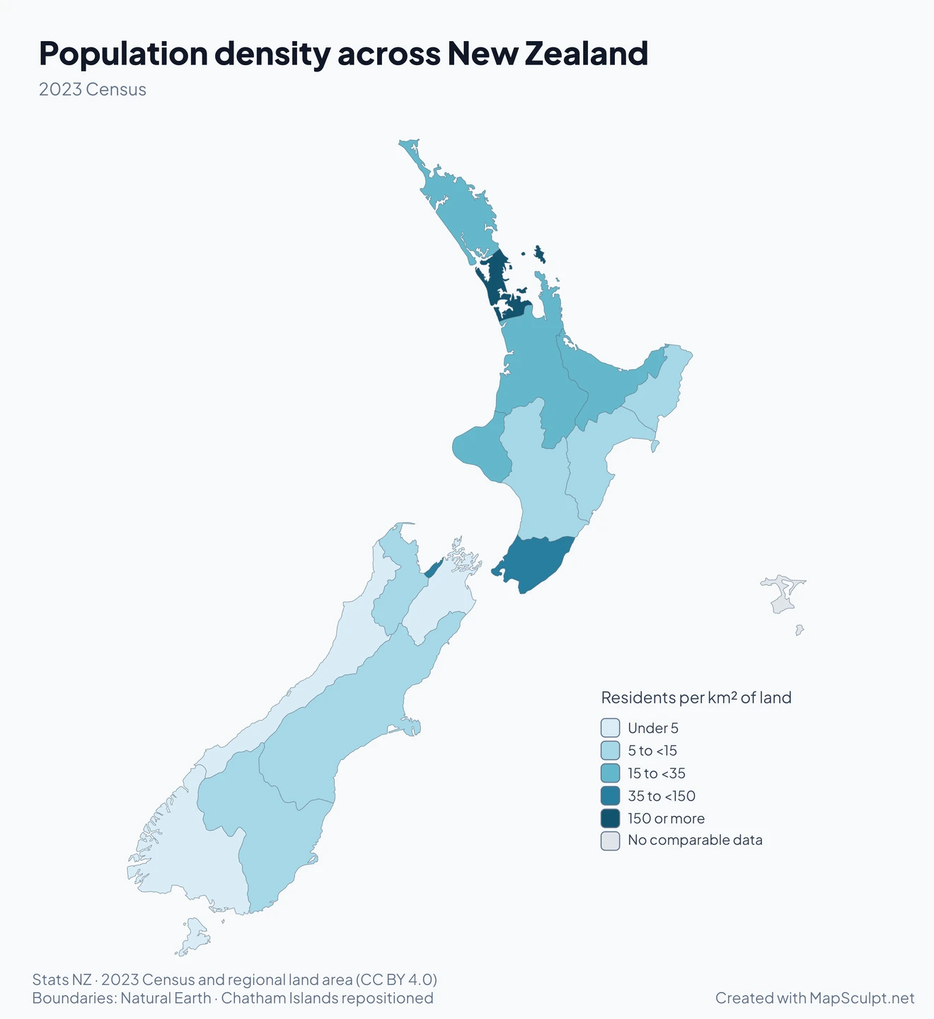
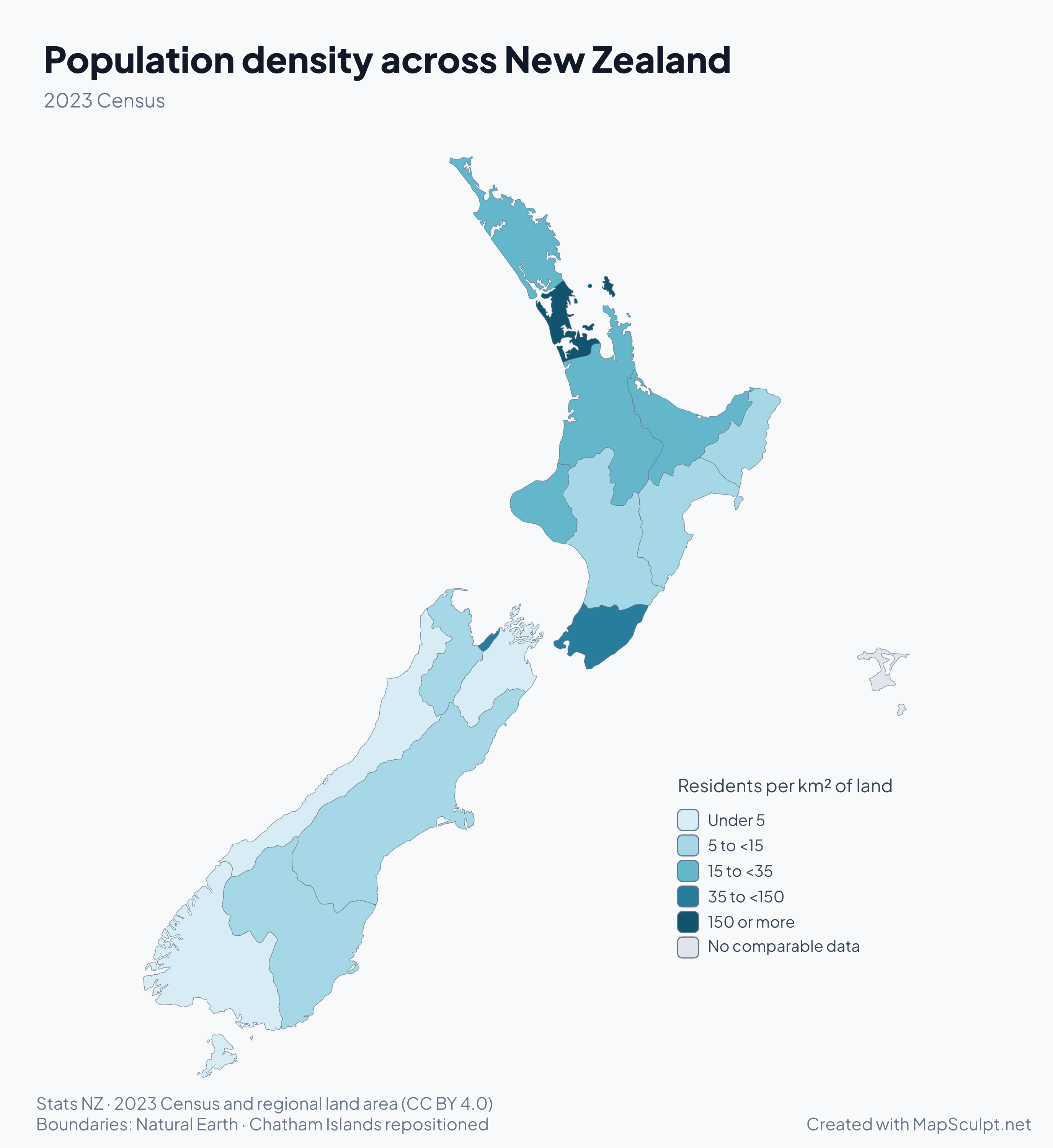
Population density across New Zealand

Population density by New Zealand region in 2023. Auckland is the darkest teal. The West Coast and Southland are among the lightest. The Chatham Islands are grey.

Residents per km² of land

  • Under 5
  • 5 to <15
  • 15 to <35
  • 35 to <150
  • 150 or more
  • No comparable data

2023 Census. Auckland had about 335 residents per square kilometre of land. The West Coast had about 1.4. Census usually resident population divided by the land area of each region. Regional averages can hide differences within a region.

KNOW YOUR GEOGRAPHY

16 regions across two main islands

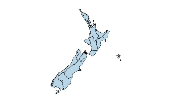
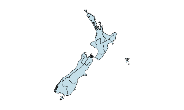
New Zealand’s 16 regions span the North and South Islands and provide a common geography for regional administration and census comparisons. The Chatham Islands have a separate local-government arrangement and are the 17th editable area in MapSculpt.

The editor uses supplied Natural Earth geometry. The Chatham Islands are shown in a repositioned inset. Statistical maps compare the 16 regional council areas and show the territory in grey.

Explore all regions and their codes

2023 CENSUS

Three more views of New Zealand

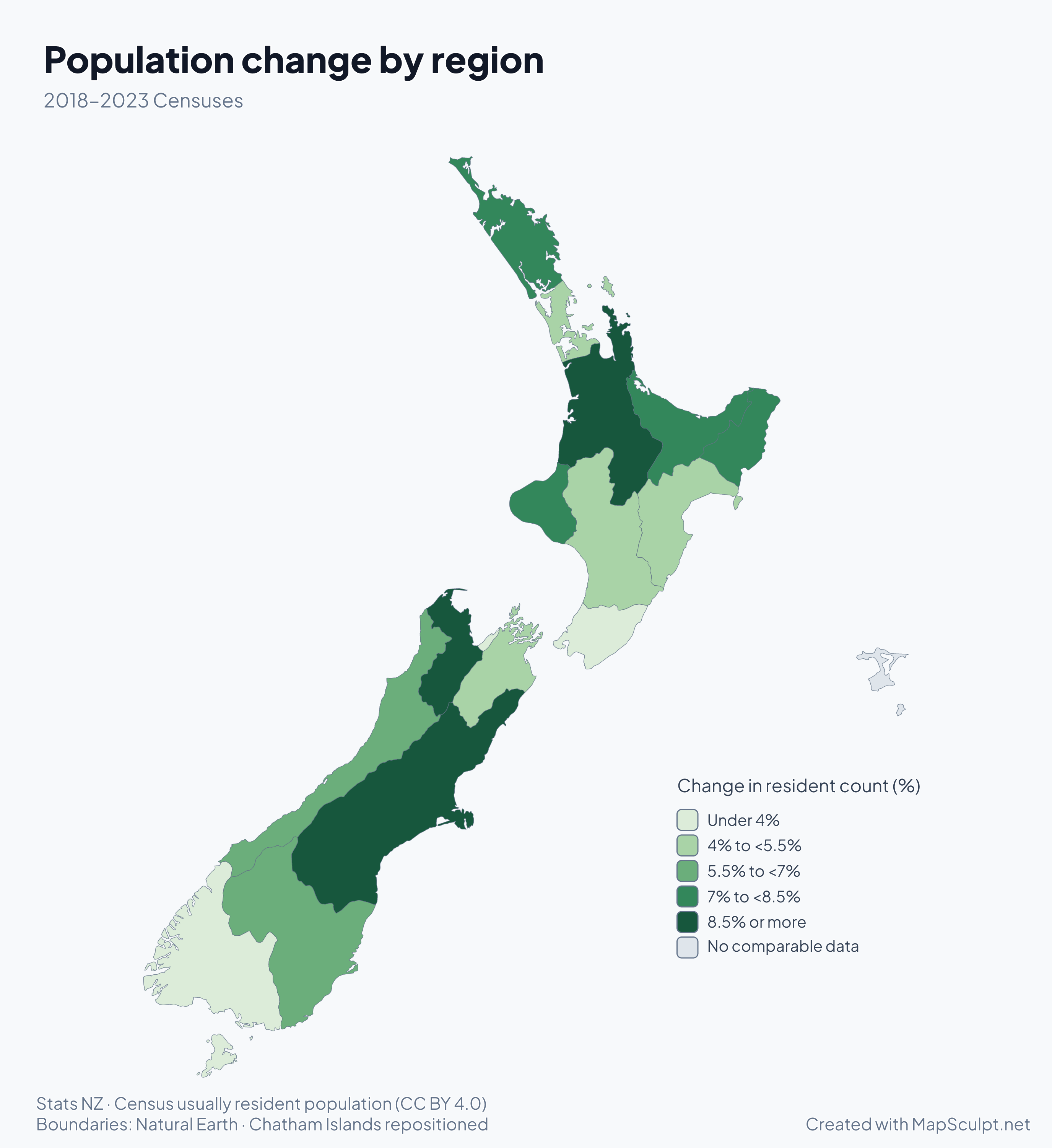
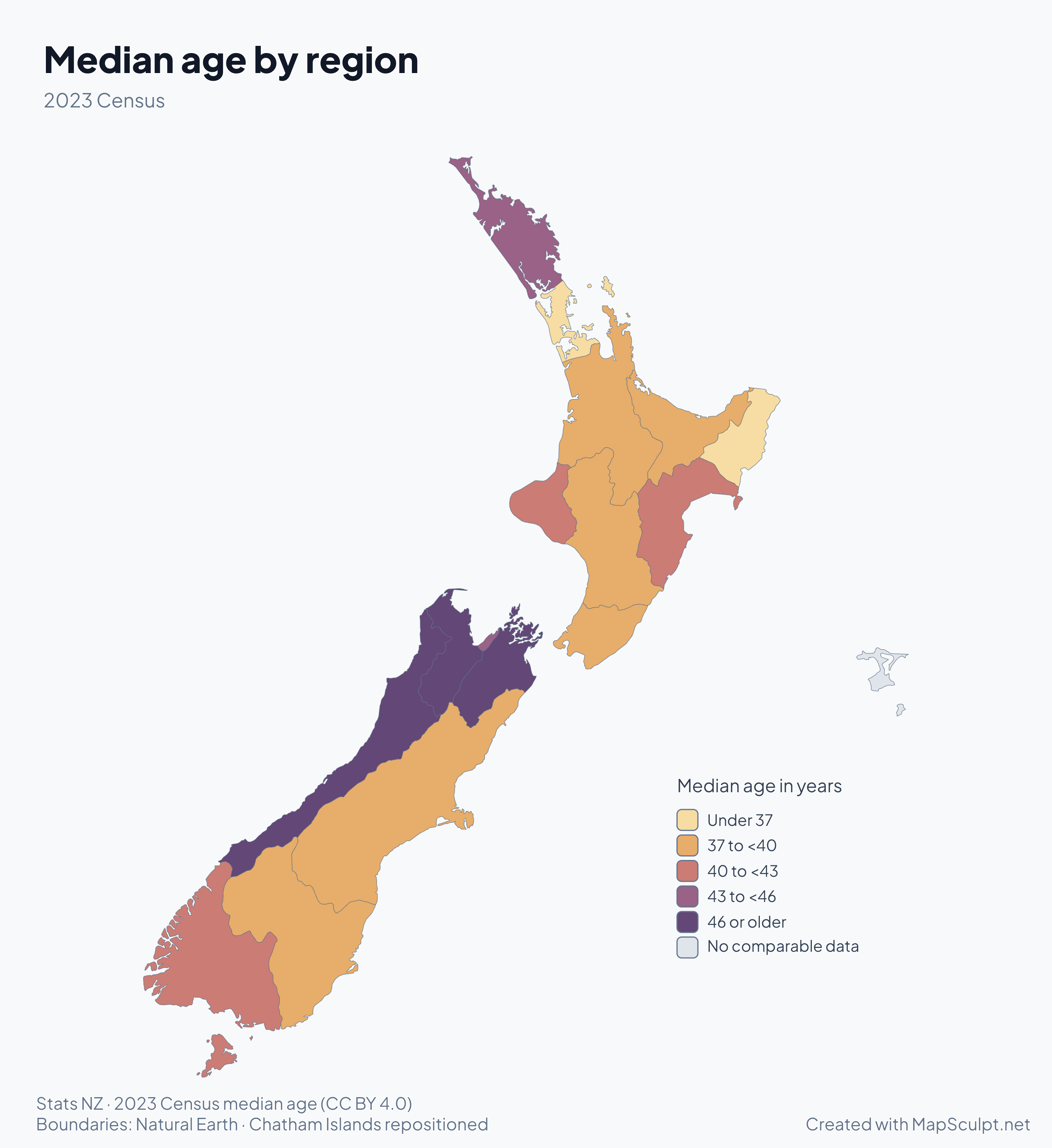
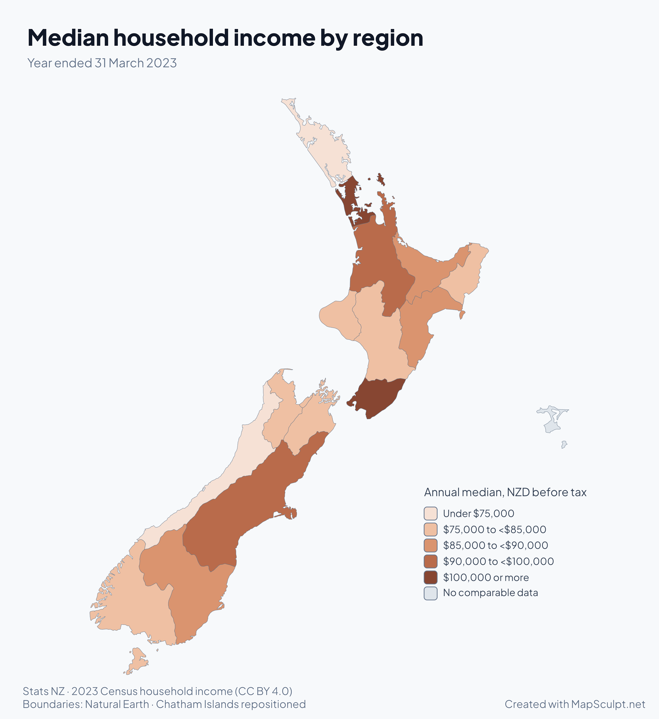
See how population growth, median age and household income vary across the regions.

HOW IT WORKS

From regional data to a finished map

  1. Choose your regions

    Colour any of New Zealand’s 16 regions or the Chatham Islands, or start with a blank map.

  2. Import your CSV

    Match rows using region names or MapSculpt IDs, then colour categories or numerical ranges.

  3. Customise your map

    Adjust colours, add a title and legend, and prepare the map for a presentation or report.

  4. Export your PNG

    Choose a canvas format, background and resolution, then download the PNG.

TRY A CSV IMPORT

From spreadsheet to New Zealand map

Planning a journey across New Zealand? Import the sample CSV to see how travel plans can become a map.

My New Zealand road trip · sample CSV
RegionMapSculpt IDStatus
AucklandNZ-AUKVisited
WaikatoNZ-WKOVisited
WellingtonNZ-WGNVisited
CanterburyNZ-CANWant to visit
OtagoNZ-OTAWant to visit
SouthlandNZ-STLWant to visit
NorthlandNZ-NTLNot visited
Bay of PlentyNZ-BOPNot visited
GisborneNZ-GISNot visited
Hawke's BayNZ-HKBNot visited
TaranakiNZ-TKINot visited
Manawatū-WhanganuiNZ-MWTNot visited
TasmanNZ-TASNot visited
NelsonNZ-NSNNot visited
MarlboroughNZ-MBHNot visited
West CoastNZ-WTCNot visited
Chatham Islands TerritoryNZ-CITNot visited

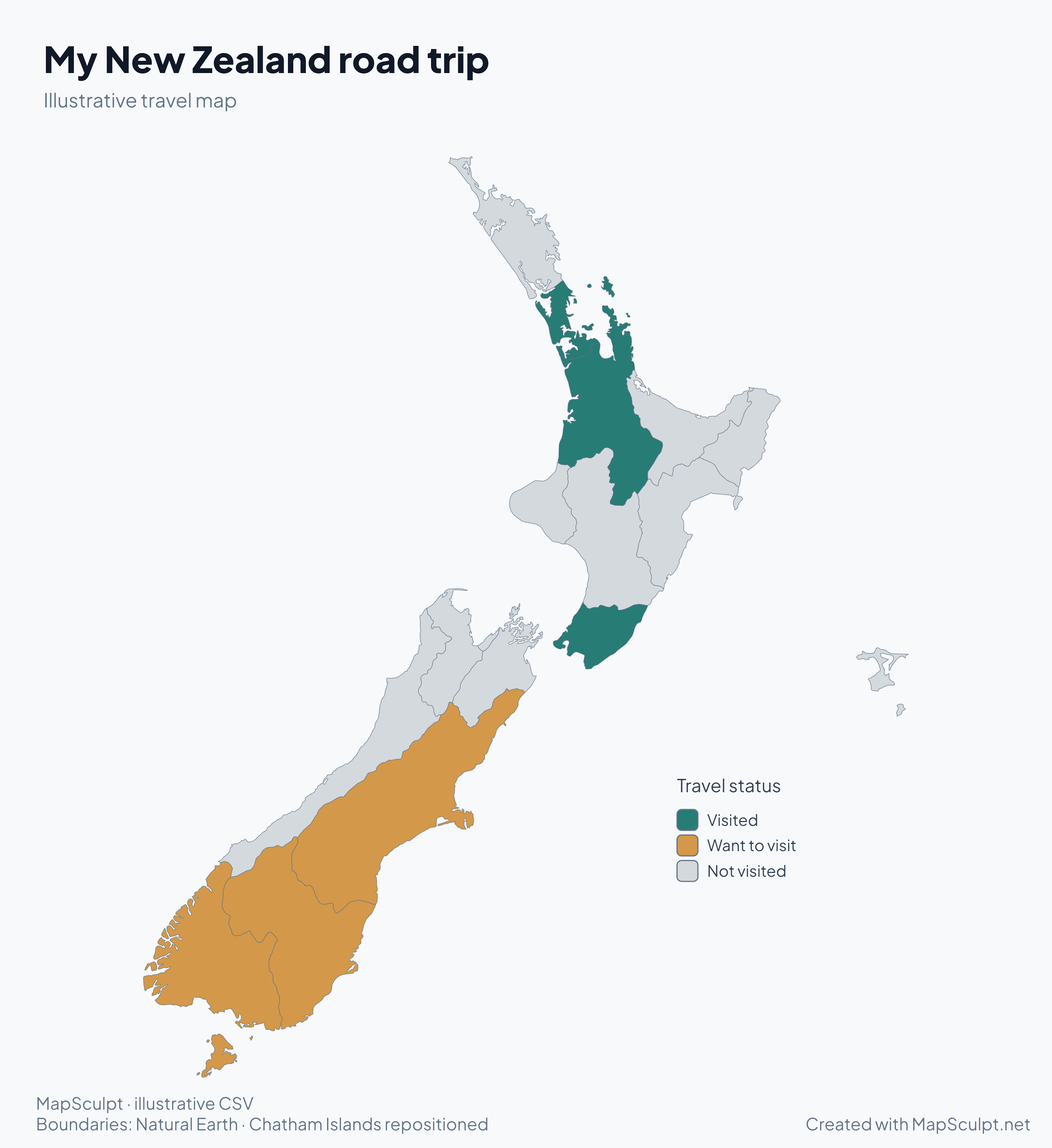
Match on MapSculpt ID and choose Status as the category column. Choose teal for Visited, amber for Want to visit, and grey for Not visited.

Download sample CSV

My New Zealand road trip

Illustrative New Zealand road-trip map. Auckland, Waikato and Wellington are teal for Visited. Canterbury, Otago and Southland are amber for Want to visit. The remaining areas are grey for Not visited.
  • Visited
  • Want to visit
  • Not visited
Create a New Zealand mapDownload full-resolution PNG

GEOGRAPHY DIRECTORY

Explore New Zealand’s 16 regions and the Chatham Islands

Use names or MapSculpt IDs to match your CSV rows. Stats NZ regional council codes and the Chatham Islands territorial authority code are shown for reference.

North Island · 9

  1. 01
    NorthlandMapSculpt ID NZ-NTL
  2. 02
    AucklandMapSculpt ID NZ-AUK
  3. 03
    WaikatoMapSculpt ID NZ-WKO
  4. 04
    Bay of PlentyMapSculpt ID NZ-BOP
  5. 05
    GisborneMapSculpt ID NZ-GIS
  6. 06
    Hawke's BayMapSculpt ID NZ-HKB
  7. 07
    TaranakiMapSculpt ID NZ-TKI
  8. 08
    Manawatū-WhanganuiMapSculpt ID NZ-MWT
  9. 09
    WellingtonMapSculpt ID NZ-WGN

South Island · 7

  1. 16
    TasmanMapSculpt ID NZ-TAS
  2. 17
    NelsonMapSculpt ID NZ-NSN
  3. 18
    MarlboroughMapSculpt ID NZ-MBH
  4. 12
    West CoastMapSculpt ID NZ-WTC
  5. 13
    CanterburyMapSculpt ID NZ-CAN
  6. 14
    OtagoMapSculpt ID NZ-OTA
  7. 15
    SouthlandMapSculpt ID NZ-STL

Outside the regional council areas · 1

  1. 067
    Chatham Islands TerritoryMapSculpt ID NZ-CIT

Stats NZ · Regional Council 2023 classification

What’s the difference between New Zealand’s regions and districts?

Regional councils manage issues such as freshwater, flood protection and public transport across a region. Territorial authorities provide local services such as roads, libraries and rubbish collection. Auckland, Gisborne, Tasman, Nelson and Marlborough have unitary authorities that do both jobs.

The North and South Islands are geographic groupings. Regional council boundaries are administrative and are useful for comparing census and economic data. The Chatham Islands Council carries out some regional functions under specific laws.

New Zealand Local Government Commission

THE MAPSCULPT COLLECTION

Choose your map.

Find your geography. Add your perspective.

98 maps / 8 collections

Countries, regions and counties. Ready for your ideas.

Sort maps

California

Counties

Texas

Counties

Florida

Counties

New York

Counties

Pennsylvania

Counties

Illinois

Counties

Ohio

Counties

Georgia

Counties

North Carolina

Counties

Michigan

Counties

New Jersey

Counties

Virginia

Counties

1–12 of 50 state maps

FAQ

New Zealand map questions

How many regions does New Zealand have?

New Zealand has 16 regional council areas across the North and South Islands. The Chatham Islands Territory sits outside those regional council areas.

Why does the editor have 17 editable areas?

The editor includes the 16 regions and the separately administered Chatham Islands Territory as an additional selectable area.

Are the Chatham Islands included?

Yes. They are shown in a repositioned inset and can be coloured independently. The census examples use grey for the territory because they compare regional council areas.

Can I colour individual New Zealand regions?

Yes. Choose a colour and select a region on the map. You can change the outline, colour and legend as you work.

Can I create a blank New Zealand map?

Yes. Open the editor and leave the regions uncoloured, or customise the borders and background before exporting.

Can I import CSV data using region names or codes?

Yes. Use the region names or the MapSculpt IDs in the directory, such as Waikato or NZ-WKO. Stats NZ codes are listed for reference.

What’s the difference between regions and districts?

Regional councils manage functions such as the environment and public transport. Territorial authorities are city or district councils responsible for local services. Five unitary authorities perform both roles.

Are both the North Island and South Island included?

Yes. The map includes nine regional council areas on the North Island and seven on the South Island, plus the Chatham Islands Territory.

Can I export a high-resolution PNG?

Yes. Choose a preset or enter a custom pixel size in the PNG download settings.

Is MapSculpt free to use?

Yes. You can create a map, import your CSV and download a PNG without signing up.

START MAPPING

Make New Zealand’s geography your own

Start with 16 regions and the Chatham Islands. Colour your map, explore regional differences and share the result.
Create a New Zealand map