

UKRAINE / ADMINISTRATIVE REGIONS
Ukraine Regions Map Maker
Create and colour a custom map of Ukraine’s 27 administrative areas. Highlight individual oblasts, import regional data and download maps for education, research and presentations.
- 27 individually editable areas
- Custom colours and legends
- CSV data import
- High-resolution PNG downloads
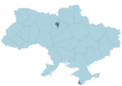
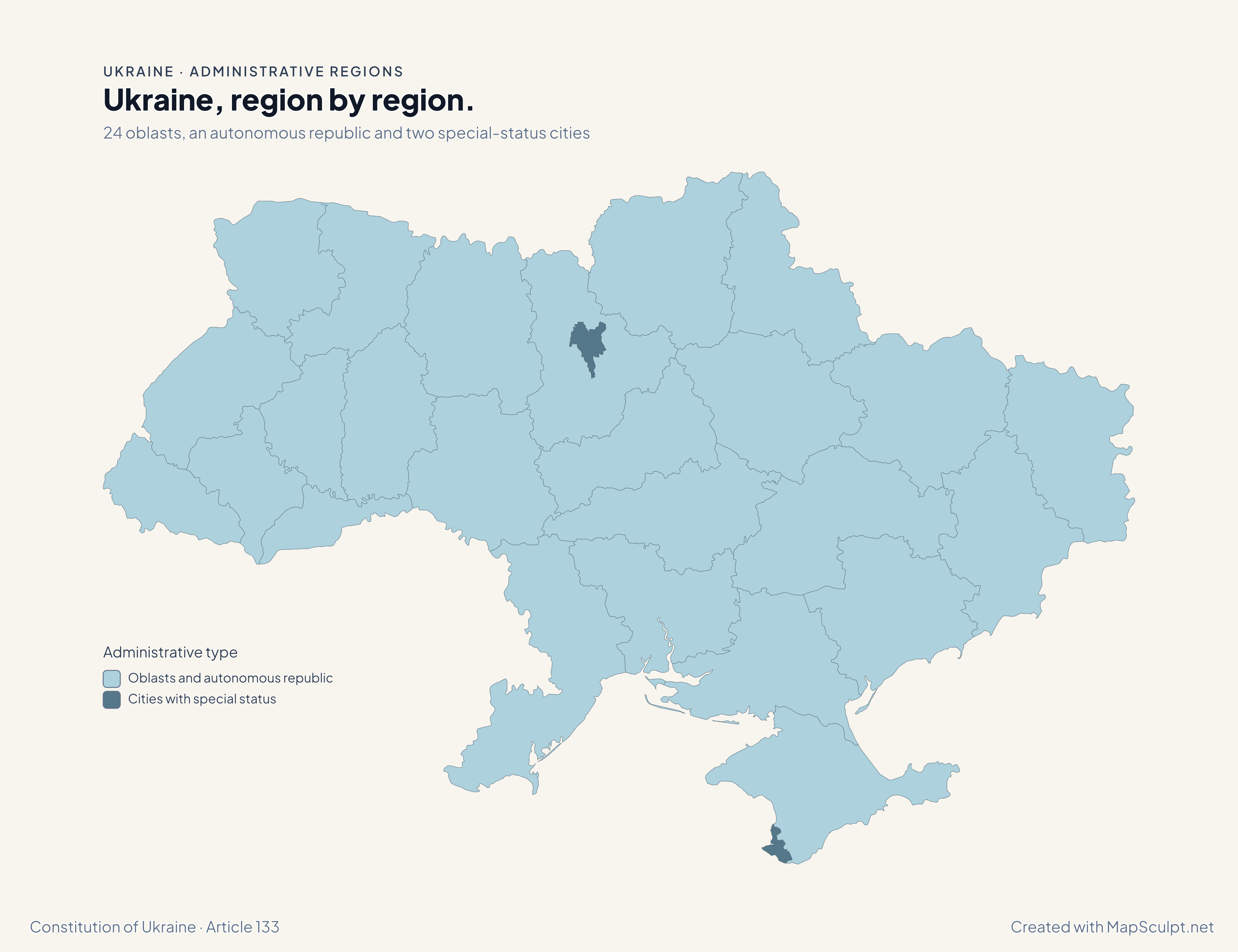
24 oblasts, an autonomous republic and two special-status cities
Ukraine, region by region.
Kyiv City sits inside Kyiv Oblast and has its own fill. Sevastopol is a separate area on the southwestern coast of the Crimean peninsula.
Administrative type
- Oblasts and autonomous republic
- Cities with special status
Zoom in to select either city precisely.
27 administrative areas. One Ukraine.
An oblast is a first-level administrative region. Ukraine has 24 oblasts, the Autonomous Republic of Crimea, and two cities with special status: Kyiv and Sevastopol. The cities are separate areas at this level. Raions are smaller districts.
See all 27 areasOne country. Many ways to explore it.
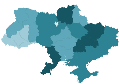
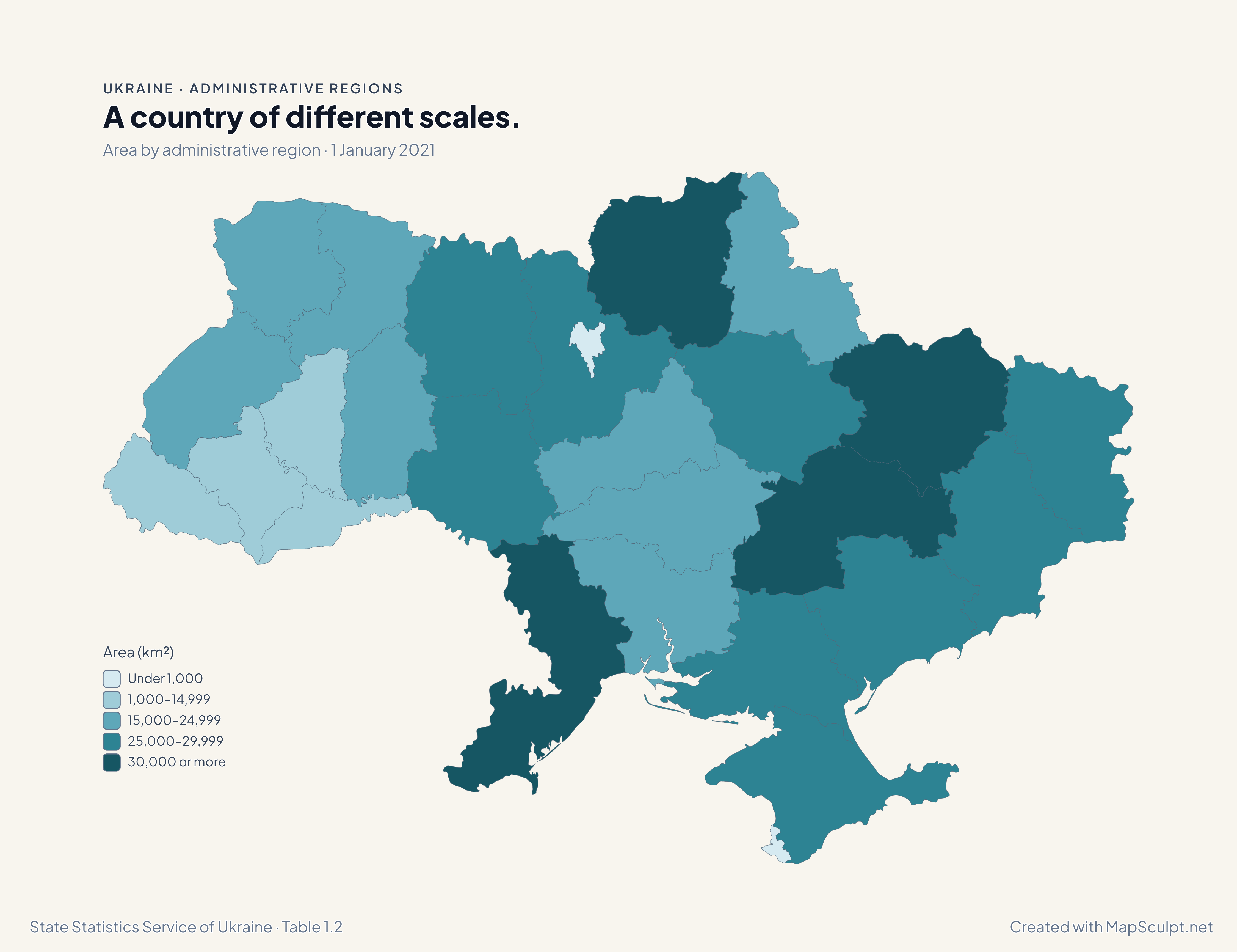
Area by administrative region · 1 January 2021
A country of different scales.
Odesa is the largest oblast in the table at 33,314 km². Kyiv City covers 836 km², compared with 28,121 km² for Kyiv Oblast.
Area (km²)
- Under 1,000
- 1,000–14,999
- 15,000–24,999
- 25,000–29,999
- 30,000 or more
Multiply the source figures in thousands of hectares by 10 to get square kilometres. Both cities fall in the lowest band.
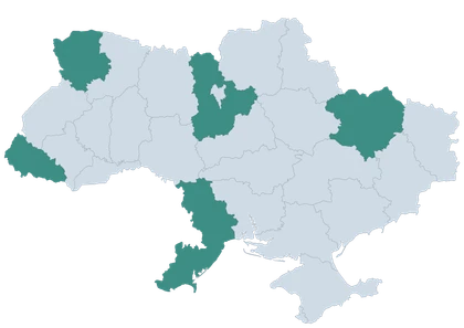
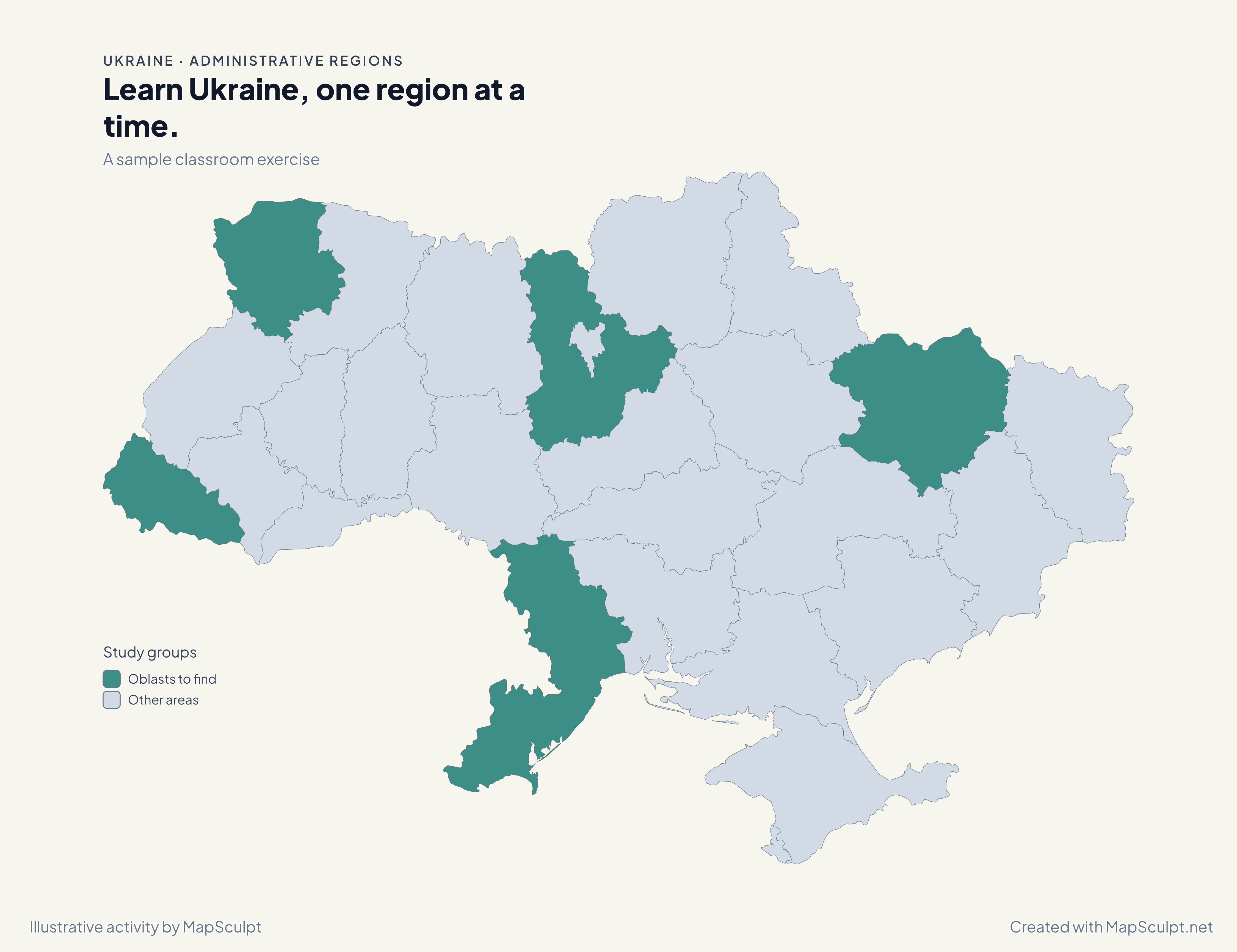
A sample classroom exercise
Learn Ukraine, one region at a time.
Ask students to find Volyn, Zakarpattia, Kyiv, Odesa and Kharkiv oblasts. Then have them colour a second set and exchange maps.
Study groups
- Oblasts to find
- Other areas
The groups are illustrative.
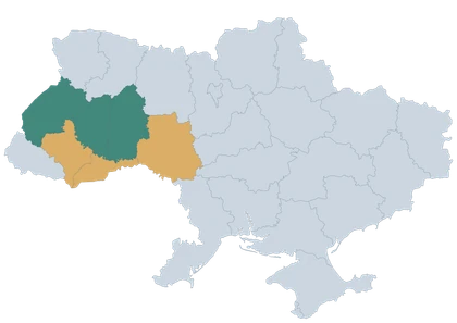
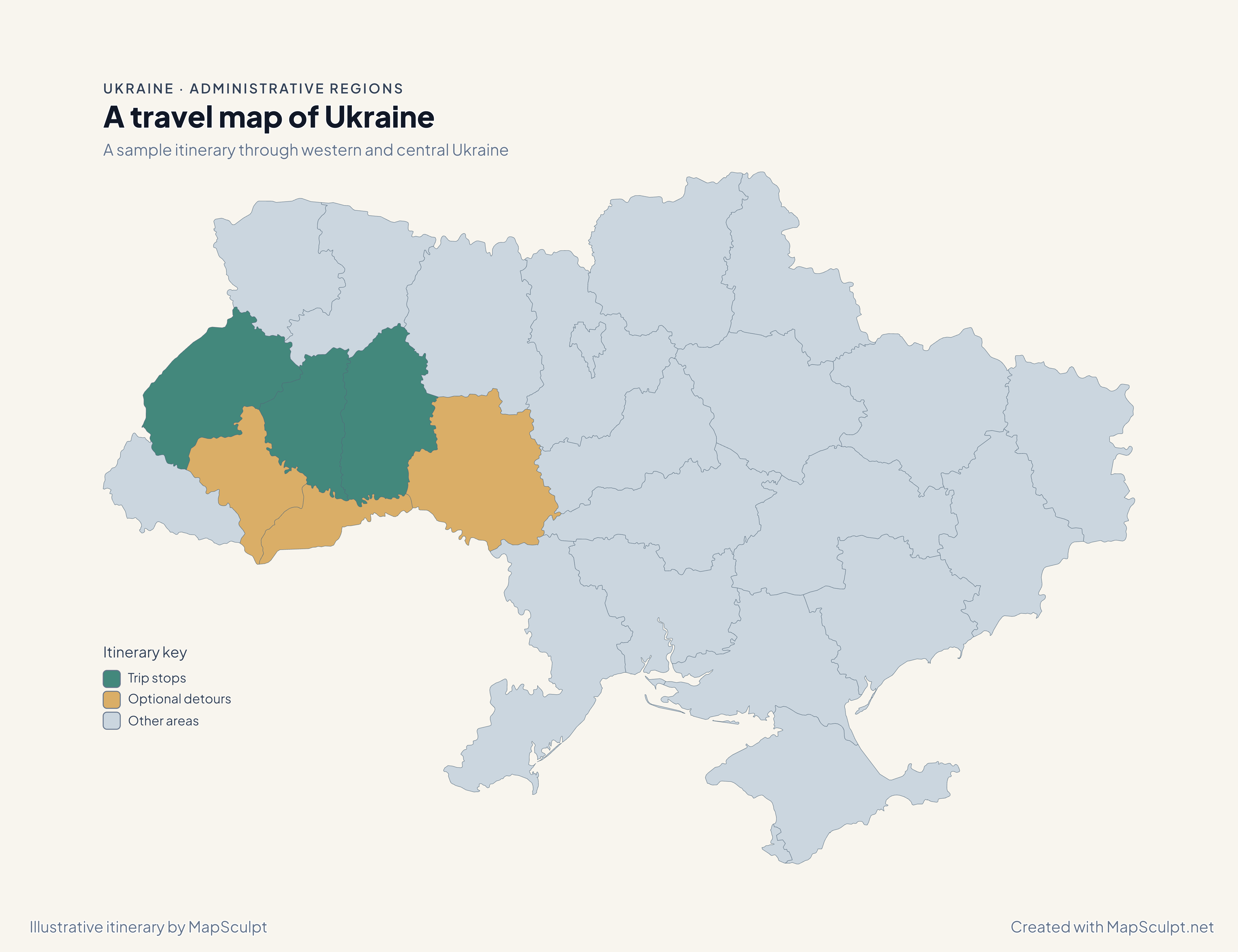
A sample itinerary through western and central Ukraine
A travel map of Ukraine
Plot the main stops and optional detours in different colours. This example marks Lviv, Ternopil and Khmelnytskyi oblasts as the main stops.
Itinerary key
- Trip stops
- Optional detours
- Other areas
An illustrative itinerary for planning your own map.
From regional data to a finished map.
Choose your regions
Open the editor, pick a colour and select an area.
Import your data
Open Import CSV, select the region column and check the matches.
Make it yours
Set the colours and legend in the design step. Add a title and source under Text & Legend.
Download your map
Choose Download, select the PNG size and save the map.
Your spreadsheet. Your Ukraine map.
The CSV contains all 27 area figures from 1 January 2021. The table shows five examples from the same map.
| Region | ID | Area (km²) |
|---|---|---|
| Kyiv City | UA-30 | 836 |
| Kyiv Oblast | UA-32 | 28,121 |
| Sevastopol | UA-40 | 864 |
| Autonomous Republic of Crimea | UA-43 | 26,081 |
| Odesa Oblast | UA-51 | 33,314 |
Choose Region for matching and Area (km²) as the numerical value. Select Custom classification and enter 0, 1000, 15000, 25000, 30000 and 34000 to reproduce the map’s ranges. Both name columns are included for reference.
Explore Ukraine’s 27 administrative areas.
Oblasts
- Cherkasy OblastЧеркаська область
UA-71 - Chernihiv OblastЧернігівська область
UA-74 - Chernivtsi OblastЧернівецька область
UA-77 - Dnipropetrovsk OblastДніпропетровська область
UA-12 - Donetsk OblastДонецька область
UA-14 - Ivano-Frankivsk OblastІвано-Франківська область
UA-26 - Kharkiv OblastХарківська область
UA-63 - Kherson OblastХерсонська область
UA-65 - Khmelnytskyi OblastХмельницька область
UA-68 - Kirovohrad OblastКіровоградська область
UA-35 - Kyiv OblastКиївська область
UA-32 - Luhansk OblastЛуганська область
UA-09 - Lviv OblastЛьвівська область
UA-46 - Mykolaiv OblastМиколаївська область
UA-48 - Odesa OblastОдеська область
UA-51 - Poltava OblastПолтавська область
UA-53 - Rivne OblastРівненська область
UA-56 - Sumy OblastСумська область
UA-59 - Ternopil OblastТернопільська область
UA-61 - Vinnytsia OblastВінницька область
UA-05 - Volyn OblastВолинська область
UA-07 - Zakarpattia OblastЗакарпатська область
UA-21 - Zaporizhzhia OblastЗапорізька область
UA-23 - Zhytomyr OblastЖитомирська область
UA-18
Autonomous republic
- Autonomous Republic of CrimeaАвтономна Республіка Крим
UA-43
Cities with special status
- Kyiv Cityмісто Київ
UA-30 - Sevastopolмісто Севастополь
UA-40
THE MAPSCULPT COLLECTION
Choose your map.
Find your geography. Add your perspective.
98 maps / 8 collections
Countries, regions and counties. Ready for your ideas.
Sort maps
Germany
States
United Kingdom
Regions
France
Regions
France
Departments
Italy
Regions
Spain
Autonomous communities
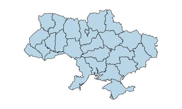
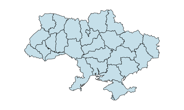
Ukraine
Regions
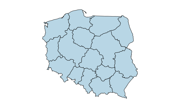
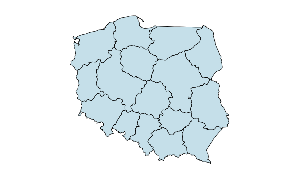
Poland
Voivodeships
Romania
Counties & Bucharest
Netherlands
Provinces
Belgium
Provinces & Brussels
Portugal
Districts & autonomous regions
Czechia
Regions
Czechia · Districts
77 districts including Prague
Sweden
Counties
Hungary
Counties & Budapest
Austria
States
Switzerland
Cantons
Bulgaria
Provinces
Denmark
Regions
Finland
Regions
Norway
Counties
Latvia · Municipalities
35 municipalities + 7 state cities
Luxembourg · Cantons
12 cantons
California
Counties
Texas
Counties
Florida
Counties
New York
Counties
Pennsylvania
Counties
Illinois
Counties
Ohio
Counties
Georgia
Counties
North Carolina
Counties
Michigan
Counties
New Jersey
Counties
Virginia
Counties
Washington
Counties
Arizona
Counties
Tennessee
Counties
Massachusetts
Counties
Indiana
Counties
Missouri
Counties
Maryland
Counties
Colorado
Counties
Wisconsin
Counties
Minnesota
Counties
South Carolina
Counties
Alabama
Counties
Louisiana
Parishes
Kentucky
Counties
Oregon
Counties
Oklahoma
Counties
Connecticut
Planning regions
Utah
Counties
Nevada
Counties & Carson City
Iowa
Counties
Arkansas
Counties
Kansas
Counties
Mississippi
Counties
New Mexico
Counties
Idaho
Counties
Nebraska
Counties
West Virginia
Counties
Hawaii
Counties
New Hampshire
Counties
Maine
Counties
Montana
Counties
Rhode Island
Counties
Delaware
Counties
South Dakota
Counties
North Dakota
Counties
Alaska
Boroughs & census areas
Vermont
Counties
Wyoming
Counties
1–12 of 50 state maps
Common questions about Ukraine maps
How many administrative regions does Ukraine have?
This map covers 27 first-level areas: 24 oblasts, the Autonomous Republic of Crimea, and Kyiv and Sevastopol, the two cities with special status.
What is an oblast?
An oblast is a first-level administrative region. Smaller districts within it are called raions.
Can I colour individual oblasts?
Yes. Pick a colour and click an oblast. Use CSV import to colour several areas from a table.
Can I download a blank map?
Yes. Leave the areas uncoloured, choose the border and background, and export a PNG.
Does the map include the Autonomous Republic of Crimea?
Yes. The Autonomous Republic of Crimea and the city of Sevastopol can be coloured separately.
Are Kyiv City and Kyiv Oblast separate?
Yes. Kyiv City uses UA-30 and Kyiv Oblast uses UA-32. Both can be selected independently.
Can I import CSV data?
Yes. Choose the column containing region IDs such as UA-51. The matching column in the sample is named Region.
Can I download a high-resolution PNG?
Yes. Choose the high-resolution option in Download. You can include a title, legend and source.
Is the map maker free?
You can colour the map, add a legend and download a PNG for free without creating an account.
Can I use the maps for education, research or presentations?
Yes. Include the source and observation date when you use a statistical map in a lesson, report or presentation.